Category:Much Hadham
Vai alla navigazione
Vai alla ricerca
English: Much Hadham is a village in east Hertfordshire, England, formerly known as Great Hadham. It is situated on the B1004 road, midway between Ware and Bishop's Stortford.
Français : Much Hadham est un village du Hertfordshire, en Angleterre. Autrefois connu sous le nom de Great Hadham, Much Hadham est l'un des villages les plus pittoresques du Hertfordshire.
village and civil parish in Hertfordshire, UK   | |||||
| Carica un file multimediale | |||||
| Istanza di | |||||
|---|---|---|---|---|---|
| Luogo | East Hertfordshire, Hertfordshire, Est dell'Inghilterra, Inghilterra | ||||
| Considerato essere uguale a | Much Hadham (pagina Wikimedia duplicata, parrocchia civile dell'Inghilterra) | ||||
 | |||||
Sottocategorie
Questa categoria contiene le 21 sottocategorie indicate di seguito, su un totale di 21.
B
- Brockets, Much Hadham (2 F)
- The Bull, Much Hadham (5 F)
F
- The Forge Museum (6 F)
G
- Green Tye (14 F)
H
- Hadham Cross (1 F)
- Hadham railway station (1 F)
J
K
- Kettle Green (1 F)
L
- Laylock Cottage (3 F)
- The Lordship, Much Hadham (2 F)
M
- Moor Place (2 F)
- Morris Cottage, Much Hadham (6 F)
- Much Hadham Hall (3 F)
- Much Hadham War Memorial (2 F)
O
- The Old House, Much Hadham (4 F)
P
V
- Vine Cottage, Much Hadham (5 F)
W
- The White House, Much Hadham (5 F)
Y
File nella categoria "Much Hadham"
Questa categoria contiene 186 file, indicati di seguito, su un totale di 186.
-
 'Large Reclining Figure' by Henry Moore - geograph.org.uk - 3885872.jpg 640 × 480; 111 KB
-
 A field of beans - geograph.org.uk - 4541008.jpg 640 × 480; 135 KB
-
 A sort of ford on Bromley Lane - geograph.org.uk - 3886061.jpg 640 × 428; 159 KB
-
 Alms Houses, Much Hadham - geograph.org.uk - 4350143.jpg 4 320 × 3 240; 3,39 MB
-

-
 Almshouses, Much Hadham - geograph.org.uk - 3528649.jpg 1 024 × 800; 202 KB
-
 Almshouses, Much Hadham 2020-08-29.jpg 5 186 × 1 752; 4,11 MB
-
 Awaiting the combine harvestor - geograph.org.uk - 213002.jpg 640 × 480; 95 KB
-
 B1004 to the East - geograph.org.uk - 213033.jpg 640 × 442; 104 KB
-
 B1004 towards Bishop's Stortford - geograph.org.uk - 6218494.jpg 800 × 600; 110 KB
-
 B1004 towards Bishop's Stortford - geograph.org.uk - 6218496.jpg 800 × 600; 176 KB
-
 B1004 towards Bishop's Stortford - geograph.org.uk - 6218668.jpg 800 × 600; 120 KB
-
 B1004 towards Dane Bridge - geograph.org.uk - 213034.jpg 640 × 496; 114 KB
-
 Barn at Old Park Farm - geograph.org.uk - 4540861.jpg 640 × 480; 108 KB
-
 Bridge Over the Nimney Bourne - geograph.org.uk - 2985657.jpg 2 560 × 1 920; 1,11 MB
-
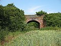
 Bridge over the River Ash - geograph.org.uk - 4350289.jpg 4 320 × 3 240; 2,9 MB
-
 Bridleway leading to Cox Lane - geograph.org.uk - 548210.jpg 640 × 428; 252 KB
-
 Bromley Lane towards Much Hadham - geograph.org.uk - 2801870.jpg 640 × 477; 68 KB
-
 Bromley Lane towards Standon - geograph.org.uk - 2801869.jpg 640 × 542; 75 KB
-
 Bush Wood - geograph.org.uk - 337294.jpg 640 × 427; 188 KB
-
 Bush Wood - geograph.org.uk - 337297.jpg 640 × 427; 113 KB
-
 Cambercroft Spring - geograph.org.uk - 3886076.jpg 640 × 480; 135 KB
-
 Cereal crop off the B1004 - geograph.org.uk - 6218493.jpg 800 × 600; 117 KB
-
 Chestnut flower - geograph.org.uk - 421476.jpg 640 × 480; 86 KB
-
 Church Lane and River Ash, Much Hadham - geograph.org.uk - 3886027.jpg 640 × 480; 203 KB
-

-
 Cottages on High Street, Much Hadham - geograph.org.uk - 5608784.jpg 1 923 × 1 424; 681 KB
-
 Course of Buntingford branch line - geograph.org.uk - 4594811.jpg 640 × 480; 149 KB
-
 Cox Lane - geograph.org.uk - 4594770.jpg 640 × 480; 160 KB
-
 Crop field near Warren Farm - geograph.org.uk - 6218655.jpg 800 × 600; 128 KB
-
 Crop field off the B1004 - geograph.org.uk - 6218667.jpg 800 × 600; 135 KB
-
 Crop of peas near Green Tye - geograph.org.uk - 6218648.jpg 800 × 600; 142 KB
-
 Crossroads in Green Tye - geograph.org.uk - 6119949.jpg 1 920 × 1 280; 1,28 MB
-
 Dane Bridge - geograph.org.uk - 213039.jpg 640 × 449; 95 KB
-

-
 Disappearing Railway - geograph.org.uk - 196602.jpg 480 × 640; 177 KB
-
 Eastwards from Green Tye - geograph.org.uk - 2801876.jpg 640 × 500; 93 KB
-
 Elizabeth II postbox on High Street, Much Hadham - geograph.org.uk - 6218485.jpg 2 685 × 4 454; 2,82 MB
-
 Entrance to Field near Kettle Green - geograph.org.uk - 207624.jpg 640 × 480; 105 KB
-
 Farmland near Kettle Green - geograph.org.uk - 207607.jpg 640 × 480; 98 KB
-
 Farmland near Kettle Green - geograph.org.uk - 207612.jpg 640 × 480; 119 KB
-
 Field and path entrance on Kettle Green Road - geograph.org.uk - 4831413.jpg 2 304 × 1 728; 936 KB
-
 Field by Dane Bridge - geograph.org.uk - 2801877.jpg 640 × 501; 76 KB
-
 Field by Kettle Green Road - geograph.org.uk - 4833807.jpg 2 254 × 1 660; 949 KB
-
 Field by Parsonage Lane, Green Tye - geograph.org.uk - 6122551.jpg 1 920 × 1 280; 1,28 MB
-
 Field by Widford Road, Much Hadham - geograph.org.uk - 5608787.jpg 2 048 × 1 536; 959 KB
-
 Field by Winding Hill - geograph.org.uk - 2918440.jpg 1 600 × 1 200; 392 KB
-
 Field by Winding Hill - geograph.org.uk - 2918442.jpg 1 600 × 1 200; 385 KB
-
 Field margin, Brand's Farm - geograph.org.uk - 548208.jpg 640 × 428; 198 KB
-
 Fields by Great Hadham Road - geograph.org.uk - 2917622.jpg 1 600 × 1 200; 478 KB
-
 Flax and Oak - geograph.org.uk - 196614.jpg 640 × 480; 137 KB
-
 Fletcher's Homestall, Much Hadham (8155193632).jpg 4 288 × 3 216; 4,22 MB
-
 Footpath north from Blackbridge Lane - geograph.org.uk - 4540993.jpg 640 × 480; 180 KB
-
 Footpath to Green Tye - geograph.org.uk - 6218495.jpg 640 × 480; 130 KB
-

-
 Ford at Hadham Cross - geograph.org.uk - 337302.jpg 640 × 427; 121 KB
-
 Ford at Hadham Cross - geograph.org.uk - 3373627.jpg 3 872 × 2 592; 2,31 MB
-
 Ford at Hadham Cross - geograph.org.uk - 3373637.jpg 3 872 × 2 592; 2,26 MB
-
 Ford at Much Hadham - geograph.org.uk - 3373559.jpg 3 872 × 2 592; 2,34 MB
-
 Ford at Much Hadham - geograph.org.uk - 3373564.jpg 3 872 × 2 592; 2,39 MB
-
 Garage on Tower Hill, Hadham Cross - geograph.org.uk - 6218475.jpg 800 × 600; 152 KB
-
 George VI postbox on Tower Hill, Hadham Cross - geograph.org.uk - 6219807.jpg 2 390 × 4 545; 2,18 MB
-
 GOC Much Hadham 001 North Leys, Much Hadham (14801047480).jpg 4 172 × 3 119; 3,9 MB
-
 GOC Much Hadham 009 Gaytons, Much Hadham (14994098571).jpg 4 112 × 3 084; 4,03 MB
-
 GOC Much Hadham 021 Best Kept Village (14830885418).jpg 2 858 × 2 144; 1,99 MB
-
 GOC Much Hadham 178 Much Hadham view (15000396607).jpg 4 288 × 3 216; 4,49 MB
-
 GOC Much Hadham 185 The Cottage, Much Hadham (15173743786).jpg 3 790 × 2 844; 3,21 MB
-
 GOC Much Hadham 187 Glebe Cottages, Much Hadham (15009980929).jpg 3 539 × 2 655; 2,92 MB
-
 GOC Much Hadham 192 Old Rectory Cottage. Much Hadham (15019223949).jpg 4 288 × 3 216; 4,58 MB
-
 GOC Much Hadham 193 Dunam Folly, Much Hadham (15027848469).jpg 3 558 × 2 667; 2,41 MB
-
 GOC Much Hadham 202 The Rectory, Much Hadham (15035882028).jpg 3 539 × 2 655; 2,8 MB
-
 GOC Much Hadham 208 Hall Cottages, Much Hadham (15219393641).jpg 3 554 × 2 221; 1,81 MB
-
 GOC Much Hadham 216 54 High Street, Much Hadham (16396132124).jpg 4 288 × 3 216; 3,39 MB
-
 Golf Club Lake - geograph.org.uk - 196613.jpg 640 × 480; 149 KB
-
 Gonepteryx rhamni (17018552975).jpg 1 864 × 1 388; 906 KB
-
 Grassland of Widford Road (B1004) - geograph.org.uk - 6218450.jpg 800 × 600; 107 KB
-
 Grazing near Homestalls Farm - geograph.org.uk - 6218662.jpg 800 × 600; 105 KB
-
 Great Hadham Road - geograph.org.uk - 2917628.jpg 1 600 × 1 200; 418 KB
-
 Great Hadham Road - geograph.org.uk - 2918427.jpg 1 600 × 1 200; 570 KB
-
 Green Shutters, Much Hadham 2020-08-29.jpg 3 723 × 2 905; 4,04 MB
-
 Hadham Cross Congregational Church - geograph.org.uk - 4541002.jpg 640 × 428; 137 KB
-
 Hadham Road, Hadham Ford - geograph.org.uk - 4831450.jpg 2 304 × 1 728; 1,16 MB
-

-
 Hart's-tongue fern (Asplenium scolopendrium) (14872292744).jpg 4 288 × 3 216; 4,34 MB
-
 High Street Much Hadham - geograph.org.uk - 2917087.jpg 1 600 × 1 200; 559 KB
-
 High Street Much Hadham - geograph.org.uk - 2917816.jpg 1 600 × 1 200; 620 KB
-
 High Street Much Hadham - geograph.org.uk - 2917829.jpg 1 600 × 1 200; 518 KB
-
 High Street, Much Hadham - geograph.org.uk - 6218482.jpg 800 × 600; 142 KB
-

-

-

-
 Homestalls - geograph.org.uk - 196616.jpg 640 × 480; 119 KB
-
 House on lane past Warren Farm - geograph.org.uk - 6043870.jpg 1 024 × 684; 325 KB
-
 House on Widford Road (B1004) - geograph.org.uk - 6218452.jpg 800 × 539; 106 KB
-
 House on Widford Road (B1004) - geograph.org.uk - 6218458.jpg 800 × 537; 165 KB
-

-

-
 Houses in Much Hadham, Hertfordshire - geograph.org.uk - 323124.jpg 640 × 480; 136 KB
-
 Houses, Green Tye - geograph.org.uk - 6043861.jpg 1 024 × 684; 311 KB
-
 Inside small building near Moor Place - geograph.org.uk - 4594867.jpg 480 × 640; 146 KB
-
 Kettle Green Bridge - geograph.org.uk - 196604.jpg 640 × 480; 181 KB
-
 Kettle Green Lane at the junction of Tower Hill - geograph.org.uk - 5608785.jpg 1 890 × 1 372; 628 KB
-
 Kettle Green Road entering Hadham Cross - geograph.org.uk - 4832034.jpg 2 304 × 1 728; 878 KB
-
 Lane From Much Hadham to Barwick Ford - geograph.org.uk - 2975608.jpg 2 560 × 1 920; 1,11 MB
-
 Lane into Much Hadham - geograph.org.uk - 2985668.jpg 2 560 × 1 920; 991 KB
-
 Lane to Camwell Hall - geograph.org.uk - 421475.jpg 640 × 480; 146 KB
-
 Last Resting Place - geograph.org.uk - 2125498.jpg 2 032 × 1 524; 1,52 MB
-

-
 Long And Short Arenas.jpg 732 × 220; 48 KB
-
 Minges - geograph.org.uk - 337308.jpg 640 × 427; 128 KB
-
 Minor road junction, Green Tye - geograph.org.uk - 6218652.jpg 800 × 600; 115 KB
-
 Minor road near Homestalls Farm - geograph.org.uk - 6218664.jpg 800 × 600; 187 KB
-
 Minor road towards Hadham Ford - geograph.org.uk - 6218491.jpg 800 × 600; 170 KB
-
 Minor road towards the B1004 - geograph.org.uk - 6218659.jpg 800 × 600; 134 KB
-
 Much Hadham - geograph.org.uk - 2529673.jpg 1 600 × 1 200; 612 KB
-
 Much Hadham - geograph.org.uk - 2529681.jpg 1 600 × 1 200; 528 KB
-
 Much Hadham Fire Station - geograph.org.uk - 6218471.jpg 800 × 544; 177 KB
-
 Much Hadham Village Hall - geograph.org.uk - 6218484.jpg 800 × 600; 102 KB
-
 Much Hadham village sign 2020-08-29.jpg 2 834 × 2 834; 2,78 MB
-
 New barn at GGL Nurseries, Kettle Green - geograph.org.uk - 4833824.jpg 2 304 × 1 728; 1 021 KB
-
 North Leys, Much Hadham.jpg 4 288 × 3 216; 4,18 MB
-
 Old Hall Farm - geograph.org.uk - 196599.jpg 640 × 480; 164 KB
-

-
 Old railway bridge over Blackbridge Lane - geograph.org.uk - 4540990.jpg 640 × 480; 165 KB
-
 Parsonage Lane joins the B1004 - geograph.org.uk - 3889083.jpg 640 × 480; 161 KB
-
 Part of the B1004, Great Hadham Road - geograph.org.uk - 1030034.jpg 640 × 480; 81 KB
-
 Path along The Bourne - geograph.org.uk - 3885859.jpg 640 × 480; 237 KB
-
 Perry Green - parish notice board (geograph 6589493).jpg 1 024 × 768; 810 KB
-
 Plaque on bridge over the River Ash - geograph.org.uk - 4350296.jpg 4 320 × 3 240; 4,64 MB
-
 Plummers Cottage, Much Hadham - geograph.org.uk - 4599358.jpg 640 × 480; 130 KB
-
 Pond at Hopleys Garden, Much Hadham - geograph.org.uk - 72958.jpg 480 × 640; 147 KB
-
 Post Office and shop on Tower Hill, Hadham Cross - geograph.org.uk - 6219809.jpg 5 184 × 3 888; 3,73 MB
-
 Power line across the fields - geograph.org.uk - 3895084.jpg 640 × 480; 112 KB
-
 Pylon by Great Hadham Road - geograph.org.uk - 6122547.jpg 1 146 × 1 840; 1 002 KB
-
 Pylons and fields - geograph.org.uk - 2801881.jpg 640 × 488; 72 KB
-
 Pylons by Great Hadham Road - geograph.org.uk - 2917609.jpg 1 600 × 1 200; 506 KB
-
 Rape field by Dane bridge - geograph.org.uk - 2918411.jpg 1 600 × 1 200; 350 KB
-
 Rape field by Dane bridge - geograph.org.uk - 2918413.jpg 1 600 × 1 200; 348 KB
-
 Rape fields by the B1004 - geograph.org.uk - 2918422.jpg 1 600 × 1 200; 623 KB
-
 Red House, Much Hadham.JPG 4 288 × 3 216; 4,07 MB
-
 River Ash - geograph.org.uk - 4350288.jpg 4 320 × 3 240; 5,69 MB
-
 River Ash at Hadham Cross, 1971 - geograph.org.uk - 2800689.jpg 640 × 415; 99 KB
-
 River Ash at Hadham Cross, 1971 - geograph.org.uk - 2800693.jpg 640 × 415; 107 KB
-
 Road or stream^ - geograph.org.uk - 3885977.jpg 640 × 480; 162 KB
-
 Rotating bird scarer - geograph.org.uk - 3889071.jpg 640 × 480; 164 KB
-

-

-

-
 Sign for the Bull, Much Hadham - geograph.org.uk - 6218489.jpg 688 × 800; 99 KB
-
 Sign for the Old Crown, Hadham Cross - geograph.org.uk - 6218470.jpg 578 × 800; 77 KB
-
 Small building, Moor Place - geograph.org.uk - 4594861.jpg 480 × 640; 209 KB
-
-
 St Elizabeth's Centre - geograph.org.uk - 320455.jpg 640 × 428; 184 KB
-
 Telephone Exchange, Hadham Cross - geograph.org.uk - 3581659.jpg 3 072 × 2 304; 1,76 MB
-
 Thatched cottage near Green Tye - geograph.org.uk - 6218661.jpg 800 × 501; 119 KB
-

-

-
 The B1004 at the junction of Parsonage Lane - geograph.org.uk - 2918418.jpg 1 600 × 1 200; 434 KB
-
 The Barn School, Much Hadham 2020-08-29.jpg 3 220 × 2 147; 2,84 MB
-
 The Bull, Much Hadham - geograph.org.uk - 6218487.jpg 800 × 578; 85 KB
-
 The Crown pub, Hadham Cross (closed) - geograph.org.uk - 4350130.jpg 4 320 × 3 240; 2,94 MB
-
 The entrance to Moor Place, Much Hadham - geograph.org.uk - 5608786.jpg 1 966 × 1 472; 964 KB
-
 The Old Bakery, Much Hadham 2020-08-29.jpg 3 452 × 2 806; 3,41 MB
-
 The Old Crown, Hadham Cross - geograph.org.uk - 6218468.jpg 800 × 567; 89 KB
-
 The Poultry Farm - geograph.org.uk - 4594834.jpg 640 × 480; 165 KB
-
 The remains of the Jolly Waggoners, Much Hadham - geograph.org.uk - 5605499.jpg 2 048 × 1 536; 1,57 MB
-

-
 Tower Hill, Hadham Cross - geograph.org.uk - 6218476.jpg 800 × 600; 131 KB
-
 Tree by Warren Farm, Green Tye - geograph.org.uk - 6122550.jpg 1 920 × 1 280; 976 KB
-
 Uphill footpath - geograph.org.uk - 3886033.jpg 640 × 480; 202 KB
-
 Verge by Kettle Green Road - geograph.org.uk - 4833814.jpg 2 304 × 1 728; 1,58 MB
-
 View from lane to Bucklers Hall Farm - geograph.org.uk - 3885902.jpg 640 × 480; 155 KB
-
 View towards Chaldean Farm - geograph.org.uk - 213008.jpg 640 × 480; 110 KB
-
 Village sign and Almshouses, High Street, Much Hadham - geograph.org.uk - 3211347.jpg 4 320 × 3 240; 5,52 MB
-
 Village Sign, Much Hadham, Hertfordshire - geograph.org.uk - 315803.jpg 492 × 640; 129 KB
-
 Whiprow Cottages, Much Hadham - geograph.org.uk - 6218490.jpg 800 × 600; 128 KB
-

-
 Widford Road leaving Much Hadham towards Ware - geograph.org.uk - 2918383.jpg 1 600 × 1 200; 582 KB
-
 Widford Road, Hadham Cross - geograph.org.uk - 2918490.jpg 1 600 × 1 200; 498 KB
-
 Widford Road, Hadham Cross - geograph.org.uk - 2918491.jpg 1 600 × 1 200; 631 KB
-
 Widford Road, Much Hadham - geograph.org.uk - 5605505.jpg 2 048 × 1 536; 1,51 MB
-
 Winding Hill at the junction of High Street Much Hadham - geograph.org.uk - 2917086.jpg 1 600 × 1 200; 541 KB
-
 Winding Hill, Much Hadham - geograph.org.uk - 5605480.jpg 2 048 × 1 536; 1,52 MB
-
 Woodham Cottage and Motts Cottage, Much Hadham 2020-08-29 2020-08-29.jpg 3 680 × 2 760; 3,99 MB
-
 Woodham House, The Manor House, Manor Cottage, Much Hadham 2020-08-29.jpg 3 751 × 2 737; 3,79 MB
-
 Woodlands by Winding Hill, Much Hadham - geograph.org.uk - 5608783.jpg 2 048 × 1 536; 1,01 MB


.jpg)


.jpg)
.jpg)
.jpg)
.jpg)
.jpg)
.jpg)
.jpg)
.jpg)
.jpg)
.jpg)
.jpg)

.jpg)
_-_geograph.org.uk_-_6218450.jpg)


_(14872292744).jpg)


_-_geograph.org.uk_-_6218452.jpg)
_-_geograph.org.uk_-_6218458.jpg)
,_Hadham_Cross_-_geograph.org.uk_-_6218460.jpg)
,_Hadham_Cross_-_geograph.org.uk_-_6218463.jpg)


.jpg)


_-_geograph.org.uk_-_3532046.jpg)
_-_geograph.org.uk_-_3532058.jpg)


_-_geograph.org.uk_-_4350130.jpg)


_towards_Hadham_Cross_-_geograph.org.uk_-_6218459.jpg)


