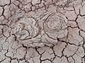
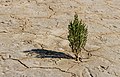
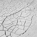
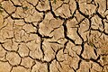
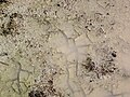
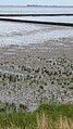
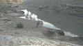
Category:Mudcracks
Zur Navigation springen
Zur Suche springen
Sedimentationsmerkmal, das durch das Trocknen eines tonreichen Sediments entsteht .jpg) | |||||
| Medium hochladen | |||||
| Ist ein(e) |
| ||||
|---|---|---|---|---|---|
| Unterklasse von | |||||
| |||||
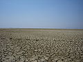
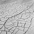
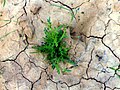
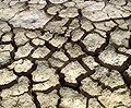
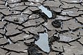
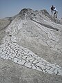
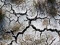
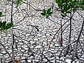
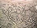
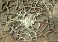
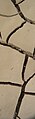
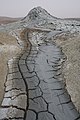
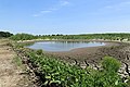
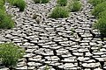
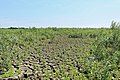
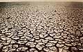
Images showing examples of mudcracks.
Unterkategorien
Es werden 13 von insgesamt 13 Unterkategorien in dieser Kategorie angezeigt:
In Klammern die Anzahl der enthaltenen Kategorien (K), Seiten (S), Dateien (D)
*
- Mud polygons (2 D)
A
C
M
- Mudcrack textures (154 D)
- Mudcracks in Bolivia (2 D)
- Mudcracks in Ecuador (1 D)
- Mudcracks in Iceland (2 D)
T
- Takir (13 D)
Medien in der Kategorie „Mudcracks“
Folgende 162 Dateien sind in dieser Kategorie, von 162 insgesamt.
-
 120820-10d mudcrack 20x PPL.jpg 2.304 × 1.728; 3,73 MB
-
 12092013205.jpg 1.600 × 1.200; 340 KB
-

-
 Adat Ombathumuri Paadam Thrissur Photo1697.jpg 2.048 × 1.536; 1,38 MB
-
 Adat Ombathumuri Paadam Thrissur Photo1700.jpg 2.048 × 1.536; 1,19 MB
-
 Arun image2.jpg 1.280 × 960; 603 KB
-
 BeltSupergroup Glacier mudcracks.jpg 1.624 × 2.275; 3,4 MB
-
 Bevloeiingswerken in Galilea Door droogte gebarsten aarde, Bestanddeelnr 255-4808.jpg 2.629 × 2.637; 1,13 MB
-
 BirCharef95.jpg 960 × 720; 114 KB
-
 Birdtracks.JPG 3.648 × 2.736; 2,77 MB
-
 Boden etosha.jpg 360 × 297; 153 KB
-
 Bosta seca.jpg 3.264 × 2.448; 2,27 MB
-
 Caked sand at price's point.jpg 3.888 × 2.592; 3,92 MB
-
 California Drought Dry Lakebed 2009.jpg 700 × 525; 143 KB
-
 CliftonFm mudcracks IMG 2385.jpg 3.456 × 2.304; 6,19 MB
-
 Cracked Earth (69760759).jpeg 1.200 × 800; 147 KB
-

-

-

-
 Curled mudcracks (Goblin Valley, Utah, USA) 2.jpg 3.008 × 2.000; 3,83 MB
-

-
 Desiccation cracks 810-0950 1.jpg 3.008 × 2.000; 2,29 MB
-
 Desiccation cracks 810-0951 1.jpg 3.008 × 2.000; 2,43 MB
-
 Dessicaton Cracks.jpg 2.366 × 1.997; 2 MB
-
 Detail IMG 6202 - Details.jpg 5.184 × 3.456; 11,11 MB
-
 Details - A IMG 6201 - Details - A.jpg 5.184 × 3.456; 10,78 MB
-
 Dried, cracking mud in Cathedral Gorge State Park, Nevada (3189763085).jpg 2.579 × 2.244; 721 KB
-
 Drought.jpg 2.336 × 3.504; 3,55 MB
-
 Dry land - panoramio.jpg 1.200 × 800; 701 KB
-

-
-
 Every Picture tells a story - Flickr - gailhampshire.jpg 2.752 × 2.240; 1,17 MB
-
 FEMA - 43179 - Mud deposit at Bombay Beach in California.jpg 3.600 × 2.400; 4,79 MB
-
 Gebarste aarde aan de Dode Zee, Bestanddeelnr 255-2709.jpg 2.614 × 2.664; 954 KB
-
 Gebarste aarde bij de Dode Zee, Bestanddeelnr 255-2708.jpg 2.620 × 2.658; 894 KB
-
 Gobustan State Reserve 06.png 2.186 × 1.453; 4,15 MB
-
 GS-Ksp024.jpg 4.464 × 2.600; 3,07 MB
-
 GS-Ksp447.jpg 4.624 × 2.600; 4,27 MB
-
 In need of rain (39308052460).jpg 5.568 × 3.712; 12,47 MB
-
 Klimawandel 003 2016 06 06.jpg 5.184 × 3.456; 8,52 MB
-
 Krustige Struktur - Trockener Lehm.jpg 5.184 × 3.456; 9,91 MB
-
 Ladakh (14687453595).jpg 640 × 640; 156 KB
-
 Ladakh India in Black & White (14507976159).jpg 1.600 × 1.069; 785 KB
-
 LECHO DE BARRO TERAPEUTICO - panoramio.jpg 446 × 297; 136 KB
-
 Mabou Group mudcracks.jpg 6.223 × 3.500; 14,33 MB
-
 Mud crackes in Magnesite quarry.jpg 1.836 × 3.264; 3 MB
-
 Mud cracks.jpg 5.184 × 3.456; 3,6 MB
-
 Mud Tracks (23385072255).jpg 4.896 × 3.264; 10,93 MB
-
 Mud Volcano in Gobustan 02.jpg 1.280 × 853; 274 KB
-
 Mud Vulcanoes Qobustan National Park 2011-07-03b.JPG 1.600 × 1.200; 882 KB
-
 Mud Vulcanoes Qobustan National Park 2011-07-03c.jpg 1.200 × 1.600; 1.008 KB
-
 Mudcracks (3 August 2018) (ground near Giant Geyser, Yellowstone, Wyoming, USA) 2.jpg 4.000 × 3.000; 7,13 MB
-
 Mudcracks (3 August 2018) (ground near Giant Geyser, Yellowstone, Wyoming, USA) 4.jpg 4.000 × 3.000; 7,77 MB
-
 Mudcracks (Canyon de Chelly National Monument, Arizona, USA) 1.jpg 3.008 × 2.000; 3,32 MB
-
 Mudcracks (Canyon de Chelly National Monument, Arizona, USA) 2.jpg 3.008 × 2.000; 3,34 MB
-
 Mudcracks (Canyon de Chelly National Monument, Arizona, USA) 3.jpg 3.008 × 2.000; 3,26 MB
-

-

-

-

-

-

-

-

-
 Mudcracks (El Malpais National Monument, New Mexico, USA).jpg 3.008 × 2.000; 3,67 MB
-
 Mudcracks (Great Salt Lake, Utah, USA).jpg 1.797 × 1.198; 2,65 MB
-
 Mudcracks 1 2016-05-13.jpg 4.912 × 3.264; 6,34 MB
-
 Mudcracks 1.jpg 3.536 × 2.312; 4,05 MB
-
 Mudcracks 2 2016-05-13.jpg 4.912 × 3.264; 6,03 MB
-
 Mudcracks along the shoreline of Storr's Lake (San Salvador Island, Bahamas) 10.jpg 4.000 × 3.000; 3,88 MB
-
 Mudcracks along the shoreline of Storr's Lake (San Salvador Island, Bahamas) 11.jpg 4.000 × 3.000; 2,56 MB
-
 Mudcracks along the shoreline of Storr's Lake (San Salvador Island, Bahamas) 12.jpg 4.000 × 3.000; 3,18 MB
-
 Mudcracks along the shoreline of Storr's Lake (San Salvador Island, Bahamas) 13.jpg 4.000 × 3.000; 2,66 MB
-
 Mudcracks along the shoreline of Storr's Lake (San Salvador Island, Bahamas) 14.jpg 4.000 × 3.000; 2,49 MB
-
 Mudcracks along the shoreline of Storr's Lake (San Salvador Island, Bahamas) 15.jpg 4.000 × 3.000; 2,55 MB
-
 Mudcracks along the shoreline of Storr's Lake (San Salvador Island, Bahamas) 16.jpg 4.000 × 3.000; 2,6 MB
-
 Mudcracks along the shoreline of Storr's Lake (San Salvador Island, Bahamas) 17.jpg 4.000 × 3.000; 2,75 MB
-
 Mudcracks along the shoreline of Storr's Lake (San Salvador Island, Bahamas) 18.jpg 4.000 × 3.000; 2,91 MB
-
 Mudcracks along the shoreline of Storr's Lake (San Salvador Island, Bahamas) 19.jpg 4.000 × 3.000; 3,59 MB
-
 Mudcracks along the shoreline of Storr's Lake (San Salvador Island, Bahamas) 2.jpg 4.000 × 3.000; 2,97 MB
-
 Mudcracks along the shoreline of Storr's Lake (San Salvador Island, Bahamas) 3.jpg 4.000 × 3.000; 3,63 MB
-
 Mudcracks along the shoreline of Storr's Lake (San Salvador Island, Bahamas) 4.jpg 4.000 × 3.000; 3,06 MB
-
 Mudcracks along the shoreline of Storr's Lake (San Salvador Island, Bahamas) 5.jpg 4.000 × 3.000; 2,55 MB
-
 Mudcracks along the shoreline of Storr's Lake (San Salvador Island, Bahamas) 7.jpg 4.000 × 3.000; 2,98 MB
-
 Mudcracks along the shoreline of Storr's Lake (San Salvador Island, Bahamas) 8.jpg 4.000 × 3.000; 2,72 MB
-
 Mudcracks along the shoreline of Storr's Lake (San Salvador Island, Bahamas) 9.jpg 4.000 × 3.000; 2,51 MB
-
 Mudcracks atop asymmetrical ripples (El Malpais National Monument, New Mexico, USA).jpg 3.008 × 2.000; 3,68 MB
-
 Mudcracks next to unnamed hot spring 20 meters south of Ragged Spring (5 August 2016) 1.jpg 4.000 × 3.000; 4,86 MB
-
 Mudcracks next to unnamed hot spring 20 meters south of Ragged Spring (5 August 2016) 2.jpg 4.000 × 3.000; 4,44 MB
-

-
 Mudcracks next to unnamed hot spring 20 meters south of Ragged Spring (5 August 2016) 4.jpg 4.000 × 3.000; 4,33 MB
-

-
 Mudcracks next to unnamed hot spring 20 meters south of Ragged Spring (5 August 2016) 6.jpg 4.000 × 3.000; 4,99 MB
-

-
 Mudcracks next to unnamed hot spring 20 meters south of Ragged Spring (5 August 2016) 8.jpg 4.000 × 3.000; 4,03 MB
-
 Mudcracks Paludi 01.jpg 4.000 × 2.848; 6,32 MB
-
 Mudcracks Paludi 02.jpg 3.802 × 2.851; 6,29 MB
-
 Mudcracks Paludi 03.jpg 4.000 × 2.344; 4,57 MB
-
 Mudcracks.jpg 2.883 × 3.291; 5,51 MB
-
 MudcracksCentripetal.JPG 1.500 × 1.085; 680 KB
-
 Nama sp. - Flickr - pellaea.jpg 3.376 × 2.532; 3,5 MB
-
 Namibie Luderitz Desert 02.JPG 3.008 × 2.000; 2,94 MB
-
 Nature Khémisset 3.JPG 1.984 × 1.488; 610 KB
-
 No Water.jpg 1.353 × 4.601; 1,47 MB
-
 Northwest of Arminto.jpg 3.600 × 2.400; 4,18 MB
-
 Ouirgane.png 2.590 × 1.883; 11,9 MB
-
 Perekishqul Mud Volcanoes.jpg 2.906 × 4.372; 3,95 MB
-
 Progardes surving the drought Richmond Qld Feb 2014 4555.JPG 3.648 × 2.736; 3,97 MB
-

-

-

-

-

-

-
 Rhede - Brahe - Spülfeld 23 ies.jpg 5.616 × 3.744; 21,13 MB
-
 Rhede - Brahe - Spülfeld 24 ies.jpg 5.616 × 3.744; 26,45 MB
-
 Rhede - Brahe - Spülfeld 25 ies.jpg 5.616 × 3.744; 26,26 MB
-
 Rhede - Brahe - Spülfeld 26 ies.jpg 5.616 × 3.744; 27,1 MB
-
 Rhede - Brahe - Spülfeld 27 ies.jpg 5.616 × 3.744; 27,48 MB
-
 Rhede - Brahe - Spülfeld 31 ies.jpg 5.616 × 3.744; 24,41 MB
-
 Rhede - Brahe - Spülfeld 32 ies.jpg 5.616 × 3.744; 19,08 MB
-
 Rhede - Brahe - Spülfeld 33 ies.jpg 5.616 × 3.744; 28,18 MB
-
 Runn of Katch - India.jpg 2.954 × 1.876; 2,05 MB
-
 Sakhalin mud Volcano 1.JPG 3.648 × 2.736; 2,12 MB
-
 Schlammloch im Tal der Geysire.jpg 2.160 × 1.440; 1,14 MB
-
 Soil Cracking.jpg 3.264 × 1.836; 2,95 MB
-
 Sol Solfatare.JPG 3.648 × 2.736; 2,63 MB
-

-

-

-

-

-
-

-

-

-
 Surviving (195166335).jpeg 2.048 × 1.168; 978 KB
-
 Takirs of Karakum Desert.jpg 947 × 710; 384 KB
-
 Takyrs Armavir Desert.jpg 4.365 × 2.910; 3,42 MB
-
 Thirst ببار ای بارون ببار - panoramio.jpg 2.930 × 3.914; 3,98 MB
-
 Toulouse - Garonne - 20121010 (3).jpg 3.648 × 2.432; 3,49 MB
-
 Trockener Lehm - desert ground.jpg 5.184 × 3.456; 9,57 MB
-
 Trockenrisse (Watt, entstehend).jpg 4.000 × 2.248; 4,05 MB
-
 Trockenrisse (Watt, Nahaufnahme).jpg 2.248 × 4.000; 3,65 MB
-
 Trockenrisse (Watt, Panorama).jpg 2.248 × 4.000; 3,67 MB
-
 UGHNN013 (unnamed hot spring 15 meters south of Beach Spring) (10 August 2018) 1.jpg 4.000 × 3.000; 10,21 MB
-
 UGHNN013 (unnamed hot spring 15 meters south of Beach Spring) (10 August 2018) 2.jpg 4.000 × 3.000; 9,02 MB
-
 UGHNN013 (unnamed hot spring 15 meters south of Beach Spring) (10 August 2018) 3.jpg 4.000 × 3.000; 6,72 MB
-
 UGHNN013 (unnamed hot spring 15 meters south of Beach Spring) (10 August 2018) 4.jpg 4.000 × 3.000; 8,44 MB
-
 UGHNN013 (unnamed hot spring 15 meters south of Beach Spring) (10 August 2018) 5.jpg 4.000 × 3.000; 8,16 MB
-
 Variation in mudcracks.jpg 10.400 × 7.800; 45,68 MB
-
 Waters Loss.jpg 2.592 × 1.944; 1,56 MB
-
 Western Cape Breton 11 mudcracks.jpg 3.247 × 2.165; 5,01 MB
-
 Wetland at Wairau Lagoons after rain.jpg 3.264 × 4.896; 6,37 MB
-
 Yw-m5.jpg 4.624 × 2.600; 2,74 MB
-
 Zmiana klimatu Draught Poland.jpg 1.440 × 1.080; 272 KB
-
 Zoormandi.JPG 3.104 × 1.746; 1,67 MB
-
 Витачів.jpg 3.000 × 4.000; 6,68 MB
-
 Растение на Модар патлиџан 02.jpg 3.264 × 1.836; 3,21 MB
-
 মাটির আদ্রতা.jpg 3.120 × 4.160; 8,86 MB
-
 సింగూర్ ప్రాజెక్ట్ లొ నీరు ఎండిపోయిన తర్వాత తీసిన చిత్రం ఇది.jpg 1.600 × 1.200; 382 KB
-
 柴达木盆地 chaidamu basin - panoramio.jpg 1.600 × 1.200; 360 KB


_julesvernex2.jpg)


.jpeg)
_1.jpg)
_2.jpg)
_3.jpg)
_2.jpg)
_7.jpg)


.jpg)


_trotseert_de_soms_barre_elementen._Locatie,_Noarderleech_Provincie_Friesland_01.jpg)
_trotseert_de_soms_barre_elementen._Locatie,_Noarderleech_Provincie_Friesland_02.jpg)


.jpg)


.jpg)
.jpg)


.jpg)


_(ground_near_Giant_Geyser,_Yellowstone,_Wyoming,_USA)_2.jpg)
_(ground_near_Giant_Geyser,_Yellowstone,_Wyoming,_USA)_4.jpg)
_1.jpg)
_2.jpg)
_3.jpg)
_1.jpg)
_2.jpg)
_3.jpg)
_4.jpg)
_5.jpg)
_6.jpg)
_7.jpg)
_8.jpg)
.jpg)
.jpg)


_10.jpg)
_11.jpg)
_12.jpg)
_13.jpg)
_14.jpg)
_15.jpg)
_16.jpg)
_17.jpg)
_18.jpg)
_19.jpg)
_2.jpg)
_3.jpg)
_4.jpg)
_5.jpg)
_7.jpg)
_8.jpg)
_9.jpg)
.jpg)
_1.jpg)
_2.jpg)
_3.jpg)
_4.jpg)
_5.jpg)
_6.jpg)
_7.jpg)
_8.jpg)


_1.jpg)
_2.jpg)
_3.jpg)
_4.jpg)
_5.jpg)
_6.jpg)


_1.jpg)
_2.jpg)
_3.jpg)
_4.jpg)
_5.jpg)
_6.jpg)
_7.jpg)
_8.jpg)
_9.jpg)
.jpeg)


.jpg)

.jpg)
.jpg)
.jpg)
_(10_August_2018)_1.jpg)
_(10_August_2018)_2.jpg)
_(10_August_2018)_3.jpg)
_(10_August_2018)_4.jpg)
_(10_August_2018)_5.jpg)


