Category:Musbury
Vai alla navigazione
Vai alla ricerca
Български: 300px|мини|Църквата Сейнт Майкъл в Мъсбъри
town in Devon, England  | |||||
| Carica un file multimediale | |||||
| Istanza di | |||||
|---|---|---|---|---|---|
| Luogo | East Devon, Devon, Sud Ovest dell'Inghilterra, Inghilterra | ||||
| Popolazione |
| ||||
| Superficie |
| ||||
| Considerato essere uguale a | Musbury (pagina Wikimedia duplicata, parrocchia civile dell'Inghilterra) | ||||
| sito web ufficiale | |||||
 | |||||
Sottocategorie
Questa categoria contiene le 3 sottocategorie indicate di seguito, su un totale di 3.
A
- Ash, Musbury (2 F)
M
- Musbury Castle (7 F)
File nella categoria "Musbury"
Questa categoria contiene 200 file, indicati di seguito, su un totale di 216.
(pagina precedente) (pagina successiva)-
 'Stockers' - geograph.org.uk - 5856086.jpg 1 024 × 823; 229 KB
-
 A seat for a well-deserved rest overlooking the Axe valley - geograph.org.uk - 6356412.jpg 1 600 × 1 200; 1,07 MB
-
 A358 - geograph.org.uk - 4407759.jpg 1 600 × 1 064; 317 KB
-
 A358 heading north - geograph.org.uk - 6219635.jpg 1 024 × 684; 342 KB
-
 A358 heading north - geograph.org.uk - 6219642.jpg 1 024 × 684; 255 KB
-
 A358 in Musbury - geograph.org.uk - 3680701.jpg 768 × 1 024; 97 KB
-
 A358 Marlborough Road, Musbury - geograph.org.uk - 6219727.jpg 1 024 × 684; 310 KB
-
 A358 north of Musbury - geograph.org.uk - 6356396.jpg 1 600 × 1 200; 660 KB
-
 A358 towards Axminster - geograph.org.uk - 6219746.jpg 1 024 × 684; 302 KB
-
 A358 towards Axminster - geograph.org.uk - 6219768.jpg 1 024 × 684; 289 KB
-
 Approaching Mounthill Lane - geograph.org.uk - 3149060.jpg 640 × 427; 63 KB
-
 Ashford Hill Plantation - geograph.org.uk - 446768.jpg 640 × 480; 147 KB
-
 Barn at Beads Farm - geograph.org.uk - 446764.jpg 640 × 473; 92 KB
-
 Barn at Little Trill - geograph.org.uk - 5855459.jpg 1 024 × 789; 195 KB
-
 Barn, Castlewood Farm - geograph.org.uk - 3150221.jpg 640 × 480; 64 KB
-
 Barns at New House Stall - geograph.org.uk - 5890919.jpg 1 024 × 768; 140 KB
-
 Beeds Hill Plantation - geograph.org.uk - 3147705.jpg 480 × 640; 89 KB
-
 Beeds Hill Plantation - geograph.org.uk - 5643132.jpg 427 × 640; 275 KB
-
 Beeds Hill Plantation - geograph.org.uk - 5643134.jpg 640 × 427; 304 KB
-
 Bulmoor Cross, Devon - geograph.org.uk - 172202.jpg 640 × 481; 120 KB
-
 Castlewood Farm - geograph.org.uk - 3150212.jpg 640 × 428; 64 KB
-
 Cat Hole Coppice - geograph.org.uk - 3149118.jpg 640 × 432; 78 KB
-
 Cattle near Sellarswood - geograph.org.uk - 3150053.jpg 640 × 447; 67 KB
-
 Cattle near Sellarswood - geograph.org.uk - 3150064.jpg 640 × 390; 59 KB
-
 Combpyne Road - geograph.org.uk - 3150043.jpg 640 × 480; 69 KB
-
 Combpyne Road - geograph.org.uk - 3150231.jpg 640 × 427; 81 KB
-
 Cottages at Musbury Cross - geograph.org.uk - 3150498.jpg 640 × 343; 36 KB
-
 Country Lane Lower Bruckland - geograph.org.uk - 6125732.jpg 800 × 549; 278 KB
-
 Cows near the chapel in Whitford Road, Musbury - geograph.org.uk - 3678825.jpg 1 536 × 1 152; 1 008 KB
-
 Crossroads in Musbury - geograph.org.uk - 4407794.jpg 1 600 × 1 064; 364 KB
-
 Dead rabbit, Mounthill Lane - geograph.org.uk - 3147729.jpg 448 × 640; 108 KB
-
 Drainage channel near Musbury - geograph.org.uk - 3150898.jpg 640 × 480; 110 KB
-
 Drainage channel near Musbury - geograph.org.uk - 3150953.jpg 640 × 480; 87 KB
-
 Drake's Farm - geograph.org.uk - 3150386.jpg 640 × 374; 69 KB
-
 Drive to Ashe Farm and Ashe House - geograph.org.uk - 5643120.jpg 640 × 427; 278 KB
-
 East Devon , Deadhorse Lane - geograph.org.uk - 2807976.jpg 4 288 × 2 848; 6,57 MB
-
 East Devon , Field ^ Haybales - geograph.org.uk - 2807937.jpg 4 288 × 2 848; 6,58 MB
-
 East Devon , Footbridge over the River Axe - geograph.org.uk - 2807943.jpg 4 288 × 2 848; 6,32 MB
-
 East Devon , Footbridge over the River Axe - geograph.org.uk - 2807949.jpg 2 542 × 4 106; 3,49 MB
-
 East Devon , Footpath ^ Grassy Field - geograph.org.uk - 2808664.jpg 4 288 × 2 848; 6,15 MB
-
 East Devon , Gate ^ Public Footpath - geograph.org.uk - 2808653.jpg 4 188 × 2 688; 5,34 MB
-
 East Devon , Grassy Field - geograph.org.uk - 2807991.jpg 4 288 × 2 848; 6,49 MB
-
 East Devon , Grassy Field - geograph.org.uk - 2808657.jpg 4 230 × 2 758; 4,17 MB
-
 East Devon , Grassy Field - geograph.org.uk - 2808658.jpg 4 158 × 2 640; 4,15 MB
-
 East Devon , Grassy Field - geograph.org.uk - 2808665.jpg 4 288 × 2 848; 4,76 MB
-
 East Devon , Grassy Field ^ Drake's Farm - geograph.org.uk - 2807986.jpg 4 288 × 2 848; 6,55 MB
-
 East Devon , Grassy Field ^ House - geograph.org.uk - 2808630.jpg 4 288 × 2 848; 4,68 MB
-
 East Devon , Grassy Field ^ Scenery - geograph.org.uk - 2808625.jpg 4 288 × 2 848; 4,97 MB
-
 East Devon , Grassy Field ^ Stream - geograph.org.uk - 2807978.jpg 4 288 × 2 848; 6,21 MB
-
 East Devon , Maidenhayne Lane - geograph.org.uk - 2808650.jpg 4 288 × 2 848; 6,35 MB
-
 East Devon , Nunford Dairy - geograph.org.uk - 2807933.jpg 4 288 × 2 848; 6,15 MB
-
 East Devon , Ploughed Field - geograph.org.uk - 2808660.jpg 4 288 × 2 848; 6,1 MB
-
 East Devon , Stream ^ Grassy Field - geograph.org.uk - 2808662.jpg 4 288 × 2 848; 6,26 MB
-
 East Devon , The River Axe - geograph.org.uk - 2807939.jpg 4 288 × 2 848; 6,39 MB
-
 East Devon , The River Axe - geograph.org.uk - 2807953.jpg 4 288 × 2 848; 6,31 MB
-
 East Devon , Waterford Farm - geograph.org.uk - 2807963.jpg 4 288 × 2 848; 5,73 MB
-
 East Devon , Waterford Farm - geograph.org.uk - 2807967.jpg 4 288 × 2 848; 6,75 MB
-
 East Devon , Waterford Lane - geograph.org.uk - 2807958.jpg 4 288 × 2 848; 6 MB
-
 East Devon Way below Musbury Castle - geograph.org.uk - 3148323.jpg 640 × 443; 92 KB
-
 East Devon Way below Musbury Castle - geograph.org.uk - 3149548.jpg 480 × 640; 128 KB
-

-

-
 East Devon Way near Hartgrove Farm - geograph.org.uk - 450131.jpg 640 × 480; 84 KB
-
 Entering Musbury from the south - geograph.org.uk - 3421000.jpg 640 × 514; 77 KB
-
 Field Above Trill - geograph.org.uk - 6091801.jpg 640 × 427; 97 KB
-
 Field boundary by Five Barrow Lane - geograph.org.uk - 4594883.jpg 1 920 × 1 357; 833 KB
-
 Field by Mounthill Lane - geograph.org.uk - 3147722.jpg 640 × 484; 82 KB
-
 Field by Pudleylake Road - geograph.org.uk - 4750335.jpg 2 808 × 2 003; 1,69 MB
-
 Field by Pudleylake Road - geograph.org.uk - 4750338.jpg 2 816 × 2 112; 1,04 MB
-
 Field in Axe valley - geograph.org.uk - 3150162.jpg 640 × 480; 97 KB
-
 Fields Above Musbury - geograph.org.uk - 5269518.jpg 640 × 427; 69 KB
-
 Five Barrow Gate - geograph.org.uk - 4593287.jpg 2 699 × 1 695; 968 KB
-
 Flooding near the River Axe - geograph.org.uk - 5269477.jpg 640 × 427; 51 KB
-
 Flooding of the River Axe - geograph.org.uk - 5269480.jpg 640 × 427; 52 KB
-
 Footbridge over the Axe - geograph.org.uk - 2099627.jpg 640 × 463; 118 KB
-
 Footpath and phone mast above Musbury - geograph.org.uk - 6356420.jpg 1 600 × 1 200; 841 KB
-
 Footpath at Lower Bruckland - geograph.org.uk - 3150036.jpg 640 × 432; 86 KB
-
 Footpath on Marlborough Road - geograph.org.uk - 3273432.jpg 1 024 × 768; 323 KB
-
 Footpath sign and stile off Mounthill Lane - geograph.org.uk - 6356416.jpg 1 600 × 1 200; 748 KB
-
 Ford at Whitford Bridge - geograph.org.uk - 4187116.jpg 3 872 × 2 592; 4,16 MB
-
 Former farmhouse on Mounthill Lane - geograph.org.uk - 5855518.jpg 1 024 × 798; 186 KB
-
 Gate and stile, Musbury Castle - geograph.org.uk - 3149165.jpg 640 × 479; 123 KB
-
 Gulf filling station and Spar shop, Musbury - geograph.org.uk - 3680693.jpg 1 024 × 768; 96 KB
-
 Hillside above Musbury - geograph.org.uk - 3147800.jpg 640 × 480; 79 KB
-
 Hillside north of Musbury Castle - geograph.org.uk - 3147743.jpg 640 × 403; 54 KB
-
 House on Maidenhayne Lane - geograph.org.uk - 5856079.jpg 1 024 × 768; 202 KB
-
 House on Trinity Hill Rd - geograph.org.uk - 5274894.jpg 640 × 427; 86 KB
-
 Houses on Whitford Road, Musbury - geograph.org.uk - 3150810.jpg 640 × 409; 59 KB
-
 In the Axe valley - geograph.org.uk - 3150023.jpg 640 × 369; 75 KB
-
 Knights Farm - geograph.org.uk - 5856092.jpg 1 024 × 768; 244 KB
-
 Lane bordering Great Trill Plantation - geograph.org.uk - 3540179.jpg 640 × 480; 111 KB
-
 Lane east of Hart Grove Farm - geograph.org.uk - 6356461.jpg 1 600 × 1 200; 1 001 KB
-
 Lane junction at Maidenhayne - geograph.org.uk - 1871084.jpg 640 × 480; 55 KB
-
 Lane junction near Hartgrove Farm - geograph.org.uk - 450105.jpg 640 × 480; 139 KB
-
 Lane near Hartgrove Farm - geograph.org.uk - 450219.jpg 480 × 640; 157 KB
-
 Lane up Hartgrove Hill - geograph.org.uk - 450081.jpg 640 × 480; 151 KB
-
 Leaving Maidenhayne for the north - geograph.org.uk - 3421018.jpg 640 × 359; 54 KB
-
 Little Trill - geograph.org.uk - 5854666.jpg 1 024 × 815; 203 KB
-
 Little Trill Holiday Cottages, Trill - geograph.org.uk - 221664.jpg 640 × 441; 123 KB
-
 Lower Bruckland Farm - geograph.org.uk - 3149793.jpg 640 × 459; 75 KB
-
 Maidenhayne , Maidenhayne Lane - geograph.org.uk - 2808645.jpg 4 288 × 2 848; 5,45 MB
-
 Maidenhayne , Public Footpath - geograph.org.uk - 2808642.jpg 4 288 × 2 848; 6,92 MB
-
 Maidenhayne , Small Dwellings - geograph.org.uk - 2808649.jpg 4 288 × 2 848; 5,39 MB
-
 Maidenhayne Cross - geograph.org.uk - 5856072.jpg 1 024 × 876; 241 KB
-
 Maize by Combpyne Road - geograph.org.uk - 3150275.jpg 640 × 414; 112 KB
-
 Meadow below Musbury Castle - geograph.org.uk - 3147866.jpg 640 × 480; 120 KB
-
 Meanders of the River Axe - geograph.org.uk - 3678751.jpg 1 024 × 768; 130 KB
-
 Mobile phone mast above Musbury - geograph.org.uk - 3147813.jpg 494 × 640; 51 KB
-
 Mounthill Lane - geograph.org.uk - 3147712.jpg 640 × 480; 135 KB
-
 Mounthill Lane - geograph.org.uk - 3149033.jpg 640 × 480; 73 KB
-
 Mounthill Lane - geograph.org.uk - 3397690.jpg 1 200 × 1 600; 949 KB
-
 Mounthill Lane - geograph.org.uk - 5274460.jpg 640 × 427; 75 KB
-
 Mounthill Lane - geograph.org.uk - 5855500.jpg 1 024 × 801; 184 KB
-
 Mounthill Lane and grit bin, above Musbury - geograph.org.uk - 6356408.jpg 1 600 × 1 200; 777 KB
-
 Mounthill Lane and the Axe valley - geograph.org.uk - 6356418.jpg 1 600 × 1 200; 743 KB
-
 Mounthill Lane at Bulmoor Cross - geograph.org.uk - 6356430.jpg 1 600 × 1 200; 1,05 MB
-
 Mounthill Lane in spring - geograph.org.uk - 6138050.jpg 1 024 × 768; 336 KB
-
 Mounthill Lane, Musbury - geograph.org.uk - 6356404.jpg 1 600 × 1 200; 772 KB
-
 Mounthll Lane - geograph.org.uk - 5855494.jpg 1 024 × 768; 227 KB
-
 Musbury , Grassy Field - geograph.org.uk - 2807995.jpg 4 288 × 2 848; 6,27 MB
-
 Musbury , Marlborough Road A358 - geograph.org.uk - 2808010.jpg 4 288 × 2 848; 6,32 MB
-
 Musbury , Memorial Tree - geograph.org.uk - 2808564.jpg 2 848 × 4 288; 6,57 MB
-
 Musbury , Path ^ Houses - geograph.org.uk - 2808534.jpg 4 288 × 2 848; 5,37 MB
-
 Musbury , Seaton Road A358 - geograph.org.uk - 2807997.jpg 4 288 × 2 848; 4,8 MB
-
 Musbury , The A358 - geograph.org.uk - 2808567.jpg 4 152 × 2 626; 3,39 MB
-
 Musbury - geograph.org.uk - 3149091.jpg 640 × 428; 67 KB
-
 Musbury - geograph.org.uk - 5642931.jpg 640 × 451; 202 KB
-
 Musbury Castle - geograph.org.uk - 3149521.jpg 640 × 448; 101 KB
-
 Musbury Church - geograph.org.uk - 5269502.jpg 427 × 640; 78 KB
-
 Musbury church and churchyard - geograph.org.uk - 3540189.jpg 640 × 471; 81 KB
-
 Musbury Cross - geograph.org.uk - 3150516.jpg 640 × 380; 44 KB
-
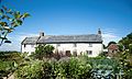
 Musbury Farmhouse.jpg 4 288 × 2 848; 5,86 MB
-
 Musbury seen from Waterford Lane - geograph.org.uk - 3678820.jpg 1 536 × 1 152; 1,18 MB
-
 Musbury Village School - geograph.org.uk - 5269510.jpg 640 × 427; 90 KB
-
 Musbury, Deadhorse Lane - geograph.org.uk - 294333.jpg 640 × 427; 272 KB
-
 Musbury, Gulf garage - geograph.org.uk - 3275630.jpg 1 024 × 768; 151 KB
-
 Musbury, in the Axe valley - geograph.org.uk - 294347.jpg 640 × 427; 248 KB
-
 Musbury, milestone on Axminster Road - geograph.org.uk - 2642896.jpg 480 × 640; 75 KB
-
 Musbury, near Millands Farm - geograph.org.uk - 294327.jpg 640 × 427; 234 KB
-
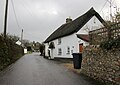
 Musbury, postbox № EX13 52 - geograph.org.uk - 2642890.jpg 480 × 640; 75 KB
-
 Musbury, Spillers Farm - geograph.org.uk - 294344.jpg 640 × 427; 156 KB
-
 Musbury, the Axe valley - geograph.org.uk - 492943.jpg 640 × 427; 187 KB
-
 Musbury, the village stores - geograph.org.uk - 2642885.jpg 640 × 480; 66 KB
-
 Musbury, towards Sellers Wood - geograph.org.uk - 294343.jpg 640 × 427; 196 KB
-
 Musbury, Turnpike Cottage - geograph.org.uk - 294328.jpg 640 × 427; 210 KB
-
 Musbury, Waterford Lane - geograph.org.uk - 294332.jpg 640 × 427; 245 KB
-
 New House Stall - geograph.org.uk - 5890925.jpg 1 024 × 768; 223 KB
-
 Nunford Bridge and WW2 pillbox - geograph.org.uk - 3678269.jpg 1 024 × 768; 140 KB
-
 Nunford Bridge near Nunford Dairy - geograph.org.uk - 6266832.jpg 1 024 × 683; 174 KB
-
 Nunford Bridge over River Axe - geograph.org.uk - 3678812.jpg 1 536 × 1 152; 1,09 MB
-

-
 On the road to Musbury - geograph.org.uk - 4407812.jpg 1 600 × 1 064; 396 KB
-
 Parapet of former railway bridge, Hart Grove Farm - geograph.org.uk - 6356454.jpg 1 600 × 1 600; 1,34 MB
-
 Pasture by Combpyne Road - geograph.org.uk - 3150285.jpg 640 × 453; 92 KB
-
 Pasture by Combpyne Road - geograph.org.uk - 3150314.jpg 640 × 474; 89 KB
-
 Path below Musbury Castle - geograph.org.uk - 3147857.jpg 480 × 640; 117 KB
-
 Path to Musbury Castle - geograph.org.uk - 5855489.jpg 1 024 × 806; 190 KB
-
 Primary School, Musbury - geograph.org.uk - 5855812.jpg 1 024 × 768; 186 KB
-
 Pudleylake Rd - geograph.org.uk - 6091203.jpg 427 × 640; 94 KB
-
 Pudleylake Rd - geograph.org.uk - 6091209.jpg 640 × 427; 124 KB
-
 Pudleylake Rd - geograph.org.uk - 6091214.jpg 640 × 427; 133 KB
-
 Pudleylake Road - geograph.org.uk - 3147702.jpg 480 × 640; 98 KB
-
 Pudleylake Road - geograph.org.uk - 4750340.jpg 1 920 × 1 440; 945 KB
-
 Pudleylake Road - geograph.org.uk - 5854661.jpg 1 024 × 802; 221 KB
-
 Pudleylake Road at Bulmoor Cross - geograph.org.uk - 6356429.jpg 1 600 × 1 200; 1,02 MB
-
 River Axe - geograph.org.uk - 5269486.jpg 640 × 427; 72 KB
-
 River Axe and Nunford Bridge (footbridge) - geograph.org.uk - 3678725.jpg 1 536 × 1 152; 1,08 MB
-
 River Axe from Nunford Bridge - geograph.org.uk - 3678807.jpg 1 536 × 1 152; 993 KB
-
 River Axe in Spate - geograph.org.uk - 5269484.jpg 640 × 427; 88 KB
-
 River Cottage Farmhouse.jpg 3 888 × 2 318; 2,12 MB
-
 Road Closed at Trill Cross - geograph.org.uk - 6091198.jpg 800 × 534; 332 KB
-
 Road junction near Musbury - geograph.org.uk - 1072490.jpg 640 × 480; 58 KB
-
 Road on Trinity Hill, passing Sir Harry Hill Plantation - geograph.org.uk - 6356474.jpg 1 600 × 1 594; 1,34 MB
-
 Rosemary Lane, Musbury - geograph.org.uk - 3150392.jpg 542 × 640; 77 KB
-
 Sheep and Lambs at Lower Bruckland - geograph.org.uk - 6125729.jpg 800 × 519; 259 KB
-
 Signpost at Bulmoor Cross - geograph.org.uk - 6356427.jpg 1 600 × 1 200; 1 016 KB
-
 South Cross Cottages - geograph.org.uk - 3150341.jpg 640 × 480; 64 KB
-
 Southerns Cross - geograph.org.uk - 3150336.jpg 640 × 441; 61 KB
-
 Spar and Gulf filling station, Musbury - geograph.org.uk - 6356399.jpg 1 600 × 999; 568 KB
-
 Spillers Farm and Bed and Breakfast - geograph.org.uk - 5021957.jpg 1 600 × 1 200; 824 KB
-
 Spillers Farm B and B - geograph.org.uk - 5890941.jpg 1 024 × 787; 177 KB
-
 Spillers Farm lake and house - geograph.org.uk - 1408749.jpg 578 × 330; 88 KB
-
 Spillers Farm, Musbury, Devon - geograph.org.uk - 1440723.jpg 640 × 480; 79 KB
-

-

-

-
 Stile on Mounthill Lane - geograph.org.uk - 3149047.jpg 480 × 640; 86 KB
-
 Stop war, Musbury Cross - geograph.org.uk - 3150469.jpg 528 × 640; 65 KB
-
 Street and crossroads in Musbury - geograph.org.uk - 3540200.jpg 640 × 480; 102 KB
-
 The A358 near Musbury - geograph.org.uk - 5890932.jpg 1 024 × 768; 148 KB
-
 The Drake Monument, St Michael's church, Musbury - geograph.org.uk - 5855809.jpg 1 024 × 768; 150 KB
-
 The farm at New House Stall - geograph.org.uk - 5021951.jpg 1 600 × 1 200; 771 KB
-
 The farmyard at New House Stall - geograph.org.uk - 5021952.jpg 1 600 × 1 200; 679 KB
-
 The Golden Hind inn, Musbury - geograph.org.uk - 3680678.jpg 1 024 × 585; 88 KB
-
 The road to Musbury - geograph.org.uk - 2112946.jpg 640 × 480; 104 KB
-
 The roads divide - geograph.org.uk - 3275616.jpg 1 024 × 768; 210 KB
-
 The Street, Musbury - geograph.org.uk - 6356400.jpg 1 600 × 1 143; 634 KB
-
 The top of the hill - geograph.org.uk - 3397701.jpg 1 600 × 1 200; 771 KB
-
 Towards the Axe valley - geograph.org.uk - 3149076.jpg 640 × 448; 69 KB
-
 Towards the Axe valley - geograph.org.uk - 3150370.jpg 640 × 437; 92 KB


_-_geograph.org.uk_-_3678725.jpg)


_-_geograph.org.uk_-_3207038.jpg)
_-_geograph.org.uk_-_3207047.jpg)
_-_geograph.org.uk_-_3207061.jpg)


