Category:N11 road (Ireland)
Salta a la navigazzion
Và a cercà
national primary road in Ireland   | |||||
| Carega su un fail audio / video | |||||
| L'è un(a) | |||||
|---|---|---|---|---|---|
| Part de | |||||
| Sit |
| ||||
| Longhesa |
| ||||
| |||||
Fail in la categoria "N11 road (Ireland)"
Quella categoria chì la gh'ha denter 24 i fail riportad chì de sota, su un total de 24.
-
 ExitSign3885-1.jpg 3 888 × 2 592; 989 KByte
-
 IMG 1963w.JPG 2 592 × 1 944; 1,36 MByte
-
 Lower Leeson Street, Dublin, Ireland.jpg 1 600 × 1 200; 362 KByte
-
 Motorway Exit 20 Ireland.PNG 150 × 130; 4 KByte
-
 Motorway Exit 6A Ireland.PNG 150 × 130; 4 KByte
-
 N11 - geograph.org.uk - 523696.jpg 640 × 480; 84 KByte
-
 N11 at Ballinacor East - geograph.org.uk - 1582419.jpg 640 × 480; 58 KByte
-
 N11 at Kilpedder - geograph.org.uk - 517070.jpg 640 × 480; 91 KByte
-
 N11 Cherrywood.jpg 4 368 × 2 912; 5,94 MByte
-
 N11 from Stillorgan Road overpass - geograph.org.uk - 1627442.jpg 640 × 427; 95 KByte
-
 N11 Gorey Bypass, County Wexford.jpg 3 246 × 1 771; 1,16 MByte
-
 N11 near Roscath - geograph.org.uk - 1456579.jpg 640 × 428; 68 KByte
-
 N11 reassurance sign.jpg 2 138 × 1 904; 2,12 MByte
-
 N11 road south of Newtownmountkennedy.jpg 2 592 × 1 944; 1,32 MByte
-
 N11 west of Wicklow Town, Ireland.jpg 2 592 × 1 944; 1,59 MByte
-
 N11BlackhillRdJnct 1010.JPG 2 592 × 1 944; 1,53 MByte
-
 N11GoreyBypass.jpg 3 875 × 2 073; 1 017 KByte
-
 Remnants of road construction beside the N11 - geograph.org.uk - 1437379.jpg 640 × 428; 92 KByte
-
 Shops beside the N11 at Ballard Lower - geograph.org.uk - 1456603.jpg 640 × 428; 57 KByte
-
 The N11 at Kilmurry - geograph.org.uk - 1401089.jpg 640 × 480; 83 KByte
-
 Tinnahask Service Station - geograph.org.uk - 1444492.jpg 640 × 480; 47 KByte
-
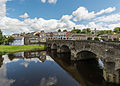 View of northern N11 bridge and Shannon Quay, Enniscorthy 20150806 1.jpg 6 549 × 4 678; 8,69 MByte
-
 View towards the sea from Johnstown North - geograph.org.uk - 1456642.jpg 640 × 428; 67 KByte
-
 View towards the sea south of Ballymoyle - geograph.org.uk - 1456637.jpg 640 × 428; 79 KByte


