Category:Nagato, Yamaguchi
Sari la navigare
Sari la căutare
city in Yamaguchi Prefecture, Japan     | |||||
| Încarcă multimedia | |||||
| Este un/o | |||||
|---|---|---|---|---|---|
| Locul actual | Prefectura Yamaguchi, Japonia | ||||
| Localizat pe malul | |||||
| Formă juridică |
| ||||
| Înființare |
| ||||
| Populație |
| ||||
| Suprafață |
| ||||
| Înlocuiește |
| ||||
| Diferit(ă) de | |||||
| site oficial | |||||
 | |||||
Subcategorii
Această categorie conține următoarele 8 subcategorii, dintr-un total de 8.
B
H
- Mount Hanao (Yamaguchi) (3 F)
K
M
- Mara Kannon (10 F)
N
- Nagato Yumoto Onsen (3 F)
O
S
- Senjojiki (Nagato) (7 F)
Y
Fișiere media din categoria „Nagato, Yamaguchi”
Următoarele 72 fișiere se află în această categorie, dintr-un total de 72.
-
 Emblem of Nagato, Yamaguchi (green).svg 500x500; 252 octeți
-
 Emblem of Nagato, Yamaguchi (red).svg 500x500; 252 octeți
-
 Emblem of Nagato, Yamaguchi.svg 500x500; 252 octeți
-
 Flag of Nagato Yamagichi.JPG 446x299; 8 KB
-
 Flag of Nagato, Yamaguchi (green).svg 512x341; 1 KB
-
 Flag of Nagato, Yamaguchi (red).svg 512x341; 1 KB
-
 Flag of Nagato, Yamaguchi.svg 600x400; 300 octeți
-
 Nagato Yamaguchi chapter green version.gif 129x92; 2 KB
-
 Nagato Yamaguchi chapter red version.gif 128x90; 3 KB
-
 Nagato Yamaguchi chapter.JPG 277x220; 8 KB
-
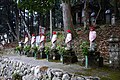 6jizo-mara-kannnon2017.jpg 5.472x3.648; 8,57 MB
-
 Cape and a Pond on the hill and flower - panoramio.jpg 2.560x1.920; 3,66 MB
-
 E9 SAN-IN-EXP MisumiIC.jpg 2.048x1.152; 2,24 MB
-
 Emblem of Nagato, Yamaguchi (1954–2005).svg 250x244; 3 KB
-
 Flag of Former Nagato Yamaguchi.png 672x407; 7 KB
-
 Flag of Nagato, Yamaguchi (1954–2005).svg 600x400; 1 KB
-
 Former Yagato Yamaguchi chapter.jpg 323x324; 16 KB
-
 Fukata Tameike 1.jpg 4.032x3.024; 9,66 MB
-
 Fukata Tameike 2.jpg 4.032x3.024; 7,59 MB
-
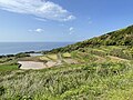
 Gakusajiki d 01.jpg 1.600x1.200; 973 KB
-
 Gakusajiki d 02.jpg 1.600x1.200; 962 KB
-
 Girl-Scouts-of-Japan-1.jpg 842x574; 257 KB
-
 Higashiushirobata Tanada 1.jpg 4.032x3.024; 5,05 MB
-
 Higashiushirobata Tanada 2.jpg 4.032x3.024; 5,25 MB
-
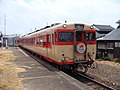 JRW kiha58-563 oide-mase-yamaguchi.jpg 3.264x2.448; 2,27 MB
-
 Kakefuchiriver1.jpg 4.608x3.456; 5,19 MB
-
 Kakefuchiriver2.jpg 4.608x3.456; 4,18 MB
-
 Kakefuchiriver3.jpg 4.608x3.456; 5,27 MB
-
 Kakefuchiriver4.jpg 4.608x3.456; 3,24 MB
-
 Map Nagato en.png 1.081x740; 33 KB
-
 Mara-kannnon2017-03.jpg 5.472x3.648; 8,9 MB
-
 Nagato 20201212150912 (50852961333).jpg 4.032x3.024; 4,27 MB
-
 Nagato 20201212152600 (50852960253).jpg 4.032x3.024; 3,64 MB
-
 Nagato branch office, Hagi Public Employment Security Office nameplate.JPG 4.608x3.456; 3,87 MB
-
 Nagato city center area Aerial photograph.2008.jpg 5.541x4.937; 6,16 MB
-
 Nagato in Yamaguchi Prefecture Ja.svg 572x444; 12 KB
-
 Nagato in Yamaguchi Prefecture.png 1.081x740; 19 KB
-
 Nagato Tainei-ji Temple 02.JPG 2.800x2.100; 3,19 MB
-
 Nagato Tainei-ji Temple 03.JPG 2.800x2.100; 2,81 MB
-
 Nagato Tainei-ji Temple 04.JPG 2.800x2.100; 2,97 MB
-
 Nagato Tainei-ji Temple. Grave of Ouchi Yoshitaka and his valet.jpg 2.800x2.100; 2,32 MB
-
 Ngatoshi station ekimae.JPG 3.072x2.304; 3,37 MB
-
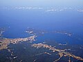 Omijima aerialshot.jpg 3.648x2.736; 6,48 MB
-
 Population distribution of Nagato, Yamaguchi, Japan.svg 512x256; 22 KB
-
 R191-2020-216.jpg 1.920x1.078; 343 KB
-
 Renaissa Nagato01.jpg 2.304x1.296; 629 KB
-
 Ryugu no shiofuki (32276211594).jpg 5.616x3.744; 12,05 MB
-
 Ryuugunoshiofuki 20190322.jpg 5.184x3.456; 6,28 MB
-
 San'in Main Line and Senzaki Branch line-01.jpg 5.472x3.648; 21,92 MB
-
 Stone stands 西立石漁港 - panoramio.jpg 2.560x1.812; 3,56 MB
-
 Tawarayama-spa.jpg 2.132x1.505; 742 KB
-
 The hill which overlooks the Gulf of Yuya 油谷湾を望む丘 - panoramio.jpg 2.560x1.761; 3,83 MB
-
 Yamaguchi Nagato-City.png 314x199; 5 KB
-
 Yamaguchimisumiriver1.jpg 4.608x3.456; 5,25 MB
-
 Yamaguchimisumiriver2.jpg 4.608x3.456; 4,16 MB
-
 Yamaguchimisumiriver3.jpg 4.608x3.456; 4,17 MB
-
 Yuya-tanada.jpg 640x480; 106 KB
-
 ベルトコンベア - panoramio.jpg 1.600x900; 187 KB
-
 三隅川 - panoramio - Yobito KAYANUMA.jpg 1.600x900; 283 KB
-
 二位局之碑.jpg 4.000x1.800; 5,71 MB
-
 仙崎 - panoramio.jpg 1.600x900; 202 KB
-
 北浦街道 - panoramio.jpg 1.600x900; 269 KB
-
 山口県長門市県内位置図.svg 797x621; 19 KB
-
 東後畑棚田 - panoramio.jpg 2.816x2.112; 731 KB
-
 津黄峠 - panoramio.jpg 1.600x900; 299 KB
-
 盤石橋 - panoramio.jpg 2.816x2.112; 1,32 MB
-
 県道66号線 - panoramio.jpg 1.600x900; 192 KB
-
 長門IMGP0806.JPG 350x263; 40 KB
-
 長門市 - panoramio.jpg 1.600x900; 244 KB
-
 長門市日置中 - panoramio.jpg 1.600x900; 295 KB
-
 長門市深川港付近の海岸 - panoramio.jpg 4.032x3.024; 2,89 MB
-
 長門市西深川 - panoramio.jpg 1.600x900; 259 KB
.svg)
.svg)

.svg)
.svg)


.svg)

.svg)


.jpg)
.jpg)


.jpg)


