Category:Nakasendō
Vai alla navigazione
Vai alla ricerca
English: Nakasendō was one of the five routes of the Edo period, and one of the two that connected Edo (former Tokyo) to Kyoto in Japan.
日本語: 中山道は日本の歴史的な街道。江戸時代には江戸と京を結ぶ五街道の一つ。
One of the five routes of the Edo period (in Japan)  | |||||
| Carica un file multimediale | |||||
| Istanza di | |||||
|---|---|---|---|---|---|
| Parte di | |||||
| Luogo | |||||
| Sistema di trasporto | |||||
| Consiste di | |||||
| |||||
Sottocategorie
Questa categoria contiene le 8 sottocategorie indicate di seguito, su un totale di 8.
File nella categoria "Nakasendō"
Questa categoria contiene 47 file, indicati di seguito, su un totale di 47.
-
 A Tour of the Waterfalls of the Provinces-Kisokaidou Onono Bakuhu.jpg 402 × 600; 192 KB
-
 Border sign(Shiga-Gifu)-01.jpg 5 472 × 3 648; 17,79 MB
-
 Border sign(Shiga-Gifu)-02.jpg 5 472 × 3 648; 19,33 MB
-
 Border sign(Shiga-Gifu)-03.jpg 3 648 × 5 472; 15,49 MB
-
 Border sign(Shiga-Gifu)-04.jpg 5 472 × 3 648; 16,94 MB
-
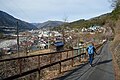 Descending the Nakasendō to Nagiso, 2016.jpg 6 016 × 4 000; 13,24 MB
-
 Foliage - Nakasendo between Magome and Tsumago - P1010024.jpg 1 920 × 2 560; 956 KB
-
 Frost - Nakasendo between Magome and Tsumago - P1010085.jpg 2 560 × 1 920; 1 001 KB
-
 Historic site of Toda ferry crossing Arakawa River.jpg 1 400 × 2 100; 524 KB
-
 Itabashi-at-nakajuku.JPG 3 264 × 2 448; 4,77 MB
-
 Itabashi2.jpg 1 920 × 1 440; 846 KB
-
 Katsushika Hokusai - Ono-Wasserfall am Kisokaido.jpeg 2 196 × 3 186; 4,17 MB
-
 KisojiMarker.jpg 1 148 × 1 702; 1,51 MB
-
 Koreyorikitakisoji01.jpg 1 024 × 1 536; 1,51 MB
-
 Koreyorikitakisoji02.jpg 1 536 × 1 024; 1,52 MB
-
 Kusatsu 20211211134854 (51816596391).jpg 4 032 × 3 024; 4,67 MB
-
 Kyu-Nakasendo, Utozaka Mitake Town 2018.jpg 1 200 × 1 600; 2,59 MB
-
 Minoji 垂井追分道標 20230502 101231.jpg 3 968 × 2 976; 4,57 MB
-
 Monument in the middle of Nakasendo.JPG 2 736 × 3 648; 3,6 MB
-
 Nakasendo between Magome and Tsumago - P1010112.jpg 1 920 × 2 560; 1,07 MB
-
 Nakasendo between Magome and Tsumago - P1010116.jpg 1 920 × 2 560; 1,06 MB
-
 Nakasendo between Magome and Tsumago - P1010118.jpg 1 920 × 2 560; 974 KB
-
 Nakasendo Highway, Japan 2003.jpg 2 560 × 1 920; 1,67 MB
-
 Nakasendo in Tsuzuracho Hikone 20110809.jpg 1 095 × 821; 198 KB
-
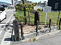
 Nakasendo marker 1.jpg 960 × 1 280; 541 KB
-
 NakasendoWJapan105CF1-2.jpg 200 × 273; 25 KB
-
 Nakasendō between Magome-juku and Tsumago-juku, Nagiso, 2016.jpg 4 000 × 6 016; 15,19 MB
-
 Nasubigawa shinoharake 02.jpg 1 024 × 1 536; 484 KB
-
 Nasubigawa shinoharake 03.jpg 1 536 × 1 024; 936 KB
-
 Nasubigawa shinoharake 04.jpg 1 536 × 1 024; 774 KB
-
 Nasubigawa shinoharake 05.jpg 1 536 × 1 024; 765 KB
-
 Persimmon - Nakasendo between Magome and Tsumago - P1010103.jpg 2 560 × 1 920; 1,02 MB
-
 Shiga prefectural road route 002, Boarder between Ritto and Moriyama.jpg 2 432 × 1 824; 1,84 MB
-
 Shimonosuwa (Tea House) and Fire Bell at Nakasendo (3110696654).jpg 760 × 645; 56 KB
-
 Tateba tea house, Tsumago-juku, Nagiso, 2016.jpg 5 255 × 3 231; 10,2 MB
-
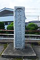
 The Middle Point of NAKASENDO - panoramio.jpg 854 × 480; 355 KB
-
 Utazume Bridge 2021-05.jpg 2 432 × 1 824; 2,58 MB
-
 Utou Pass (Kakamigahara).jpg 5 184 × 3 456; 11,37 MB
-
 Wooden sign - 2324.jpg 3 456 × 2 304; 3,02 MB
-
 Yoshimi-nishi intersection, Moriyama, Shiga.jpg 2 432 × 1 824; 1,82 MB
-
 「是より北木曽路」の碑.jpg 600 × 800; 278 KB
-
 「是より南木曽路」の碑.jpg 600 × 800; 284 KB
-
 中山道(諏訪大社 下社近く) (3604351884).jpg 2 640 × 1 760; 1,18 MB
-
 平岩 - panoramio.jpg 1 600 × 900; 178 KB
-
 旧中山道 - panoramio - Yobito KAYANUMA (5).jpg 900 × 1 600; 386 KB
-
 県道65号線 - panoramio - Yobito KAYANUMA.jpg 900 × 1 600; 189 KB
-
 県道65号線 - panoramio.jpg 1 600 × 900; 188 KB


.jpg)


.jpg)


.jpg)

.jpg)


_and_Fire_Bell_at_Nakasendo_(3110696654).jpg)