Category:Nanstallon
Aller à la navigation
Aller à la recherche
village britannique  | |||||
| Téléverser des médias | |||||
| Nature de l’élément | |||||
|---|---|---|---|---|---|
| Lieu | Lanivet, Cornouailles, Angleterre du Sud-Ouest, Angleterre | ||||
 | |||||
English: Nanstallon is a small village in north Cornwall, United Kingdom, two kilometres west of Bodmin. The village overlooks the River Camel and has two routes onto the Camel Trail, one at Boscarne, the other at Nanstallon Halt on the old railway line.
Sous-catégories
Cette catégorie comprend seulement la sous-catégorie ci-dessous.
N
Média dans la catégorie « Nanstallon »
Cette catégorie comprend 11 fichiers, dont les 11 ci-dessous.
-
 Camel Trail at Nanstallon Halt (9570).jpg 4 288 × 2 848 ; 6,51 Mio
-
 Mount Charles - geograph.org.uk - 378818.jpg 640 × 480 ; 63 kio
-
 Nanstallon Halt - geograph.org.uk - 4175868.jpg 640 × 480 ; 164 kio
-
 Nanstallon Methodist Church - geograph.org.uk - 1842053.jpg 480 × 640 ; 85 kio
-
 Nanstallon Village - geograph.org.uk - 2098067.jpg 640 × 439 ; 82 kio
-
 Small tributary of the Camel at Nanstallon - geograph.org.uk - 1842020.jpg 480 × 640 ; 148 kio
-
 The Church of St Stephens at Nanstallon - geograph.org.uk - 1842040.jpg 640 × 480 ; 91 kio
-
 This way to Nanstallon - geograph.org.uk - 2098053.jpg 640 × 507 ; 77 kio
-
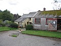 Barrington Farm near Nanstallon, Cornwall - geograph.org.uk - 308336.jpg 640 × 480 ; 90 kio
-
 Lane to Nanstallon - geograph.org.uk - 379991.jpg 640 × 428 ; 93 kio
-
 Nanstallon Primary School - geograph.org.uk - 378799.jpg 640 × 480 ; 64 kio
.jpg)


