Category:Nantyglo
Vai alla navigazione
Vai alla ricerca
villaggio del Galles  | |||||
| Carica un file multimediale | |||||
| Istanza di | |||||
|---|---|---|---|---|---|
| Luogo | Blaenau Gwent, Galles | ||||
 | |||||

Cymraeg: Pentref mawr ym mwrdeisdref sirol Blaenau Gwent yn ne-ddwyrain Cymru yw Nantyglo, hefyd Nant-y-glo. Saif ychydig i'r de o Frynmawr ac i'r gogledd o Blaina.
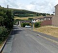
English: Nantyglo is a village, situated deep within the South Wales Valleys between Blaina and Brynmawr, in the county borough of Blaenau Gwent, Wales.
Sottocategorie
Questa categoria contiene le 3 sottocategorie indicate di seguito, su un totale di 3.
N
- Nantyglo Rugby Club (5 F)
W
File nella categoria "Nantyglo"
Questa categoria contiene 14 file, indicati di seguito, su un totale di 14.
-
 Entrance to Nantyglo (geograph 6927949).jpg 4 032 × 3 024; 4,29 MB
-
 Farm below Mulfran - geograph.org.uk - 676570.jpg 624 × 460; 174 KB
-

-
 Gastineau Nantyglo 1820.jpg 1 754 × 1 118; 469 KB
-
 Holy Trinity & St Anne church, Nantyglo - geograph.org.uk - 3514787.jpg 800 × 602; 154 KB
-
 Nant y Glo, Monmouthshire (1131349).jpg 1 498 × 947; 1,18 MB
-
 Nantyglo Church1.JPG 1 776 × 795; 305 KB
-
 Nantyglo Senior Citizens Hall - geograph.org.uk - 2281335.jpg 640 × 496; 73 KB
-
 Nantyglo Wesley Methodist Church (geograph 6927945).jpg 3 768 × 2 826; 3,16 MB
-

-
 Road to Coalbrookvale, Nantyglo.jpg 800 × 728; 180 KB
-
 Round tower, Waun Pond, Nantyglo (geograph 2260002).jpg 640 × 589; 79 KB
-

-
 The workshops on Pond road - geograph.org.uk - 688028.jpg 640 × 480; 66 KB
.jpg)


.jpg)


.jpg)

.jpg)

