Category:Narford
Aller à la navigation
Aller à la recherche
English: Narford is situated in the Breckland District of Norfolk and covers an area of 970 hectares (3.75 square miles).
localité britannique du comté anglais de Norfolk  | |||||
| Téléverser des médias | |||||
| Nature de l’élément | |||||
|---|---|---|---|---|---|
| Lieu | Breckland, Norfolk, Angleterre de l'Est, Angleterre | ||||
| Population |
| ||||
| Superficie |
| ||||
 | |||||
Sous-catégories
Cette catégorie comprend 2 sous-catégories, dont les 2 ci-dessous.
M
N
Média dans la catégorie « Narford »
Cette catégorie comprend 147 fichiers, dont les 147 ci-dessous.
-
 A47 Eastbound near Narborough - geograph.org.uk - 4619454.jpg 640 × 480 ; 354 kio
-
 A47 near Narborough - geograph.org.uk - 4619448.jpg 640 × 480 ; 420 kio
-
 A47 towards King's Lynn - geograph.org.uk - 6536902.jpg 1 024 × 684 ; 330 kio
-
 A47 towards King's Lynn - geograph.org.uk - 6537036.jpg 1 024 × 684 ; 312 kio
-
 Approaching Narford Hall on unnamed country lane - geograph.org.uk - 1812165.jpg 640 × 480 ; 133 kio
-
 Avenue of young trees opposite Narford Hall - geograph.org.uk - 6557551.jpg 3 927 × 2 945 ; 4,57 Mio
-
 Beech trees at Swaffham Heath - geograph.org.uk - 83045.jpg 425 × 640 ; 208 kio
-
 Bio security measures on a pig farm - geograph.org.uk - 6169355.jpg 3 456 × 2 592 ; 3,66 Mio
-
 Bridge on Narford Lane - geograph.org.uk - 5545132.jpg 4 608 × 3 072 ; 1,93 Mio
-
 Bridge on Narford Lane - geograph.org.uk - 5545662.jpg 4 608 × 3 072 ; 1,95 Mio
-
 Bridge over the River Nar, Narford - geograph.org.uk - 2576465.jpg 640 × 480 ; 260 kio
-
 Bridge over the River Nar, Narford - geograph.org.uk - 2576467.jpg 640 × 480 ; 238 kio
-
 Brown hare, ears down, trying not to be noticed - geograph.org.uk - 6169343.jpg 3 456 × 2 592 ; 3,92 Mio
-
 Country lane from Swaffham to Narford - geograph.org.uk - 2763850.jpg 640 × 480 ; 246 kio
-
 Country lane to Narford - geograph.org.uk - 2763847.jpg 640 × 480 ; 186 kio
-
 Country road - geograph.org.uk - 778165.jpg 480 × 640 ; 129 kio
-
 Crane Garden Buildings sign - geograph.org.uk - 5543655.jpg 2 539 × 3 822 ; 3,89 Mio
-
 Cultivated field and Scoot Wood - geograph.org.uk - 6169388.jpg 3 456 × 2 592 ; 2,79 Mio
-
 Damaged weak bridge over The River Nar - geograph.org.uk - 3769532.jpg 4 320 × 3 240 ; 5,55 Mio
-
 Dappled shade - geograph.org.uk - 777671.jpg 640 × 480 ; 177 kio
-
 Distant car emerging from Scoot Wood - geograph.org.uk - 6169386.jpg 3 456 × 2 592 ; 2,82 Mio
-
 Driveway to Narford Hall - geograph.org.uk - 1817425.jpg 640 × 480 ; 122 kio
-
 Driveway to The Kennels - geograph.org.uk - 1812161.jpg 640 × 480 ; 140 kio
-
 Eastbound A47 near Narborough - geograph.org.uk - 4619373.jpg 640 × 480 ; 332 kio
-
 Entrance to Crane Garden Buildings - geograph.org.uk - 5543647.jpg 4 608 × 3 072 ; 1,84 Mio
-
 Entrance to Estate House ^ Farm - geograph.org.uk - 5513188.jpg 4 608 × 3 072 ; 1,91 Mio
-
 Entrance to Hall Farm, Narford - geograph.org.uk - 2289863.jpg 760 × 570 ; 257 kio
-
 Entrance to Narford Hall - geograph.org.uk - 1817421.jpg 640 × 480 ; 144 kio
-
 Entrance to Narford Hall and Fairfax ^ Favor - geograph.org.uk - 5513216.jpg 3 659 × 2 668 ; 6,01 Mio
-
 Farm track to Keeper's Cottage, eventually - geograph.org.uk - 6169385.jpg 3 456 × 2 592 ; 3,34 Mio
-
 Farm track to Twenty Acre Plantation and beyond - geograph.org.uk - 6169344.jpg 3 456 × 2 592 ; 3,88 Mio
-
 Field entrance with Burntstalk Plantation in the distance - geograph.org.uk - 6169354.jpg 3 456 × 2 592 ; 2,47 Mio
-
 Field of ripening barley - geograph.org.uk - 6169377.jpg 3 456 × 2 592 ; 3,68 Mio
-
 Guinea fowl at Narford Hall - geograph.org.uk - 1817438.jpg 640 × 480 ; 106 kio
-
 Humpback bridge over the River Nar near Narford Hall - geograph.org.uk - 3769579.jpg 4 320 × 3 240 ; 6,05 Mio
-
 Junction of Hall Road, Narford and the A47 - geograph.org.uk - 2289871.jpg 760 × 570 ; 226 kio
-
 Lane past Narford Hall - geograph.org.uk - 1817384.jpg 640 × 480 ; 144 kio
-
 Layby near Narborough - geograph.org.uk - 4645063.jpg 640 × 480 ; 433 kio
-
 Layby on Westbound A47 near Narborough - geograph.org.uk - 4645061.jpg 640 × 480 ; 394 kio
-
 Little used rural road near Narford - geograph.org.uk - 6169381.jpg 3 456 × 2 592 ; 2,93 Mio
-
 Log piles at Narford - geograph.org.uk - 2289886.jpg 760 × 570 ; 172 kio
-
 Long straight road from West Acre to Swaffham - geograph.org.uk - 6169346.jpg 3 456 × 2 592 ; 3,96 Mio
-
 Low Cottages near West Acre - geograph.org.uk - 3769581.jpg 4 320 × 3 240 ; 5,44 Mio
-
 Low Road (track) - geograph.org.uk - 777857.jpg 640 × 480 ; 93 kio
-
 Maize crop near Narford Hall in Norfolk - geograph.org.uk - 6557561.jpg 4 032 × 3 024 ; 4,8 Mio
-
 Minor road to Swaffham - geograph.org.uk - 6169376.jpg 3 456 × 2 592 ; 3,88 Mio
-
 Nar Valley Way - geograph.org.uk - 754623.jpg 480 × 640 ; 138 kio
-
 Narford Hall - geograph.org.uk - 5172561.jpg 2 507 × 1 881 ; 806 kio
-
 Narford Hall in late winter - geograph.org.uk - 2289882.jpg 760 × 570 ; 243 kio
-
 Narford Hall in Norfolk - geograph.org.uk - 6557315.jpg 4 032 × 3 024 ; 1,98 Mio
-
 Narford Hall viewed from the south-west - geograph.org.uk - 1817430.jpg 640 × 480 ; 115 kio
-
 Narford Hall viewed from the west - geograph.org.uk - 1817432.jpg 640 × 480 ; 118 kio
-
 Narford Hall, Narborough - geograph.org.uk - 3397198.jpg 640 × 413 ; 194 kio
-
 Narford Hall, Narford - geograph.org.uk - 5544245.jpg 4 608 × 3 072 ; 1,89 Mio
-
 Narford Hall, Narford - geograph.org.uk - 5544246.jpg 4 608 × 3 072 ; 1,8 Mio
-
 Narford Hall, the south facade (detail) - geograph.org.uk - 1817419.jpg 640 × 480 ; 100 kio
-
 Narford Hall, the south facade - geograph.org.uk - 1817416.jpg 640 × 480 ; 119 kio
-
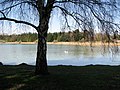 Narford Lake - geograph.org.uk - 1817439.jpg 640 × 480 ; 143 kio
-
 Narford Lane. Narford - geograph.org.uk - 5545129.jpg 4 608 × 3 072 ; 1,78 Mio
-
 Narford Lane. Narford - geograph.org.uk - 5545672.jpg 4 608 × 3 072 ; 1,91 Mio
-
 Narford Lane. Narford - geograph.org.uk - 5545679.jpg 4 608 × 3 072 ; 1,95 Mio
-
 Narford Road (1) - geograph.org.uk - 5172577.jpg 2 560 × 1 920 ; 1,24 Mio
-
 Narford Road (2) - geograph.org.uk - 5172579.jpg 2 509 × 1 883 ; 986 kio
-
 Narford Road sign - geograph.org.uk - 5544965.jpg 4 000 × 2 667 ; 5,22 Mio
-
 Narford Road, Narford - geograph.org.uk - 5544229.jpg 4 608 × 3 072 ; 1,98 Mio
-
 Narford Road, Narford - geograph.org.uk - 5544234.jpg 4 608 × 3 072 ; 1,91 Mio
-
 Narford Road, Narford - geograph.org.uk - 5544948.jpg 4 608 × 3 072 ; 1,89 Mio
-
 Narford Road, Narford - geograph.org.uk - 5544976.jpg 4 608 × 3 072 ; 1,83 Mio
-
 Narford Road, Narford - geograph.org.uk - 5545083.jpg 4 608 × 3 072 ; 2 Mio
-
 Narford Road, Narford - geograph.org.uk - 5545685.jpg 4 608 × 3 072 ; 1,88 Mio
-
 Narford Road, Norfolk - geograph.org.uk - 5543662.jpg 4 608 × 3 072 ; 1,77 Mio
-
 Narford Road, Norfolk - geograph.org.uk - 5543664.jpg 4 608 × 3 072 ; 1,98 Mio
-
 Narford Road, West Acre - geograph.org.uk - 5513165.jpg 4 608 × 3 072 ; 1,79 Mio
-
 Narford Road, West Acre - geograph.org.uk - 5513169.jpg 4 608 × 3 072 ; 1,93 Mio
-
 Narford Road, West Acre - geograph.org.uk - 5513271.jpg 4 608 × 3 072 ; 1,85 Mio
-
 Narford Road, West Acre - geograph.org.uk - 5513276.jpg 3 569 × 2 552 ; 4,62 Mio
-
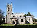
 Narford St. Mary the Virgin's church - geograph.org.uk - 4353799.jpg 1 024 × 768 ; 369 kio
-
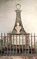
 Narford WW1 War Memorial - geograph.org.uk - 4891458.jpg 2 592 × 3 456 ; 3,07 Mio
-
 Old bridge - geograph.org.uk - 630770.jpg 640 × 480 ; 104 kio
-
 Path to St Mary's church - geograph.org.uk - 1817450.jpg 640 × 480 ; 163 kio
-
 Public Bridleway - geograph.org.uk - 778044.jpg 480 × 640 ; 158 kio
-
 Ribwort plantain in flower - geograph.org.uk - 6169340.jpg 3 456 × 2 592 ; 3,52 Mio
-
 River Nar off Narford Lane - geograph.org.uk - 5545654.jpg 2 667 × 4 000 ; 5,81 Mio
-
 River Nar off Narford Lane - geograph.org.uk - 5545660.jpg 2 667 × 4 000 ; 6,41 Mio
-
 Road from Narford to Swaffham - geograph.org.uk - 6169378.jpg 3 456 × 2 592 ; 2,74 Mio
-
 Road junction on the Narborough by-pass. - geograph.org.uk - 594291.jpg 600 × 450 ; 98 kio
-
 Road to Swaffham from West Acre - geograph.org.uk - 6169369.jpg 3 456 × 2 592 ; 1,85 Mio
-
 Roadsign on Narford Road - geograph.org.uk - 5545094.jpg 2 651 × 3 990 ; 4,01 Mio
-
 Roadsigns on the A47 - geograph.org.uk - 5543673.jpg 4 608 × 3 072 ; 1,7 Mio
-
 Roadsigns on the A47 - geograph.org.uk - 5544953.jpg 4 608 × 3 072 ; 1,83 Mio
-
 Roadsigns on the A47 - geograph.org.uk - 5544966.jpg 3 857 × 2 569 ; 5,71 Mio
-
 Rural lane past Narford Lake - geograph.org.uk - 2576457.jpg 640 × 480 ; 249 kio
-
 Shooting may be in progress signage - geograph.org.uk - 6169373.jpg 3 456 × 2 592 ; 3,79 Mio
-
 Spinners plantation, south-east of Narford Hall - geograph.org.uk - 1817410.jpg 640 × 480 ; 119 kio
-
 Tall pine trees growing on field boundary - geograph.org.uk - 2763855.jpg 640 × 480 ; 136 kio
-
 Tank traps, Narford - geograph.org.uk - 2576491.jpg 480 × 640 ; 253 kio
-
 The A47 at Narford - geograph.org.uk - 5544971.jpg 4 608 × 3 072 ; 1,91 Mio
-
 The A47 at Narford - geograph.org.uk - 5544972.jpg 4 608 × 3 072 ; 1,81 Mio
-
-
 The church of St Mary in Narford - C18 monument - geograph.org.uk - 1817533.jpg 480 × 640 ; 115 kio
-

-
 The church of St Mary in Narford - churchyard - geograph.org.uk - 1817493.jpg 480 × 640 ; 117 kio
-

-
 The church of St Mary in Narford - geograph.org.uk - 1817457.jpg 640 × 480 ; 120 kio
-
 The church of St Mary in Narford - geograph.org.uk - 1817484.jpg 640 × 480 ; 105 kio
-
 The church of St Mary in Narford - geograph.org.uk - 1817485.jpg 640 × 480 ; 107 kio
-
 The church of St Mary in Narford - geograph.org.uk - 1817498.jpg 640 × 587 ; 115 kio
-
-

-
 The church of St Mary in Narford - monument - geograph.org.uk - 1817525.jpg 411 × 640 ; 85 kio
-

-
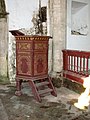
 The church of St Mary in Narford - the crypt - geograph.org.uk - 1817552.jpg 640 × 556 ; 147 kio
-

-
 The church of St Mary in Narford - view east - geograph.org.uk - 1817509.jpg 640 × 480 ; 95 kio
-
 The church of St Mary in Narford - view east - geograph.org.uk - 1817513.jpg 640 × 480 ; 95 kio
-
 The church of St Mary in Narford - view west - geograph.org.uk - 1817548.jpg 640 × 480 ; 83 kio
-

-

-
 The view from the hall - geograph.org.uk - 5172569.jpg 2 555 × 1 917 ; 951 kio
-
 Two hares having a stand-off and french partridges foraging - geograph.org.uk - 6169375.jpg 3 456 × 2 592 ; 3,84 Mio
-
 Two WW1 graves in Narford churchyard - geograph.org.uk - 4891444.jpg 3 456 × 2 592 ; 3,9 Mio
-
 Unnamed country lane to West Acre - geograph.org.uk - 1812169.jpg 640 × 480 ; 131 kio
-
 Viper's Bugloss - geograph.org.uk - 482211.jpg 480 × 640 ; 117 kio
-
 Weak bridge over The River Nar - geograph.org.uk - 3769523.jpg 4 320 × 3 240 ; 5,45 Mio
-
 Westacre Theatre sign - geograph.org.uk - 5544982.jpg 4 608 × 3 072 ; 1,8 Mio
-
 Wheatfield and the Hundred Acre Belt - geograph.org.uk - 482217.jpg 640 × 480 ; 108 kio
-
 Wheatfield at Narford - geograph.org.uk - 6169342.jpg 3 456 × 2 592 ; 3,95 Mio
-
 A1122 just south of the A47 - geograph.org.uk - 589481.jpg 640 × 480 ; 155 kio
-
 A47 at Chalk Farm garden centre - geograph.org.uk - 594308.jpg 600 × 450 ; 123 kio
-
 A47 between Narborough and Swaffham - geograph.org.uk - 594297.jpg 600 × 450 ; 103 kio
-
 Broken finger post - geograph.org.uk - 778042.jpg 480 × 640 ; 81 kio
-
 Burntstalk Plantation - geograph.org.uk - 482208.jpg 640 × 480 ; 111 kio
-
 Carr Covert - geograph.org.uk - 482242.jpg 640 × 480 ; 153 kio
-
 Crossroads - geograph.org.uk - 778106.jpg 640 × 480 ; 99 kio
-
 Dry fields - geograph.org.uk - 778119.jpg 640 × 480 ; 86 kio
-
 Eyetrap Plantation - geograph.org.uk - 778012.jpg 640 × 480 ; 62 kio
-
 Farm track to Twenty Acre Plantation - geograph.org.uk - 482213.jpg 640 × 480 ; 104 kio
-
 Finger post - geograph.org.uk - 778020.jpg 640 × 480 ; 109 kio
-
 Footbridge - geograph.org.uk - 754626.jpg 480 × 640 ; 131 kio
-
 Green lane - geograph.org.uk - 777848.jpg 480 × 640 ; 128 kio
-
 Industrial Buildings on the A1122 - geograph.org.uk - 589502.jpg 640 × 480 ; 157 kio
-

-

-
 Looking towards the A47 on the A1122 - geograph.org.uk - 589503.jpg 640 × 480 ; 144 kio
-
 Mixed trees on the A1122 - geograph.org.uk - 589492.jpg 640 × 480 ; 141 kio
-
 Private farm road in TF 7810 (2) - geograph.org.uk - 594318.jpg 600 × 450 ; 91 kio
-
 Private farm road in TF 7810 - geograph.org.uk - 594313.jpg 600 × 450 ; 149 kio


_-_geograph.org.uk_-_777857.jpg)


_-_geograph.org.uk_-_1817419.jpg)


_-_geograph.org.uk_-_5172577.jpg)
_-_geograph.org.uk_-_5172579.jpg)


_-_geograph.org.uk_-_1817528.jpg)


_-_geograph.org.uk_-_594318.jpg)
