Category:Navajo Mountain
Zur Navigation springen
Zur Suche springen
Berg in den Vereinigten Staaten .jpg) | |||||
| Medium hochladen | |||||
| Ist ein(e) | |||||
|---|---|---|---|---|---|
| Ist Teil von | |||||
| Ort |
| ||||
| Gebirgszug | |||||
| Schartenhöhe |
| ||||
| Höhe über dem Meeresspiegel |
| ||||
 | |||||
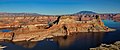
English: Navajo Mountain — a 10,388 ft (3,166 m) laccolith of the Canyon Lands Section, primarily in southeastern Utah.
- The peak is in San Juan County, Utah, with its southern flank extending into Coconino County, Arizona. Navajo Mountain is on the Navajo Nation lands.
- The landform is a sacred mountain in the traditions of three local Native American tribes.
Diné bizaad: Naatsisʼáán.
Medien in der Kategorie „Navajo Mountain“
Folgende 37 Dateien sind in dieser Kategorie, von 37 insgesamt.
-
 NavajoMtn ISS012-E-5172.jpg 1.000 × 697; 501 KB
-
 AZ Lake Powell Navajo Mountain.jpg 2.272 × 1.443; 443 KB
-
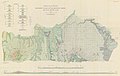 Baker 1936 USGS Bulletin 865 plate-1.jpg 17.361 × 10.939; 12,57 MB
-
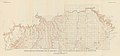 Baker 1936 USGS Bulletin 865 plate-2.jpg 13.169 × 6.148; 4,13 MB
-
 Grand Staircase-big.jpg 1.700 × 483; 204 KB
-
 Gunsight Butte, Lake Powell.jpg 800 × 533; 455 KB
-
 Indian Route 16 at 48.28 km, towards Naatsisʼáán, January 2019.jpg 6.000 × 4.000; 19,38 MB
-
 Indian Route 16, 48.28 km marker, to southeast, January 2019.jpg 6.000 × 4.000; 20,47 MB
-
 Lake powell utah.jpg 773 × 1.000; 193 KB
-
 Lake Powell and Grand Staircase-Escalante.jpg 4.000 × 2.667; 8,66 MB
-
 Naatsisʼáán from east, January 2019.jpg 6.000 × 4.000; 18,22 MB
-
 NavajoMtn.jpg 1.842 × 600; 183 KB
-
 Navajo Mountain (DSC06292).jpg 1.280 × 960; 560 KB
-
 Navajo Mountain Aerial.jpg 3.264 × 2.448; 3,22 MB
-

-

-
-
 Navajo Mountain from Gd Staircase.jpg 2.893 × 2.018; 4,94 MB
-
 Navajo Mountain High School entrance sign, January 2019.jpg 6.000 × 4.000; 16,88 MB
-
 Navajo Mountain Utah 2020.jpg 1.715 × 1.139; 689 KB
-
 Navajo Mountain view.jpg 5.616 × 3.744; 8,85 MB
-
 Navajo Mountain, Lake Powell, Utah (15829657390).jpg 4.000 × 3.000; 2,31 MB
-
 Navajo Mountain, Lake Powell, Utah (15830881359).jpg 4.000 × 3.000; 2,41 MB
-
 Navajo Mountain, Lake Powell, Utah (16014956341).jpg 4.000 × 3.000; 2,32 MB
-
 Navajo Mountain, Lake Powell, Utah (16016910725).jpg 4.000 × 3.000; 2,31 MB
-
 Navajo Mountain.jpeg 1.000 × 577; 51 KB
-
 Navajo Mtn from Hole in the Rock Rd (GSEscalante NM).jpg 1.930 × 1.345; 2,1 MB
-
 NavajoMtnAerial.jpg 982 × 482; 983 KB
-
 Plateau laccoliths NASA.jpg 900 × 1.124; 324 KB
-
 Rainbow Bridge Area and Navajo Mountain, Lake Powell, Utah (15397284853).jpg 4.000 × 3.000; 2,23 MB
-
 Rainbow Bridge Area and Navajo Mountain, Lake Powell, Utah (15829656000).jpg 4.000 × 3.000; 2,01 MB
-
 Rainbow Bridge Area and Navajo Mountain, Lake Powell, Utah (15991132866).jpg 4.000 × 3.000; 2,03 MB
-
 Rainbow Bridge Area and Navajo Mountain, Lake Powell, Utah (16014954321).jpg 4.000 × 3.000; 2,06 MB
-
 Rainbow Bridge Area and Navajo Mountain, Lake Powell, Utah (16016911045).jpg 4.000 × 3.000; 2,3 MB
-
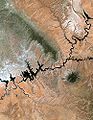
 Rainbow Bridge National Monument EO-1.jpg 2.000 × 2.000; 2,76 MB
-
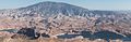
 USA on the road...and Navajo Mountain (3.150 mts.) at the end - panoramio.jpg 3.072 × 2.304; 1,82 MB
-
 View of Gunsight Butte and Navajo Mountain.jpg 4.313 × 1.782; 1,28 MB


.jpg)


.jpg)
.jpg)
.jpg)
.jpg)

.jpg)


.jpg)
.jpg)
.jpg)
.jpg)
.jpg)

_at_the_end_-_panoramio.jpg)

Kategorien:
- Mountains of Utah
- Mountains of Arizona
- Native American religious places
- Sacred mountains
- 3160s mountains of the United States
- Canyon Lands of Utah
- Canyon Lands of Arizona
- Landforms of San Juan County, Utah
- Landforms of Coconino County, Arizona
- Landforms on the Navajo Nation
- Laccoliths in Arizona
- Laccoliths in Utah