Category:Nay Pyi Taw International Airport
Zur Navigation springen
Zur Suche springen
English: Naypyidaw Airport (opened in December 2011)
Flughafen in Myanmar | |||||
| Medium hochladen | |||||
| Ist ein(e) |
| ||||
|---|---|---|---|---|---|
| Benannt nach | |||||
| Ort | Mandalay-Region, Myanmar | ||||
| Eröffnungsdatum |
| ||||
| Höhe über dem Meeresspiegel |
| ||||
| IATA-Flughafencode |
| ||||
| ICAO-Flughafencode |
| ||||
| offizielle Website | |||||
 | |||||
IATA: NYT
ICAO: VYNT
Unterkategorien
Diese Kategorie enthält folgende Unterkategorie:
In Klammern die Anzahl der enthaltenen Kategorien (K), Seiten (S), Dateien (D)
Medien in der Kategorie „Nay Pyi Taw International Airport“
Folgende 7 Dateien sind in dieser Kategorie, von 7 insgesamt.
-
 Naypidiaw airport - panoramio.jpg 4.608 × 3.456; 3,74 MB
-
 Naypyidaw Airport - panoramio.jpg 4.608 × 3.456; 3,68 MB
-
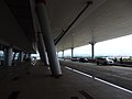
 Naypyitaw International Airport (2).jpg 4.032 × 3.024; 4,11 MB
-
 Naypyitaw International Airport (3).jpg 4.032 × 3.024; 4,14 MB
-
 Naypyitaw International Airport (4).jpg 4.032 × 3.024; 4,56 MB
-
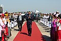 P111414PS-0069 (16139767732).jpg 1.500 × 1.000; 301 KB
-
 Sukhoi Superjet 97004 at Naypyidaw Lystseva-1.jpg 1.200 × 848; 772 KB


.jpg)
.jpg)
.jpg)
.jpg)
