Category:Neatishead
Aller à la navigation
Aller à la recherche
English: Neatishead is a village and civil parish in the English county of Norfolk. The village is situated some north-east of the city of Norwich, within The Norfolk Broads and to the west of Barton Broad. Access to Neatishead from the broad is by way of Limekiln Dyke, a narrow channel leading off the broad.
localité britannique du comté anglais de Norfolk  | |||||
| Téléverser des médias | |||||
| Nature de l’élément | |||||
|---|---|---|---|---|---|
| Lieu | North Norfolk, Norfolk, Angleterre de l'Est, Angleterre | ||||
| Superficie |
| ||||
 | |||||
Sous-catégories
Cette catégorie comprend 4 sous-catégories, dont les 4 ci-dessous.
Média dans la catégorie « Neatishead »
Cette catégorie comprend 180 fichiers, dont les 180 ci-dessous.
-
 1950s generator house - geograph.org.uk - 4896654.jpg 640 × 546 ; 417 kio
-
 A bend in Cangate Road - geograph.org.uk - 4894188.jpg 640 × 395 ; 358 kio
-
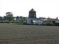
 A disused windmill near Neatishead - geograph.org.uk - 24696.jpg 640 × 480 ; 90 kio
-

-
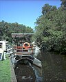
 Boats moored near Neatishead - geograph.org.uk - 24657.jpg 640 × 480 ; 85 kio
-
 Brick chimney - geograph.org.uk - 4896647.jpg 640 × 480 ; 306 kio
-
 Bungalow on Butcher's Common - geograph.org.uk - 4894067.jpg 640 × 529 ; 368 kio
-
 Bungalow on Butcher's Common - geograph.org.uk - 4894069.jpg 640 × 480 ; 358 kio
-
 Bungalow on Butcher's Common - geograph.org.uk - 4894070.jpg 640 × 480 ; 221 kio
-
 Bungalow on Butcher's Common - geograph.org.uk - 4894073.jpg 640 × 521 ; 234 kio
-
 Cangate Road, Hoveton - geograph.org.uk - 6103691.jpg 3 456 × 2 592 ; 3,98 Mio
-
 Cangates - geograph.org.uk - 548630.jpg 640 × 480 ; 96 kio
-
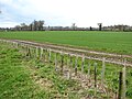
 Cereal crop at Threehammer Common - geograph.org.uk - 4894157.jpg 640 × 387 ; 247 kio
-
 Cereal crop field at Threehammer Common - geograph.org.uk - 4894151.jpg 640 × 480 ; 403 kio
-
 Cereal crop field south of Chapel Road - geograph.org.uk - 4894154.jpg 640 × 380 ; 235 kio
-
 Chapel Corner, Horning Road - geograph.org.uk - 6103700.jpg 3 456 × 2 592 ; 3,85 Mio
-
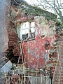
 Dangerous Structure - Keep Out - geograph.org.uk - 4896663.jpg 516 × 640 ; 488 kio
-
 Derelict cottage by Browns Hill - geograph.org.uk - 2863841.jpg 640 × 480 ; 231 kio
-
 Derelict cottage by Browns Hill - geograph.org.uk - 2863843.jpg 640 × 480 ; 230 kio
-
 Derelict cottage by Browns Hill - geograph.org.uk - 2863846.jpg 480 × 640 ; 246 kio
-
 Derelict cottage by Browns Hill - geograph.org.uk - 2863847.jpg 640 × 480 ; 311 kio
-
 Derelict cottage by Browns Hill - geograph.org.uk - 2863851.jpg 640 × 480 ; 281 kio
-
 Derelict cottage by Browns Hill - geograph.org.uk - 2863856.jpg 480 × 640 ; 234 kio
-
 Derelict cottage by Browns Hill - geograph.org.uk - 2863858.jpg 480 × 640 ; 264 kio
-
 Derelict cottage by Browns Hill - geograph.org.uk - 2863860.jpg 640 × 596 ; 272 kio
-
 Derelict cottage by Browns Hill - geograph.org.uk - 2863865.jpg 640 × 554 ; 282 kio
-
 Derelict cottage by Browns Hill - geograph.org.uk - 2863871.jpg 480 × 640 ; 188 kio
-
 Derelict cottage by Browns Hill - geograph.org.uk - 2863873.jpg 480 × 640 ; 268 kio
-
 Derelict cottage by Browns Hill - geograph.org.uk - 2863874.jpg 640 × 480 ; 213 kio
-
 Derelict cottage by Browns Hill - geograph.org.uk - 2863877.jpg 640 × 597 ; 363 kio
-
 Derelict cottage by Browns Hill - geograph.org.uk - 2863879.jpg 568 × 640 ; 274 kio
-
 Disused pit, Neatishead - geograph.org.uk - 2546384.jpg 640 × 480 ; 251 kio
-
 Dragonfly - geograph.org.uk - 561984.jpg 640 × 455 ; 107 kio
-

-
 Electricity transformers beside School Road - geograph.org.uk - 4894089.jpg 640 × 640 ; 457 kio
-
 Entrance to RAF Neatishead - geograph.org.uk - 4171374.jpg 640 × 475 ; 170 kio
-
 Flue opening - geograph.org.uk - 4896640.jpg 534 × 640 ; 498 kio
-
 Footpath on Threehammer Common - geograph.org.uk - 4894137.jpg 640 × 480 ; 423 kio
-
 Footpath through a hedge on Threehammer Common - geograph.org.uk - 4894133.jpg 640 × 480 ; 467 kio
-
 Footpath traversing cereal crop field - geograph.org.uk - 4894149.jpg 640 × 480 ; 395 kio
-
 Footpath, Neatishead - geograph.org.uk - 1655580.jpg 640 × 428 ; 83 kio
-
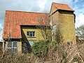
 Former corn mill at Neatishead - geograph.org.uk - 4894167.jpg 595 × 640 ; 363 kio
-
 Generator house (detail) - geograph.org.uk - 4896661.jpg 480 × 640 ; 436 kio
-
 Horning Road, Neatishead - geograph.org.uk - 6103699.jpg 3 456 × 2 592 ; 3,9 Mio
-
 Houses by Holly Grove - geograph.org.uk - 4894081.jpg 640 × 480 ; 432 kio
-
 Houses in Horning Road - geograph.org.uk - 4894147.jpg 640 × 480 ; 299 kio
-
 Houses in Horning Road - geograph.org.uk - 4894161.jpg 640 × 602 ; 423 kio
-
 Houses in Neatishead - geograph.org.uk - 561989.jpg 640 × 478 ; 153 kio
-
 Hoveton Hall - geograph.org.uk - 6178269.jpg 6 683 × 4 455 ; 6,11 Mio
-
 Hoveton Hall - geograph.org.uk - 6181476.jpg 5 991 × 3 994 ; 6,11 Mio
-
 Hoveton Hall Gardens, Beetle by the Stone Bridge - geograph.org.uk - 6179342.jpg 3 327 × 2 217 ; 1,17 Mio
-
 Hoveton Hall Gardens, Bridge carrying the road to the Hall - geograph.org.uk - 6179351.jpg 5 935 × 3 957 ; 7,35 Mio
-
 Hoveton Hall Gardens, Pump next to the greenhouse - geograph.org.uk - 6178279.jpg 3 777 × 5 667 ; 7,75 Mio
-
 Hoveton Hall Gardens, Shrub border - geograph.org.uk - 6181483.jpg 5 767 × 3 843 ; 6,81 Mio
-
 Hoveton Hall Gardens, Shrub border - geograph.org.uk - 6181488.jpg 6 546 × 4 365 ; 6,34 Mio
-
 Hoveton Hall Gardens, Swans and their cygnets in the Water Garden 1 - geograph.org.uk - 6181494.jpg 4 838 × 3 225 ; 4,78 Mio
-
 Hoveton Hall Gardens, Swans and their cygnets in the Water Garden 2 - geograph.org.uk - 6181497.jpg 5 393 × 3 596 ; 5,63 Mio
-
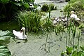 Hoveton Hall Gardens, Swans and their cygnets in the Water Garden 3 - geograph.org.uk - 6181502.jpg 5 898 × 3 932 ; 7,23 Mio
-
 Hoveton Hall Gardens, The Lake - geograph.org.uk - 6179347.jpg 6 199 × 4 132 ; 7,01 Mio
-
 Hoveton Hall Gardens, The Stone Bridge - geograph.org.uk - 6179340.jpg 5 306 × 3 537 ; 7,36 Mio
-
 Hoveton Hall Gardens, The view from the road bridge - geograph.org.uk - 6181463.jpg 5 562 × 3 708 ; 4,94 Mio
-
 Hoveton Hall Gardens, The Water Garden - geograph.org.uk - 6181467.jpg 6 342 × 4 228 ; 7,76 Mio
-
 Hoveton Hall Gardens, The Water Garden - geograph.org.uk - 6181472.jpg 6 152 × 4 101 ; 7,55 Mio
-
 Hoveton Hall, Greenhouse - geograph.org.uk - 6178275.jpg 7 420 × 4 947 ; 7,48 Mio
-
 Industrial buildings beside School Road - geograph.org.uk - 4894080.jpg 640 × 480 ; 321 kio
-
 It looks like a chapel - geograph.org.uk - 4896636.jpg 640 × 562 ; 367 kio
-
 Looking west along Chapel Road - geograph.org.uk - 691645.jpg 480 × 640 ; 183 kio
-
 Louvred shutters - geograph.org.uk - 4896632.jpg 533 × 640 ; 506 kio
-
 Marsh pasture by Irstead - geograph.org.uk - 2863801.jpg 640 × 480 ; 240 kio
-
 Moss on churchyard wall - geograph.org.uk - 691658.jpg 480 × 640 ; 153 kio
-
 Neatishead 024654 f6398b46-by-GaryReggae.jpg 480 × 640 ; 100 kio
-
 Neatishead Baptist church - geograph.org.uk - 6103704.jpg 3 456 × 2 592 ; 3,91 Mio
-
 Neatishead Baptist Church - graffiti - geograph.org.uk - 691695.jpg 480 × 640 ; 221 kio
-
 Neatishead First World War Memorial - geograph.org.uk - 4774425.jpg 3 456 × 2 592 ; 3,46 Mio
-
 Neatishead Hall farmyard - geograph.org.uk - 6103759.jpg 3 456 × 2 592 ; 3,91 Mio
-
 Neatishead Lodge, Neatishead - geograph.org.uk - 2546391.jpg 640 × 480 ; 296 kio
-
 Neatishead Post Office - geograph.org.uk - 471074.jpg 640 × 480 ; 101 kio
-
 Neatishead St Peter's church - geograph.org.uk - 2199769.jpg 640 × 480 ; 172 kio
-
 Neatishead tower mill - geograph.org.uk - 4894128.jpg 640 × 624 ; 439 kio
-
 Neatishead tower mill - geograph.org.uk - 4894174.jpg 575 × 640 ; 334 kio
-
 Neatishead Tower Mill from Horning Road - geograph.org.uk - 6103702.jpg 3 267 × 2 256 ; 2,15 Mio
-
 Neatishead Towermill - geograph.org.uk - 5587761.jpg 640 × 480 ; 68 kio
-
 Neatishead village sign - geograph.org.uk - 4345083.jpg 640 × 480 ; 154 kio
-
 Neatishead Village Sign - geograph.org.uk - 5587725.jpg 480 × 640 ; 103 kio
-
 New hedge beside Cangate Road - geograph.org.uk - 4894193.jpg 640 × 480 ; 367 kio
-
 Not a chapel - geograph.org.uk - 4896622.jpg 640 × 480 ; 366 kio
-
 Old generator house - geograph.org.uk - 4896677.jpg 640 × 480 ; 435 kio
-
 Old windmill - geograph.org.uk - 562004.jpg 640 × 478 ; 136 kio
-
 Path to Horning Road - geograph.org.uk - 4894134.jpg 640 × 480 ; 419 kio
-
 RA at Gay's Staithe - geograph.org.uk - 20666.jpg 512 × 640 ; 107 kio
-

-

-

-

-
-
-

-
-
-

-

-
 RAF Air Defence Radar Museum, Neatishead - geograph.org.uk - 6103718.jpg 3 456 × 2 592 ; 3,83 Mio
-
 RAF Neatishead - the Picket post - geograph.org.uk - 4171429.jpg 640 × 480 ; 206 kio
-
 RAF Neatishead - the R12 bunker - geograph.org.uk - 4171398.jpg 640 × 480 ; 144 kio
-
 RAF Neatishead - the R12 bunker - geograph.org.uk - 4171403.jpg 640 × 480 ; 195 kio
-
 RAF Neatishead - the R12 bunker - geograph.org.uk - 4171416.jpg 640 × 480 ; 143 kio
-
 RAF Neatishead - the R12 bunker - geograph.org.uk - 4171418.jpg 640 × 480 ; 194 kio
-
 RAF Neatishead - the R12 bunker - geograph.org.uk - 4171421.jpg 640 × 480 ; 183 kio
-
 RAF Neatishead - the wartime Control Room - geograph.org.uk - 4171376.jpg 640 × 480 ; 148 kio
-
 RAF Neatishead Radar Museum - Cold War control - geograph.org.uk - 6151086.jpg 1 024 × 683 ; 157 kio
-
 Rear entrance to Beeston Hall from Neatishead street - geograph.org.uk - 6103706.jpg 3 456 × 2 592 ; 3,99 Mio
-
 Reflections in a Crittal window - geograph.org.uk - 4896667.jpg 640 × 589 ; 544 kio
-
 Road leading to Cangate House caravan site - geograph.org.uk - 6103692.jpg 3 456 × 2 592 ; 3,99 Mio
-
 Road near Pennygate - geograph.org.uk - 561998.jpg 640 × 478 ; 123 kio
-
 School Road approaching Butcher's Common - geograph.org.uk - 4894065.jpg 640 × 480 ; 277 kio
-
 School Road closed for 5 days - geograph.org.uk - 6103696.jpg 3 456 × 2 592 ; 3,91 Mio
-
 Security fence and camera at RAF Neatishead - geograph.org.uk - 4171383.jpg 480 × 640 ; 217 kio
-
 Sign of The White Horse Inn, Neatishead - geograph.org.uk - 6103716.jpg 3 456 × 2 592 ; 3,91 Mio
-
 Thatched boathouse, Limekiln Dyke - geograph.org.uk - 405343.jpg 640 × 480 ; 62 kio
-
 The "bell tower" - geograph.org.uk - 4896672.jpg 480 × 640 ; 412 kio
-
 The Old Saddlery - geograph.org.uk - 3329184.jpg 2 564 × 1 904 ; 2,04 Mio
-
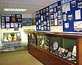
 The RAF Air Defence Radar Museum - geograph.org.uk - 4171378.jpg 640 × 480 ; 192 kio
-
 The Street, Neatishead - geograph.org.uk - 3329187.jpg 2 307 × 1 618 ; 1,58 Mio
-
 The White Horse Inn, Neatishead - geograph.org.uk - 3329186.jpg 2 215 × 1 740 ; 1,87 Mio
-
 Track along a field margin beside Cangate Road - geograph.org.uk - 4894191.jpg 640 × 480 ; 411 kio
-
 Track from Browns Hill to Irstead Road, Irstead - geograph.org.uk - 2863808.jpg 640 × 480 ; 223 kio
-
 Track to Browns Hill, Irstead - geograph.org.uk - 2863802.jpg 640 × 480 ; 261 kio
-
 Type 84 Radar head - geograph.org.uk - 6103712.jpg 3 456 × 2 592 ; 3,91 Mio
-

-
 View along School Road - geograph.org.uk - 4894077.jpg 640 × 480 ; 354 kio
-
 View towards Allens Farm - geograph.org.uk - 4894181.jpg 640 × 480 ; 289 kio
-
 View towards Neatishead tower mill - geograph.org.uk - 4894123.jpg 640 × 373 ; 209 kio
-
 View west along School Road - geograph.org.uk - 4894084.jpg 640 × 480 ; 378 kio
-
 View west from Norwich Road - geograph.org.uk - 548621.jpg 480 × 640 ; 69 kio
-
 White and pink blossom at Neatishead - geograph.org.uk - 6103760.jpg 3 456 × 2 592 ; 3,87 Mio
-
 White Horse Inn, Neatishead - geograph.org.uk - 5587726.jpg 640 × 480 ; 61 kio
-
 White Horse Inn, Neatishead - geograph.org.uk - 6103713.jpg 3 456 × 2 592 ; 3,84 Mio
-
 Woodland on Beeston Hall estate - geograph.org.uk - 6103707.jpg 3 456 × 2 592 ; 4,02 Mio
-
 Yarnold shelter at RAF Neatishead - geograph.org.uk - 4171385.jpg 640 × 514 ; 218 kio
-
 Yarnold shelter at RAF Neatishead - geograph.org.uk - 4171390.jpg 640 × 544 ; 243 kio
-
 Yarnold shelter at RAF Neatishead - geograph.org.uk - 4171394.jpg 640 × 480 ; 141 kio
-
 Along the boardwalks - geograph.org.uk - 561981.jpg 478 × 640 ; 144 kio
-
 An attractive red-brick cottage - geograph.org.uk - 1146639.jpg 640 × 480 ; 98 kio
-
 An autumnal scene - geograph.org.uk - 1147505.jpg 640 × 480 ; 90 kio
-
 Approach to Irstead Street, Norfolk - geograph.org.uk - 310677.jpg 640 × 480 ; 447 kio
-
 Barton Turf boathouse - geograph.org.uk - 561995.jpg 640 × 478 ; 134 kio
-
 Barton Turf Moorings - geograph.org.uk - 45008.jpg 640 × 480 ; 83 kio
-
 Berry Hall - geograph.org.uk - 561997.jpg 640 × 478 ; 143 kio
-
 Boardwalks - geograph.org.uk - 561980.jpg 640 × 478 ; 222 kio
-
 Boardwalks - geograph.org.uk - 561985.jpg 478 × 640 ; 213 kio
-
 Chapel Road - geograph.org.uk - 691690.jpg 640 × 480 ; 110 kio
-
 Concrete track - geograph.org.uk - 691609.jpg 640 × 480 ; 118 kio
-

-
 Field near Neatishead - geograph.org.uk - 24656.jpg 640 × 480 ; 72 kio
-
 From Beeston Lane to Barton Road - geograph.org.uk - 548553.jpg 640 × 480 ; 71 kio
-
 Garage on Smallburgh Road - geograph.org.uk - 548519.jpg 640 × 480 ; 66 kio
-
 Heading west on Mill Lane - geograph.org.uk - 548526.jpg 640 × 480 ; 78 kio
-
 House and garden at Irstead on the River Ant - geograph.org.uk - 400034.jpg 640 × 480 ; 65 kio
-
 Junction of Smallburgh Road with Beeston Lane - geograph.org.uk - 548541.jpg 640 × 480 ; 73 kio
-

-
 Limekiln Dyke - geograph.org.uk - 45005.jpg 640 × 480 ; 84 kio
-
 Limekiln Dyke at Neatishead - geograph.org.uk - 45001.jpg 640 × 480 ; 119 kio
-
 Marina at Neatishead - geograph.org.uk - 561986.jpg 640 × 478 ; 160 kio
-
 Marsh near Berry Hall - geograph.org.uk - 561996.jpg 640 × 478 ; 231 kio
-
 Military installation near Barton Turf - geograph.org.uk - 275434.jpg 640 × 480 ; 155 kio
-
 Moored on Barton Broad - geograph.org.uk - 690479.jpg 640 × 427 ; 211 kio
-
 Neatishead Baptist Church - churchyard - geograph.org.uk - 691685.jpg 480 × 640 ; 154 kio
-
 Neatishead Staithe - geograph.org.uk - 357999.jpg 640 × 480 ; 127 kio
-

-
 Onto the broads - geograph.org.uk - 561994.jpg 640 × 478 ; 124 kio
-
 Pennygate Farm - geograph.org.uk - 548525.jpg 640 × 480 ; 105 kio
-
 Pennygate junction - geograph.org.uk - 561999.jpg 640 × 478 ; 122 kio
-
 Pennygate Lane - geograph.org.uk - 548521.jpg 640 × 480 ; 74 kio
-
 Pig farm - geograph.org.uk - 562003.jpg 640 × 478 ; 148 kio
-
 Pigs near Pennygate - geograph.org.uk - 562000.jpg 640 × 478 ; 135 kio
-
 Pond House in Mill Lane - geograph.org.uk - 548523.jpg 640 × 480 ; 108 kio
-
 Pond near Pond House - geograph.org.uk - 548524.jpg 640 × 480 ; 91 kio
-
 Private mooring and gardens, Limekiln Dyke - geograph.org.uk - 405348.jpg 640 × 480 ; 72 kio
-
 The Staithe, Barton Turf - geograph.org.uk - 357965.jpg 640 × 480 ; 80 kio
-
 View along Limekiln Dyke - geograph.org.uk - 399601.jpg 636 × 444 ; 60 kio


_-_geograph.org.uk_-_4896661.jpg)


