Category:Negev
Направо към навигацията
Направо към търсенето
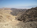
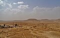
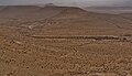
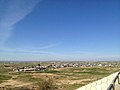
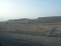
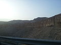
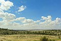
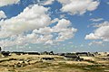
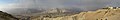
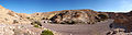
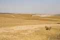
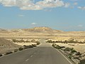
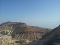
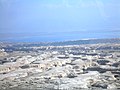
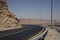
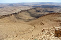
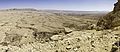
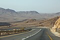
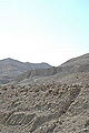
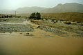
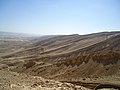
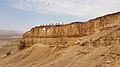
English: The Negev is a desert and semidesert region of southern Israel.
desert and semidesert region of southern Israel  | |||||
| Качване на файл | |||||
| Екземпляр на | |||||
|---|---|---|---|---|---|
| Част от | |||||
| Местоположение | Израел | ||||
| Столица | |||||
| Най-висока точка | |||||
| Площ |
| ||||
| Различно от | |||||
 | |||||
Подкатегории
Показани са 82 от общо 82 подкатегории на тази категория.
- Animals of Negev (0 К, 0 С, 49 Ф)
- Flora of Negev (0 К, 0 С, 153 Ф)
1
3
- Highway 31 (Israel) (0 К, 0 С, 20 Ф)
A
- Amatsyahu Stream (0 К, 0 С, 3 Ф)
- Atak stream (0 К, 0 С, 7 Ф)
B
- B225 (Israel) (0 К, 0 С, 14 Ф)
- Blueprint Negev (0 К, 0 С, 3 Ф)
- Bulbus rocks in the Negev (0 К, 0 С, 4 Ф)
C
D
- Desert kites in Israel (0 К, 0 С, 12 Ф)
- Dudaim Landfill (0 К, 0 С, 5 Ф)
- Dust devils in Negev (0 К, 0 С, 9 Ф)
E
- Ein Hosov police Station (0 К, 0 С, 22 Ф)
- Ein Yorke'am (0 К, 0 С, 30 Ф)
- Eshkol (region) (0 К, 0 С, 51 Ф)
G
- Ganey Hadas Landfill (0 К, 0 С, 4 Ф)
- Gov stream (0 К, 0 С, 23 Ф)
H
- Haggai lookout (0 К, 0 С, 10 Ф)
- Haroah recreation park (0 К, 0 С, 8 Ф)
- Hava river (0 К, 0 С, 100 Ф)
- Holot detention center (0 К, 0 С, 6 Ф)
I
- Ibdis (0 К, 0 С, 17 Ф)
J
- Jacob Blaustein Institutes for Desert Research (0 К, 0 С, 17 Ф)
K
- Ktzi'ot Base (0 К, 0 С, 10 Ф)
M
- Makhtesh Katan (0 К, 0 С, 49 Ф)
- Midreshet Sde Boker (0 К, 0 С, 42 Ф)
- Monument to the French Commando (0 К, 0 С, 34 Ф)
N
- Nachal Secher (0 К, 0 С, 9 Ф)
- Nahal Roded (0 К, 0 С, 27 Ф)
- Nahal Tamar (0 К, 0 С, 10 Ф)
- Nahal Tzihor (0 К, 0 С, 3 Ф)
- Nahal Zaquf (0 К, 0 С, 7 Ф)
- Naot farm (0 К, 0 С, 15 Ф)
O
P
- Paran Stream (0 К, 0 С, 6 Ф)
R
- Re'im Base (0 К, 0 С, 10 Ф)
- Red Canyon, Negev (0 К, 0 С, 78 Ф)
S
- Saraf stream (0 К, 0 С, 17 Ф)
T
U
- Umm al-Hiran (0 К, 0 С, 15 Ф)
W
- Wadi Akrabim (0 К, 0 С, 3 Ф)
- Wikivoyage banners of the Negev region (0 К, 0 С, 14 Ф)
Y
Z
- Zin Mountain (0 К, 0 С, 25 Ф)
Файлове в категория „Negev“
Показани са 200 от общо 724 файла в тази категория.
(предишна страница) (следваща страница)-
 Folds in southern Israel He.jpg 774 × 693; 242 КБ
-
 Israel outline southern negev north.png 1471 × 715; 50 КБ
-
 Klimadiagramm-metrisch-deutsch-Beersheba-Israel.png 1024 × 713; 106 КБ
-
 Kvish 10.svg 280 × 680; 99 КБ
-
 Stamps of Israel - Israel landscape 15.jpg 354 × 469; 158 КБ
-
 Tzomet hanegev.svg 70 × 70; 28 КБ
-
 מפת מסע ה 14 לאום רשרש.jpg 861 × 1600; 284 КБ
-
 מפת ספקים מרחביים נגב.png 841 × 1190; 86 КБ
-
 - panoramio - dudi shiler (1).jpg 2592 × 1944; 1,07 МБ
-
 151228-009a-Eir-Gedi-Tzuriya-Hever-Essense-Arugot (23477070114).jpg 852 × 640; 301 КБ
-
 151228-011a-Eir-Gedi-Tzuriya-Hever-Essense-Arugot (24079216236).jpg 1600 × 1200; 386 КБ
-
 151228-011b-Eir-Gedi-Tzuriya-Hever-Essense-Arugot (24022706071).jpg 1600 × 1200; 294 КБ
-
 151228-018a-Eir-Gedi-Tzuriya-Hever-Essense-Arugot (23477073984).jpg 1600 × 298; 139 КБ
-
 1991-NegevDesert-IG.jpg 5288 × 3267; 15,1 МБ
-
 20100703 negev petra eilat 7663 (4774779444).jpg 1280 × 675; 108 КБ
-
 20100703 negev petra eilat 7674 (4774779340).jpg 1280 × 663; 80 КБ
-
 20100703 negev petra eilat 7747 (4774140873).jpg 1280 × 853; 136 КБ
-
 2014-01 Negev Radar Site.JPG 4288 × 2848; 6,78 МБ
-
 2014-02-01-Lehavim-and-surroundings-pano-from-hilltop.jpg 26 379 × 2803; 11,94 МБ
-
 2014-02-01-Negev-tortoise.jpg 4000 × 6016; 10,62 МБ
-
 4X-JYO Shimon-Kahlon a.jpg 3158 × 2167; 6,8 МБ
-
 89224 za'ak ruin PikiWiki Israel.jpg 1600 × 1067; 1,85 МБ
-
 89225 za'ak ruin PikiWiki Israel.jpg 1600 × 1067; 1,93 МБ
-
 89226 za'ak ruin PikiWiki Israel.jpg 1600 × 1067; 1,91 МБ
-
 89227 za'ak ruin PikiWiki Israel.jpg 1600 × 1067; 1,28 МБ
-
 89228 za'ak ruin PikiWiki Israel.jpg 1600 × 1067; 1,54 МБ
-
 A Negev Bedouin bazaar.jpg 2560 × 1905; 472 КБ
-
-
 A young Bedouin woman working at Kafar Hanokdim in the Negev, Israel DSF2016.jpg 4160 × 6240; 15,4 МБ
-
 A-soldier-digging-in-rock-land-with-machine-352128850820.jpg 801 × 989; 321 КБ
-
 After rain, после дождя, אחרי גשם - panoramio.jpg 3264 × 2448; 1,96 МБ
-
 Amateur astronomy in israel.jpg 1704 × 2272; 931 КБ
-
-
 An educational moment on the hike (3499220057).jpg 3072 × 2304; 1,83 МБ
-
 An outing of Israeli Jewish families at Kafar Hanokdim in the Negev DSF2010.jpg 5122 × 3415; 9,52 МБ
-
 Animal statues (4076576094).jpg 3008 × 2000; 724 КБ
-
 Arif, entrance to larger makhtesh at sunset.jpg 2048 × 1365; 2,9 МБ
-
 Arif, the wall larger makhtesh panorama.jpg 2048 × 1363; 2,82 МБ
-
 Ashalim heachzut.jpg 564 × 199; 40 КБ
-
 Astfeld-024.JPG 3888 × 2440; 1,38 МБ
-
 Astfeld-025.JPG 3253 × 2310; 1,3 МБ
-
 Avdat (5733967769).jpg 1280 × 853; 1,1 МБ
-
 Avdat bei Avdat 01.JPG 4550 × 3056; 4,52 МБ
-
 Avdat bei Avdat 02.JPG 4592 × 2939; 5,06 МБ
-
 Avdat bei Avdat 03.JPG 4564 × 2431; 4,4 МБ
-
 Avdat bei Avdat 04.JPG 4534 × 2571; 4,66 МБ
-
 Avdat bei Avdat 05.JPG 4533 × 3163; 6,04 МБ
-
 Avdat bei Avdat 06.JPG 4592 × 3448; 6,69 МБ
-
 Avdat bei Avdat 07.JPG 4554 × 2634; 5,26 МБ
-
 AzZarnug Western Neighborhood.jpg 960 × 720; 68 КБ
-
 Badawit naqib.jpg 720 × 1059; 108 КБ
-
 Baden in der Negev.jpg 800 × 600; 152 КБ
-
 Bajada al mar muerto desde Dimona 1.jpg 3264 × 2448; 2,13 МБ
-
 Bajada al mar muerto desde Dimona 2.jpg 3264 × 2448; 1,8 МБ
-
 Bajada al mar muerto desde Dimona 3.jpg 3264 × 2448; 1,66 МБ
-
 Be'er Sheva, Israel - panoramio (1).jpg 2759 × 1839; 1,92 МБ
-
 Bedouin boys negev desert (37913281).jpg 848 × 1252; 120 КБ
-
 Bedouin desert sunset (425808299).jpg 2194 × 1569; 1,63 МБ
-
 Bedouin village - panoramio.jpg 2203 × 1469; 1,04 МБ
-
 Bedouinamman.jpg 500 × 285; 52 КБ
-
 Beer-Sheeva Negev.jpg 2592 × 1944; 1,43 МБ
-
 Biqat-tzin-panoramic.jpg 8406 × 1423; 1,65 МБ
-
 Blueprint Negev planned community.jpg 3340 × 2504; 8,27 МБ
-
 Borderline - panoramio (1).jpg 3648 × 2736; 2,96 МБ
-
 Bus stop in the desert (7680528912).jpg 4288 × 2848; 5,74 МБ
-
 C+B-Negeb-Map.JPG 1049 × 1484; 482 КБ
-
 Campground sign.jpg 3062 × 3413; 2,92 МБ
-
 Canyon 2.jpg 8703 × 2506; 5,72 МБ
-
 Canyon 3.jpg 6970 × 2989; 5,4 МБ
-
 Canyon in Israel.jpg 10 558 × 2854; 8,02 МБ
-
 Carmit1-1.jpg 1024 × 680; 197 КБ
-
 Carmit1.jpg 1500 × 1000; 119 КБ
-
 Carmit2.jpg 1500 × 1000; 310 КБ
-
 Carmitnew.jpg 1024 × 680; 220 КБ
-
 Carpenter's Shop (5733966523).jpg 1280 × 853; 1,81 МБ
-
 Cement factory in the Negev desert of Israel.jpg 3340 × 2504; 7,11 МБ
-
 Cliff, Lavan Creek, Negev, Israel מצוק, נחל לבן, רמת הנגב - panoramio.jpg 4288 × 3216; 7,45 МБ
-
 Climbing down the ladders (3500051544).jpg 3072 × 2304; 2,13 МБ
-
 Colored Sands - panoramio.jpg 3648 × 2736; 1,13 МБ
-
 Complex Ripples in Sand Dune in Negev Desert.jpg 3872 × 2592; 4,67 МБ
-
 Cultural Center in the Negev 1.jpg 1024 × 683; 574 КБ
-
 Cultural Center in the Negev 2.jpg 1024 × 683; 477 КБ
-
 Dams, Negev Mountains, Israel סכרים, הר מחייה, הנגב - panoramio.jpg 4288 × 2412; 5,96 МБ
-
 DANGER WHEN BRIDGE FLOODED (4076575064).jpg 2000 × 3008; 1,17 МБ
-
 Dannger Ahead (Negev, Israel).jpg 1280 × 853; 1,04 МБ
-
 Dead Sea Panorama.jpg 3173 × 750; 775 КБ
-
 Derech Hadorot 1.JPG 2592 × 1944; 4,23 МБ
-
 Descent from maale Divshon.JPG 2736 × 3648; 1,83 МБ
-
 Descent from maale Divshon1.JPG 2736 × 3648; 1,75 МБ
-
 Descent from maale Divshon2.JPG 2736 × 3648; 1,73 МБ
-
 Desert (4076573066).jpg 2000 × 3008; 1,14 МБ
-
 Desert - panoramio (28).jpg 4320 × 3240; 2,98 МБ
-
 Desert - panoramio - josefstuefer.jpg 1200 × 800; 739 КБ
-
 Desert road - panoramio (3).jpg 3648 × 2736; 2,6 МБ
-
 Desierto de Negev.jpg 3264 × 2448; 2,55 МБ
-
 Desolate (7680644950).jpg 4288 × 2848; 7,22 МБ
-
 Die Negev blueht.jpg 800 × 600; 162 КБ
-
 Diving through the Negev (7680535444).jpg 4288 × 2848; 6,33 МБ
-

-
 Dry land - panoramio.jpg 1200 × 800; 701 КБ
-
 DSCN2133.JPG 3072 × 2304; 2,93 МБ
-
 Dudaim.jpg 772 × 512; 87 КБ
-
 Désert Negev - Israel 07-2012 (7656923982).jpg 1856 × 2784; 2,25 МБ
-
 Désert Negev - Israel 07-2012 (7656929490).jpg 2784 × 1856; 1,62 МБ
-
 Désert Negev - Israel 07-2012 (7656936210).jpg 1856 × 2784; 2,17 МБ
-
 Désert Negev - Israel 07-2012 (7656942918).jpg 1856 × 2784; 1,91 МБ
-
 Désert Negev - Israel 07-2012 (7656947182).jpg 2784 × 1856; 1,33 МБ
-
 Désert Negev - Israel 07-2012 (7656953962).jpg 2784 × 1856; 2,01 МБ
-
 Désert Negev - Israel 07-2012 (7656959522).jpg 2784 × 1856; 1,66 МБ
-
 Désert Negev - Israel 07-2012 (7656965974).jpg 1856 × 2784; 1,83 МБ
-
 Désert Negev - Israel 07-2012 (7656972166).jpg 1856 × 2784; 1,88 МБ
-
 Désert Negev - Israel 07-2012 (7656977420).jpg 2784 × 1856; 1,74 МБ
-
 Désert Negev - Israel 07-2012 (7656983124).jpg 2784 × 1856; 1,88 МБ
-
 Egypt Israel borderline - panoramio.jpg 3648 × 2736; 4,01 МБ
-
 Egyptian watch post - panoramio.jpg 3648 × 2736; 3,26 МБ
-
 Eilat (2468176525).jpg 2816 × 2112; 2,28 МБ
-
 Ein akrabim.jpg 2816 × 2112; 2,13 МБ
-
 Ein Avdat (5721635864).jpg 1280 × 853; 1,52 МБ
-
 Ein Avdat (5746833163).jpg 1280 × 853; 1,32 МБ
-
 En Zin in der Wüste Zin-2.jpg 3061 × 2237; 3,75 МБ
-
 En Zin in der Wüste Zin.jpg 3072 × 2304; 1,29 МБ
-
 Entering the desert (7680523102).jpg 4288 × 2848; 5,9 МБ
-
 EshelHanassi.jpg 772 × 512; 87 КБ
-
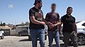
 Extensive arrests of rioters in the Negev, May 2021 I.jpg 1280 × 720; 222 КБ
-
 Extensive arrests of rioters in the Negev, May 2021 II.jpg 1280 × 720; 220 КБ
-
 Extensive arrests of rioters in the Negev, May 2021 III.jpg 1280 × 720; 198 КБ
-
 Extensive arrests of rioters in the Negev, May 2021 IV.jpg 1280 × 720; 212 КБ
-
 Extensive arrests of rioters in the Negev, May 2021 IX.jpg 1280 × 720; 156 КБ
-
 Extensive arrests of rioters in the Negev, May 2021 V.jpg 1280 × 720; 328 КБ
-
 Extensive arrests of rioters in the Negev, May 2021 VI.jpg 1280 × 720; 165 КБ
-
 Extensive arrests of rioters in the Negev, May 2021 VII.jpg 1280 × 720; 306 КБ
-
 Extensive arrests of rioters in the Negev, May 2021 VIII.jpg 1280 × 720; 273 КБ
-
 Extensive arrests of rioters in the Negev, May 2021 X.jpg 1280 × 720; 166 КБ
-
Extensive arrests of rioters in the Negev, May 2021.webm 1 мин 31 сек, 1280 × 720; 29,03 МБ
-
 Eye of God - Negev n001.jpg 1101 × 720; 139 КБ
-
 Ezor Be'er Sheva, Israel - panoramio.jpg 3648 × 2432; 2,72 МБ
-
 Fast flood creation israel negev1.JPG 640 × 480; 75 КБ
-
 Fast flood creation israel negev2.JPG 640 × 480; 77 КБ
-
 Fire zone - panoramio (1).jpg 2562 × 1708; 1,75 МБ
-
 Fire zone - panoramio.jpg 2592 × 1728; 2,11 МБ
-
 Flickr - Government Press Office (GPO) - Centurion Tanks.jpg 3060 × 2048; 753 КБ
-
 Flickr - Government Press Office (GPO) - Desert Landscape.jpg 3072 × 2048; 733 КБ
-

-
-

-

-
 Foreign worker negev.jpg 361 × 241; 111 КБ
-
 Fortress - panoramio (1).jpg 1424 × 949; 446 КБ
-
 Gullynegev1.jpg 4000 × 3000; 3,21 МБ
-
 Gullynegev3.jpg 3000 × 4000; 3 МБ
-
 Ha-Minsara (The Carpentry Shop) in Makhtesh Ramon, Negev, Israel.jpg 798 × 1064; 459 КБ
-
 Habitats (10.5852-ejt.2022.832.1877) Figure 25.png 1893 × 1421; 5,45 МБ
-
 HagaiAvriel SdeBoker.jpg 642 × 610; 88 КБ
-
 Har 'Arif 041014.jpg 3680 × 2292; 6,81 МБ
-
 Har 'Arif Makhtesh 041014.jpg 3872 × 2592; 8,25 МБ
-
 Hava river trek (25-27.03.13) 1372 panorama (9297862249).jpg 10 443 × 4500; 18,72 МБ
-
 Heart on a rock in the Negev desert of Israel.jpg 3340 × 2504; 5,47 МБ
-
 HiatusConcretionsIsrael060910.jpg 4000 × 2322; 7,57 МБ
-
 Highway 40 between Mitzpe Ramon and Beer Sheva (34128049660).jpg 5184 × 3456; 6,63 МБ
-
 Highway 40 descending in the Ramon Crater (33703297593).jpg 5184 × 3456; 9,74 МБ
-
 Highway 40 in the Ramon Crater, Negev desert (34383246891).jpg 5184 × 3456; 10,08 МБ
-
 Highway 90 leaving En Bokek (33670953454).jpg 5077 × 3392; 7,87 МБ
-
 Highway-25-Cropped.jpg 2252 × 1057; 439 КБ
-
 Highway-25.jpg 3264 × 2245; 1,31 МБ
-
 Hills and walls (4075817787).jpg 2000 × 3008; 1,15 МБ
-
 Horse ride - panoramio.jpg 3648 × 2736; 3,6 МБ
-
 Huge piles of salt and other minerals (4075816555).jpg 3008 × 2000; 684 КБ
-
 Hulikat after conquest.jpg 774 × 565; 65 КБ
-
 Ibexes. Negev (2861283853).jpg 1280 × 960; 1,37 МБ
-
 IHM מצפה מקלף.jpeg 1600 × 1067; 631 КБ
-
 IL-negev-wadi.jpg 1402 × 931; 477 КБ
-
 Israel 1 (3396793).jpg 720 × 1082; 52 КБ
-
 Israel 1988 - panoramio (2).jpg 9286 × 6237; 11,8 МБ
-
 Israel 1988 - panoramio (3).jpg 9174 × 5782; 9,53 МБ
-
 Israel 2 017.Rucksack-Tourists.jpg 1545 × 1024; 750 КБ
-
 Israel 2 029 Sign-down.jpg 1024 × 1545; 1,06 МБ
-
 Israel 2 029 Sign-right.jpg 1545 × 1024; 958 КБ
-
 Israel 2 029 Sign.jpg 1545 × 1024; 1,08 МБ
-
 Israel 2 037.Car in the Desert of Negev.jpg 1545 × 1024; 760 КБ
-
 Israel by Jim Greenhill 071203-A-3715G-551 (5885254325).jpg 2464 × 1632; 2,04 МБ
-
 Israel Camels on Road (9537241937).jpg 4309 × 2484; 2,45 МБ
-
 Israel Caution! Tanks Crossing and Dust Clouds (9540035824).jpg 4320 × 3240; 3,53 МБ
-
 Israel DSC08390 (9537244401).jpg 4320 × 3240; 3,31 МБ
-
 Israel DSC08555 (9538788239).jpg 4320 × 3240; 3,88 МБ
-
 Israel DSC08556 (9538789391).jpg 4320 × 3240; 4,07 МБ
-
 Israel DSC08557 (9541580254).jpg 4320 × 3240; 3,89 МБ
-
 Israel DSC08558 (9541581306).jpg 4320 × 3240; 4,22 МБ
-
 Israel DSC08559 (9538792773).jpg 4320 × 3240; 4,6 МБ
-
 Israel DSC08560 (9541583922).jpg 4320 × 3240; 4,54 МБ
-
 Israel DSC08561 (9541585016).jpg 4320 × 3240; 3,85 МБ
-
 Israel DSC08569 (9538796721).jpg 3240 × 4320; 3,87 МБ
-
 Israel DSC08570 (9538797587).jpg 4320 × 3240; 4,04 МБ
-
 Israel DSC08573 (9541588552).jpg 3240 × 4320; 4,04 МБ
-
 Israel Egypt Border.JPG 423 × 552; 113 КБ
-
 Israel Hiking Map באר מילחן.jpeg 3264 × 2448; 4,19 МБ
-
 Israel Hiking Map גב זרחן 1.jpeg 4032 × 3024; 2,5 МБ
-
 Israel Hiking Map גב זרחן 2.jpeg 4032 × 3024; 2,6 МБ
-
 Israel Hiking Map גב זרחן.jpeg 4032 × 3024; 2,54 МБ
-
 Israel Hiking Map גב זרחן.JPG 2448 × 2448; 1,8 МБ
-
 Israel Hiking Map העין של נחל זרחן.jpeg 4032 × 2268; 3,46 МБ


.jpg)
.jpg)
.jpg)
.jpg)

.jpg)
.jpg)
.jpg)


.jpg)


.jpg)
.jpg)

.jpg)


.jpg)


.jpg)
.jpg)
.jpg)


.jpg)
.jpg)


.jpg)


.jpg)


.jpg)
.jpg)


.jpg)
.jpg)

.jpg)

.jpg)

.jpg)
,_at_the_north_edge_of_Ramon_crater_(Makhtesh_Ramon),_Negev,_Israel.jpg)


.jpg)
.jpg)
.jpg)
.jpg)
.jpg)
.jpg)
.jpg)
.jpg)
.jpg)
.jpg)
.jpg)


.jpg)

.jpg)
.jpg)


.jpg)


.jpg)

_-_Centurion_Tanks.jpg)
_-_Desert_Landscape.jpg)
_-_Observant_Soldier_Reciting_Morning_Prayers.jpg)
_-_P.M._Levy_Eshkol_with_Chief_of_Staff_Yitzhak_Rabin_and_Min._Yigal_Allon.jpg)
_-_YITZHAK_RABIN_AS_YOUNG_PALMACH_COMMANDER_ON_TOUR_OF_NEGEV_WITH_DAVID_BEN_GURION_AND_YIGAL_ALLON..jpg)


.jpg)


_in_Makhtesh_Ramon,_Negev,_Israel.jpg)
_Figure_25.png)


_1372_panorama_(9297862249).jpg)


.jpg)
.jpg)
.jpg)
.jpg)


.jpg)

.jpg)

.jpg)


.jpg)
.jpg)
.jpg)


.jpg)
.jpg)
.jpg)
.jpg)
.jpg)
.jpg)
.jpg)
.jpg)
.jpg)
.jpg)
.jpg)
.jpg)
.jpg)
.jpg)


.jpg)