Category:Nether Heyford
Aller à la navigation
Aller à la recherche
English: Nether Heyford is an English village to the north of the village close to the A45 road and is also part of Nether Heyford Parish.
village britannique  | |||||
| Téléverser des médias | |||||
| Nature de l’élément | |||||
|---|---|---|---|---|---|
| Lieu | West Northamptonshire, Northamptonshire, Midlands de l'Est, Angleterre | ||||
| Population |
| ||||
| Superficie |
| ||||
 | |||||
Sous-catégories
Cette catégorie comprend 2 sous-catégories, dont les 2 ci-dessous.
H
- Horestone Mosaic (4 F)
Média dans la catégorie « Nether Heyford »
Cette catégorie comprend 219 fichiers, dont les 200 ci-dessous.
(page précédente) (page suivante)-
 2012 flooding in Nether Heyford.jpg 2 336 × 1 992 ; 617 kio
-
 A Daventry Dart turning left into Middle Street - geograph.org.uk - 3791140.jpg 800 × 600 ; 156 kio
-
 A5 heading north - geograph.org.uk - 5647401.jpg 640 × 428 ; 113 kio
-
 Access bridge over Grand Union Canal - geograph.org.uk - 6720844.jpg 924 × 1 024 ; 149 kio
-
 Autumnal Trees - geograph.org.uk - 1002819.jpg 432 × 640 ; 154 kio
-
 Barn along Heyford Lane - geograph.org.uk - 4732600.jpg 800 × 600 ; 124 kio
-
 Barn at High House Wharf - geograph.org.uk - 2490562.jpg 640 × 480 ; 101 kio
-
 Blazing Saddles - geograph.org.uk - 6395267.jpg 2 304 × 1 728 ; 1,92 Mio
-
 Brickfield Cottage, Nether Heyford - geograph.org.uk - 272558.jpg 640 × 480 ; 94 kio
-
 Bridge 27, Grand Junction Canal - geograph.org.uk - 3447483.jpg 4 000 × 3 000 ; 5,01 Mio
-
 Bridge 28, Grand Junction Canal - geograph.org.uk - 3447533.jpg 4 000 × 3 000 ; 4,58 Mio
-
 Bridge 29 over Grand Union Canal - geograph.org.uk - 3654385.jpg 1 066 × 800 ; 294 kio
-
 Bridge 29, Grand Junction Canal - geograph.org.uk - 3447575.jpg 4 000 × 3 000 ; 4,64 Mio
-
 Bridge 30, Grand Junction Canal - geograph.org.uk - 3447576.jpg 4 000 × 3 000 ; 4,77 Mio
-
 Bridge 31, Grand Junction Canal - geograph.org.uk - 3447591.jpg 4 000 × 3 000 ; 4,7 Mio
-
 Bridge 32, Grand Junction Canal - geograph.org.uk - 3448063.jpg 4 000 × 3 000 ; 4,86 Mio
-
 Bridge 33, Grand Junction Canal - geograph.org.uk - 3448336.jpg 4 000 × 3 000 ; 4,98 Mio
-
 Bridge No 33 crossing the Grand Union Canal - geograph.org.uk - 4739157.jpg 800 × 600 ; 133 kio
-
 Bridge of River Nene - geograph.org.uk - 2490482.jpg 640 × 480 ; 73 kio
-
 Bridge over Grand Union Canal, Stanton's Barn - geograph.org.uk - 3654365.jpg 1 066 × 800 ; 266 kio
-
 Bugbrooke Mill - geograph.org.uk - 169693.jpg 640 × 480 ; 84 kio
-
 Bugbrooke Road in Nether Heyford - geograph.org.uk - 4732249.jpg 800 × 504 ; 128 kio
-
 Campsite near Whitehall Farm - geograph.org.uk - 4732577.jpg 800 × 580 ; 141 kio
-
 Canal - geograph.org.uk - 982522.jpg 640 × 480 ; 56 kio
-
 Canal - geograph.org.uk - 982560.jpg 640 × 480 ; 63 kio
-
 Canal Bridge 27, Grand Union Canal - geograph.org.uk - 3654431.jpg 1 066 × 800 ; 322 kio
-
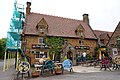
 Chaff Cutters outside The Olde Sun pub - geograph.org.uk - 2490541.jpg 640 × 480 ; 118 kio
-
 Church Path - geograph.org.uk - 1071382.jpg 427 × 640 ; 87 kio
-
 Church Street - geograph.org.uk - 1428457.jpg 640 × 480 ; 78 kio
-
 Church Street - geograph.org.uk - 1428468.jpg 640 × 480 ; 91 kio
-
 Church Street, Nether Heyford - geograph.org.uk - 356644.jpg 640 × 480 ; 103 kio
-
 Church Street, Nether Heyford - geograph.org.uk - 4972999.jpg 1 600 × 1 065 ; 530 kio
-
 Crane at Stowe Hill Workshop - geograph.org.uk - 5071544.jpg 5 184 × 3 456 ; 6,46 Mio
-
 Crane at Stowe Hill Workshop - geograph.org.uk - 5071545.jpg 3 456 × 5 184 ; 3,67 Mio
-
 Crop field by Grand Union Canal - geograph.org.uk - 5072851.jpg 5 000 × 3 333 ; 4,56 Mio
-
 Dark and Misty Night - geograph.org.uk - 2703198.jpg 2 336 × 3 504 ; 706 kio
-
 Different shades of green - geograph.org.uk - 4853588.jpg 640 × 426 ; 50 kio
-
 Evening Trees - geograph.org.uk - 1746534.jpg 640 × 287 ; 27 kio
-
 Fallow fields - geograph.org.uk - 3640213.jpg 640 × 430 ; 33 kio
-
 Farmland and rainbow next to the A5 - geograph.org.uk - 6659642.jpg 1 600 × 1 200 ; 452 kio
-
 Farmland and woodland - geograph.org.uk - 4853591.jpg 640 × 351 ; 44 kio
-
 Farmland by the West Coast Main Line - geograph.org.uk - 2734987.jpg 640 × 338 ; 22 kio
-
 Farmland near Nether Heyford - geograph.org.uk - 2850515.jpg 640 × 265 ; 21 kio
-
 Farmland near New Creation Farm - geograph.org.uk - 4853605.jpg 640 × 426 ; 41 kio
-
 Farmland near Stowehill - geograph.org.uk - 2942699.jpg 640 × 480 ; 67 kio
-
 Farmland near Stowehill Tunnel - geograph.org.uk - 2850513.jpg 640 × 430 ; 42 kio
-
 Farmland west of Nether Heyford - geograph.org.uk - 2496426.jpg 640 × 430 ; 46 kio
-
 Field - geograph.org.uk - 1342469.jpg 640 × 427 ; 89 kio
-
 Field near Whitehall Farm - geograph.org.uk - 2492472.jpg 640 × 480 ; 95 kio
-
 Flore Lane Bridge No 27 - geograph.org.uk - 4738972.jpg 800 × 613 ; 192 kio
-
 Flore Lane Bridge, Grand Union Canal - geograph.org.uk - 6259400.jpg 1 280 × 851 ; 407 kio
-
 Flore Lane Wharf next to the Grand Union Canal - geograph.org.uk - 4733975.jpg 800 × 554 ; 122 kio
-
 Flore, footbridge - geograph.org.uk - 4170274.jpg 1 024 × 768 ; 222 kio
-
 Footpath from the A5 to Whaitehall Farm - geograph.org.uk - 6659662.jpg 1 600 × 1 066 ; 719 kio
-
 Footpath to Whitehall Farm - geograph.org.uk - 6658184.jpg 1 600 × 1 066 ; 448 kio
-
 Foresters Arms, Nether Heyford - geograph.org.uk - 4973595.jpg 1 600 × 1 065 ; 569 kio
-
 Foresters Arms, Nether Heyford - geograph.org.uk - 4973599.jpg 1 392 × 1 600 ; 351 kio
-
 Furnace Lane at the A5 - geograph.org.uk - 4973630.jpg 1 600 × 1 129 ; 603 kio
-
 Furnace Lane crossed by Northampton to Rugby mainline - geograph.org.uk - 2934150.jpg 3 648 × 2 736 ; 1,47 Mio
-
 Furnace Lane joins Bugbrooke Road - geograph.org.uk - 2934232.jpg 3 522 × 2 544 ; 1,41 Mio
-
 Furnace Lane, northeast of the A5 - geograph.org.uk - 2934141.jpg 3 455 × 2 520 ; 1,48 Mio
-
 Garage on Middle Street - geograph.org.uk - 2490538.jpg 640 × 480 ; 109 kio
-
 Gitty - geograph.org.uk - 1144598.jpg 427 × 640 ; 74 kio
-
 Give way A5 ahead - geograph.org.uk - 2463615.jpg 1 024 × 768 ; 146 kio
-
 God Save the Queen - geograph.org.uk - 2973400.jpg 2 205 × 3 396 ; 659 kio
-
 Grand Union Canal - geograph.org.uk - 2942676.jpg 640 × 480 ; 117 kio
-
 Grand Union canal and Furnace Lane bridge - geograph.org.uk - 5932925.jpg 1 600 × 1 067 ; 345 kio
-
 Grand Union Canal at Heyford Wharf - geograph.org.uk - 2934153.jpg 3 648 × 2 736 ; 2,02 Mio
-
 Grand Union Canal at Nether Heyford - geograph.org.uk - 4739073.jpg 800 × 512 ; 182 kio
-
 Grand Union Canal from Furnace Lane - geograph.org.uk - 5071556.jpg 3 456 × 5 184 ; 4,97 Mio
-
 Grand Union Canal near Nether Heyford - geograph.org.uk - 5932742.jpg 1 600 × 1 066 ; 609 kio
-
 Grand Union Canal near Nether Heyford - geograph.org.uk - 5932936.jpg 1 600 × 1 066 ; 425 kio
-
 Grand Union Canal north of Heyford Wharf - geograph.org.uk - 5836137.jpg 1 024 × 683 ; 226 kio
-
 Grand Union Canal south of Nether Heyford - geograph.org.uk - 4739152.jpg 800 × 600 ; 176 kio
-
 Grand Union Canal towpath near Nether Heyford - geograph.org.uk - 4739065.jpg 800 × 608 ; 121 kio
-
 Grand Union Canal Walk - geograph.org.uk - 5244000.jpg 640 × 480 ; 117 kio
-
 Grand Union Canal Walk - geograph.org.uk - 5244033.jpg 640 × 480 ; 72 kio
-
 Grand Union Canal Walk - geograph.org.uk - 5244056.jpg 640 × 480 ; 52 kio
-
 Grand Union Canal Walk by Nether Heyford - geograph.org.uk - 5932933.jpg 1 600 × 1 066 ; 593 kio
-
 Grand Union Canal, Bridge Number 29 - geograph.org.uk - 3087313.jpg 640 × 480 ; 90 kio
-
 Grand Union Canal, Bridge Number 33 - geograph.org.uk - 3218025.jpg 640 × 480 ; 66 kio
-

-

-
 Grand Union Canal, Heyford Winding Hole - geograph.org.uk - 3218032.jpg 640 × 480 ; 95 kio
-
 Grand Union Canal, near Flore - geograph.org.uk - 6259218.jpg 1 280 × 851 ; 342 kio
-
 Grand Union Canal, near Flore - geograph.org.uk - 6259502.jpg 1 280 × 851 ; 429 kio
-
 Grand Union Canal, Nether Heyford - geograph.org.uk - 5075301.jpg 5 000 × 3 333 ; 5,03 Mio
-
 Grand Union Canal, Nether Heyford - geograph.org.uk - 5075306.jpg 5 184 × 3 456 ; 7,63 Mio
-
 Grand Union Canal, Site of Bridge Number 30 - geograph.org.uk - 3579765.jpg 640 × 480 ; 59 kio
-
 Grand Union Canal, Stowehill - geograph.org.uk - 6259450.jpg 1 280 × 851 ; 432 kio
-
 Grand Union Canal, Stowehill Wharf - geograph.org.uk - 3073374.jpg 640 × 480 ; 80 kio
-
 Grand-Union-Canal-near-Nether-Heyford-by-Maurice-Pullin.jpg 640 × 480 ; 136 kio
-
 Grazing by the footpath - geograph.org.uk - 6502968.jpg 1 600 × 1 066 ; 391 kio
-
 Harvesting the crops near Flore - geograph.org.uk - 4738996.jpg 800 × 600 ; 169 kio
-
 Hedgerow near New Creation Farm - geograph.org.uk - 2734985.jpg 640 × 452 ; 36 kio
-
 Heyford Parish Church and part of its burial ground - geograph.org.uk - 6287836.jpg 4 000 × 3 000 ; 3,67 Mio
-
 Heyford Wharf Bridge No 32 - geograph.org.uk - 4739139.jpg 800 × 590 ; 135 kio
-
 Heyford Wharf Bridge No 32 - geograph.org.uk - 4739143.jpg 800 × 588 ; 180 kio
-
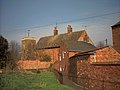
 House next to the Church in Nether Heyford - geograph.org.uk - 356649.jpg 640 × 480 ; 108 kio
-
 Industrial unit - geograph.org.uk - 5366772.jpg 640 × 425 ; 45 kio
-
 Lightning over Heyford - geograph.org.uk - 1897222.jpg 632 × 438 ; 36 kio
-
 Low rail bridge Furnace Lane, near Nether Heyford - geograph.org.uk - 2463625.jpg 1 024 × 620 ; 124 kio
-
 Manor Park in Nether Heyford - geograph.org.uk - 6287830.jpg 4 000 × 3 000 ; 3,74 Mio
-
 Manor Walk - geograph.org.uk - 1070086.jpg 640 × 427 ; 87 kio
-
 Manor Walk - geograph.org.uk - 588784.jpg 480 × 640 ; 100 kio
-
 Middle Street - geograph.org.uk - 2490546.jpg 640 × 480 ; 77 kio
-
 Midshires Way along the Grand Union Canal - geograph.org.uk - 5932923.jpg 1 600 × 1 066 ; 516 kio
-
 Milestone 12 - geograph.org.uk - 4796682.jpg 640 × 480 ; 154 kio
-

-
 Moored narrowboats at Stowehill Wharf - geograph.org.uk - 4049945.jpg 640 × 427 ; 109 kio
-
 Moored narrowboats near Stowehill Wharf - geograph.org.uk - 4049754.jpg 640 × 427 ; 105 kio
-
 Moorings by Brickfield cottages - geograph.org.uk - 5932924.jpg 1 600 × 1 066 ; 313 kio
-
 Narrow Boat - geograph.org.uk - 6503000.jpg 1 024 × 681 ; 54 kio
-
 Narrowboat on Grand Union Canal - geograph.org.uk - 3872534.jpg 640 × 371 ; 32 kio
-
 Narrowboat on the Grand Union - geograph.org.uk - 2487883.jpg 640 × 204 ; 40 kio
-
 Narrowboat on the Grand Union Canal - geograph.org.uk - 4733967.jpg 800 × 603 ; 161 kio
-
 Narrowboats at Stowe Hill - geograph.org.uk - 5071537.jpg 5 000 × 3 333 ; 5,12 Mio
-
 Narrowboats at Stowehill - geograph.org.uk - 4049760.jpg 640 × 427 ; 98 kio
-
 Near Tanborough - geograph.org.uk - 3640215.jpg 640 × 430 ; 39 kio
-
 Near Wharf Farm - geograph.org.uk - 3640211.jpg 640 × 430 ; 38 kio
-
 Nene Way - geograph.org.uk - 1070078.jpg 427 × 640 ; 113 kio
-
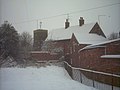 Rear of the House in snow. - geograph.org.uk - 355687.jpg 640 × 480 ; 61 kio
-
 Nether Heyford - geograph.org.uk - 1042683.jpg 640 × 427 ; 95 kio
-
 Nether Heyford - geograph.org.uk - 1042687.jpg 427 × 640 ; 104 kio
-
 Nether Heyford - geograph.org.uk - 835468.jpg 480 × 640 ; 83 kio
-
 Nether Heyford -Weedon Road - geograph.org.uk - 1333109.jpg 640 × 480 ; 113 kio
-
 Nether Heyford -Weedon Road - geograph.org.uk - 1333112.jpg 640 × 480 ; 87 kio
-
 Nether Heyford Bridge - geograph.org.uk - 1042674.jpg 640 × 427 ; 91 kio
-
 Nether Heyford Green - geograph.org.uk - 1338833.jpg 640 × 480 ; 85 kio
-
 Nether Heyford School - geograph.org.uk - 1330685.jpg 640 × 480 ; 93 kio
-
 Nether Heyford village sign - geograph.org.uk - 2463629.jpg 1 024 × 768 ; 166 kio
-
 Nether Heyford village sign - geograph.org.uk - 4732257.jpg 800 × 682 ; 204 kio
-
 Nether Heyford Wharf - geograph.org.uk - 1335231.jpg 640 × 480 ; 101 kio
-
 Nether Heyford Wharf - geograph.org.uk - 1335266.jpg 640 × 480 ; 115 kio
-
 Nether Heyford, Bridge No 27 - geograph.org.uk - 4170221.jpg 1 024 × 763 ; 200 kio
-
 Nether Heyford, Bridge No 28 - geograph.org.uk - 4170201.jpg 1 024 × 768 ; 260 kio
-
 Nether Heyford, Bridge No 29 - geograph.org.uk - 4170435.jpg 1 024 × 768 ; 248 kio
-
 Nether Heyford, canal moorings - geograph.org.uk - 4170188.jpg 1 024 × 768 ; 188 kio
-
 Nether Heyford, footpath - geograph.org.uk - 4170543.jpg 1 024 × 768 ; 209 kio
-
 Nether Heyford, footpath - geograph.org.uk - 4170553.jpg 1 024 × 768 ; 181 kio
-
 Nether Heyford, High House Wharf - geograph.org.uk - 4170181.jpg 1 024 × 768 ; 237 kio
-
 Nether Heyford, path - geograph.org.uk - 4170246.jpg 1 024 × 768 ; 164 kio
-
 Nether Heyford, stile - geograph.org.uk - 4170419.jpg 1 024 × 768 ; 301 kio
-
 Nether Heyford, The Bliss Charity School - geograph.org.uk - 4364459.jpg 640 × 480 ; 92 kio
-
 Nether Heyford, The Green - geograph.org.uk - 4364475.jpg 640 × 480 ; 74 kio
-
 Nether Heyford-Furnace Lane - geograph.org.uk - 1335228.jpg 640 × 480 ; 69 kio
-
 Nether Heyford-Grand Union canal - geograph.org.uk - 1328095.jpg 640 × 480 ; 97 kio
-
 Nether Heyford-Grand Union canal - geograph.org.uk - 1335264.jpg 640 × 480 ; 102 kio
-
 Nether Heyford-Post Box - geograph.org.uk - 1329504.jpg 480 × 640 ; 119 kio
-
 Nether Heyford-West Coast Mainline - geograph.org.uk - 1328258.jpg 640 × 480 ; 74 kio
-
 Nether Heyford-West Coast Mainline - geograph.org.uk - 1329498.jpg 640 × 480 ; 93 kio
-
 Nether Heywood Baptist Church - geograph.org.uk - 4972989.jpg 1 600 × 1 065 ; 607 kio
-
 Old advertising signs - geograph.org.uk - 4972910.jpg 1 600 × 1 065 ; 747 kio
-
 Old Sun public house, Nether Heyford.jpg 640 × 480 ; 82 kio
-
 Parsons Close on Middle Street, Nether Heywood - geograph.org.uk - 4972960.jpg 1 600 × 1 065 ; 522 kio
-
 Post Office, Nether Heyford - geograph.org.uk - 4973602.jpg 1 600 × 1 065 ; 534 kio
-
 Primitive Methodist Church - geograph.org.uk - 4973032.jpg 1 600 × 1 065 ; 590 kio
-
 Pylon - geograph.org.uk - 6502990.jpg 1 024 × 735 ; 70 kio
-
 Pylon in a field by Nether Heyford - geograph.org.uk - 5932932.jpg 1 600 × 1 066 ; 255 kio
-
 Pylon in the distance - geograph.org.uk - 3872533.jpg 640 × 378 ; 43 kio
-
 Rail Bridge on Furnace Lane - geograph.org.uk - 4973621.jpg 1 600 × 1 107 ; 667 kio
-
 Rear of the House - geograph.org.uk - 355625.jpg 640 × 480 ; 106 kio
-
 Road Sign, The Green, Nether Heyford - geograph.org.uk - 4973605.jpg 1 065 × 1 600 ; 636 kio
-
 Road to Heyford - geograph.org.uk - 1042677.jpg 640 × 427 ; 86 kio
-
 Rolling farmland - geograph.org.uk - 6720859.jpg 1 024 × 684 ; 104 kio
-
 Simon's Cottage along Heyford Lane - geograph.org.uk - 4732288.jpg 800 × 600 ; 143 kio
-
 Simon's Cottage and High House Bridge No 29 - geograph.org.uk - 4739063.jpg 800 × 603 ; 183 kio
-
 Snow Man Creators - geograph.org.uk - 1144611.jpg 427 × 640 ; 38 kio
-
 Snowy Directions - geograph.org.uk - 1144661.jpg 427 × 640 ; 64 kio
-
 South View - geograph.org.uk - 5073232.jpg 5 184 × 3 456 ; 7,65 Mio
-
 St Peter ^ St Paul's church - geograph.org.uk - 5890696.jpg 640 × 480 ; 49 kio
-
 Standingham Bridge No 28 - geograph.org.uk - 4738983.jpg 800 × 644 ; 214 kio
-
 Stanton's Barn - geograph.org.uk - 3654362.jpg 1 066 × 800 ; 216 kio
-
 Stanton's Barn and Standingham Bridge No 28 - geograph.org.uk - 4738976.jpg 800 × 583 ; 153 kio
-
 Stowe Hill Marina along the Grand Union Canal - geograph.org.uk - 4738955.jpg 800 × 548 ; 140 kio
-
 Stowe Hill Marina Service Wharf - geograph.org.uk - 4738949.jpg 800 × 549 ; 157 kio
-
 Stowe Hill Wharf - geograph.org.uk - 6259482.jpg 1 280 × 851 ; 388 kio
-
 Stowe Hill Workshop, Stowe Hill Wharf, Grand Union Canal, Stowehill - geograph.org.uk - 4566182.jpg 5 184 × 3 456 ; 7,34 Mio
-
 Stowe Hill-The Narrowboat Inn - geograph.org.uk - 2147496.jpg 640 × 529 ; 58 kio
-
 Stowehill Wharf - geograph.org.uk - 4049758.jpg 640 × 427 ; 80 kio
-
 Swingbridge House along the Grand Union Canal - geograph.org.uk - 4739070.jpg 800 × 620 ; 153 kio
-
 The Bliss Charity Primary School, Nether Heyford - geograph.org.uk - 5836147.jpg 1 024 × 683 ; 242 kio
-
 The Bliss Charity School - Nether Heyford - geograph.org.uk - 3448958.jpg 4 000 × 3 000 ; 4,68 Mio
-
 The Grand Union Canal - geograph.org.uk - 4973610.jpg 1 600 × 1 065 ; 608 kio
-
 The Grand Union Canal - geograph.org.uk - 4973616.jpg 1 600 × 1 065 ; 794 kio
-
 The Grand Union Canal at Stowe Hill - geograph.org.uk - 4738964.jpg 800 × 603 ; 192 kio
-
 The Narrow Boat at Stowe Hill - geograph.org.uk - 4738943.jpg 684 × 800 ; 113 kio
-
 The Narrowboat - geograph.org.uk - 3866333.jpg 640 × 430 ; 49 kio
-
 The Narrowboat Inn - geograph.org.uk - 2850510.jpg 640 × 430 ; 38 kio
-
 The Nene at Heyford - geograph.org.uk - 6502971.jpg 1 600 × 1 066 ; 407 kio
-
 The Nene Way heading for Kislingbury - geograph.org.uk - 6502965.jpg 1 600 × 1 066 ; 542 kio
-
 The Old and the New - geograph.org.uk - 1841420.jpg 1 024 × 683 ; 293 kio
-
 The Old Sun - geograph.org.uk - 1000907.jpg 640 × 474 ; 62 kio
-
 The Old Sun - geograph.org.uk - 2934238.jpg 3 648 × 2 736 ; 2,01 Mio
-
 The Olde Sun sign - geograph.org.uk - 2490540.jpg 480 × 640 ; 77 kio
-
 The Olde Sun, Nether Heyford - geograph.org.uk - 4972721.jpg 1 600 × 1 065 ; 743 kio
-
 The Olde Sun, Nether Heyford - geograph.org.uk - 4972899.jpg 1 600 × 1 065 ; 823 kio
-
 The Olde Sun, Nether Heyford - geograph.org.uk - 4972942.jpg 1 600 × 1 065 ; 615 kio
-
 The River Nene downstream from Nether Heyford Bridge - geograph.org.uk - 2934254.jpg 3 648 × 2 736 ; 2,34 Mio
-
 Touring Caravan Site - geograph.org.uk - 3654344.jpg 1 066 × 800 ; 197 kio


_-_geograph.org.uk_-_3218511.jpg)


