Category:Nether Kellet
Aller à la navigation
Aller à la recherche
English: Nether Kellet is a village and civil parish in the City of Lancaster in Lancashire, England, a few miles south of Carnforth. It had a population of 646 recorded in the 2001 census. The parish includes the small hamlet of Addington, to the east. (→Nether Kellet)
Nederlands: Nether Kellet is een plaats en civil parish in het bestuurlijke gebied Lancaster, in het Engelse graafschap Lancashire met 646 inwoners. (→Nether Kellet)
Polski: Nether Kellet – wieś w Anglii, w hrabstwie Lancashire, w dystrykcie Lancaster. Leży 80 km na północny zachód od miasta Manchester i 339 km na północny zachód od Londynu. W 2001 miejscowość liczyła 646 mieszkańców. (→Nether Kellet)
localité britannique du comté anglais de Lancashire  | |||||
| Téléverser des médias | |||||
| Nature de l’élément | |||||
|---|---|---|---|---|---|
| Lieu | cité de Lancaster, Lancashire, Angleterre du Nord-Ouest, Angleterre | ||||
| Population |
| ||||
| Réputé identique à | Nether Kellet (page en doublon, paroisse civile) | ||||
 | |||||
Média dans la catégorie « Nether Kellet »
Cette catégorie comprend 188 fichiers, dont les 188 ci-dessous.
-
 Back Lane Bridge, M6 - geograph.org.uk - 2637145.jpg 640 × 430 ; 29 kio
-
 Back Lane Crosses the M6 - geograph.org.uk - 3101792.jpg 3 948 × 2 475 ; 4,68 Mio
-
 Back Lane Quarry wind turbine - geograph.org.uk - 4936676.jpg 640 × 640 ; 165 kio
-
 Bolton Lane - geograph.org.uk - 3120929.jpg 4 608 × 3 456 ; 3,41 Mio
-
 Bolton Lane - geograph.org.uk - 4689684.jpg 640 × 480 ; 51 kio
-
 Bolton Lane - geograph.org.uk - 4689692.jpg 640 × 480 ; 45 kio
-
 Bolton Lane Bridge, M6 - geograph.org.uk - 2637143.jpg 640 × 430 ; 30 kio
-
 Boxwood Cottage - panoramio.jpg 3 072 × 1 728 ; 2 Mio
-
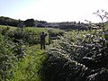
 Buttercup meadow, Addington - geograph.org.uk - 1921672.jpg 640 × 480 ; 144 kio
-
 Cattle grazing south of Over Kellet - geograph.org.uk - 4463115.jpg 640 × 480 ; 63 kio
-
 Chestnut Hill - panoramio.jpg 3 072 × 1 728 ; 2,02 Mio
-
 Cole Wood from the M6 - geograph.org.uk - 3101806.jpg 2 814 × 2 432 ; 3,21 Mio
-
 Congregational chapel, Nether Kellet - geograph.org.uk - 2757982.jpg 834 × 1 024 ; 414 kio
-
 Congregational Church Hall, Nether Kellet - geograph.org.uk - 1751493.jpg 640 × 425 ; 151 kio
-
 Congregational Church Hall, Nether Kellet - geograph.org.uk - 1751499.jpg 640 × 425 ; 145 kio
-
 Congregational Church, Nether Kellet - geograph.org.uk - 1751505.jpg 640 × 425 ; 129 kio
-
 Dunald Mill Cave - geograph.org.uk - 2218711.jpg 2 304 × 3 072 ; 1,25 Mio
-
 Dunald Mill Lane - geograph.org.uk - 3016078.jpg 640 × 425 ; 193 kio
-
 Dunald Mill Quarry - geograph.org.uk - 1611253.jpg 640 × 480 ; 183 kio
-
 Dunald Mill Quarry - geograph.org.uk - 1946833.jpg 3 072 × 2 304 ; 2,33 Mio
-
 Dunald Mill Quarry - geograph.org.uk - 4689727.jpg 640 × 415 ; 56 kio
-
 Dunald Mill Quarry - geograph.org.uk - 767238.jpg 640 × 480 ; 122 kio
-
 Entering Nether Kellet - geograph.org.uk - 4689698.jpg 640 × 480 ; 72 kio
-
 Entrance to Dunald Mill Quarry - geograph.org.uk - 4689724.jpg 640 × 480 ; 57 kio
-
 Essential Travel Only - geograph.org.uk - 6428760.jpg 1 280 × 869 ; 544 kio
-
 Farm buildings on Kellet Lane - geograph.org.uk - 2410057.jpg 640 × 480 ; 73 kio
-
 Farm track, Nether Kellet - geograph.org.uk - 1611239.jpg 640 × 480 ; 207 kio
-
 Farmland near Nether Kellet - geograph.org.uk - 1923453.jpg 800 × 531 ; 141 kio
-
 Farmland near Nether Kellet - geograph.org.uk - 2442994.jpg 640 × 425 ; 247 kio
-
 Farmland, Nether Kellet - geograph.org.uk - 4367568.jpg 640 × 407 ; 101 kio
-
 Farmland, Nether Kellet - geograph.org.uk - 4367573.jpg 640 × 422 ; 102 kio
-
 Farmland, Nether Kellet - geograph.org.uk - 4367575.jpg 640 × 425 ; 109 kio
-
 Field entrance and footpath, Swarthdale - geograph.org.uk - 5923275.jpg 640 × 476 ; 114 kio
-
 Field, Moor End - geograph.org.uk - 4717042.jpg 1 024 × 576 ; 263 kio
-
 Footbridge over the M6 - geograph.org.uk - 2637142.jpg 640 × 430 ; 33 kio
-
 Footbridge over the M6 at Cole Wood - geograph.org.uk - 2311352.jpg 640 × 480 ; 124 kio
-
 Footbridge over the M6 at Nether Kellet - geograph.org.uk - 3943681.jpg 640 × 480 ; 231 kio
-
 Footbridge over the M6 near Nether Kellet - geograph.org.uk - 3943671.jpg 640 × 427 ; 228 kio
-
 Footpath and seat - geograph.org.uk - 2218698.jpg 1 600 × 1 200 ; 536 kio
-
 Footpath, Bessybank - geograph.org.uk - 2261002.jpg 640 × 480 ; 89 kio
-
 Former Post Office, Nether Kellet - geograph.org.uk - 6660726.jpg 1 280 × 720 ; 538 kio
-
 Garden path near Swarthdale - geograph.org.uk - 1924016.jpg 800 × 531 ; 306 kio
-
 Golden cottages - geograph.org.uk - 483944.jpg 575 × 383 ; 91 kio
-
 Grassland off Long Dales Lane - geograph.org.uk - 4678383.jpg 640 × 480 ; 45 kio
-
 Grazing and hedgerow - geograph.org.uk - 4678370.jpg 640 × 480 ; 54 kio
-
 Grazing and hedgerow - geograph.org.uk - 4678372.jpg 640 × 480 ; 95 kio
-
 Grazing and pylon off Bolton Lane - geograph.org.uk - 4678366.jpg 640 × 480 ; 39 kio
-
 Grazing and woodland near Swarthdale - geograph.org.uk - 5923280.jpg 640 × 480 ; 58 kio
-
 Grazing and woodland, Swarthdale - geograph.org.uk - 5923277.jpg 640 × 480 ; 79 kio
-
 Grazing land - geograph.org.uk - 5675418.jpg 1 180 × 784 ; 675 kio
-
 Grazing land and quarry - geograph.org.uk - 1719181.jpg 640 × 425 ; 143 kio
-
 Grazing land and quarry - geograph.org.uk - 2558558.jpg 640 × 425 ; 245 kio
-
 Grazing land and quarry - geograph.org.uk - 6046783.jpg 1 280 × 850 ; 629 kio
-
 Grazing land, Nether Kellet - geograph.org.uk - 5720763.jpg 1 280 × 1 280 ; 665 kio
-
 Grazing near Wayside - geograph.org.uk - 4690813.jpg 640 × 480 ; 41 kio
-
 Grazing off Bolton Lane - geograph.org.uk - 4689689.jpg 640 × 480 ; 43 kio
-
 Grazing off Shaw Lane - geograph.org.uk - 4689702.jpg 640 × 480 ; 57 kio
-
 Grazing, Hill Top - geograph.org.uk - 4678381.jpg 640 × 480 ; 65 kio
-
 Green Hill Lane (Track) near Higher Addington - geograph.org.uk - 1946850.jpg 3 072 × 2 304 ; 2,86 Mio
-
 Green Hill Lane - geograph.org.uk - 1866712.jpg 640 × 398 ; 331 kio
-
 Green Hill lane - geograph.org.uk - 1946805.jpg 1 600 × 1 200 ; 615 kio
-
 Half a mile south of junction 35 - geograph.org.uk - 1867503.jpg 1 956 × 1 354 ; 411 kio
-
 Half mile sign to junction 35 M6 north - geograph.org.uk - 2945920.jpg 640 × 485 ; 68 kio
-
 Halton Fingerpost - panoramio.jpg 3 072 × 1 728 ; 1,56 Mio
-
 Heading north east on Bolton Lane - geograph.org.uk - 4689688.jpg 640 × 480 ; 60 kio
-
 Heathfield Farm - panoramio.jpg 3 072 × 1 728 ; 1,82 Mio
-
 High Roads and Back Lane Quarries - geograph.org.uk - 1719199.jpg 640 × 425 ; 186 kio
-
 Hill Lane - geograph.org.uk - 2218629.jpg 1 200 × 1 600 ; 521 kio
-
 Hill Lane, Nether Kellet - geograph.org.uk - 1611279.jpg 640 × 480 ; 190 kio
-
 Hill Lane, Nether Kellet - geograph.org.uk - 2558561.jpg 640 × 425 ; 249 kio
-
 Hill Lane, Nether Kellet - geograph.org.uk - 4367565.jpg 640 × 425 ; 190 kio
-
 Hill Top Farm, Nether Kellet - geograph.org.uk - 3510288.jpg 640 × 425 ; 126 kio
-
 House on Dunald Mill Lane - geograph.org.uk - 1946821.jpg 2 886 × 2 229 ; 1,4 Mio
-
 Inglebrick in winter - geograph.org.uk - 5895794.jpg 1 280 × 854 ; 541 kio
-
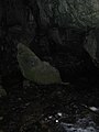 Inside Dunald Mill Hole - geograph.org.uk - 2218605.jpg 1 200 × 1 600 ; 259 kio
-
 Kirkby Lonsdale Road - geograph.org.uk - 5923282.jpg 640 × 438 ; 60 kio
-
 Laithbutts Lane, Nether Kellet - geograph.org.uk - 3510291.jpg 640 × 425 ; 237 kio
-
 Lane heading east from Swarthdale - geograph.org.uk - 5923278.jpg 640 × 480 ; 113 kio
-
 Lawsons Farm Gate - panoramio.jpg 3 072 × 1 728 ; 2,17 Mio
-
 Lawsons Farm house - panoramio.jpg 3 072 × 1 728 ; 2,36 Mio
-
 Limeburners Arms - geograph.org.uk - 4878567.jpg 5 083 × 2 698 ; 1,66 Mio
-
 Limeburners Arms - panoramio.jpg 3 072 × 1 728 ; 1,84 Mio
-
 Limeburners Arms Nether Kellet - geograph.org.uk - 844986.jpg 640 × 480 ; 229 kio
-
 Limestone outcrop above Green Hill Lane - geograph.org.uk - 2482195.jpg 640 × 480 ; 88 kio
-
 Long Dales and Dunald Mill Lanes junction - geograph.org.uk - 2311395.jpg 640 × 480 ; 90 kio
-
 Long Dales Lane - geograph.org.uk - 2154735.jpg 640 × 425 ; 367 kio
-
 Long Dales Lane - geograph.org.uk - 4689714.jpg 640 × 480 ; 68 kio
-
 Long Dales Lane - geograph.org.uk - 4690810.jpg 640 × 480 ; 63 kio
-
 Long Dales Lane near Nether Kellet - geograph.org.uk - 1923490.jpg 800 × 531 ; 173 kio
-
 M6 at Back Lane Quarry wind turbine - geograph.org.uk - 3894436.jpg 2 592 × 1 936 ; 1,63 Mio
-
 M6 at Nether Kellet - geograph.org.uk - 1983392.jpg 2 560 × 1 920 ; 1,8 Mio
-
 M6 Motorway - geograph.org.uk - 4878020.jpg 4 800 × 2 688 ; 1,68 Mio
-
 M6 Nether Kellet - geograph.org.uk - 2475967.jpg 640 × 480 ; 53 kio
-
 M6 north 1 mile south of Junction 35 - geograph.org.uk - 2945917.jpg 640 × 454 ; 53 kio
-
 M6 northbound near Back Lane Quarry - geograph.org.uk - 3502707.jpg 640 × 480 ; 57 kio
-
 M6 northbound near Nether Kellet - geograph.org.uk - 3502703.jpg 640 × 481 ; 45 kio
-
 M6 northbound near Nether Kellet - geograph.org.uk - 4678371.jpg 640 × 480 ; 55 kio
-
 M6, Back Lane Bridge - geograph.org.uk - 3231988.jpg 640 × 430 ; 44 kio
-
 M6, Bolton Lane Bridge - geograph.org.uk - 3231998.jpg 640 × 430 ; 38 kio
-
 M6, Cole Wood - geograph.org.uk - 3232003.jpg 640 × 430 ; 37 kio
-
 M6, southbound - geograph.org.uk - 3231987.jpg 640 × 430 ; 40 kio
-
 M6, southbound - geograph.org.uk - 3231996.jpg 640 × 430 ; 50 kio
-
 Modified road sign - geograph.org.uk - 2443003.jpg 478 × 640 ; 348 kio
-
 Moor End - geograph.org.uk - 4878023.jpg 5 184 × 3 224 ; 1,61 Mio
-
 Moor End - geograph.org.uk - 4878569.jpg 4 981 × 2 132 ; 1,81 Mio
-
 Morecambe Bay from Nether Kellett - geograph.org.uk - 4671012.jpg 1 024 × 768 ; 653 kio
-
 Narrow lane near Nether Kellet - geograph.org.uk - 1923460.jpg 800 × 531 ; 187 kio
-
 Narrow lane near Nether Kellet - geograph.org.uk - 1923483.jpg 800 × 531 ; 150 kio
-
 Nether Kellet , M6 Motorway - geograph.org.uk - 6300550.jpg 6 000 × 4 000 ; 4,81 Mio
-
 Nether Kellet , M6 Motorway - geograph.org.uk - 6300551.jpg 6 000 × 4 000 ; 5,04 Mio
-
 Nether Kellet , M6 Motorway - geograph.org.uk - 6300555.jpg 6 000 × 4 000 ; 4,86 Mio
-
 Nether Kellet , M6 Motorway - geograph.org.uk - 6300556.jpg 6 000 × 4 000 ; 5,22 Mio
-
 Nether Kellet , M6 Motorway - geograph.org.uk - 6359826.jpg 6 000 × 4 000 ; 5,84 Mio
-
 Nether Kellet , M6 Motorway - geograph.org.uk - 6359828.jpg 6 000 × 4 000 ; 5,29 Mio
-
 Nether Kellet , M6 Motorway - geograph.org.uk - 6359830.jpg 6 000 × 4 000 ; 4 Mio
-
 Nether Kellet - geograph.org.uk - 1923430.jpg 800 × 531 ; 200 kio
-
 Nether Kellet Peace Stone - geograph.org.uk - 2397430.jpg 425 × 640 ; 112 kio
-
 Nether Kellet Village Green - geograph.org.uk - 1611231.jpg 640 × 480 ; 235 kio
-
 Nether Kellet Village Green - geograph.org.uk - 1611269.jpg 640 × 480 ; 134 kio
-
 Nether Kellet Village Green - geograph.org.uk - 1853192.jpg 640 × 425 ; 189 kio
-
 Nether Kellet Village Green - geograph.org.uk - 3510287.jpg 640 × 425 ; 248 kio
-
 Nether Kellet Village Green - geograph.org.uk - 4367561.jpg 640 × 425 ; 219 kio
-
 Nether Kellet Village Green - geograph.org.uk - 5513.jpg 640 × 480 ; 86 kio
-
 Nether Kellet Village Green - geograph.org.uk - 5966891.jpg 1 280 × 850 ; 425 kio
-
 Nether Kellet Village Green - geograph.org.uk - 6660732.jpg 1 280 × 720 ; 716 kio
-
 New wind turbine near Back Lane Quarry - geograph.org.uk - 3496943.jpg 704 × 480 ; 95 kio
-
 Northbound M6, Bolton Lane Bridge - geograph.org.uk - 3943672.jpg 640 × 480 ; 251 kio
-
 Northbound M6, Nether Kellet - geograph.org.uk - 3943677.jpg 640 × 427 ; 254 kio
-
 One mile to junction 35, M6 northbound - geograph.org.uk - 2712817.jpg 2 754 × 1 966 ; 572 kio
-
 Pastures south of Nether Kellet - geograph.org.uk - 2311333.jpg 640 × 480 ; 77 kio
-
 Peace Memorial - panoramio.jpg 3 072 × 1 728 ; 1,99 Mio
-
 Play area, Nether Kellet - geograph.org.uk - 2261009.jpg 640 × 480 ; 109 kio
-
 Pond at Westfield - geograph.org.uk - 1617055.jpg 640 × 480 ; 136 kio
-
 Pond near Nether Kellet - geograph.org.uk - 1866689.jpg 640 × 425 ; 313 kio
-
 Poultry shed under construction - geograph.org.uk - 5064018.jpg 640 × 365 ; 154 kio
-
 Pt 79m north of Dale Barns - geograph.org.uk - 2311382.jpg 640 × 480 ; 46 kio
-
 Pump - panoramio (1).jpg 3 072 × 1 728 ; 1,93 Mio
-
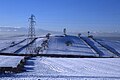
 Pylon painting - geograph.org.uk - 5441265.jpg 640 × 640 ; 159 kio
-
 Quarry berm, Nether Kellet - geograph.org.uk - 4717046.jpg 1 024 × 576 ; 241 kio
-

-
 Quarry viewing point - geograph.org.uk - 2154732.jpg 640 × 425 ; 352 kio
-
 Quarry Workings, Back Lane Quarry - geograph.org.uk - 1946841.jpg 3 072 × 2 304 ; 2,44 Mio
-
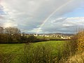 Rainbow over Carnforth - geograph.org.uk - 3894431.jpg 2 592 × 1 936 ; 1,8 Mio
-
 Reflections in a flooded field - geograph.org.uk - 1573674.jpg 640 × 480 ; 92 kio
-
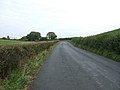
 Road from Lancaster to Kirkby Lonsdale - geograph.org.uk - 1923815.jpg 800 × 531 ; 157 kio
-
 Road junction near Dunald Mill - geograph.org.uk - 1923498.jpg 800 × 531 ; 183 kio
-
 Road junction north of Moor End - geograph.org.uk - 2069328.jpg 640 × 480 ; 83 kio
-
 Road near Newlands Farm - geograph.org.uk - 3120922.jpg 3 261 × 3 122 ; 1,74 Mio
-
 Road to a quarry near Nether Kellet - geograph.org.uk - 1923416.jpg 800 × 531 ; 211 kio
-
 Rough grazing near Nether Kellet - geograph.org.uk - 1866700.jpg 640 × 425 ; 300 kio
-
 Shaw Lane - geograph.org.uk - 4689705.jpg 640 × 480 ; 68 kio
-
 Shaw Lane - geograph.org.uk - 4878568.jpg 5 184 × 3 042 ; 1,57 Mio
-
 Southbound M6 near Nether Kellet - geograph.org.uk - 4355442.jpg 640 × 480 ; 239 kio
-
 Southbound M6, Back Lane Bridge - geograph.org.uk - 4032754.jpg 640 × 480 ; 253 kio
-
 Spring - panoramio (34).jpg 3 072 × 1 728 ; 1,88 Mio
-
 St. Mark's Church in Nether Kellett - geograph.org.uk - 4671009.jpg 1 024 × 767 ; 701 kio
-
 The end of the lane - geograph.org.uk - 2261022.jpg 640 × 480 ; 136 kio
-
 The footpath to Over Kellet - geograph.org.uk - 1921663.jpg 640 × 480 ; 65 kio
-
 The Limeburners Arms, Nether Kellet - geograph.org.uk - 644260.jpg 640 × 438 ; 55 kio
-
 The path to Kellet Lane west of Cole Wood - geograph.org.uk - 2311360.jpg 640 × 480 ; 79 kio
-
 The Thankful Villages Run - geograph.org.uk - 3582831.jpg 640 × 437 ; 149 kio
-
 The Thankful Villages Run - geograph.org.uk - 3582832.jpg 640 × 425 ; 192 kio
-
 The Thankful Villages Run - geograph.org.uk - 3582833.jpg 640 × 516 ; 216 kio
-
 The valley of Cote Beck - geograph.org.uk - 2311346.jpg 640 × 480 ; 57 kio
-
 Track near Nether Kellet - geograph.org.uk - 2347990.jpg 640 × 425 ; 343 kio
-
 Tree in winter, Nether Kellet - geograph.org.uk - 4367563.jpg 640 × 425 ; 172 kio
-
 Tree lined road near Swarthdale - geograph.org.uk - 1923869.jpg 800 × 531 ; 243 kio
-
 Tree-lined road near Swarthdale - geograph.org.uk - 2710863.jpg 640 × 425 ; 304 kio
-
 Village Store, Nether Kellet - geograph.org.uk - 844987.jpg 640 × 480 ; 129 kio
-
 Water tankers, Nether Kellet - geograph.org.uk - 5845716.jpg 1 280 × 862 ; 311 kio
-
 Weighbridge at Dunald Mill Quarry - geograph.org.uk - 2154733.jpg 640 × 425 ; 371 kio
-
 Wind turbine, Intack Farm - geograph.org.uk - 5097623.jpg 640 × 512 ; 168 kio
-
 Woodland off Dunald Mill Lane - geograph.org.uk - 4689720.jpg 640 × 480 ; 54 kio
-
 Blot on the landscape - geograph.org.uk - 123108.jpg 640 × 426 ; 67 kio
-
 Dale Barns Farm, near Nether Kellet - geograph.org.uk - 6445.jpg 640 × 480 ; 59 kio
-
 Farmland and wood, near Nether Kellet - geograph.org.uk - 28376.jpg 640 × 480 ; 77 kio
-
 Green Hill - geograph.org.uk - 12296.jpg 640 × 401 ; 66 kio
-
 Green Hill House Farm, near Halton - geograph.org.uk - 13159.jpg 640 × 480 ; 70 kio
-
 Heights are good for you. - geograph.org.uk - 356115.jpg 640 × 480 ; 54 kio
-
 Jubilee Terrace, Nether Kellet - geograph.org.uk - 644256.jpg 640 × 429 ; 56 kio
-
 Lime Kiln near Nether Kellet - geograph.org.uk - 13153.jpg 640 × 480 ; 154 kio
-
 Moor End Farm, near Nether Kellet - geograph.org.uk - 30119.jpg 640 × 480 ; 89 kio
-
 New pond at Westfield - geograph.org.uk - 323791.jpg 626 × 359 ; 55 kio
-
 Scargill Farm, near Nether Kellet - geograph.org.uk - 30120.jpg 640 × 480 ; 57 kio
-
 The hole gets bigger - geograph.org.uk - 123109.jpg 640 × 426 ; 87 kio
-
 Transco Gas Installation - geograph.org.uk - 123107.jpg 640 × 426 ; 70 kio
-
 View Field trig pillar - geograph.org.uk - 357128.jpg 640 × 480 ; 65 kio
-
 What goes up must look down - geograph.org.uk - 356094.jpg 640 × 480 ; 110 kio


_near_Higher_Addington_-_geograph.org.uk_-_1946850.jpg)


.jpg)


.jpg)


