Category:New Holland, Lincolnshire
Vai alla navigazione
Vai alla ricerca
English: New Holland is a small village, civil parish and port on the Humber estuary in the Borough of North Lincolnshire in Lincolnshire, England. It has a population of 955.
village in North Lincolnshire, England  | |||||
| Carica un file multimediale | |||||
| Istanza di | |||||
|---|---|---|---|---|---|
| Luogo | North Lincolnshire, Lincolnshire, Yorkshire e Humber, Inghilterra | ||||
 | |||||
Sottocategorie
Questa categoria contiene le 14 sottocategorie indicate di seguito, su un totale di 14.
A
B
H
N
P
R
S
T
Y
File nella categoria "New Holland, Lincolnshire"
Questa categoria contiene 200 file, indicati di seguito, su un totale di 286.
(pagina precedente) (pagina successiva)-
 A bleak view of the Humber - geograph.org.uk - 1974941.jpg 1 024 × 768; 128 KB
-
 A field of swans - geograph.org.uk - 2229073.jpg 800 × 600; 215 KB
-
 A point and a pointer - geograph.org.uk - 2002083.jpg 1 024 × 768; 136 KB
-
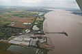
 A view of New Holland from Hessle - geograph.org.uk - 5332947.jpg 5 003 × 3 701; 3,4 MB
-
 Admiralty Chart No 3497 Thorngumbald Lights to Barton Haven, Published 1913, New Edition 1954.jpg 20 085 × 11 210; 89,39 MB
-
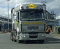
 Alford Traffic Services Renault HGV.jpg 2 175 × 2 046; 2,29 MB
-
 Another Rubber Plantation - geograph.org.uk - 284321.jpg 640 × 482; 153 KB
-
 Approaching New Holland - geograph.org.uk - 4388811.jpg 800 × 533; 75 KB
-
 Approaching the 'Snails Trail' seat - geograph.org.uk - 6376043.jpg 1 024 × 576; 362 KB
-
 Arable field toward Summercroft Farm - geograph.org.uk - 6079645.jpg 4 608 × 3 456; 4,35 MB
-
 ArborForest offices - geograph.org.uk - 4520280.jpg 1 024 × 768; 176 KB
-
 Bales - geograph.org.uk - 3039625.jpg 1 500 × 1 500; 2,05 MB
-
 Barrow Hann, North Lincolnshire - geograph.org.uk - 4362604.jpg 640 × 427; 187 KB
-

-

-
 Barrow Road, New Holland - geograph.org.uk - 2508295.jpg 1 600 × 1 200; 422 KB
-
 Barrow Road, New Holland - geograph.org.uk - 3296260.jpg 640 × 426; 198 KB
-
 Barrow Road, New Holland - geograph.org.uk - 3753784.jpg 640 × 480; 66 KB
-
 Barrow upon Humber, Lincolnshire - geograph.org.uk - 3309135.jpg 3 254 × 2 436; 2,49 MB
-
 Beached - geograph.org.uk - 284316.jpg 640 × 482; 107 KB
-
 Behind the Humber Bank - geograph.org.uk - 1974922.jpg 1 024 × 768; 215 KB
-
 Bird scarer at former clay pit - geograph.org.uk - 4514684.jpg 1 024 × 768; 222 KB
-
 Buildings at Coulbeck Farm, West Hann Lane - geograph.org.uk - 4351275.jpg 1 600 × 1 062; 699 KB
-
 Bulk terminal at New Holland - geograph.org.uk - 4346666.jpg 1 600 × 1 062; 627 KB
-
 Cargo ship discharging at New Holland Pier - geograph.org.uk - 6078724.jpg 4 608 × 3 456; 3,96 MB
-
 Construction Site near New Holland - geograph.org.uk - 1498058.jpg 640 × 480; 287 KB
-
 Construction Work on New Storage Shed, New Holland - geograph.org.uk - 2949031.jpg 1 500 × 1 089; 1,04 MB
-
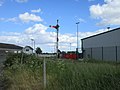
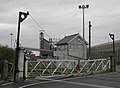 Crossing Gates and Signal Box, New Holland - geograph.org.uk - 1852793.jpg 1 000 × 734; 510 KB
-
 Crown Timber - geograph.org.uk - 242726.jpg 640 × 354; 57 KB
-
 Crown Timber, New Holland - geograph.org.uk - 4346789.jpg 1 600 × 1 062; 486 KB
-
 Demolished House near New Holland - geograph.org.uk - 1519901.jpg 640 × 510; 391 KB
-
 Demolition of Old Sheds at New Holland - geograph.org.uk - 3151321.jpg 1 931 × 1 000; 1,59 MB
-
 Demolition Slipway at New Holland - geograph.org.uk - 1519943.jpg 640 × 509; 311 KB
-
 Destination - Barton Upon Humber - geograph.org.uk - 1976638.jpg 665 × 1 000; 532 KB
-
 Disused Rail Tracks - geograph.org.uk - 3039604.jpg 1 125 × 1 500; 2,1 MB
-
 Disused Wharf at New Holland Dock - geograph.org.uk - 2825962.jpg 987 × 1 280; 1,24 MB
-
 Drain and Field Bridge, Marsh Lane, New Holland - geograph.org.uk - 1820795.jpg 750 × 1 000; 889 KB
-
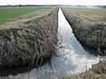
 Drain at New Holland - geograph.org.uk - 4346471.jpg 1 600 × 1 062; 662 KB
-
 Drain near New Holland - geograph.org.uk - 1605829.jpg 640 × 465; 424 KB
-
 Drain near New Holland - geograph.org.uk - 2023217.jpg 1 000 × 750; 974 KB
-
 Drain near Oxford Grange Farm - geograph.org.uk - 1605847.jpg 640 × 427; 412 KB
-
 Drain near Oxford Grange Farm - geograph.org.uk - 1717915.jpg 640 × 480; 348 KB
-
 Drain near Summercroft Farm - geograph.org.uk - 2565754.jpg 1 280 × 960; 1,1 MB
-
 Drainage ditch and Hull - geograph.org.uk - 2549959.jpg 1 024 × 768; 197 KB
-
 Driving the Combine, Thorney's Field. - geograph.org.uk - 2569511.jpg 850 × 835; 631 KB
-
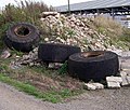 Dumped Wheels - geograph.org.uk - 242942.jpg 640 × 546; 184 KB
-
 Dutch coaster Alizee discharging at New Holland - geograph.org.uk - 6077510.jpg 4 608 × 3 456; 3,1 MB
-
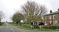
 East Hann Lane - geograph.org.uk - 2508288.jpg 1 600 × 1 200; 517 KB
-
 East Hann Lane - geograph.org.uk - 3729323.jpg 800 × 451; 194 KB
-
 East Hann Lane towards New Holland Road - geograph.org.uk - 4350251.jpg 1 600 × 1 062; 856 KB
-
 East Hann Lane, near New Holland - geograph.org.uk - 4389514.jpg 3 954 × 2 164; 5,37 MB
-
 Farm building at Leys Farm - geograph.org.uk - 4350233.jpg 1 600 × 1 073; 555 KB
-
 Farmland alongside the railway at New Holland - geograph.org.uk - 5045020.jpg 1 024 × 768; 121 KB
-
 Farmland near New Holland - geograph.org.uk - 2508304.jpg 1 600 × 1 200; 600 KB
-
 Farmland near Summercroft Farm - geograph.org.uk - 5308250.jpg 800 × 597; 153 KB
-
 Farmland off Marsh Lane - geograph.org.uk - 2508466.jpg 1 600 × 1 200; 582 KB
-
 Farmland, Barrow Hann - geograph.org.uk - 2508287.jpg 1 600 × 1 200; 573 KB
-
 Field Access Bridge off Marsh Lane - geograph.org.uk - 2023265.jpg 750 × 1 000; 903 KB
-
 Field Drain, Marsh Lane - geograph.org.uk - 2652443.jpg 960 × 1 280; 1,13 MB
-
 Field Farm - geograph.org.uk - 2057264.jpg 1 000 × 821; 663 KB
-
 Fire Damage Repairs, Barrow Road - geograph.org.uk - 2026853.jpg 1 000 × 718; 613 KB
-
 Flag by the Humber, New Holland - geograph.org.uk - 3296226.jpg 640 × 476; 170 KB
-
 Footbridge over drain on footpath to New Holland - geograph.org.uk - 6079637.jpg 4 608 × 3 456; 5,55 MB
-
 Footbridge over Marsh Lane Drain - geograph.org.uk - 3180017.jpg 1 500 × 1 125; 1,68 MB
-
 Footpath at New Holland - geograph.org.uk - 4346568.jpg 1 600 × 1 062; 574 KB
-
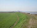
 Footpath beside the Humber heading east - geograph.org.uk - 2507550.jpg 1 600 × 1 200; 530 KB
-
 Footpath beside the Humber heading east - geograph.org.uk - 2507570.jpg 1 600 × 1 200; 547 KB
-
 Footpath junction by the Humber - geograph.org.uk - 2507574.jpg 1 600 × 1 200; 455 KB
-
 Footpath junction on Humber flood bank - geograph.org.uk - 6078826.jpg 4 608 × 3 456; 4,12 MB
-
 Footpath sign by the Humber - geograph.org.uk - 4834014.jpg 640 × 427; 214 KB
-
 Footpath to Barrow upon Humber - geograph.org.uk - 2014044.jpg 1 024 × 768; 232 KB
-
 Footpath to Marsh Lane - geograph.org.uk - 2014046.jpg 1 024 × 768; 223 KB
-
 Footpath to New Holland - geograph.org.uk - 4834012.jpg 640 × 427; 369 KB
-
 Footpath towards the Humber bank - geograph.org.uk - 4514857.jpg 1 024 × 768; 231 KB
-
 Footpath towards West End - geograph.org.uk - 2508300.jpg 1 600 × 1 200; 589 KB
-
 Goose island - geograph.org.uk - 4514681.jpg 1 024 × 768; 240 KB
-
 Hann Farm Nurseries on New Holland Road - geograph.org.uk - 4350255.jpg 1 600 × 1 062; 592 KB
-
 Heading east out of New Holland Dock - geograph.org.uk - 2229134.jpg 800 × 600; 213 KB
-
 HGV leaving New Holland Bulk Storage - geograph.org.uk - 3308970.jpg 1 500 × 1 226; 1,1 MB
-
 HGV Waiting at New Holland Dock - geograph.org.uk - 2066566.jpg 1 000 × 992; 868 KB
-
 HGV with Giant Armistice Day Poppy - geograph.org.uk - 2155757.jpg 1 280 × 857; 790 KB
-
 HGV's Waiting at New Holland Dock - geograph.org.uk - 1852763.jpg 1 000 × 635; 453 KB
-
 Home signal at Barrow Road Crossing - geograph.org.uk - 4520266.jpg 1 024 × 768; 157 KB
-
 Howarth Timber Depot - geograph.org.uk - 242723.jpg 640 × 480; 90 KB
-
 Hull from across the River Humber - geograph.org.uk - 4514801.jpg 1 024 × 768; 141 KB
-
 Humber Bank - geograph.org.uk - 242739.jpg 640 × 480; 129 KB
-
 Humber bank footpath - geograph.org.uk - 4834017.jpg 640 × 427; 305 KB
-
 Humber Bank looking west - geograph.org.uk - 5810578.jpg 1 024 × 768; 186 KB
-
 Humber Bank near New Holland - geograph.org.uk - 2061557.jpg 1 000 × 667; 739 KB
-
 Humber Bank towards New Holland - geograph.org.uk - 5810581.jpg 1 024 × 768; 180 KB
-
 Humber Bank west of New Holland - geograph.org.uk - 5810584.jpg 1 024 × 768; 184 KB
-
 Humber Bridge - geograph.org.uk - 1423864.jpg 640 × 480; 102 KB
-
 Humber Estuary, New Holland - geograph.org.uk - 5460103.jpg 640 × 427; 381 KB
-
 Humber flood bank to footpath sign - geograph.org.uk - 6078843.jpg 4 608 × 3 456; 4,61 MB
-
 Humber flood bank toward New Holland - geograph.org.uk - 6078737.jpg 4 608 × 3 456; 4,36 MB
-
 Humber Foreshore - geograph.org.uk - 1691665.jpg 640 × 427; 313 KB
-
 Humber Foreshore near New Holland - geograph.org.uk - 1691656.jpg 640 × 480; 179 KB
-
 Humber Foreshore near New Holland Jetty - geograph.org.uk - 2065004.jpg 667 × 1 000; 583 KB
-
 Humber Foreshore, New Holland - geograph.org.uk - 1519882.jpg 640 × 480; 337 KB
-
 Humber Navigation Aid - geograph.org.uk - 2061486.jpg 747 × 1 000; 653 KB
-
 Humber promontory - geograph.org.uk - 4834009.jpg 427 × 640; 378 KB
-
 Humber shoreline - geograph.org.uk - 2507568.jpg 1 600 × 1 200; 413 KB
-
 Humber shoreline - geograph.org.uk - 2507572.jpg 1 600 × 1 200; 369 KB
-
 Humber shoreline near New Holland - geograph.org.uk - 5308342.jpg 800 × 600; 190 KB
-
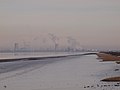
 Industry at New Holland - geograph.org.uk - 5045018.jpg 1 024 × 755; 151 KB
-
 Jack Richards & Son Ltd. Daf XF.jpg 3 610 × 2 279; 5,21 MB
-

-
-
 Land near Summercroft Farm - geograph.org.uk - 4346950.jpg 1 600 × 1 062; 554 KB
-
 Last resting place - geograph.org.uk - 4514668.jpg 1 024 × 768; 211 KB
-
 Level Crossing at the end of Peploe Lane - geograph.org.uk - 1511249.jpg 640 × 480; 335 KB
-
 Level crossing by New Holland Pier - geograph.org.uk - 4389484.jpg 4 000 × 2 248; 3,79 MB
-

-
 Lincoln Castle Way, New Holland - geograph.org.uk - 1397058.jpg 640 × 425; 52 KB
-
 Lincoln Castle Way, New Holland - geograph.org.uk - 3041299.jpg 1 500 × 1 125; 1,34 MB
-
 Lincolnshire Humber Estuary shoreline - geograph.org.uk - 4389408.jpg 4 000 × 2 248; 3,75 MB
-
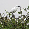 Little Egret (Egretta garzetta) Marsh Lane, New Holland - geograph.org.uk - 3930917.jpg 1 599 × 1 602; 1,65 MB
-
 Looking across to New Holland - geograph.org.uk - 2031900.jpg 800 × 600; 211 KB
-

-
 Looking towards New Holland - geograph.org.uk - 1479013.jpg 640 × 425; 73 KB
-
 Lorry at New Holland Timber Terminal - geograph.org.uk - 4346704.jpg 1 600 × 1 062; 476 KB
-
 Manchester Square - geograph.org.uk - 1245179.jpg 640 × 426; 72 KB
-
 Manchester Square - geograph.org.uk - 3528040.jpg 640 × 427; 105 KB
-
 Manchester Square - geograph.org.uk - 3528041.jpg 640 × 427; 90 KB
-
 Manchester Square, east side - geograph.org.uk - 4514906.jpg 1 024 × 768; 238 KB
-
 Manchester Square, New Holland - geograph.org.uk - 1974954.jpg 1 024 × 768; 164 KB
-
 Manchester Square, New Holland - geograph.org.uk - 2235909.jpg 1 280 × 1 005; 1,56 MB
-
 Marine archaeology - geograph.org.uk - 4514675.jpg 1 024 × 768; 275 KB
-
 Marsh Lane, Barrow Haven - geograph.org.uk - 1516109.jpg 640 × 480; 291 KB
-
 Marsh Lane, New Holland - geograph.org.uk - 1499922.jpg 640 × 480; 301 KB
-
 Marsh Lane, New Holland - geograph.org.uk - 1822408.jpg 1 000 × 750; 771 KB
-
 Marsh Lane, New Holland - geograph.org.uk - 2031916.jpg 800 × 600; 266 KB
-
 Marsh Lane, New Holland - geograph.org.uk - 3296295.jpg 640 × 426; 215 KB
-
 Marsh Lane, New Holland - geograph.org.uk - 4389513.jpg 4 000 × 2 248; 3,61 MB
-

-
 Millennium Walk, New Holland - geograph.org.uk - 1398391.jpg 640 × 425; 98 KB
-
 MJ Marine Services Site at New Holland - geograph.org.uk - 1519992.jpg 640 × 480; 302 KB
-
-
 Mudflats and a plantation - geograph.org.uk - 4498621.jpg 1 024 × 768; 143 KB
-
 Mudflats and New Holland Pier - geograph.org.uk - 4498563.jpg 1 024 × 686; 104 KB
-
 New Holland - geograph.org.uk - 153524.jpg 640 × 480; 100 KB
-
 New Holland - geograph.org.uk - 4823879.jpg 640 × 427; 67 KB
-
 New Holland - Manchester Square - geograph.org.uk - 50296.jpg 640 × 427; 101 KB
-
 New Holland - War Memorial 1914-1918 - geograph.org.uk - 4467414.jpg 1 130 × 1 600; 1,31 MB
-
 New Holland - War Memorial 1939-1945 - geograph.org.uk - 4467424.jpg 1 600 × 1 266; 1,34 MB
-

-
-
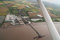
 New Holland Dock and Pier, aerial 2019 - geograph.org.uk - 6352058.jpg 800 × 533; 109 KB
-
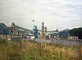
 New Holland Extraction (NHE), Plant - geograph.org.uk - 1605815.jpg 640 × 427; 257 KB
-

-
 New Holland Extraction Ltd. - geograph.org.uk - 242707.jpg 640 × 480; 98 KB
-
 New Holland Main Drain - geograph.org.uk - 1398380.jpg 640 × 425; 104 KB
-
 New Holland Main Drain Outfall - geograph.org.uk - 5308329.jpg 800 × 600; 133 KB
-
 New Holland Main Drain Outflow - geograph.org.uk - 4389430.jpg 4 000 × 2 248; 5 MB
-

-
 New Holland Mere near the River Humber - geograph.org.uk - 5308271.jpg 800 × 600; 152 KB
-
 New Holland Pier - geograph.org.uk - 6375859.jpg 1 024 × 576; 296 KB
-
 New Holland pier, Humber estuary - geograph.org.uk - 6242468.jpg 1 280 × 853; 253 KB
-
 New Holland railway crossing - geograph.org.uk - 5045017.jpg 1 024 × 768; 152 KB
-
 New Holland railway station, Lincolnshire - geograph.org.uk - 3388559.jpg 1 024 × 731; 150 KB
-
 New Holland Road towards Barrow upon Humber - geograph.org.uk - 4350301.jpg 1 600 × 1 062; 686 KB
-
 New Holland Road towards Barrow upon Humber - geograph.org.uk - 4350312.jpg 1 600 × 1 062; 718 KB
-
 New Holland Sewage Treatment Plant - geograph.org.uk - 383098.jpg 640 × 371; 98 KB
-
 New Holland signal box - geograph.org.uk - 5810582.jpg 1 024 × 768; 157 KB
-
 New Holland Station - geograph.org.uk - 2064512.jpg 640 × 434; 88 KB
-
-

-
 New Shed on Industrial Estate - geograph.org.uk - 4039061.jpg 1 600 × 1 200; 1,51 MB
-
 Off to Summercroft Farm - geograph.org.uk - 2569521.jpg 1 280 × 894; 720 KB
-
 Oilseed Rape Field near New Holland - geograph.org.uk - 2398354.jpg 853 × 1 280; 1,42 MB
-
 Oilseed Rape Field near New Holland - geograph.org.uk - 2398363.jpg 1 280 × 853; 1,44 MB
-
 Oilseed Rape near New Holland - geograph.org.uk - 1822424.jpg 1 000 × 879; 1,17 MB
-
 Old Style Railway Signal, New Holland - geograph.org.uk - 1933857.jpg 1 000 × 960; 722 KB
-
 On the Humber bank footpath - geograph.org.uk - 6376031.jpg 1 024 × 576; 275 KB
-
 On the Humber footpath - geograph.org.uk - 6376034.jpg 1 024 × 576; 241 KB
-
 Outfall into the Humber - geograph.org.uk - 2507559.jpg 1 600 × 1 200; 498 KB
-
 Oxmarsh Lane railway crossing - geograph.org.uk - 5045014.jpg 1 024 × 768; 169 KB
-
 Oxmarsh Lane Signal Box, New Holland - geograph.org.uk - 1430960.jpg 640 × 435; 76 KB
-

-
 Paji leads the way - geograph.org.uk - 4514849.jpg 1 024 × 768; 243 KB
-
 Patch of Poppies by the Railway - geograph.org.uk - 1901610.jpg 750 × 1 000; 1,05 MB
-
 Path along the Humber shoreline - geograph.org.uk - 5308228.jpg 800 × 491; 94 KB
-
 Path at New Holland - geograph.org.uk - 4346572.jpg 1 600 × 1 062; 625 KB
-
 Path beside the Humber - geograph.org.uk - 6376038.jpg 1 024 × 576; 358 KB
-
 Path beside the Humber estuary - geograph.org.uk - 6375871.jpg 1 024 × 576; 350 KB
-
 Path leading to East Hann Lane - geograph.org.uk - 4350232.jpg 1 600 × 1 062; 1,13 MB
-
 Pelham House, Oxmarsh Lane - geograph.org.uk - 4514909.jpg 1 024 × 768; 197 KB
-
 Picture III 207.jpg 1 600 × 1 200; 521 KB
-
 Private Road to Pearson's Cottages - geograph.org.uk - 910408.jpg 640 × 480; 79 KB
-
 Private Track near Summercroft Farm - geograph.org.uk - 2565766.jpg 1 280 × 921; 1,06 MB
-
 Public house Magna Charta not a misspelling - geograph.org.uk - 6079677.jpg 4 608 × 3 456; 3,19 MB
-
 Railway at New Holland - geograph.org.uk - 3296249.jpg 640 × 421; 189 KB
-

-
 Railway line, New Holland - geograph.org.uk - 2507563.jpg 1 600 × 1 200; 417 KB
-
 Railway lines to New Holland Pier - geograph.org.uk - 4388803.jpg 800 × 533; 116 KB
-
 Railway out of use - geograph.org.uk - 4520287.jpg 1 024 × 768; 202 KB
-
 Railway toward New Holland Station - geograph.org.uk - 6079654.jpg 4 608 × 3 456; 4,49 MB
-
 Railway towards Cleethorpes - geograph.org.uk - 2508307.jpg 1 600 × 1 200; 535 KB
-
 Rape Field near New Holland - geograph.org.uk - 1820781.jpg 1 000 × 779; 829 KB
-
 Reeds beside the Humber - geograph.org.uk - 6375866.jpg 1 024 × 576; 362 KB


_Ltd._Storage_Facility_-_geograph.org.uk_-_1499875.jpg)


_Marsh_Lane,_New_Holland_-_geograph.org.uk_-_3930917.jpg)


,_Plant_-_geograph.org.uk_-_1605815.jpg)


