Category:Newburyport, Massachusetts
Jump to navigation
Jump to search
city in Massachusetts    | |||||
| Upload media | |||||
| Instance of | |||||
|---|---|---|---|---|---|
| Part of | |||||
| Location | Condado han Essex, Massachusetts, Massachusetts, Estados Unidos | ||||
| Inception |
| ||||
| Population |
| ||||
| Area |
| ||||
| Elevation above sea level |
| ||||
| Different from | |||||
| official website | |||||
 | |||||
Mga ubos-nga-kaarangay
Ini nga kaarangay mayda han mga nasunod nga 21 nga mga ubos-nga-kaarangay, tikang hin 21 nga kabug-osan.
Media ha kaarangay nga "Newburyport, Massachusetts"
An mga nasunod nga 35 ka mga fayl aada han hini nga kaarangay, tikang hin 35 nga kabug-osan.
-
 (River, possibly Nerrinack River) (LOC).jpg 1,024 × 526; 321 nga KB
-
 1773 EssexJournal Newburyport Massachusetts Dec4.png 319 × 515; 231 nga KB
-
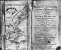 Bowditch-1st-edition.jpg 655 × 534; 126 nga KB
-
 Britain ^ France are neighbors here too ("Best of Britain" next to "French lessons"-) - panoramio.jpg 2,560 × 1,920; 1.26 nga MB
-
 Coffin House, High Street, Newburyport, Mass. - DPLA - 57c13745e95ee8203679dd6a1303b38b.jpg 1,041 × 800; 401 nga KB
-
 Coffin House, High Street, Newburyport, Mass. - DPLA - 5f2fc75a03270e231bc45a1c538cd925.jpg 1,039 × 800; 419 nga KB
-
 Coffin House, High Street, Newburyport, Mass. - DPLA - 7bd5bb470d3d2e8c5921882819aab56c.jpg 1,037 × 800; 368 nga KB
-
 Demolition of the former Pine Hill Road Ferry Road Bridge over I-95 (20689553668).jpg 1,306 × 980; 606 nga KB
-
 Historical Society of Old Newbury emblem.png 292 × 288; 84 nga KB
-
 History of Newburyport, Mass., 1764-1905; (IA historyofnewbury03curr).pdf 854 × 1,320, 688 mga pakli; 38.47 nga MB
-
 Little Free Library, Clipper City Rail Trail, Newburyport MA.jpg 4,032 × 3,024; 6.9 nga MB
-
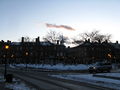 Market Square at dusk, Newburyport MA.jpg 2,048 × 1,536; 719 nga KB
-
 Market Square, December, Newburyport MA.jpg 2,025 × 1,350; 495 nga KB
-
 Market Square, Newburyport, September 2021.jpg 4,032 × 3,024; 3.64 nga MB
-
 Martin Johnson Heade - Sunset, Newburyport Meadows.jpg 600 × 315; 272 nga KB
-
 Mouth Merrimack River.jpg 3,992 × 2,992; 5.26 nga MB
-
 New Pine Hill Road Ferry Road Bridge in Newburyport (19098796804).jpg 3,264 × 2,448; 1.93 nga MB
-
 Newburyport Breakfast - April 28 (7516880646).jpg 600 × 450; 38 nga KB
-
 Newburyport downtown.jpg 800 × 600; 144 nga KB
-
 Newburyport, MA, USA - panoramio (1).jpg 3,264 × 1,836; 2.93 nga MB
-
 Newburyport, MA, USA - panoramio (2).jpg 3,264 × 1,836; 1.57 nga MB
-
 Newburyport, MA, USA - panoramio.jpg 3,264 × 1,836; 1.48 nga MB
-
 No Trespassing area.jpg 4,032 × 3,024; 2.79 nga MB
-
 Old Whittier Bridge Disappears (April 2016) (26175295740).jpg 1,632 × 1,224; 616 nga KB
-
 Old Whittier Bridge Steel Removal (April 2016) (26448130915).jpg 1,632 × 1,224; 664 nga KB
-
 Paving of roadway at new Whittier Bridge south abutment (21543760424).jpg 1,632 × 1,224; 720 nga KB
-
 RE MASTER LOGO.png 300 × 232; 7 nga KB
-
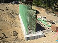 Reinforcing Steel for Stem Wall at South Abutment (September 12, 2016) (29075882214).jpg 980 × 735; 461 nga KB
-
 RMV AAA Newburyport RibbonCutting, January 20, 2015 (16139091058).jpg 1,632 × 1,224; 528 nga KB
-
 Seal of Newburyport, Massachusetts.png 224 × 224; 109 nga KB
-
 Southern Approach to Whittier Bridge (19721380485).jpg 3,264 × 2,448; 1.27 nga MB
-

-
 Sunset in Newburyport - panoramio.jpg 2,560 × 1,920; 1.28 nga MB
-
 The Old Bridge, Merrimac River, Newburyport, Leroy Milton Yale, 1887.jpg 650 × 431; 65 nga KB
-

_(LOC).jpg)


_-_panoramio.jpg)


.jpg)


.jpg)
.jpg)

.jpg)
.jpg)


_(26175295740).jpg)
_(26448130915).jpg)
.jpg)
_(29075882214).jpg)
.jpg)
.jpg)
_(28400488906).jpg)


