Category:Newcastleton
Aller à la navigation
Aller à la recherche
village britannique  | |||||
| Téléverser des médias | |||||
| Nature de l’élément | |||||
|---|---|---|---|---|---|
| Lieu |
| ||||
| Population |
| ||||
 | |||||
English: Newcastleton, or Copshaw Holm is a village in the Scottish Borders, only a few miles from the border of Scotland with England.
The village is in Liddesdale and is on the Liddel Water, and is the site of Hermitage Castle.
Sous-catégories
Cette catégorie comprend 2 sous-catégories, dont les 2 ci-dessous.
B
- Blinkbonny Height (2 F)
T
- Telford's (bus company) (2 F)
Média dans la catégorie « Newcastleton »
Cette catégorie comprend 148 fichiers, dont les 148 ci-dessous.
-
 A dismantled railway at Mangerton - geograph.org.uk - 1253571.jpg 640 × 427 ; 148 kio
-
 A drystane dyke on Kirk Hill - geograph.org.uk - 522020.jpg 640 × 480 ; 103 kio
-
 A fence on Millstone Edge - geograph.org.uk - 549773.jpg 640 × 480 ; 104 kio
-
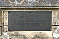 A plaque at Frank Coutts Court - geograph.org.uk - 818242.jpg 639 × 420 ; 149 kio
-
 A sheepfold by the Stanygill Burn - geograph.org.uk - 809447.jpg 640 × 427 ; 121 kio
-
 A tree by the track from Blackburn - geograph.org.uk - 880624.jpg 637 × 395 ; 126 kio
-
 A view from the ruined building at Greenburn - geograph.org.uk - 818274.jpg 427 × 640 ; 134 kio
-
 Beware of the bull... - geograph.org.uk - 209918.jpg 640 × 480 ; 99 kio
-
 Boundary fence - geograph.org.uk - 522006.jpg 640 × 480 ; 113 kio
-
 Callonherd.jpg 225 × 225 ; 10 kio
-
 Castleton Cross - geograph.org.uk - 795843.jpg 640 × 427 ; 128 kio
-
 Cattle near Sorbietrees, Newcastleton - geograph.org.uk - 208999.jpg 640 × 480 ; 88 kio
-
 Disguised petrol pumps at Newcastleton - geograph.org.uk - 886957.jpg 640 × 427 ; 145 kio
-
 Douglas Square, Newcastleton - geograph.org.uk - 818254.jpg 640 × 427 ; 135 kio
-
 Ettleton.jpg 2 592 × 1 944 ; 2,06 Mio
-
 Farm cottage - geograph.org.uk - 320845.jpg 640 × 516 ; 73 kio
-
 Fence across Kershope Burn - geograph.org.uk - 209036.jpg 640 × 480 ; 104 kio
-
 Forest road near Scotch Kershope - geograph.org.uk - 209050.jpg 640 × 480 ; 131 kio
-
 Forest track Signs - geograph.org.uk - 330145.jpg 640 × 480 ; 124 kio
-
 Frank Coutts Court - geograph.org.uk - 818233.jpg 640 × 427 ; 128 kio
-
 Inscribed stone on a sheepfold - geograph.org.uk - 880653.jpg 640 × 427 ; 159 kio
-
 Kershope Burn - geograph.org.uk - 209043.jpg 640 × 480 ; 104 kio
-
 Leysburnfoot (geograph 1896642) (cropped).jpg 2 494 × 1 659 ; 982 kio
-
 Leysburnfoot (geograph 1896642).jpg 3 888 × 2 592 ; 2,51 Mio
-
 Liddel bridge.jpg 3 008 × 2 000 ; 2,53 Mio
-
 Liddel Water - geograph.org.uk - 1003578.jpg 640 × 480 ; 61 kio
-

-
 Millholm Cross.jpg 1 944 × 2 592 ; 1,6 Mio
-
 Newcastleton - geograph.org.uk - 909550.jpg 640 × 480 ; 73 kio
-
 Newcastleton main street. View north. Scottish Borders.jpg 4 896 × 2 752 ; 2,55 Mio
-
 Newcastleton main street. View south-west. Scottish Borders.jpg 4 896 × 2 752 ; 2,94 Mio
-
 Newcastleton Post Office - geograph.org.uk - 818263.jpg 623 × 423 ; 145 kio
-
 Newcastleton Primary School - geograph.org.uk - 818208.jpg 640 × 427 ; 143 kio
-
 Newcastleton Square.jpg 640 × 480 ; 71 kio
-
 Newcastleton Village - geograph.org.uk - 828643.jpg 640 × 480 ; 86 kio
-
 Newcastleton Village Hall - geograph.org.uk - 818213.jpg 640 × 427 ; 150 kio
-
 Newcastleton War Memorial - geograph.org.uk - 818144.jpg 427 × 640 ; 120 kio
-
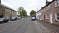
 North Hermitage Street, Newcastleton - geograph.org.uk - 818226.jpg 640 × 427 ; 121 kio
-
 Old railway arches at Raltonburn Cottage - geograph.org.uk - 209919.jpg 640 × 480 ; 115 kio
-
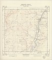
 Ordnance Survey One-Inch Sheet 85 Hawick & Eskdale, Published 1925.jpg 12 237 × 9 263 ; 14,48 Mio
-
 Ordnance Survey Sheet NY 48 (35 48) Newcastleton, Published 1950.jpg 7 680 × 8 876 ; 12,49 Mio
-
 Rough grazing near Blinkbonny - geograph.org.uk - 814520.jpg 639 × 411 ; 163 kio
-
 Sheepfold - geograph.org.uk - 764606.jpg 640 × 427 ; 94 kio
-
 The bridge over Liddel Water - geograph.org.uk - 1003558.jpg 640 × 480 ; 72 kio
-
 The Grapes Hotel sign - geograph.org.uk - 818199.jpg 422 × 609 ; 123 kio
-
 The Pant Well at Newcastleton - geograph.org.uk - 818161.jpg 427 × 640 ; 131 kio
-
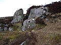
 The remains of Riccarton Tower - geograph.org.uk - 1253516.jpg 640 × 427 ; 134 kio
-
 The road to Blackburn Farm - geograph.org.uk - 522009.jpg 640 × 480 ; 111 kio
-
 The summit area of Pike Fell - geograph.org.uk - 328300.jpg 640 × 480 ; 88 kio
-
 Tweeden Burn - geograph.org.uk - 763995.jpg 640 × 427 ; 89 kio
-
 Tweeden Burn - geograph.org.uk - 764013.jpg 640 × 427 ; 91 kio
-
 Tweeden Burn - geograph.org.uk - 764030.jpg 640 × 427 ; 95 kio
-
 Tweedenhead - geograph.org.uk - 763999.jpg 640 × 412 ; 101 kio
-
 Two hotels at Newcastleton - geograph.org.uk - 818193.jpg 640 × 399 ; 135 kio
-
 Whithaugh Burn - geograph.org.uk - 764600.jpg 427 × 640 ; 100 kio
-
 A fence on Hartsgarth Fell - geograph.org.uk - 320821.jpg 640 × 480 ; 59 kio
-
 A grass track and gate - geograph.org.uk - 636316.jpg 640 × 480 ; 120 kio
-
 A lone tree on Hermitage Hill - geograph.org.uk - 379311.jpg 640 × 480 ; 107 kio
-
 A panorama of Newcastleton - geograph.org.uk - 1003598.jpg 640 × 480 ; 78 kio
-
 An old tree by the Ralton Burn - geograph.org.uk - 1141563.jpg 427 × 640 ; 127 kio
-
 An unusual place for a bird's nest - geograph.org.uk - 819395.jpg 600 × 417 ; 144 kio
-
 Approaching the summit of Din Fell - geograph.org.uk - 320792.jpg 640 × 480 ; 56 kio
-
 Arnton Fell from Priest Hill - geograph.org.uk - 12637.jpg 640 × 480 ; 72 kio
-
 B6357 - geograph.org.uk - 84622.jpg 640 × 423 ; 95 kio
-
 Base of Dawsonburn Viaduct - geograph.org.uk - 1475565.jpg 600 × 450 ; 146 kio
-
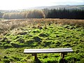 Bench on Priest Hill - geograph.org.uk - 608624.jpg 640 × 480 ; 181 kio
-
 Blackburn Farm - geograph.org.uk - 520606.jpg 640 × 480 ; 108 kio
-
 Boggy ground at Millstone Edge - geograph.org.uk - 548151.jpg 640 × 480 ; 99 kio
-
 Boulder - geograph.org.uk - 727190.jpg 640 × 480 ; 92 kio
-
 Bridge over a stream in Newcastleton Forest. - geograph.org.uk - 394513.jpg 640 × 427 ; 166 kio
-
 Byre Cleuchs - geograph.org.uk - 636306.jpg 640 × 480 ; 115 kio
-
 Castle Hill - geograph.org.uk - 763972.jpg 640 × 377 ; 82 kio
-
 Castle Hill - geograph.org.uk - 763976.jpg 640 × 427 ; 87 kio
-
 Caulker Grain - geograph.org.uk - 320831.jpg 640 × 480 ; 80 kio
-
 Clear Fell on Blaemount Rig - geograph.org.uk - 608660.jpg 640 × 480 ; 219 kio
-
 Cockplay Hill - geograph.org.uk - 320834.jpg 640 × 480 ; 50 kio
-
 Disused garage in Newcastleton - geograph.org.uk - 595705.jpg 640 × 455 ; 108 kio
-

-
-
 Dykecrofts - geograph.org.uk - 763969.jpg 640 × 427 ; 150 kio
-
 Dykecrofts Cottage - geograph.org.uk - 764589.jpg 640 × 329 ; 66 kio
-
 Fence on Unthank Pikes - geograph.org.uk - 328301.jpg 640 × 480 ; 81 kio
-
 Field Near Tweeden Burn - geograph.org.uk - 608612.jpg 640 × 480 ; 184 kio
-
 Footpath Around Priest Hill - geograph.org.uk - 608621.jpg 640 × 480 ; 171 kio
-
 Ford Across Whithaugh Burn - geograph.org.uk - 608630.jpg 640 × 480 ; 220 kio
-
 Forest Walk - geograph.org.uk - 84237.jpg 640 × 426 ; 126 kio
-
 Frog - geograph.org.uk - 728150.jpg 640 × 497 ; 131 kio
-
 Gall Sike - geograph.org.uk - 764595.jpg 640 × 427 ; 104 kio
-

-
 Grain Head - geograph.org.uk - 320826.jpg 626 × 476 ; 71 kio
-
 Grasses on Din Fell - geograph.org.uk - 320807.jpg 640 × 480 ; 62 kio
-
 Grouse moorland at Blackgate Rig - geograph.org.uk - 548165.jpg 640 × 480 ; 117 kio
-
 Hawknest Sike from Arkleton Hill - geograph.org.uk - 328303.jpg 640 × 480 ; 100 kio
-
 Heather moorland at Black Edge - geograph.org.uk - 548131.jpg 640 × 480 ; 109 kio
-
 Hermitage Hill - geograph.org.uk - 378720.jpg 640 × 480 ; 125 kio
-
 Hermitage Hill - geograph.org.uk - 379330.jpg 640 × 480 ; 114 kio
-
 High moorland - geograph.org.uk - 549513.jpg 478 × 589 ; 108 kio
-
 Hillend, above Kershopefoot - geograph.org.uk - 208995.jpg 640 × 480 ; 97 kio
-
 Junction of forest tracks - geograph.org.uk - 209040.jpg 640 × 480 ; 81 kio
-
 Kershope Bridge - geograph.org.uk - 209007.jpg 480 × 640 ; 113 kio
-
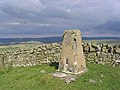 Kirk Hill triangulation pillar - geograph.org.uk - 521973.jpg 640 × 480 ; 116 kio
-
 Large Conifers Beside Tweeden Burn - geograph.org.uk - 611610.jpg 640 × 480 ; 215 kio
-
 Lidalia Caravan Site - Newcastleton - geograph.org.uk - 128280.jpg 640 × 480 ; 88 kio
-
 Linns View, Harelaw - geograph.org.uk - 334094.jpg 640 × 480 ; 96 kio
-
 Loch Knowe - geograph.org.uk - 548162.jpg 480 × 640 ; 121 kio
-
 Looking down the northeast ridge of Din Fell - geograph.org.uk - 320803.jpg 640 × 480 ; 51 kio
-
 Looking towards Tinnis Hill - geograph.org.uk - 413399.jpg 640 × 423 ; 39 kio
-
 Moorland bridge - geograph.org.uk - 520611.jpg 637 × 460 ; 107 kio
-
 Moorland road - geograph.org.uk - 520615.jpg 640 × 480 ; 115 kio
-
 Newcastleton Forest - geograph.org.uk - 608652.jpg 640 × 480 ; 209 kio
-
 Newcastleton Forest on Blaemount Rig - geograph.org.uk - 608663.jpg 640 × 480 ; 175 kio
-
 Newcastleton Health Centre - geograph.org.uk - 595709.jpg 635 × 474 ; 114 kio
-
 Newcastleton Health Centre entrance - geograph.org.uk - 595716.jpg 480 × 640 ; 114 kio
-
 Newcastleton Traditional Music Festival 2005 - geograph.org.uk - 635068.jpg 640 × 480 ; 107 kio
-
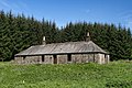
 Old Braidlie - geograph.org.uk - 320851.jpg 640 × 480 ; 86 kio
-
 Old sheepfold - geograph.org.uk - 634739.jpg 640 × 480 ; 111 kio
-
 Old Wall and Meadow Near Tweeden Burn - geograph.org.uk - 608645.jpg 640 × 480 ; 239 kio
-
 Priest Hill - geograph.org.uk - 374854.jpg 640 × 480 ; 58 kio
-
 Road barrier near Scotch Kershope - geograph.org.uk - 209049.jpg 640 × 480 ; 119 kio
-
 Roan Fell Flow - geograph.org.uk - 548154.jpg 640 × 480 ; 102 kio
-
 Rough grazing - geograph.org.uk - 522014.jpg 640 × 480 ; 109 kio
-
 Rough grazing at Stanygill Rig - geograph.org.uk - 520614.jpg 640 × 480 ; 98 kio
-
 Rough grazing north of Bedda Hill - geograph.org.uk - 520607.jpg 640 × 480 ; 108 kio
-
 Rough grazing on Bedda Hill - geograph.org.uk - 520608.jpg 640 × 480 ; 109 kio
-
 Rough grazing on Cooms Fell - geograph.org.uk - 548169.jpg 637 × 454 ; 106 kio
-
 Rough grazing on Hermitage Hill - geograph.org.uk - 379369.jpg 640 × 480 ; 112 kio
-
 Rough grazing on Watch Hill - geograph.org.uk - 548143.jpg 640 × 480 ; 103 kio
-
 Rough grazing on Yethouse Hill - geograph.org.uk - 549516.jpg 640 × 480 ; 123 kio
-
 Scrubland by the B6357 - geograph.org.uk - 520860.jpg 640 × 480 ; 122 kio
-
 Sorbietrees, near Newcastleton - geograph.org.uk - 208996.jpg 640 × 480 ; 87 kio
-
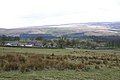
 Southern approach to Newcastleton - geograph.org.uk - 208994.jpg 640 × 480 ; 88 kio
-
 Stables near Newcastleton - geograph.org.uk - 208997.jpg 640 × 480 ; 117 kio
-
 Sunlit Conifers on Hillside Above Tweeden Burn - geograph.org.uk - 608649.jpg 480 × 640 ; 197 kio
-
 The 9th green at Newcastleton Golf Course - geograph.org.uk - 520603.jpg 640 × 480 ; 105 kio
-
 The flush bracket on Din Fell trig point - geograph.org.uk - 320801.jpg 480 × 640 ; 130 kio
-
 The grip of winter - geograph.org.uk - 320901.jpg 640 × 480 ; 87 kio
-
 The River Liddel from the bridge at Newcastleton - geograph.org.uk - 209001.jpg 640 × 480 ; 105 kio
-
 The road to Yethouse - geograph.org.uk - 548173.jpg 640 × 480 ; 110 kio
-
 The summit of Wetherhorn Hill - geograph.org.uk - 320828.jpg 640 × 480 ; 57 kio
-
 The Tarras Water - geograph.org.uk - 636309.jpg 480 × 640 ; 134 kio
-
 The trig point at Millstone Edge - geograph.org.uk - 548148.jpg 640 × 480 ; 99 kio
-
 The trig point on Cooms Fell - geograph.org.uk - 552854.jpg 640 × 480 ; 102 kio
-
 Tinnis - geograph.org.uk - 280439.jpg 640 × 480 ; 133 kio
-
 Tinnis from Whita - geograph.org.uk - 281451.jpg 640 × 480 ; 46 kio
-
 Twislehope Farm - geograph.org.uk - 320843.jpg 640 × 480 ; 75 kio
-
 View south from Tinnis - geograph.org.uk - 280438.jpg 640 × 480 ; 69 kio
-
 Which Way^^ - geograph.org.uk - 394806.jpg 640 × 427 ; 88 kio
-
 Winter Landscape - geograph.org.uk - 320808.jpg 640 × 480 ; 58 kio


_(cropped).jpg)
.jpg)


_Newcastleton,_Published_1950.jpg)


