Category:Newry and Mourne District Council
Vai alla navigazione
Vai alla ricerca
administrative territorial entity of the United Kingdom  | |||||
| Carica un file multimediale | |||||
| Istanza di |
| ||||
|---|---|---|---|---|---|
| Luogo |
| ||||
| Capitale | |||||
| Superficie |
| ||||
| Religione | |||||
| sito web ufficiale | |||||
 | |||||
Sottocategorie
Questa categoria contiene le 6 sottocategorie indicate di seguito, su un totale di 6.
File nella categoria "Newry and Mourne District Council"
Questa categoria contiene 181 file, indicati di seguito, su un totale di 181.
-

-
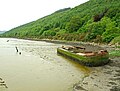
 Annalong Harbour, May 2010 (06).JPG 4 272 × 2 848; 4,56 MB
-
 Bus stop, Jerrettspass - geograph.org.uk - 1395010.jpg 640 × 374; 60 KB
-
 Canal bridge near Newry - geograph.org.uk - 1055265.jpg 640 × 360; 93 KB
-
 Canal bridge, Jerrettspass (2) - geograph.org.uk - 1114665.jpg 640 × 357; 80 KB
-
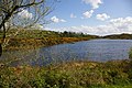 Cashel Lough Lower - geograph.org.uk - 1282583.jpg 640 × 426; 118 KB
-
 Cattle grid near Newry - geograph.org.uk - 1393905.jpg 640 × 439; 100 KB
-
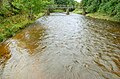
 Clanrye at Cullion Bridge - geograph.org.uk - 1245618.jpg 426 × 640; 123 KB
-
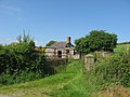 Cottage at Slievenabolea, Co. Armagh - geograph.org.uk - 802735.jpg 640 × 480; 92 KB
-
 Croan Bridge - geograph.org.uk - 1245583.jpg 640 × 426; 119 KB
-
 Disused cottage, Rostrevor forest - geograph.org.uk - 952805.jpg 608 × 350; 85 KB
-
 Disused Mourne quarry railway (1of4) - geograph.org.uk - 1108737.jpg 444 × 640; 129 KB
-
 Disused Mourne quarry railway (2of4) - geograph.org.uk - 1108769.jpg 434 × 640; 115 KB
-
 Disused Mourne quarry railway (3of4) - geograph.org.uk - 1108799.jpg 640 × 433; 148 KB
-
 Disused Mourne quarry railway (4of4) - geograph.org.uk - 1108823.jpg 608 × 375; 97 KB
-
 Drumlins north of the B8 - geograph.org.uk - 1587241.jpg 640 × 362; 30 KB
-
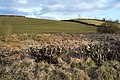
 Drystone wall - geograph.org.uk - 1095486.jpg 640 × 426; 109 KB
-
 Drystone wall near Attical - geograph.org.uk - 941574.jpg 640 × 365; 76 KB
-
 Drystone wall near Hilltown (2) - geograph.org.uk - 801669.jpg 640 × 390; 89 KB
-
 Drystone wall near Spelga - geograph.org.uk - 1141741.jpg 640 × 396; 94 KB
-
 Drystone wall, Greencastle, Co Down - geograph.org.uk - 941435.jpg 640 × 397; 93 KB
-
 Drystone walls near Attical - geograph.org.uk - 1104719.jpg 640 × 358; 100 KB
-
 Drystone walls near Hilltown - geograph.org.uk - 801692.jpg 640 × 388; 99 KB
-
 Early whins near Newry - geograph.org.uk - 1183362.jpg 617 × 343; 84 KB
-
 Entering the village of Mullaghbane - geograph.org.uk - 1564144.jpg 640 × 480; 90 KB
-

-
 Farmland East of Shinn Road - geograph.org.uk - 1752817.jpg 640 × 428; 104 KB
-
 Farmland overlooking Shinn Road - geograph.org.uk - 1707350.jpg 640 × 427; 59 KB
-
 Farmland south of the Newry Road - geograph.org.uk - 1750144.jpg 1 024 × 768; 97 KB
-
 Farmland with lone thorn tree - geograph.org.uk - 1752798.jpg 640 × 428; 85 KB
-

-
 Flooded farmland and Farm Lane - geograph.org.uk - 1752037.jpg 640 × 429; 67 KB
-
 Flooded ford near Hilltown - geograph.org.uk - 952628.jpg 640 × 424; 93 KB
-
 Flowering sycamore near Newry - geograph.org.uk - 1303735.jpg 640 × 405; 102 KB
-
 Footbridge near Newry - geograph.org.uk - 1114502.jpg 596 × 373; 96 KB
-
 Footbridge, Rostrevor forest (2) - geograph.org.uk - 952858.jpg 640 × 413; 104 KB
-
 Footbridge, Rostrevor forest - geograph.org.uk - 801566.jpg 640 × 408; 105 KB
-
 Forest path near Attical (2) - geograph.org.uk - 941606.jpg 640 × 383; 88 KB
-

-

-

-
 Forsythe's Lock, Newry canal - geograph.org.uk - 1055190.jpg 640 × 386; 118 KB
-
 Fungus, Rostrevor forest - geograph.org.uk - 952842.jpg 640 × 412; 101 KB
-
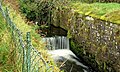
 Goraghwood lock, Newry Canal (1) - geograph.org.uk - 1394643.jpg 640 × 400; 130 KB
-
 Goraghwood lock, Newry Canal (2) - geograph.org.uk - 1394810.jpg 637 × 420; 127 KB
-
 Hen Mountain near Hilltown (2) - geograph.org.uk - 1104189.jpg 640 × 380; 83 KB
-
 Hen Mountain near Hilltown - geograph.org.uk - 801726.jpg 640 × 383; 66 KB
-
 HGVs on the Dublin Road at Cloghoge - geograph.org.uk - 1753781.jpg 1 024 × 532; 56 KB
-

-

-
 Knockshee near Rostrevor - geograph.org.uk - 972514.jpg 640 × 376; 65 KB
-
 Lislea Chapel - geograph.org.uk - 1564217.jpg 640 × 480; 43 KB
-
 Looking across the Kilbroney Valley - geograph.org.uk - 755178.jpg 640 × 480; 72 KB
-

-

-

-

-
 Magee Terrace, Tullyogallaghan - geograph.org.uk - 1542636.jpg 640 × 480; 81 KB
-
 Main Street, Hilltown - geograph.org.uk - 1438609.jpg 640 × 374; 67 KB
-
 Modern House, Clady Road, Markethill - geograph.org.uk - 729579.jpg 640 × 480; 50 KB
-

-
 Mountain Road near Drumilly - geograph.org.uk - 1527634.jpg 640 × 480; 76 KB
-
 Mullaghbane Chapel - geograph.org.uk - 1564195.jpg 640 × 480; 47 KB
-
 Narrow Water Bluebells - geograph.org.uk - 1420536.jpg 640 × 480; 166 KB
-
 Narrowwater Castle in the fog - geograph.org.uk - 1096124.jpg 640 × 426; 40 KB
-
 Near the 'Blue Lough' - geograph.org.uk - 643399.jpg 640 × 480; 62 KB
-
 Near to Kilfeaghan Lane - geograph.org.uk - 1396354.jpg 640 × 480; 93 KB
-
 Newtown Road at Tullyogallaghan - geograph.org.uk - 1542648.jpg 640 × 480; 83 KB
-
-
 Old farm on Leitrim Road - geograph.org.uk - 755524.jpg 640 × 480; 62 KB
-
 Old fort at Cavan Road - geograph.org.uk - 1420509.jpg 640 × 480; 166 KB
-
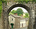
 Old Viaduct, Knockduff near Jerrettspass - geograph.org.uk - 778713.jpg 640 × 480; 102 KB
-

-
 Pastureland below Slievebolea - geograph.org.uk - 1568359.jpg 640 × 383; 42 KB
-

-

-
 Path, Rostrevor forest (1) - geograph.org.uk - 952748.jpg 640 × 386; 126 KB
-
 Path, Rostrevor forest (2) - geograph.org.uk - 952781.jpg 640 × 380; 109 KB
-
 Pigeon Rock in the Mournes (1) - geograph.org.uk - 1141615.jpg 631 × 403; 81 KB
-
 Pigeon Rock in the Mournes (2) - geograph.org.uk - 1141651.jpg 621 × 371; 101 KB
-
 Pylon near Newry - geograph.org.uk - 1183322.jpg 640 × 533; 51 KB
-
 Railway bridge, Jerrettspass (2) - geograph.org.uk - 1394876.jpg 615 × 418; 97 KB
-
 Railway bridge, Jerrettspass - geograph.org.uk - 1353223.jpg 627 × 501; 128 KB
-

-
 Red Moss River - geograph.org.uk - 1124637.jpg 427 × 640; 87 KB
-
 Road signs near Newry - geograph.org.uk - 1183525.jpg 631 × 371; 105 KB
-
 Rocky Mountain near Hilltown - geograph.org.uk - 801760.jpg 635 × 364; 107 KB
-

-

-
 Ruined cottage with blackthorn blossom - geograph.org.uk - 1255174.jpg 640 × 426; 116 KB
-
 Seat near Goraghwood - geograph.org.uk - 1182718.jpg 640 × 390; 103 KB
-
 Shepherds Way, Newry - geograph.org.uk - 1055376.jpg 601 × 360; 78 KB
-
 Sign, towpath, Jerrettspass - geograph.org.uk - 1395175.jpg 640 × 417; 71 KB
-
 Slieve Meelmore and Slieve Meelbeg - geograph.org.uk - 942682.jpg 640 × 377; 59 KB
-
 Slieve Muck - geograph.org.uk - 1104466.jpg 640 × 371; 121 KB
-
 Small Lake surrounded by farmland - geograph.org.uk - 1752021.jpg 640 × 427; 89 KB
-
 Spring colours near Rostrevor - geograph.org.uk - 801359.jpg 633 × 442; 119 KB
-
 St John's church, Hilltown (1) - geograph.org.uk - 1438714.jpg 640 × 366; 50 KB
-
 St John's church, Hilltown (2) - geograph.org.uk - 1438757.jpg 640 × 428; 109 KB
-

-
 Sunset looking towards Newry - geograph.org.uk - 1652750.jpg 640 × 427; 50 KB
-
 Telephone box, Jerrettspass - geograph.org.uk - 1394974.jpg 640 × 405; 83 KB
-
 The Brandy Pad near Newcastle (1) - geograph.org.uk - 1136219.jpg 640 × 363; 91 KB
-
 The Brandy Pad near Newcastle (2) - geograph.org.uk - 1136243.jpg 640 × 348; 101 KB
-
 The Carnbane Road near Newry (1) - geograph.org.uk - 1303691.jpg 640 × 374; 51 KB
-

-
 The Kilfeaghan car park and amenity area - geograph.org.uk - 1396337.jpg 640 × 480; 122 KB
-
 The Kilfeaghan car park and amenity area - geograph.org.uk - 1396343.jpg 640 × 480; 114 KB
-
 The Kilfeaghan car park and amenity area - geograph.org.uk - 1396345.jpg 640 × 480; 120 KB
-
 The Kilfeaghan Road near Kilkeel (2) - geograph.org.uk - 842242.jpg 640 × 400; 91 KB
-
 The Kilfeaghan Road near Kilkeel (3) - geograph.org.uk - 842301.jpg 640 × 407; 90 KB
-
 The Kilfeaghan Road near Kilkeel (4) - geograph.org.uk - 842331.jpg 640 × 396; 119 KB
-
 The Kilkeel Road near Spelga - geograph.org.uk - 1104337.jpg 640 × 378; 69 KB
-

-
 The Mount Mill near Newry - geograph.org.uk - 899033.jpg 640 × 392; 71 KB
-
 The Mountain House public house - geograph.org.uk - 1563985.jpg 640 × 480; 76 KB
-
 The mouth of the Sheepstown Road - geograph.org.uk - 1587134.jpg 640 × 385; 37 KB
-
 The new Newry bypass (51) - geograph.org.uk - 1303647.jpg 640 × 363; 74 KB
-
 The new Newry bypass (52) - geograph.org.uk - 1303668.jpg 640 × 398; 76 KB
-
 The new Newry bypass (54) - geograph.org.uk - 1352955.jpg 640 × 360; 75 KB
-
 The new Newry bypass (55) - geograph.org.uk - 1352991.jpg 640 × 375; 65 KB
-
 The new Newry bypass (56) - geograph.org.uk - 1353052.jpg 640 × 363; 75 KB
-
 The new Newry bypass (57) - geograph.org.uk - 1353092.jpg 640 × 350; 59 KB
-
 The new Newry bypass (58) - geograph.org.uk - 1353138.jpg 640 × 359; 88 KB
-
 The new Newry bypass (60) - geograph.org.uk - 1353732.jpg 640 × 384; 73 KB
-
 The new Newry bypass (61) - geograph.org.uk - 1353758.jpg 640 × 348; 64 KB
-
 The new Newry bypass (62) - geograph.org.uk - 1353775.jpg 640 × 354; 66 KB
-
 The new Newry bypass (63) - geograph.org.uk - 1353788.jpg 640 × 358; 62 KB
-
 The new Newry bypass (64) - geograph.org.uk - 1353793.jpg 640 × 365; 76 KB
-
 The new Newry bypass (65) - geograph.org.uk - 1353819.jpg 640 × 348; 67 KB
-
 The new Newry bypass (66) - geograph.org.uk - 1353928.jpg 640 × 410; 94 KB
-
 The new Newry bypass (67) - geograph.org.uk - 1353945.jpg 640 × 434; 94 KB
-
 The new Newry bypass (68) - geograph.org.uk - 1395276.jpg 640 × 429; 91 KB
-
 The new Newry bypass (69) - geograph.org.uk - 1395390.jpg 640 × 386; 71 KB
-
 The new Newry bypass (70) - geograph.org.uk - 1420962.jpg 640 × 383; 55 KB
-
 The new Newry bypass (71) - geograph.org.uk - 1420992.jpg 640 × 415; 91 KB
-
 The new Newry bypass (72) - geograph.org.uk - 1421192.jpg 640 × 384; 92 KB
-
 The new Newry bypass (73) - geograph.org.uk - 1474420.jpg 640 × 392; 83 KB
-
 The new Newry bypass (74) - geograph.org.uk - 1474612.jpg 640 × 429; 94 KB
-
 The new Newry bypass (75) - geograph.org.uk - 1474644.jpg 640 × 380; 86 KB
-
 The new Newry bypass (78) - geograph.org.uk - 1474791.jpg 640 × 359; 78 KB
-
 The new Newry bypass (79) - geograph.org.uk - 1474817.jpg 640 × 341; 76 KB
-
 The new Newry bypass (80) - geograph.org.uk - 1474848.jpg 640 × 460; 94 KB
-
 The new Newry bypass (81) - geograph.org.uk - 1475644.jpg 640 × 378; 81 KB
-
 The new Newry bypass (82) - geograph.org.uk - 1475672.jpg 565 × 561; 114 KB
-
 The new Newry bypass (83) - geograph.org.uk - 1475768.jpg 640 × 405; 81 KB
-
 The new Newry bypass (84) - geograph.org.uk - 1475827.jpg 640 × 386; 72 KB
-
 The new Newry bypass (85) - geograph.org.uk - 1475872.jpg 640 × 397; 80 KB
-
 The new Newry bypass (86) - geograph.org.uk - 1475900.jpg 640 × 387; 83 KB
-
 The new Newry bypass (87) - geograph.org.uk - 1551353.jpg 640 × 405; 81 KB
-
 The new Newry bypass (90) - geograph.org.uk - 1551452.jpg 640 × 334; 72 KB
-
 The new Newry bypass (92) - geograph.org.uk - 1551554.jpg 640 × 371; 77 KB
-
 The Newry River at the Victoria Lock - geograph.org.uk - 833614.jpg 640 × 463; 71 KB
-

-
 The Newtown Road near Rostrevor (2) - geograph.org.uk - 801610.jpg 640 × 396; 90 KB
-
 The Newtown Road near Rostrevor - geograph.org.uk - 801363.jpg 640 × 396; 121 KB
-
 The Slivenaman Road near Hilltown - geograph.org.uk - 941637.jpg 640 × 374; 40 KB
-
 The Tanderagee Road near Newry (2) - geograph.org.uk - 1183498.jpg 640 × 371; 77 KB
-
 The Tanderagee Road near Newry - geograph.org.uk - 718190.jpg 640 × 374; 61 KB
-
 The Tanderagee Road, Jerrettspass - geograph.org.uk - 1394939.jpg 640 × 350; 62 KB
-
 The Victoria Lock near Newry (1) - geograph.org.uk - 833599.jpg 640 × 429; 86 KB
-
 The Victoria Lock near Newry (2) - geograph.org.uk - 833606.jpg 640 × 460; 86 KB
-

-
 The Watergap River near Kilkeel - geograph.org.uk - 842353.jpg 640 × 429; 115 KB
-
 The White Water near Spelga (1) - geograph.org.uk - 1141545.jpg 640 × 424; 92 KB
-
 The White Water near Spelga (2) - geograph.org.uk - 1141569.jpg 640 × 424; 102 KB
-
 The Yellow Water bridge near Attical - geograph.org.uk - 1104693.jpg 640 × 381; 99 KB
-
 The Yellow Water near Rostrevor - geograph.org.uk - 801526.jpg 581 × 389; 96 KB
-
 The Yellow Water River near Rostrevor - geograph.org.uk - 527370.jpg 640 × 426; 98 KB
-
 Towpath gate, Jerrettspass - geograph.org.uk - 1395133.jpg 638 × 443; 111 KB
-
 Towpath markings near Goraghwood - geograph.org.uk - 1183154.jpg 640 × 371; 112 KB
-
 Towpath near Newry - geograph.org.uk - 1055237.jpg 613 × 345; 104 KB
-
 Transport depot at Newtown Bridge - geograph.org.uk - 494114.jpg 640 × 480; 89 KB
-
 Trees on Milltown Hill - geograph.org.uk - 1255304.jpg 426 × 640; 123 KB
-
 Tyrones Ditches - geograph.org.uk - 778926.jpg 640 × 480; 74 KB
-
 Up Down ^ - geograph.org.uk - 1007315.jpg 640 × 480; 61 KB
-
 Village Centre - Newtownhamilton - geograph.org.uk - 547838.jpg 640 × 480; 115 KB
-
 Waterwheel, Annalong - geograph.org.uk - 583264.jpg 640 × 427; 116 KB
-
 Waymark signs, Jerrettspass - geograph.org.uk - 1395064.jpg 640 × 395; 104 KB
-
 Wedding cars south of Newtownhamilton - geograph.org.uk - 547851.jpg 640 × 480; 123 KB
-
 Whitewater Brewing Company - geograph.org.uk - 1095517.jpg 640 × 426; 58 KB

.JPG)


_-_geograph.org.uk_-_1114665.jpg)


_-_geograph.org.uk_-_1108737.jpg)
_-_geograph.org.uk_-_1108769.jpg)
_-_geograph.org.uk_-_1108799.jpg)
_-_geograph.org.uk_-_1108823.jpg)


_-_geograph.org.uk_-_801669.jpg)


_-_geograph.org.uk_-_952858.jpg)

_-_geograph.org.uk_-_941606.jpg)

_-_geograph.org.uk_-_1354024.jpg)


_-_geograph.org.uk_-_1394643.jpg)
_-_geograph.org.uk_-_1394810.jpg)
_-_geograph.org.uk_-_1104189.jpg)


_-_geograph.org.uk_-_1587229.jpg)

_-_geograph.org.uk_-_952748.jpg)
_-_geograph.org.uk_-_952781.jpg)
_-_geograph.org.uk_-_1141615.jpg)
_-_geograph.org.uk_-_1141651.jpg)

_-_geograph.org.uk_-_1394876.jpg)


_-_geograph.org.uk_-_1438714.jpg)
_-_geograph.org.uk_-_1438757.jpg)


_-_geograph.org.uk_-_1136219.jpg)
_-_geograph.org.uk_-_1136243.jpg)
_-_geograph.org.uk_-_1303691.jpg)


_-_geograph.org.uk_-_842242.jpg)
_-_geograph.org.uk_-_842301.jpg)
_-_geograph.org.uk_-_842331.jpg)


_-_geograph.org.uk_-_1303647.jpg)
_-_geograph.org.uk_-_1303668.jpg)
_-_geograph.org.uk_-_1352955.jpg)
_-_geograph.org.uk_-_1352991.jpg)
_-_geograph.org.uk_-_1353052.jpg)
_-_geograph.org.uk_-_1353092.jpg)
_-_geograph.org.uk_-_1353138.jpg)
_-_geograph.org.uk_-_1353732.jpg)
_-_geograph.org.uk_-_1353758.jpg)
_-_geograph.org.uk_-_1353775.jpg)
_-_geograph.org.uk_-_1353788.jpg)
_-_geograph.org.uk_-_1353793.jpg)
_-_geograph.org.uk_-_1353819.jpg)
_-_geograph.org.uk_-_1353928.jpg)
_-_geograph.org.uk_-_1353945.jpg)
_-_geograph.org.uk_-_1395276.jpg)
_-_geograph.org.uk_-_1395390.jpg)
_-_geograph.org.uk_-_1420962.jpg)
_-_geograph.org.uk_-_1420992.jpg)
_-_geograph.org.uk_-_1421192.jpg)
_-_geograph.org.uk_-_1474420.jpg)
_-_geograph.org.uk_-_1474612.jpg)
_-_geograph.org.uk_-_1474644.jpg)
_-_geograph.org.uk_-_1474791.jpg)
_-_geograph.org.uk_-_1474817.jpg)
_-_geograph.org.uk_-_1474848.jpg)
_-_geograph.org.uk_-_1475644.jpg)
_-_geograph.org.uk_-_1475672.jpg)
_-_geograph.org.uk_-_1475768.jpg)
_-_geograph.org.uk_-_1475827.jpg)
_-_geograph.org.uk_-_1475872.jpg)
_-_geograph.org.uk_-_1475900.jpg)
_-_geograph.org.uk_-_1551353.jpg)
_-_geograph.org.uk_-_1551452.jpg)
_-_geograph.org.uk_-_1551554.jpg)


_-_geograph.org.uk_-_801610.jpg)


_-_geograph.org.uk_-_1183498.jpg)


_-_geograph.org.uk_-_833599.jpg)
_-_geograph.org.uk_-_833606.jpg)


_-_geograph.org.uk_-_1141545.jpg)
_-_geograph.org.uk_-_1141569.jpg)


