Category:Newtown Linford
Aller à la navigation
Aller à la recherche
Cymraeg: Pentref a chymuned yn Lloegr ydy Newtown Linford.
Deutsch: Newtown Linford ist ein Straßendorf in Leicestershire. Es liegt innerhalb des National Forest und verfügt über Bradgate Park, in dem die Ruine des Geburtshauses von Lady Jane Grey steht.
Polski: Newtown Linford – wieś w Anglii, w hrabstwie Leicestershire, w dystrykcie Charnwood. Leży 9 km na północny zachód od miasta Leicester i 151 km na północny zachód od Londynu.
اردو: نیو ٹاؤن لنفورڈ ( انگریزی: Newtown Linford) برطانیہ کا ایک گاؤں و civil parish جو مشرقی مڈلینڈز میں واقع ہے۔

localité britannique du comté anglais de Leicestershire  | |||||
| Téléverser des médias | |||||
| Nature de l’élément | |||||
|---|---|---|---|---|---|
| Lieu | Charnwood, Leicestershire, Midlands de l'Est, Angleterre | ||||
 | |||||
Sous-catégories
Cette catégorie comprend 3 sous-catégories, dont les 3 ci-dessous.
Média dans la catégorie « Newtown Linford »
Cette catégorie comprend 426 fichiers, dont les 200 ci-dessous.
(page précédente) (page suivante)-
 43 Main Street, Newtown Linford (geograph 7450637).jpg 1 024 × 768 ; 259 kio
-
 A buck in Bradgate Park near Newtown Linford - geograph.org.uk - 565175.jpg 640 × 480 ; 145 kio
-
 A busy day at Bradgate Country Park - geograph.org.uk - 4007094.jpg 1 600 × 1 118 ; 498 kio
-
 A row of trees on Lingdale Golf Course - geograph.org.uk - 6255259.jpg 640 × 480 ; 161 kio
-
 A stream is culverted beneath a bridleway in Swithland Wood - geograph.org.uk - 5093833.jpg 2 000 × 1 500 ; 511 kio
-

-
 Amongst the oak trees - geograph.org.uk - 5987417.jpg 640 × 427 ; 284 kio
-
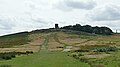 Approaching Old John Tower - geograph.org.uk - 6255264.jpg 640 × 360 ; 51 kio
-
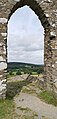 Arch by Old John Tower, Bradgate Park - geograph.org.uk - 6255074.jpg 1 744 × 3 648 ; 2,88 Mio
-
 Ascending towards the war memorial - geograph.org.uk - 5591365.jpg 800 × 516 ; 114 kio
-
 Ascending Warren Hill - geograph.org.uk - 3038164.jpg 3 264 × 2 190 ; 2,59 Mio
-
 Bencliffe xroads.jpg 2 448 × 3 264 ; 1,64 Mio
-
 Benscliffe Hay Cottage and woodland - geograph.org.uk - 4004975.jpg 1 600 × 1 600 ; 653 kio
-
 Benscliffe Road and Benscliffe Wood - geograph.org.uk - 5143069.jpg 2 000 × 1 500 ; 732 kio
-
 Benscliffe Wood - geograph.org.uk - 3037125.jpg 640 × 480 ; 119 kio
-
 Boat on the Cropston Reservoir - geograph.org.uk - 3303303.jpg 3 680 × 2 586 ; 3 Mio
-
 Boathouse on Cropston Reservoir with Bradgate Country Park beyond - geograph.org.uk - 5236777.jpg 5 184 × 2 920 ; 5,99 Mio
-
 Boggy ground near the stream - geograph.org.uk - 6124116.jpg 2 000 × 1 333 ; 3,11 Mio
-
 Bowling Green Wood in Bradgate Park - geograph.org.uk - 4008562.jpg 1 600 × 1 093 ; 645 kio
-
 Bowling Green Wood in Bradgate Park - geograph.org.uk - 4008570.jpg 1 600 × 1 207 ; 780 kio
-
 Bracken at the Bradgate Country Park - geograph.org.uk - 5591289.jpg 800 × 541 ; 119 kio
-
 Bradgate Country Park - geograph.org.uk - 5591476.jpg 800 × 553 ; 179 kio
-
 Bradgate Country Park viewed from Beacon Hill - geograph.org.uk - 4055492.jpg 1 600 × 1 213 ; 285 kio
-
 Bradgate Deer Park - geograph.org.uk - 2154291.jpg 800 × 531 ; 103 kio
-
 Bradgate Hall - geograph.org.uk - 2154195.jpg 800 × 531 ; 107 kio
-
 Bradgate Hall - geograph.org.uk - 2154205.jpg 800 × 531 ; 122 kio
-
 Bradgate Hall - geograph.org.uk - 2154225.jpg 800 × 531 ; 104 kio
-
 Bradgate Hall - geograph.org.uk - 2154253.jpg 800 × 531 ; 128 kio
-
 Bradgate Hall - geograph.org.uk - 2154263.jpg 800 × 531 ; 74 kio
-
 Bradgate Hall - geograph.org.uk - 2154603.jpg 800 × 532 ; 95 kio
-
 Bradgate Hall and Parkland - geograph.org.uk - 2154274.jpg 800 × 531 ; 101 kio
-
 Bradgate House and Countryside.JPG 3 456 × 2 304 ; 3,81 Mio
-
 Bradgate House ruins - geograph.org.uk - 6124108.jpg 6 000 × 4 000 ; 6,08 Mio
-
 Bradgate Park - geograph.org.uk - 2154180.jpg 800 × 531 ; 88 kio
-
 Bradgate Park - geograph.org.uk - 2154241.jpg 800 × 531 ; 102 kio
-
 Bradgate Park - geograph.org.uk - 2154302.jpg 800 × 532 ; 110 kio
-
 Bradgate Park - geograph.org.uk - 2154521.jpg 800 × 531 ; 111 kio
-
 Bradgate Park - geograph.org.uk - 2155594.jpg 800 × 531 ; 220 kio
-
 Bradgate Park - geograph.org.uk - 2636893.jpg 800 × 530 ; 82 kio
-
 Bradgate Park - geograph.org.uk - 2636900.jpg 800 × 530 ; 89 kio
-
 Bradgate Park - geograph.org.uk - 2636923.jpg 800 × 530 ; 88 kio
-
 Bradgate Park - geograph.org.uk - 2636944.jpg 800 × 530 ; 113 kio
-
 Bradgate Park - geograph.org.uk - 5782799.jpg 1 280 × 960 ; 570 kio
-
 Bradgate Park entrance, Newtown Linford - geograph.org.uk - 3667381.jpg 1 024 × 768 ; 282 kio
-
 Bradgate Park War Memorial - geograph.org.uk - 2154569.jpg 800 × 531 ; 114 kio
-
 Bradgate Park, bridge - geograph.org.uk - 5782947.jpg 1 280 × 960 ; 375 kio
-
 Bradgate Road, Newtown Linford - geograph.org.uk - 6257436.jpg 3 230 × 1 628 ; 1,18 Mio
-
 Bradgate Trees - geograph.org.uk - 3038215.jpg 2 012 × 2 395 ; 1,93 Mio
-
 Bridge across the reservoir overflow - geograph.org.uk - 3305024.jpg 4 000 × 3 000 ; 2,37 Mio
-
 Bridge at Bradgate - geograph.org.uk - 6269129.jpg 1 600 × 1 066 ; 445 kio
-
 Bridge over the River Lin - geograph.org.uk - 4788566.jpg 2 000 × 1 514 ; 565 kio
-
 Bridleway exits Swithland Wood - geograph.org.uk - 5093861.jpg 2 000 × 1 500 ; 576 kio
-
 Bridleway from Roecliffe Road to Warren Hill - geograph.org.uk - 5152633.jpg 2 000 × 1 500 ; 527 kio
-
 Bridleway in Swithland Wood - geograph.org.uk - 5987544.jpg 427 × 640 ; 242 kio
-
 Bridleway leaving Swithland Wood - geograph.org.uk - 6022301.jpg 3 776 × 2 520 ; 3,16 Mio
-
 Bridleway marker in the woods - geograph.org.uk - 5987455.jpg 640 × 427 ; 278 kio
-
 Bronze oak leaves in Memorial Wood - geograph.org.uk - 6261305.jpg 480 × 640 ; 126 kio
-
 Building at Warren Hill - geograph.org.uk - 4102916.jpg 1 600 × 1 170 ; 516 kio
-
 Car park at Hunt's Hill - geograph.org.uk - 3708389.jpg 1 600 × 1 031 ; 662 kio
-
 Car park in Swithland Wood - geograph.org.uk - 6257459.jpg 3 648 × 1 744 ; 3,82 Mio
-
 Car park one - geograph.org.uk - 6124067.jpg 2 000 × 1 333 ; 2,45 Mio
-
 Chapel and tower, Bradgate House, Bradgate Park - geograph.org.uk - 6022333.jpg 3 776 × 2 520 ; 3,06 Mio
-
 Charnwood Cider - geograph.org.uk - 4443279.jpg 640 × 424 ; 81 kio
-
 Charnwood Cidery - geograph.org.uk - 4443263.jpg 424 × 640 ; 53 kio
-
 Charnwood Orchard - geograph.org.uk - 4443293.jpg 640 × 424 ; 78 kio
-
 Church of All Saints - geograph.org.uk - 6260890.jpg 640 × 480 ; 145 kio
-
 City of Leicester Waterworks, built 1920 - geograph.org.uk - 863169.jpg 640 × 480 ; 90 kio
-
 Cleared woodland at Sharply Hill - geograph.org.uk - 4102889.jpg 1 600 × 1 187 ; 746 kio
-
 Clearing in Swithland Wood - geograph.org.uk - 6261332.jpg 640 × 480 ; 166 kio
-
 Clearing in Swithland Woods - geograph.org.uk - 863144.jpg 640 × 480 ; 149 kio
-
 Cobbled entrance to Bradgate House - geograph.org.uk - 4200705.jpg 1 600 × 1 243 ; 520 kio
-
 Col east of Elder Plantation - geograph.org.uk - 4542926.jpg 2 000 × 1 500 ; 410 kio
-
 Commemorative plaque in Swithland Wood - geograph.org.uk - 5987548.jpg 640 × 427 ; 244 kio
-
 Coppice Plantation - geograph.org.uk - 4788570.jpg 2 000 × 1 500 ; 317 kio
-
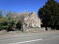
 Cottage in Newtown Linford (geograph 7450635).jpg 1 024 × 768 ; 251 kio
-
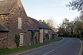
 Cottages at Newton Linford - geograph.org.uk - 6258157.jpg 3 420 × 1 635 ; 1,43 Mio
-
 Cottages, Newtown Linford (geograph 7448250).jpg 1 024 × 768 ; 142 kio
-
 Cottages, Newtown Linford (geograph 7450649).jpg 1 024 × 768 ; 176 kio
-
 Covered reservoir, Bradgate Park - geograph.org.uk - 6269951.jpg 1 600 × 1 066 ; 616 kio
-
 Crags at the Bradgate Country Park - geograph.org.uk - 5591394.jpg 800 × 498 ; 94 kio
-
 Cricket match at Newtown Linford - geograph.org.uk - 4201094.jpg 1 600 × 1 186 ; 390 kio
-
 Cropston Reservoir - geograph.org.uk - 2050131.jpg 640 × 477 ; 79 kio
-
 Cropston Reservoir - geograph.org.uk - 2052082.jpg 640 × 480 ; 96 kio
-
 Cropston Reservoir - geograph.org.uk - 2843631.jpg 2 168 × 1 703 ; 1,36 Mio
-
 Cropston Reservoir - geograph.org.uk - 3034278.jpg 3 264 × 2 448 ; 3,15 Mio
-
 Cropston Reservoir - geograph.org.uk - 3034283.jpg 3 264 × 2 448 ; 2,52 Mio
-
 Cropston Reservoir - geograph.org.uk - 3036952.jpg 3 264 × 2 448 ; 3,2 Mio
-
 Cropston Reservoir - geograph.org.uk - 3132991.jpg 1 280 × 856 ; 236 kio
-
 Cropston Reservoir - geograph.org.uk - 4786541.jpg 2 000 × 1 500 ; 515 kio
-
 Crow on a crag - geograph.org.uk - 4661978.jpg 800 × 474 ; 77 kio
-
 Cut Mark, Bradgate Park, Bridge - geograph.org.uk - 5782945.jpg 1 280 × 960 ; 593 kio
-
 Deer at Bradgate Country Park - geograph.org.uk - 6270059.jpg 1 600 × 1 066 ; 415 kio
-
 Deer at Bradgate Park - geograph.org.uk - 1856688.jpg 2 048 × 1 536 ; 1,98 Mio
-
 Deer at Bradgate Park - geograph.org.uk - 2154295.jpg 800 × 531 ; 115 kio
-
 Deer at Bradgate Park - geograph.org.uk - 2154598.jpg 800 × 531 ; 108 kio
-
 Deer Barn Tea Room at Bradgate Park - geograph.org.uk - 4200550.jpg 1 600 × 1 200 ; 421 kio
-
 Deer in the Bradgate Country Park - geograph.org.uk - 4007384.jpg 1 600 × 1 127 ; 445 kio
-
 Deer sculpture in Memorial Wood - geograph.org.uk - 6261309.jpg 480 × 640 ; 136 kio
-
 Deer sculpture in Memorial Wood - geograph.org.uk - 6262662.jpg 640 × 480 ; 156 kio
-
 Derelict cottage, Benscliffe Wood - geograph.org.uk - 3037121.jpg 640 × 480 ; 91 kio
-
 Descending Warren Hill - geograph.org.uk - 3038148.jpg 2 493 × 1 628 ; 1,55 Mio
-
 Detail on the wall of Bradgate House - geograph.org.uk - 4200743.jpg 1 600 × 1 200 ; 694 kio
-
 Dimmingsdale Spinney - geograph.org.uk - 1475153.jpg 640 × 480 ; 112 kio
-
 Dry stone wall along Roecliffe Road - geograph.org.uk - 3036975.jpg 2 428 × 3 091 ; 3,71 Mio
-
 Dry stone wall at the Bradgate Country Park - geograph.org.uk - 5591487.jpg 800 × 515 ; 136 kio
-
 Early morning at the Bradgate Country Park - geograph.org.uk - 4661981.jpg 800 × 600 ; 83 kio
-
 Eastern Avalonia - geograph.org.uk - 2154435.jpg 800 × 531 ; 89 kio
-
 Entering Newton Linford - geograph.org.uk - 5259160.jpg 480 × 640 ; 89 kio
-
 Entrance to Sheet Hedges Wood - geograph.org.uk - 3038266.jpg 3 264 × 2 448 ; 3,07 Mio
-
 Entrance to Sheet Hedges Wood - geograph.org.uk - 5259174.jpg 640 × 480 ; 105 kio
-
 Entrance to The Grey Lady Restaurant - geograph.org.uk - 4102906.jpg 1 600 × 1 309 ; 649 kio
-
 Exposed tree roots in Swithland Wood - geograph.org.uk - 5987557.jpg 427 × 640 ; 234 kio
-
 Fallow deer - geograph.org.uk - 6124103.jpg 6 000 × 4 000 ; 4,81 Mio
-
 Fallow deer at Bradgate Country Park - geograph.org.uk - 5591333.jpg 800 × 485 ; 110 kio
-
 Fallow Deer at Bradgate House - geograph.org.uk - 4662001.jpg 800 × 572 ; 134 kio
-
 Fallow Deer at Bradgate House - geograph.org.uk - 4662006.jpg 800 × 595 ; 168 kio
-
 Fallow Deer at Bradgate Park - geograph.org.uk - 4200544.jpg 1 600 × 1 098 ; 656 kio
-
 Fallow Deer at Bradgate Park - geograph.org.uk - 4200546.jpg 1 600 × 1 134 ; 527 kio
-
 Fallow deer at the Bradgate Country Park - geograph.org.uk - 4661987.jpg 800 × 546 ; 162 kio
-
 Fallow deer at the Bradgate Country Park - geograph.org.uk - 4662011.jpg 794 × 800 ; 240 kio
-
 Fallow deer at the Bradgate Country Park - geograph.org.uk - 4662014.jpg 800 × 621 ; 181 kio
-
 Fallow Deer Buck at Bradgate Park - geograph.org.uk - 4200568.jpg 1 600 × 1 332 ; 866 kio
-
 Fallow Deer Bucks at Bradgate Park - geograph.org.uk - 4200774.jpg 1 600 × 1 537 ; 783 kio
-
 Fallow deer grazing in Bradgate Park - geograph.org.uk - 6260901.jpg 640 × 480 ; 101 kio
-
 Fallow Deer, Bradgate Park - geograph.org.uk - 3565056.jpg 2 000 × 2 000 ; 1,17 Mio
-
 Farm buildings at Hallgate, near Cropstone - geograph.org.uk - 6257562.jpg 3 648 × 1 744 ; 3,23 Mio
-
 Farm track off Main Street - geograph.org.uk - 3056569.jpg 2 000 × 1 505 ; 502 kio
-
 Farmland next to Roecliffe Road at Warren Hill - geograph.org.uk - 5591502.jpg 800 × 682 ; 182 kio
-

-
 Fenced man-lid in Swithland Woods - geograph.org.uk - 863154.jpg 640 × 480 ; 138 kio
-
 Field entrance off Ulverscroft Lane - geograph.org.uk - 3037101.jpg 640 × 480 ; 132 kio
-
 Field Head Hotel - geograph.org.uk - 2859210.jpg 640 × 480 ; 117 kio
-
 Field in Newtown Linford - geograph.org.uk - 3038235.jpg 2 423 × 2 974 ; 3,2 Mio
-
 Flooded quarry in Swithland Wood - geograph.org.uk - 1471635.jpg 640 × 480 ; 124 kio
-
 Foggy day along Bradgate Road - geograph.org.uk - 4311163.jpg 1 600 × 1 095 ; 311 kio
-
 Foot bridge over Ulverscroft Brook in Lea Meadows Nature Reserve - geograph.org.uk - 5086786.jpg 2 000 × 1 500 ; 721 kio
-
 Footbridge on edge of Swithland Wood - geograph.org.uk - 6257577.jpg 3 648 × 1 744 ; 2,62 Mio
-
 Footpath along the west boundary of Bradgate Park - geograph.org.uk - 6022151.jpg 3 776 × 2 520 ; 3,19 Mio
-
 Footpath at Swithland Wood - geograph.org.uk - 3036986.jpg 2 815 × 2 285 ; 2,68 Mio
-
 Footpath at Swithland Wood - geograph.org.uk - 3036989.jpg 3 264 × 2 448 ; 2,97 Mio
-
 Footpath from Anstey to Cropston - geograph.org.uk - 4744725.jpg 2 000 × 1 500 ; 626 kio
-
 Footpath from Field Head to John's Lee Wood - geograph.org.uk - 4890237.jpg 2 000 × 1 500 ; 646 kio
-
 Footpath from Field Head to John's Lee Wood - geograph.org.uk - 4890245.jpg 2 000 × 1 500 ; 358 kio
-
 Footpath from Hallgates to Swithland Wood - geograph.org.uk - 5093470.jpg 2 000 × 1 500 ; 366 kio
-
 Footpath leads to Bradgate Park - geograph.org.uk - 4788560.jpg 2 000 × 1 500 ; 457 kio
-
 Footpath on the west side of Bradgate Park - geograph.org.uk - 6022144.jpg 3 776 × 2 520 ; 4 Mio
-
 Footpath signpost in Bradgate Park - geograph.org.uk - 6260899.jpg 640 × 480 ; 119 kio
-
 Footpath through Bailey Sim Wood - geograph.org.uk - 5086789.jpg 1 500 × 2 000 ; 671 kio
-
 Freezing fog at Cropston Reservoir - geograph.org.uk - 4311149.jpg 1 600 × 1 117 ; 350 kio
-
 From the War Memorial, Bradgate Park - geograph.org.uk - 6269729.jpg 1 600 × 1 066 ; 426 kio
-
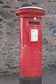 George VI Postbox, Newtown Linford - geograph.org.uk - 494093.jpg 683 × 1 024 ; 162 kio
-
 Glimpse of Cropstone Reservoir - geograph.org.uk - 6257579.jpg 3 648 × 1 744 ; 2,7 Mio
-
 Going up the hill - geograph.org.uk - 6124088.jpg 6 000 × 4 000 ; 6,82 Mio
-
 Grass Field - geograph.org.uk - 3445331.jpg 640 × 424 ; 248 kio
-
 Grass verge along Warren Hill - geograph.org.uk - 3038219.jpg 2 443 × 2 598 ; 2,72 Mio
-
 Hallgates Car Park, Bradgate Park - geograph.org.uk - 6022306.jpg 3 776 × 2 520 ; 4,02 Mio
-
 Hallgates Waterworks - geograph.org.uk - 1471678.jpg 640 × 480 ; 149 kio
-
 Herd of Red Deer at Bradgate Park - geograph.org.uk - 4003369.jpg 1 600 × 1 245 ; 806 kio
-
 Horse rider and pond at Bradgate Country Park - geograph.org.uk - 5591465.jpg 800 × 648 ; 157 kio
-
 Horse rider at Bradgate Park - geograph.org.uk - 5591307.jpg 800 × 668 ; 195 kio
-
 Horseshoe Cottage Farm - geograph.org.uk - 3036962.jpg 3 264 × 2 448 ; 3,12 Mio
-
 Horseshoe Cottage Farm - geograph.org.uk - 4443234.jpg 640 × 424 ; 69 kio
-
 Horseshoe Cottage Farm - geograph.org.uk - 6261318.jpg 640 × 480 ; 93 kio
-
 House on Cropston Reservoir - geograph.org.uk - 3036945.jpg 2 421 × 1 879 ; 1,74 Mio
-
 Houses at Warren Hill - geograph.org.uk - 3708523.jpg 1 600 × 1 195 ; 682 kio
-
 In Swithland Wood - geograph.org.uk - 5987393.jpg 427 × 640 ; 271 kio
-
 In Swithland Wood - geograph.org.uk - 5987423.jpg 427 × 640 ; 308 kio
-
 Incongruous man-lid, Swithland Woods - geograph.org.uk - 1250895.jpg 640 × 480 ; 145 kio
-
 Information board at Bradgate Park - geograph.org.uk - 5591277.jpg 800 × 547 ; 128 kio
-
 Information board at Swithland Woods Farm - geograph.org.uk - 3303371.jpg 3 734 × 2 537 ; 3,41 Mio
-
 Inside the ruins of Bradgate House - geograph.org.uk - 4200720.jpg 1 600 × 1 200 ; 714 kio
-
 Jogger at Bradgate Park - geograph.org.uk - 5591312.jpg 800 × 527 ; 111 kio
-
 Jubilee bunting along Roecliffe Road - geograph.org.uk - 3036993.jpg 3 264 × 2 448 ; 2,93 Mio
-
 Junction of Ulverscroft Lane and Priory Lane - geograph.org.uk - 5071939.jpg 2 000 × 1 500 ; 595 kio
-
 Kissing gate on path towards Newtown Linford - geograph.org.uk - 6257515.jpg 3 648 × 1 744 ; 2,28 Mio
-
 Layby along the westbound A50 at Markfield - geograph.org.uk - 4341892.jpg 1 600 × 1 013 ; 325 kio
-
 Leicester - geograph.org.uk - 2154471.jpg 800 × 531 ; 104 kio
-
 Leicester Road, Markfield - geograph.org.uk - 3360229.jpg 1 142 × 857 ; 681 kio
-
 Leicestershire Round - geograph.org.uk - 5259178.jpg 640 × 640 ; 76 kio
-
 Leicestershire Round - geograph.org.uk - 5259179.jpg 480 × 640 ; 85 kio
-
 Leicestershire Round, John's Lee Wood - geograph.org.uk - 5259180.jpg 640 × 480 ; 117 kio
-
 Leicestershire Yeomanry War Memorial - geograph.org.uk - 4004593.jpg 1 600 × 1 171 ; 397 kio
-
 Leicestershire Yeomanry War Memorial - geograph.org.uk - 4007297.jpg 1 600 × 1 274 ; 125 kio
-
 Leicestershire Yeomanry War Memorial - geograph.org.uk - 4007310.jpg 1 600 × 1 172 ; 329 kio
-
 Leicestershire Yeomanry War Memorial - geograph.org.uk - 5591414.jpg 633 × 800 ; 76 kio
-
 Leicestershire Yeomanry War Memorial - geograph.org.uk - 5591427.jpg 800 × 432 ; 72 kio
-
 Lingdale Golf Club - geograph.org.uk - 3303412.jpg 3 986 × 2 749 ; 3,31 Mio
-
 Looking over the brow - geograph.org.uk - 6124091.jpg 6 000 × 4 000 ; 5,18 Mio
-
 Looking over the wall by Cropston Reservoir - geograph.org.uk - 6124113.jpg 6 000 × 4 000 ; 5,67 Mio
-
 Looking through the arch of Old John Tower - geograph.org.uk - 6256084.jpg 480 × 640 ; 97 kio
-
 Main Street, Newtown Linford - geograph.org.uk - 3056519.jpg 2 000 × 1 494 ; 477 kio
-
 Main track through Swithland Wood - 1 - geograph.org.uk - 1471450.jpg 640 × 480 ; 154 kio
-
 Main track through Swithland Wood - 2 - geograph.org.uk - 1471452.jpg 640 × 480 ; 160 kio
-

-
 Markfield Lane, Newton Linford - geograph.org.uk - 5259177.jpg 640 × 480 ; 67 kio
-
 Meadow near Dimmingsdale Spinney - geograph.org.uk - 1475157.jpg 640 × 480 ; 86 kio
-
 Meadow near the Hallgates Waterworks - geograph.org.uk - 1471730.jpg 640 × 480 ; 89 kio
-
 Meeting of the ways - geograph.org.uk - 5987444.jpg 640 × 427 ; 240 kio
-
 Memorial Wood, Bradgate Park - geograph.org.uk - 6022315.jpg 3 776 × 2 520 ; 3,11 Mio
-
 Memorial Wood, Bradgate Park - geograph.org.uk - 6257546.jpg 3 648 × 1 744 ; 3,97 Mio
.jpg)


.jpg)

.jpg)
.jpg)


