Category:Newtown St Boswells
Перейти к навигации
Перейти к поиску
городок, административный центр шотландского округа Скоттиш-Бордерс, Великобритания  | |||||
| Медиафайл | |||||
| Это частный случай понятия | |||||
|---|---|---|---|---|---|
| Местонахождение |
| ||||
| Численность населения |
| ||||
 | |||||
Deutsch: Newtown St. Boswells ist der Verwaltungssitz der schottischen Region Scottish Borders und liegt im Gebiet des Flusses Tweed südöstlich von Edinburgh in der traditionellen Grafschaft Roxburghshire.
English: Newtown St. Boswells , is the administrative centre of the Scottish Borders council. It is part of a ribbon of settlements running between the A7 and A68 roads, which also includes Galashiels, Melrose, and St. Boswells.
Gàidhlig: 'S e baile ann an Alba a Deas a tha ann Baile Ur Chille Bhoisil, a bha ann an Siorrachd Bhearaig. Se priomh-bhaile na criochan a tha ann.
Italiano: Newtown St. Boswells è il capoluogo dell' area amministrativa scozzese delle Scottish Borders, nel Regno Unito. Fa parte di una fascia di centri abitati disposti sulle strade A7 ed A68, che comprende Galashiels, Melrose e St. Boswells. Secondo le stime del 2004 , Newtown St. Boswells ha una popolazione di circa 1.190 abitanti.
Norsk bokmål: Newtown St. Boswells er en by i Scottish Borders, Skottland. Den er administrasjonsenter for regionen, og tilhører en gruppe byer som ligger mellom veiene A7 og A68, som inkluderer Galashiels, Melrose og St. Boswells.
Українська: Ньюта́ун-Сент-Бо́свеллс — місто на півдні Шотландії, адміністративний центр області Шотландські кордони.
Подкатегории
В этой категории отображается 3 подкатегории из имеющихся 3.
M
- Milestone Garden centre (8 Ф)
Файлы в категории «Newtown St Boswells»
Показано 33 файла из 33, находящихся в данной категории.
-
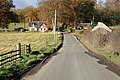
 A country road at Greenwells - geograph.org.uk - 854814.jpg 640 × 427; 137 КБ
-
 A footpath sign at Newtown St Boswells - geograph.org.uk - 1753515.jpg 427 × 640; 151 КБ
-
-
 A memorial stone on Ravenswood Estate - geograph.org.uk - 1565927.jpg 427 × 640; 144 КБ
-
 A memorial stone on Ravenswood Estate - geograph.org.uk - 1565931.jpg 427 × 640; 138 КБ
-
 Dismantled railway line - geograph.org.uk - 588559.jpg 640 × 480; 129 КБ
-
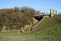
 Footbridge over the Bowden Burn - geograph.org.uk - 761396.jpg 640 × 480; 144 КБ
-
 Newton St Boswells, Auction Mart, Livestock Ring.jpg 8000 × 6000; 9,47 МБ
-
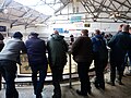 Newton St Boswells, inside Auction Mart, Livestock Ring.jpg 8000 × 6000; 9,66 МБ
-
 Newtown St Boswells - Eileen Henderson.jpg 640 × 480; 76 КБ
-
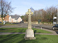
 Newtown St Boswells, Newtown St Boswells War Memorial.jpg 8000 × 6000; 16,1 МБ
-
 Oil seed rape field at Greenwells - geograph.org.uk - 854821.jpg 640 × 427; 139 КБ
-
 Old Newtown - geograph.org.uk - 761398.jpg 640 × 480; 68 КБ
-
 Scottsview3.1.jpg 3872 × 2592; 2,05 МБ
-
 The Borders College - geograph.org.uk - 812916.jpg 640 × 480; 58 КБ
-
 The Waverley Line at Thornielaw - geograph.org.uk - 576962.jpg 640 × 480; 94 КБ
-
 Tweed Horizons - geograph.org.uk - 58169.jpg 640 × 480; 188 КБ
-
-

-
 A country road at Thornielaw - geograph.org.uk - 1050750.jpg 640 × 427; 135 КБ
-
 A farm track at Arthurshiel - geograph.org.uk - 1062468.jpg 427 × 640; 144 КБ
-
 A field edge at Thornielaw - geograph.org.uk - 1050755.jpg 633 × 430; 134 КБ
-

-
 A winter barley field - geograph.org.uk - 1062451.jpg 427 × 640; 135 КБ
-
 A68 old and new - geograph.org.uk - 1056854.jpg 640 × 480; 106 КБ
-
 Across the fields to Eildon - geograph.org.uk - 1518728.jpg 640 × 480; 68 КБ
-
 Bridge over the bowden Burn - geograph.org.uk - 764089.jpg 640 × 480; 142 КБ
-
 Cattle Mart, Newton St Boswells - geograph.org.uk - 1518721.jpg 640 × 480; 69 КБ
-
 Former A road, Eildon - geograph.org.uk - 450899.jpg 640 × 491; 84 КБ
-
 Pasture and Hedgerow at Thornielaw - geograph.org.uk - 576864.jpg 640 × 480; 72 КБ
-
 Pasture at Birseslees - geograph.org.uk - 576818.jpg 640 × 480; 64 КБ
-
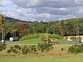 Roundabout on the A68 - geograph.org.uk - 588552.jpg 640 × 480; 120 КБ
-
 Sheep at Thornielaw - geograph.org.uk - 576856.jpg 640 × 480; 77 КБ


