Category:Nichinan, Miyazaki
Zur Navigation springen
Zur Suche springen
Ort in der Präfektur Miyazaki, Japan     | |||||
| Medium hochladen | |||||
| Ist ein(e) | |||||
|---|---|---|---|---|---|
| Ort | Präfektur Miyazaki, Japan | ||||
| Liegt am oder im Gewässer | |||||
| Leiter der Regierung oder Verwaltung |
| ||||
| Rechtsform |
| ||||
| Datum der Gründung, Erstellung, Entstehung, Erbauung |
| ||||
| Einwohnerzahl |
| ||||
| Fläche |
| ||||
| Ersetzt |
| ||||
| offizielle Website | |||||
 | |||||
Unterkategorien
Es werden 15 von insgesamt 15 Unterkategorien in dieser Kategorie angezeigt:
In Klammern die Anzahl der enthaltenen Kategorien (K), Seiten (S), Dateien (D)
A
- Ahiratsu jinja (5 D)
- Atago shrine, Nichinan (10 D)
G
I
- Ioshi-jinja (11 D)
- Iwasaki Inari-jinja (24 D)
K
M
- Miyaura Fishing Port (7 D)
N
O
P
- Port of Aburatsu (5 D)
S
- Sakamoto Tanada (17 D)
- Sunmesse Nichinan (6 D)
T
U
Y
- Yowara-jinja (15 D)
Medien in der Kategorie „Nichinan, Miyazaki“
Folgende 160 Dateien sind in dieser Kategorie, von 160 insgesamt.
-
 Emblem of Nichinan, Miyazaki.svg 500 × 500; 638 Bytes
-
 Flag of Nichinan Miyazaki.JPG 308 × 221; 10 KB
-
 Flag of Nichinan, Miyazaki.svg 600 × 400; 643 Bytes
-
 Nichian Miyazaki chapter.JPG 177 × 175; 10 KB
-
 Aburatsu lion rock scenery in the morning.jpg 3.648 × 2.736; 3,94 MB
-
 Akazura Houin , 赤面法印 - panoramio (1).jpg 2.316 × 900; 504 KB
-
 Akazura Houin , 赤面法印 - panoramio (2).jpg 1.200 × 900; 273 KB
-
 Akazura Houin , 赤面法印 - panoramio (3).jpg 1.310 × 900; 274 KB
-
 Akazura Houin , 赤面法印 - panoramio (4).jpg 3.701 × 900; 975 KB
-
 Akazura Houin , 赤面法印 - panoramio (5).jpg 2.595 × 900; 684 KB
-
 Akazura Houin , 赤面法印 - panoramio.jpg 900 × 1.200; 385 KB
-
 Akebono3.jpg 3.840 × 2.160; 2,27 MB
-
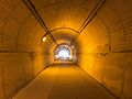
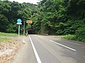
 Atago tunnel , 愛宕トンネル - panoramio.jpg 1.378 × 900; 253 KB
-
 Atago tunnel, 愛宕トンネル - panoramio.jpg 900 × 1.200; 272 KB
-
 Bridge of Nichinan Line on Ibiigawa River from Ibiibashi Bridge.jpg 4.032 × 3.024; 3,62 MB
-
 Cactuses and herbs Park Nichinan Miyazaki 2008.jpg 1.440 × 810; 405 KB
-
 Café near Udo Shrine.jpg 3.932 × 2.949; 2,16 MB
-
 Demography45322.svg 512 × 256; 22 KB
-
 East entrance of Udozaki Tunnel.jpg 4.032 × 3.024; 4,32 MB
-
 Flag of Former Nichinan Miyazaki.JPG 320 × 216; 13 KB
-
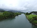 Fukushimariver-nichinanline.jpg 4.608 × 3.456; 3 MB
-
 Haiden of Ibii Shrine.jpg 4.032 × 3.024; 3,29 MB
-
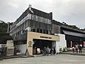
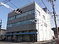
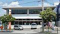
 Head store of Nangō shinkin bank.JPG 3.850 × 1.895; 1,96 MB
-
 Horikawa Bridge in Nichinan, Miyazaki - Apr 27, 2008.jpg 2.272 × 1.704; 2,9 MB
-
 Horikawa canal horikawa bridge.jpg 1.280 × 960; 422 KB
-
 Hyuga osima.jpg 3.840 × 2.160; 3,12 MB
-
 Hyugaosima1.jpg 3.840 × 2.160; 3,94 MB
-
 Ibiibashi Bridge on Ibiigawa River.jpg 4.032 × 3.024; 3,72 MB
-
 Ibiigawa River from Ibiibashi Bridge.jpg 4.032 × 3.024; 2,31 MB
-
 Ibiigawa River near Ibii Shrine.jpg 4.032 × 3.024; 3,37 MB
-
 Japan National Route 220 in front of Ibii Station (east).jpg 3.937 × 2.953; 3,5 MB
-
 Japan National Route 220 in front of Ibii Station (west) 2.jpg 3.902 × 2.927; 3,28 MB
-
 Japan National Route 220 in front of Ibii Station (west).jpg 4.032 × 3.024; 3,1 MB
-
 Japan National Route 220 near Ibii Station.jpg 3.913 × 2.935; 3,09 MB
-
 Japan National Route 220 near Ibiibashi Bridge.jpg 4.032 × 3.024; 2,9 MB
-
 Katsuo Aburi-Ju in Meitsu.JPG 1.684 × 1.263; 727 KB
-
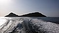
 Kokuuzoshima island.jpg 3.648 × 2.736; 6,91 MB
-
 Map Nichinan en.png 801 × 901; 30 KB
-
 Matsuno-tuyu brewera , 松の露酒造 - panoramio (1).jpg 3.782 × 1.200; 442 KB
-
 Matsuno-tuyu brewera , 松の露酒造 - panoramio.jpg 5.419 × 1.200; 599 KB
-
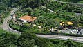 Michinoeki Nango Miyazaki 200809.jpg 1.920 × 1.080; 1,11 MB
-
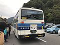 Miyazaki Kotsu Bus near Udo Shrine.jpg 4.032 × 3.024; 2,26 MB
-
 Miyazaki Nichinan Hospital.JPG 3.969 × 1.428; 2,07 MB
-
 Miyazaki Prefectural Road No.433 near Udo Shrine.jpg 4.032 × 3.024; 3,42 MB
-

-

-

-

-

-

-

-
 Miyazaki Shrine Grand Festival in 2008 Obi Taihei Dance 01.jpg 1.280 × 720; 398 KB
-
 Miyazaki-ken nanbu Shinso.JPG 3.648 × 2.052; 2,08 MB
-
 Moai Nichinan Miyazaki.jpg 770 × 393; 223 KB
-
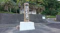
 Nakanooka Stele.jpg 800 × 647; 249 KB
-
 Nanatsubae , 七つ八重 - panoramio.jpg 1.764 × 900; 1,43 MB
-
 Nango in Miyazaki Prefecture.png 801 × 901; 31 KB
-
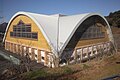 Nango Kuroshio Dome.JPG 960 × 640; 136 KB
-
 Nango shinkin Meitsu.JPG 3.648 × 2.736; 3,85 MB
-
 Nango Stadium Ground.JPG 960 × 640; 84 KB
-
 Nango Stadium.JPG 960 × 640; 74 KB
-
 Nango Town Communitybus 659.jpg 2.142 × 1.377; 1,24 MB
-
 Nango Town Communitybus bustei.jpg 1.194 × 2.496; 611 KB
-
 Nango town office Miyazaki Japan 200809.jpg 1.920 × 1.080; 599 KB
-
 NHK-JOMG JOMC DTV Wanitsukayama 2016.JPG 1.591 × 2.121; 1,01 MB
-
 NHK-JOMG Wanitsukayama.JPG 2.292 × 2.573; 1.005 KB
-
 NHK-JOMG-FM Wanitsukayama 2016.JPG 1.370 × 1.874; 688 KB
-
 Nichinan agriculture and forestry High School 2010.JPG 1.440 × 810; 470 KB
-
 Nichinan city Aburatsu district Aerial photograph.1975.jpg 4.193 × 3.144; 5,1 MB
-
 Nichinan city Agata district Aerial photograph.1975.jpg 3.084 × 2.314; 3,09 MB
-
 Nichinan City Hall 2023.jpg 2.560 × 1.440; 1.016 KB
-
 Nichinan city Kitago district Aerial photograph.1975.jpg 3.349 × 2.512; 3,44 MB
-
 Nichinan city Nango district Aerial photograph.1975.jpg 3.380 × 2.536; 3,35 MB
-
 Nichinan city Obi district Aerial photograph.1975.jpg 2.682 × 2.012; 2,31 MB
-
 Nichinan city Odotsu district Aerial photograph.1975.jpg 4.265 × 3.199; 3,73 MB
-
 Nichinan City Office 2010.JPG 1.440 × 810; 390 KB
-
 Nichinan High school 2010.JPG 1.536 × 1.152; 701 KB
-
 Nichinan IC 2008.JPG 1.920 × 1.080; 665 KB
-
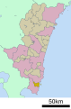
 Nichinan in Miyazaki Prefecture Ja.svg 411 × 596; 9 KB
-
 Nichinan in Miyazaki Prefecture.png 801 × 901; 30 KB
-
 Nichinan Kaigan Nango Prince Hotel.jpg 1.280 × 720; 429 KB
-
 Nichinan Phoenix Road - panoramio.jpg 2.976 × 3.968; 4,09 MB
-
 Nichinan Post Office 200809.jpg 1.440 × 810; 487 KB
-
 Nichinan Seashore - panoramio - abu 9495 (1).jpg 640 × 480; 56 KB
-
 Nichinan Seashore - panoramio - abu 9495.jpg 640 × 480; 58 KB
-
 Nichinan Seashore - panoramio.jpg 480 × 640; 55 KB
-
 Nichinan Shintoku High School 2012.JPG 1.296 × 972; 434 KB
-
 Nichinan Yumemi-bridge.jpg 5.472 × 3.648; 12,86 MB
-
 Nichinan-Togo IC 2018 01.JPG 1.632 × 1.224; 459 KB
-
 Obamaport.hyugaosima.jpg 3.840 × 2.160; 3,73 MB
-
 Odotsu,大堂津 遠景 - panoramio.jpg 7.149 × 1.820; 1,12 MB
-
 Ohshima Island Hyuga 2008.JPG 1.726 × 572; 339 KB
-
 Paddy fields near Ibiibashi Bridge 2.jpg 4.032 × 3.024; 2 MB
-
 Paddy fields near Ibiibashi Bridge.jpg 4.032 × 3.024; 2,79 MB
-
 Parking area of Udo Shrine 2.jpg 4.032 × 3.024; 2,71 MB
-
 Parking area of Udo Shrine.jpg 3.957 × 2.968; 3,01 MB
-
 Population distribution of Nichinan, Miyazaki, Japan.svg 512 × 256; 22 KB
-
 Rental EV TOYOTA COMS - panoramio (1).jpg 1.600 × 1.200; 377 KB
-
 Rental EV TOYOTA COMS - panoramio (2).jpg 1.600 × 1.200; 338 KB
-
 Rental EV TOYOTA COMS - panoramio.jpg 1.200 × 1.600; 260 KB
-
 Road for Udo Shrine.jpg 4.032 × 3.024; 4,62 MB
-
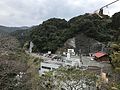
 Road side station Nango , 道の駅 南郷 - panoramio (1).jpg 1.771 × 900; 328 KB
-
 Road side station Nango , 道の駅 南郷 - panoramio (2).jpg 1.735 × 900; 292 KB
-
 Road side station Nango , 道の駅 南郷 - panoramio.jpg 2.438 × 900; 407 KB
-
 Roadside station Sakatani , 道の駅 酒谷 - panoramio.jpg 2.281 × 700; 199 KB
-
 Roadside Station Sakatani 2008.jpg 1.920 × 1.080; 593 KB
-
 Rodeside station nango , 道の駅 なんごう前 - panoramio.jpg 6.775 × 1.726; 1,43 MB
-
 Route220 Nichinan Coast 01.JPG 1.440 × 810; 462 KB
-
 Sakatani river , 酒谷川 - panoramio.jpg 6.082 × 1.200; 921 KB
-
 SAPIA Nichinan SC 2016.JPG 2.121 × 1.591; 1,01 MB
-
 Shaden of Ibii Shrine.jpg 4.032 × 3.024; 3,03 MB
-
 Stairs on sando of Udo Shrine.jpg 3.977 × 2.983; 6,02 MB
-
 Stela near Ibii Shrine.jpg 4.032 × 3.024; 4,65 MB
-
 Stone wall of Ibii Shrine.jpg 4.015 × 3.011; 5,67 MB
-
 Tokoji-baseballpark.jpg 3.840 × 2.160; 2,13 MB
-
 Torii of Ibii Shrine.jpg 3.985 × 2.989; 5,89 MB
-
 Turist mascot Nichinanjya sama , にちなんぢゃ様 - panoramio.jpg 1.200 × 1.600; 353 KB
-
 Udejima Island.jpg 2.592 × 720; 183 KB
-
 Udozaki Tunnel.jpg 4.032 × 3.024; 1,77 MB
-
 View from west entrance of Udozaki Tunnel.jpg 4.032 × 3.024; 3,79 MB
-
 View in Ibii Shrine 2.jpg 4.032 × 3.024; 4,06 MB
-
 View in Ibii Shrine.jpg 3.982 × 2.987; 5,5 MB
-
 View near west entrance of Udozaki Tunnel.jpg 4.032 × 3.024; 4,52 MB
-
 West entrance of Udozaki Tunnel.jpg 4.032 × 3.024; 4,82 MB
-
 お地蔵様 - panoramio (3).jpg 4.288 × 2.848; 5,4 MB
-
 アドベンチャーキャビン・コテージ入口 - panoramio.jpg 3.264 × 2.448; 3,23 MB
-
 七ツ八重 - panoramio.jpg 2.048 × 1.536; 730 KB
-
 亜熱帯 - panoramio.jpg 4.288 × 2.848; 5,49 MB
-
 人柱様 - panoramio.jpg 3.356 × 2.261; 1,81 MB
-
 吾平津神社と堀川橋 - panoramio.jpg 2.412 × 700; 309 KB
-
 国道220号線 - panoramio (1).jpg 1.600 × 900; 270 KB
-
 国道220号線 - panoramio.jpg 1.600 × 900; 265 KB
-
 基礎自治体位置図 45322.svg 480 × 732; 12 KB
-
 大島 - panoramio (3).jpg 4.288 × 2.848; 5,06 MB
-
 大島より - panoramio.jpg 4.288 × 2.848; 5,68 MB
-
 大島アドベンチャーキャビン - panoramio.jpg 4.288 × 2.848; 5,47 MB
-
 太平洋 - panoramio (1).jpg 3.264 × 2.448; 2,34 MB
-
 宮崎交通油津待合所 日南市 2020-09-20.jpg 4.032 × 3.024; 4,32 MB
-
 宮崎県道433号鵜戸神宮線.jpg 5.520 × 4.140; 11,77 MB
-
 宮崎県道446号榎原停車場線.jpg 3.024 × 3.024; 5,48 MB
-
 富土バス停 - panoramio.jpg 2.816 × 2.112; 1.008 KB
-
 小布瀬の滝 - panoramio.jpg 3.648 × 2.736; 4,2 MB
-
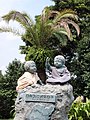
 小村寿太郎像 - panoramio.jpg 1.600 × 1.022; 268 KB
-
 小浜港 - panoramio.jpg 4.288 × 2.848; 5,66 MB
-
 日南市文化センター.jpg 3.456 × 2.304; 2,49 MB
-
 杉村金物本店 - panoramio - z tanuki.jpg 700 × 933; 140 KB
-
 杉村金物本店 - panoramio.jpg 933 × 700; 173 KB
-
 河口付近 - panoramio.jpg 4.288 × 2.848; 5,61 MB
-
 油津 - panoramio (1).jpg 3.357 × 2.247; 6,5 MB
-
 油津 - panoramio (2).jpg 3.360 × 2.252; 1,53 MB
-
 油津 - panoramio.jpg 933 × 700; 169 KB
-
 油津 赤レンガ館 - panoramio.jpg 933 × 700; 191 KB
-
 瀬平崎 - panoramio (1).jpg 1.600 × 900; 260 KB
-
 瀬平崎 - panoramio (2).jpg 1.600 × 900; 207 KB
-
 瀬平崎 - panoramio.jpg 1.600 × 900; 326 KB
-
 花峯橋 - panoramio.jpg 4.896 × 3.264; 6,54 MB
-
 虚空蔵島、大島 - panoramio.jpg 1.200 × 900; 1,06 MB
-
 過疎 - panoramio.jpg 2.848 × 4.288; 5,64 MB
-
 道の駅「なんごう」からの眺望 - panoramio.jpg 2.048 × 1.536; 728 KB
-
 鳥居 - panoramio (2).jpg 2.848 × 4.288; 5,47 MB


.jpg)
.jpg)


.jpg)
_2.jpg)
.jpg)


.jpg)
.jpg)
.jpg)
.jpg)
.jpg)


.jpg)


.jpg)
.jpg)


.jpg)
.jpg)


.jpg)


.jpg)


.jpg)


.jpg)


.jpg)
.jpg)


.jpg)
.jpg)


.jpg)
.jpg)
.jpg)
.jpg)
.jpg)
.jpg)