Category:Ninfield
Vai alla navigazione
Vai alla ricerca
English: Ninfield is a village and civil parish in the Wealden District of East Sussex, England. The village is situated 4 miles (6.4 km) north of Bexhill-on-Sea, at the junction of two roads: the A269 from Bexhill to Battle and the A271 to Hailsham. The parish covers some 2,500 acres (1,010 ha) on the Weald.
Français : Ninfield est une commune du Royaume-Uni. Elle se situe en Angleterre dans la région du Sud-Est, dans le comté de l'East Sussex et dans le district de Wealden.
village in United Kingdom  | |||||
| Carica un file multimediale | |||||
| Istanza di | |||||
|---|---|---|---|---|---|
| Luogo | Wealden, East Sussex, Sud Est dell'Inghilterra, Inghilterra | ||||
| Superficie |
| ||||
 | |||||
Sottocategorie
Questa categoria contiene le 5 sottocategorie indicate di seguito, su un totale di 5.
File nella categoria "Ninfield"
Questa categoria contiene 168 file, indicati di seguito, su un totale di 168.
-
 A269 near Hazards Green - geograph.org.uk - 2062543.jpg 1 024 × 679; 174 KB
-
 Alpacas grazing, near Ninfield - geograph.org.uk - 1163048.jpg 640 × 424; 85 KB
-
 B2204 towards Catsfield - geograph.org.uk - 4228326.jpg 640 × 480; 218 KB
-
 Barn Field - geograph.org.uk - 6280482.jpg 640 × 480; 85 KB
-
 Barn Field - geograph.org.uk - 6280508.jpg 640 × 480; 64 KB
-
 Bexhill Road, A269 - geograph.org.uk - 3881036.jpg 640 × 480; 116 KB
-
 Blacksmiths Inn, Ninfield - geograph.org.uk - 3817637.jpg 1 024 × 620; 148 KB
-
 Bog Field-Barn Field - geograph.org.uk - 6280952.jpg 640 × 480; 71 KB
-
 Brick built cottages, Ninfield, East Sussex - geograph.org.uk - 2191949.jpg 1 024 × 668; 215 KB
-
-
 Clump of trees north of A269 - geograph.org.uk - 3475517.jpg 640 × 480; 80 KB
-
 Cockerel in a strawberry field - geograph.org.uk - 3138514.jpg 640 × 640; 195 KB
-
 Cockerel in a strawberry field - geograph.org.uk - 3138517.jpg 640 × 640; 173 KB
-
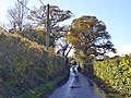
 Compass Lane meets Combe Lane - geograph.org.uk - 3354052.jpg 640 × 480; 169 KB
-
 Coney Burrow - geograph.org.uk - 6280485.jpg 640 × 480; 79 KB
-
 Cows near Boreham Bridge - geograph.org.uk - 1372263.jpg 640 × 427; 134 KB
-
 Cows near Boreham Bridge - geograph.org.uk - 1372277.jpg 640 × 480; 156 KB
-
 Cows near Boreham Bridge - geograph.org.uk - 1372297.jpg 640 × 282; 101 KB
-
 Crouch Field-Gate Field - geograph.org.uk - 6280641.jpg 640 × 480; 72 KB
-
 Crouch Lane - geograph.org.uk - 4985115.jpg 4 608 × 3 456; 3,6 MB
-
 Disused Railway Track, Sidley - geograph.org.uk - 692714.jpg 640 × 480; 143 KB
-
 Entering Ninfield - geograph.org.uk - 1330152.jpg 640 × 424; 105 KB
-
 Entrance Road to Burnt Barns Farm - geograph.org.uk - 399953.jpg 640 × 480; 109 KB
-
 Entrance Road to Quarry - geograph.org.uk - 1372244.jpg 640 × 427; 99 KB
-
 Field near Pashley Farm, Ninfield - geograph.org.uk - 1020903.jpg 640 × 427; 100 KB
-
 Field near Russells Green - geograph.org.uk - 1330172.jpg 640 × 424; 75 KB
-
 Fields near Hazards Green - geograph.org.uk - 2062547.jpg 1 024 × 679; 227 KB
-
 Flat Field - geograph.org.uk - 6280530.jpg 640 × 585; 121 KB
-
 Footpath from Hooe, East Sussex - geograph.org.uk - 115463.jpg 640 × 480; 152 KB
-
 Forest Field - geograph.org.uk - 6280479.jpg 640 × 480; 69 KB
-
 Front Field - geograph.org.uk - 6280433.jpg 640 × 480; 71 KB
-
 Front Field - geograph.org.uk - 6280644.jpg 640 × 480; 73 KB
-
 Furzy Field-Pit Field - geograph.org.uk - 6280456.jpg 640 × 480; 79 KB
-
 High Knowle (geograph 6629405).jpg 1 024 × 684; 184 KB
-
 Hooe Common - geograph.org.uk - 4985208.jpg 4 608 × 3 456; 3,37 MB
-
 Hooe Road at junction with Straight Lane, Ninfield - geograph.org.uk - 4096959.jpg 4 896 × 3 672; 5,71 MB
-
 Hop Garden Field - geograph.org.uk - 6280611.jpg 640 × 480; 64 KB
-
 Hop Garden Field-Rick Yard Field - geograph.org.uk - 6280621.jpg 640 × 480; 50 KB
-
 House Field - geograph.org.uk - 6280438.jpg 640 × 480; 72 KB
-
 House Meadow - geograph.org.uk - 6280534.jpg 640 × 480; 61 KB
-
 House on Combe Lane - geograph.org.uk - 1372245.jpg 640 × 427; 125 KB
-
 Houses, Ninfield - geograph.org.uk - 3880385.jpg 640 × 480; 116 KB
-
 Hurst Wood Field - geograph.org.uk - 6280604.jpg 640 × 480; 117 KB
-

-

-
 Kiln Field - geograph.org.uk - 6280498.jpg 640 × 638; 94 KB
-

-
 Kings Arms, Ninfield - geograph.org.uk - 1163031.jpg 640 × 424; 78 KB
-
 Kings Arms, Ninfield - geograph.org.uk - 2107043.jpg 640 × 480; 102 KB
-
 Kings Arms, Ninfield - geograph.org.uk - 2542565.jpg 4 320 × 3 240; 4,13 MB
-
 Kitchen Meadow - geograph.org.uk - 6280626.jpg 640 × 480; 78 KB
-
 Land off Whydown Road - geograph.org.uk - 1780729.jpg 1 024 × 768; 191 KB
-
 Looking across the A269 in Ninfield - geograph.org.uk - 6203664.jpg 800 × 600; 139 KB
-
 Looking east on Ninfield High Street - geograph.org.uk - 6203660.jpg 800 × 600; 106 KB
-
 Lower Brick Field - geograph.org.uk - 6280597.jpg 640 × 480; 81 KB
-
 Lower Gate Field-Site of Hooe Shaw - geograph.org.uk - 6280468.jpg 640 × 480; 85 KB
-
 Marlpit Mead - geograph.org.uk - 6280472.jpg 640 × 480; 78 KB
-
 Marlpits Lane - geograph.org.uk - 4984972.jpg 4 608 × 3 456; 3,37 MB
-
 Marlpits Lane - geograph.org.uk - 4984977.jpg 4 608 × 3 456; 3,43 MB
-

-
 Middle High Knows - geograph.org.uk - 6280518.jpg 640 × 480; 70 KB
-
 Miller's Farm, Ninfield - geograph.org.uk - 2844119.jpg 1 866 × 1 266; 349 KB
-
 Millers Mews, Ninfield - geograph.org.uk - 1330159.jpg 640 × 424; 63 KB
-
 Morhouse (geograph 6629464).jpg 1 024 × 684; 274 KB
-
 Mount Field - geograph.org.uk - 6280896.jpg 640 × 480; 79 KB
-
 Muddy footpath - geograph.org.uk - 3881021.jpg 640 × 480; 128 KB
-
 Nine Acres - geograph.org.uk - 6280538.jpg 640 × 480; 88 KB
-
 Nine Acres - geograph.org.uk - 6280629.jpg 640 × 480; 86 KB
-
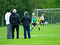 Ninfield II v Little Chelsea (14018439300).jpg 3 640 × 2 724; 6,39 MB
-
 Ninfield II v Little Chelsea (14181932326).jpg 2 113 × 1 712; 2,33 MB
-
 Ninfield II v Little Chelsea (14201786551).jpg 3 648 × 2 736; 6,86 MB
-
 Ninfield II v Little Chelsea (14205069235).jpg 2 820 × 1 868; 3,47 MB
-
 Ninfield II v Little Chelsea (14205095735).jpg 3 630 × 2 712; 6,5 MB
-
 Ninfield II v Little Chelsea (14225209533).jpg 2 430 × 1 824; 3,21 MB
-
 Ninfield II v Little Chelsea (14225228273).jpg 3 648 × 2 736; 7,48 MB
-
 Ninfield Memorial Hall - geograph.org.uk - 3880416.jpg 640 × 428; 138 KB
-
 Ninfield Recreation Ground.JPG 2 048 × 1 536; 516 KB
-
 Ninfield Stream Valley - geograph.org.uk - 461023.jpg 640 × 479; 138 KB
-
 Ninfield Transforming Station from public footpath - geograph.org.uk - 5670483.jpg 2 071 × 1 553; 1,34 MB
-
 Ninfield.JPG 2 045 × 1 446; 476 KB
-
 Not a public footpath - geograph.org.uk - 2820275.jpg 640 × 480; 136 KB
-
 Notice at Ninfield Transforming Station off Potman's Lane - geograph.org.uk - 5670495.jpg 2 211 × 1 659; 1,01 MB
-
 Old Direction Sign - Signpost - geograph.org.uk - 6051028.jpg 402 × 600; 281 KB
-

-

-

-

-
-

-
-

-
 Old Kiln Field - geograph.org.uk - 6280633.jpg 640 × 480; 72 KB
-
 Park Field - geograph.org.uk - 6280490.jpg 640 × 480; 84 KB
-
 Park Wood - geograph.org.uk - 6280469.jpg 640 × 480; 68 KB
-
 Peartree Lane, Lunsford's Cross, East Sussex - geograph.org.uk - 2973904.jpg 1 600 × 1 030; 296 KB
-
 Petrol station, Ninfield - geograph.org.uk - 2542574.jpg 4 320 × 3 240; 4,22 MB
-
 Pond near A271 - geograph.org.uk - 1330075.jpg 640 × 424; 75 KB
-
 Pond, Pit Field - geograph.org.uk - 6280461.jpg 640 × 469; 73 KB
-
 Potman's Lane - geograph.org.uk - 3881060.jpg 640 × 480; 136 KB
-
 Potmans Lane, Lunsford's Cross - geograph.org.uk - 6280527.jpg 640 × 480; 61 KB
-
 Public footpath at Boreham Bridge, East Sussex - geograph.org.uk - 2199147.jpg 1 600 × 1 200; 399 KB
-
 Pumping station track - geograph.org.uk - 3475532.jpg 640 × 480; 114 KB
-
 Pumping Station Whydown East Sussex - geograph.org.uk - 140540.jpg 640 × 480; 145 KB
-
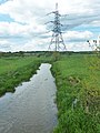
 Pylon near Boreham Hill - geograph.org.uk - 2514097.jpg 640 × 480; 99 KB
-
 Pylons from Crouch Lane - geograph.org.uk - 5740065.jpg 4 896 × 3 672; 6,02 MB
-
 Pylons next to Crouch Lane - geograph.org.uk - 4985119.jpg 4 608 × 3 456; 3,57 MB
-
 Railway Bridge, Sidley - geograph.org.uk - 692718.jpg 640 × 480; 90 KB
-
 Rear of Miller's Farm, Ninfield - geograph.org.uk - 2844124.jpg 1 850 × 1 196; 400 KB
-
 Road junction, Ninfield - geograph.org.uk - 3043247.jpg 1 600 × 1 151; 331 KB
-
 Roadworks on the B2095 - geograph.org.uk - 4359211.jpg 640 × 428; 79 KB
-
 Skinners Sheds, Bexhill Road - geograph.org.uk - 6280517.jpg 640 × 579; 78 KB
-
 Sluice and Bridge, New Ash Bourne - geograph.org.uk - 460990.jpg 479 × 640; 197 KB
-
 Snow at Boreham Hill - geograph.org.uk - 5713992.jpg 4 000 × 3 000; 2,12 MB
-
 Spring Field - geograph.org.uk - 6280458.jpg 640 × 480; 72 KB
-
 St Mary's Church, Ninfield - geograph.org.uk - 4985101.jpg 4 608 × 3 456; 3,59 MB
-
 St Mary's Church, Ninfield - geograph.org.uk - 4985106.jpg 4 608 × 3 456; 3,6 MB
-
 St Mary's Churchyard, Ninfield - geograph.org.uk - 4985108.jpg 4 608 × 3 456; 3,32 MB
-
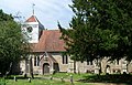 St. Mary's, Ninfield, East Sussex - geograph.org.uk - 4291024.jpg 1 600 × 1 027; 453 KB
-
 St. Mary, Ninfield, churchyard (a) - geograph.org.uk - 5464749.jpg 640 × 480; 124 KB
-
 St. Mary, Ninfield, churchyard (b) - geograph.org.uk - 5464754.jpg 640 × 480; 117 KB
-
 St. Mary, Ninfield, churchyard (c) - geograph.org.uk - 5464755.jpg 640 × 480; 115 KB
-
 St. Mary, Ninfield, churchyard (d) - geograph.org.uk - 5464756.jpg 640 × 480; 123 KB
-
 St. Mary, Ninfield, churchyard (e) - geograph.org.uk - 5464757.jpg 640 × 480; 108 KB
-
 St. Mary, Ninfield, early July 2017 - geograph.org.uk - 5455399.jpg 640 × 480; 92 KB
-
 Stocks and Whipping post (geograph 6629424).jpg 1 024 × 685; 234 KB
-
 Stubble Field-Long Field-Barn Field - geograph.org.uk - 6280448.jpg 640 × 480; 76 KB
-
 Supermarket, Sidley - geograph.org.uk - 692732.jpg 640 × 480; 56 KB
-

-
 The Stocks and Whipping Post at Ninfield - geograph.org.uk - 304751.jpg 640 × 480; 171 KB
-
 The Water Tower at Ninfield - geograph.org.uk - 304749.jpg 640 × 480; 143 KB
-
 Thorne Mill - geograph.org.uk - 1414667.jpg 640 × 424; 112 KB
-
 Thorne Oast Farm, Ninfield Road - geograph.org.uk - 6280503.jpg 640 × 480; 57 KB
-
 Topiary sailing sheep, Athelas Plants, Hooe - geograph.org.uk - 3468954.jpg 1 600 × 1 117; 642 KB
-
 Track from Bexhill Road (A269) to Solar Farm - geograph.org.uk - 5670563.jpg 2 272 × 1 704; 1,62 MB
-
 Track near Boreham Street - geograph.org.uk - 3867770.jpg 4 896 × 3 672; 5,8 MB
-
 Upper Swin Garden - geograph.org.uk - 6280958.jpg 640 × 480; 85 KB
-
 Valley near Ninfield in Winter - geograph.org.uk - 1632614.jpg 640 × 424; 45 KB
-
 Waller's Haven - geograph.org.uk - 3475550.jpg 640 × 480; 117 KB
-
 Waller's Haven north of Boreham Bridge - geograph.org.uk - 3475523.jpg 480 × 640; 101 KB
-
 Waller's Haven, Boreham Bridge, East Sussex - geograph.org.uk - 2199148.jpg 1 600 × 1 200; 420 KB
-
 Wallers Haven - geograph.org.uk - 2374824.jpg 1 600 × 1 061; 390 KB
-
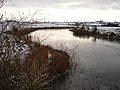 Wallers Haven East Sussex - geograph.org.uk - 97055.jpg 640 × 480; 140 KB
-
 Wallers Haven from Boreham Bridge - geograph.org.uk - 2062555.jpg 1 061 × 1 600; 450 KB
-
 Watermill Stream - geograph.org.uk - 6280587.jpg 480 × 640; 130 KB
-
 Wet lane near Marlpits - geograph.org.uk - 4228340.jpg 640 × 480; 242 KB
-
 Wode Road - geograph.org.uk - 1372721.jpg 640 × 480; 125 KB
-
 Yoking Close Meadow - geograph.org.uk - 6280632.jpg 640 × 480; 75 KB
-
 Agmerhurst Farm - geograph.org.uk - 461063.jpg 640 × 480; 74 KB
-
 Ash Bourne - geograph.org.uk - 460979.jpg 640 × 479; 159 KB
-
 Bridge over dismantled railway - geograph.org.uk - 1463354.jpg 640 × 424; 90 KB
-
 Cattle Grid Nr Ninfield East Sussex - geograph.org.uk - 140545.jpg 640 × 480; 146 KB
-
 Chinese Restaurant, Bexhill-on-Sea - geograph.org.uk - 681352.jpg 640 × 480; 71 KB
-
 Christmas Tree Farm - geograph.org.uk - 461099.jpg 640 × 480; 123 KB
-
 Community Centre, Sidley - geograph.org.uk - 692608.jpg 640 × 480; 65 KB
-
 Coombe Hill Cottage near Ninfield - geograph.org.uk - 304757.jpg 640 × 486; 166 KB
-
 Farmland at Whydown East Sussex - geograph.org.uk - 86000.jpg 640 × 480; 145 KB
-
 Farmland Ninfield East Sussex - geograph.org.uk - 133802.jpg 640 × 480; 136 KB
-
 Farmland Nr Hooe, East Sussex - geograph.org.uk - 129873.jpg 640 × 480; 120 KB
-
 Field, Russell's Green - geograph.org.uk - 640868.jpg 640 × 516; 93 KB
-
 Footpath to Stevens Close, Sidley - geograph.org.uk - 708582.jpg 640 × 480; 72 KB
-
 Ninfield Road, Sidley - geograph.org.uk - 692678.jpg 640 × 480; 72 KB
-
 Normanhurst Estate - geograph.org.uk - 479265.jpg 640 × 480; 134 KB
-
 Parting of Ways at Marlpits near Ninfield - geograph.org.uk - 355303.jpg 640 × 480; 109 KB
-

-
 Temporary Medical Centre, Sidley - geograph.org.uk - 692645.jpg 640 × 480; 66 KB
-
 Wealden view - geograph.org.uk - 461087.jpg 640 × 480; 83 KB
-
 Whydown Road Nr Hooe East Sussex - geograph.org.uk - 85996.jpg 640 × 480; 119 KB
-
 Wilding Wood - geograph.org.uk - 461000.jpg 640 × 479; 118 KB


.jpg)


.jpg)


.jpg)
.jpg)
.jpg)
.jpg)
.jpg)
.jpg)
.jpg)


_-_geograph.org.uk_-_5464749.jpg)
_-_geograph.org.uk_-_5464754.jpg)
_-_geograph.org.uk_-_5464755.jpg)
_-_geograph.org.uk_-_5464756.jpg)
_-_geograph.org.uk_-_5464757.jpg)

.jpg)


_to_Solar_Farm_-_geograph.org.uk_-_5670563.jpg)


