Category:Norðurland eystra
Salti al navigilo
Salti al serĉilo
Regions of Iceland: Austurland · Höfuðborgarsvæðið · Norðurland eystra · Norðurland vestra · Suðurland · Suðurnes · Vestfirðir · Vesturland

regiono en orienta Islando  | |||||
| Alŝuti plurmedion | |||||
| Estas | |||||
|---|---|---|---|---|---|
| Loko | Islando | ||||
| Ĉefurbo | |||||
| Loĝantaro |
| ||||
| Areo |
| ||||
 | |||||
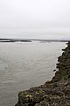
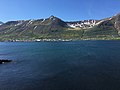
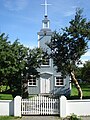
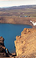
English: Norðurland eystra, litt. Northern Land east in Icelandic, is a region of Iceland.
Subkategorioj
Ĉi tiu kategorio havas la 34 jenajn subkategoriojn, el 34 entute.
Dosieroj en kategorio “Norðurland eystra”
La jenaj 91 dosieroj estas en ĉi tiu kategorio, el 91 entute.
-
Norðurland eystra pronunciation.ogg 4,1 s; 216 KB
-
 Norðurland eystra in Iceland.svg 1 186 × 841; 519 KB
-
 Gunnlaugsson 1844 Iceland NE.djvu 8 040 × 6 548; 406 KB
-
 2005-05-28 11 50 43 Iceland-Þverá.JPG 2 048 × 1 536; 2,29 MB
-
 2005-05-28 12 19 08 Iceland-Skútustaðir.jpg 2 048 × 1 536; 2,28 MB
-
 2008-05-20 12-12-37 Iceland Norðurland Eystra Skinnastaður.JPG 1 536 × 2 048; 2,98 MB
-
 2008-05-20 12-18-05 Iceland Norðurland Eystra Skinnastaður.JPG 2 048 × 1 536; 2,11 MB
-
 2014-05-02 12-19-44 Iceland Norðurland Eystra - Kópasker 4h 140°.JPG 10 990 × 2 370; 13,8 MB
-
 Akureyri , Islande - panoramio (1).jpg 3 648 × 2 736; 8,74 MB
-
 Akureyri , Islande - panoramio (11).jpg 3 648 × 2 736; 8,15 MB
-
 Akureyri , Islande - panoramio (13).jpg 3 648 × 2 736; 9,23 MB
-
 Akureyri , Islande - panoramio (14).jpg 3 648 × 2 736; 7,85 MB
-
 Akureyri , Islande - panoramio (15).jpg 3 648 × 2 736; 6,54 MB
-
 Akureyri , Islande - panoramio (16).jpg 3 648 × 2 736; 7,01 MB
-
 Akureyri , Islande - panoramio (17).jpg 3 648 × 2 736; 7,63 MB
-
 Akureyri , Islande - panoramio (18).jpg 3 648 × 2 736; 8,26 MB
-
 Akureyri , Islande - panoramio (19).jpg 3 648 × 2 736; 7,45 MB
-
 Akureyri , Islande - panoramio (2).jpg 3 648 × 2 736; 8,94 MB
-
 Akureyri , Islande - panoramio (20).jpg 3 648 × 2 736; 7,65 MB
-
 Akureyri , Islande - panoramio (21).jpg 3 648 × 2 736; 8,44 MB
-
 Akureyri , Islande - panoramio (22).jpg 3 648 × 2 736; 8,45 MB
-
 Akureyri , Islande - panoramio (23).jpg 3 648 × 2 736; 7,36 MB
-
 Akureyri , Islande - panoramio (25).jpg 3 648 × 2 736; 7,96 MB
-
 Akureyri , Islande - panoramio (26).jpg 3 648 × 2 736; 8,61 MB
-
 Akureyri , Islande - panoramio (3).jpg 3 648 × 2 736; 9,68 MB
-
 Akureyri , Islande - panoramio (4).jpg 3 648 × 2 736; 8,85 MB
-
 Akureyri , Islande - panoramio (5).jpg 3 648 × 2 736; 7,77 MB
-
 Akureyri , Islande - panoramio (6).jpg 3 648 × 2 736; 9,18 MB
-
 Akureyri , Islande - panoramio (7).jpg 3 648 × 2 736; 8,3 MB
-
 Between Krafla and Detifoss - panoramio.jpg 1 354 × 838; 351 KB
-
 Brautarholl.jpg 1 500 × 1 125; 380 KB
-
 Digranes lighthouse.jpg 7 967 × 5 975; 5,7 MB
-
 Eastern Region, Iceland - panoramio (3).jpg 4 272 × 2 848; 5,59 MB
-
 Eyjafjörður01.jpg 640 × 480; 153 KB
-
 Fjallasýn (2895345471).jpg 2 592 × 1 964; 2,07 MB
-
 Geothermal power plant at Jarðbaðshólar.jpg 1 247 × 1 000; 417 KB
-
 Hafen Husavik.jpg 3 504 × 2 336; 486 KB
-
 Hellir.jpg 3 024 × 4 032; 2,79 MB
-
 Hjalteyri02.jpg 480 × 640; 215 KB
-
 Hjalteyri03.jpg 640 × 480; 147 KB
-
 Hof í Svarfaðardal.jpg 1 764 × 1 312; 554 KB
-
 HverfellInnerCrater.jpg 2 980 × 1 955; 1,06 MB
-
 I Natturunni.jpg 3 024 × 4 032; 2,59 MB
-
 Iceland - panoramio (40).jpg 2 432 × 3 648; 12,09 MB
-
 Island 2017 228-0 (38321720672).jpg 6 693 × 4 459; 13,69 MB
-
 Island Hafragilsfoss 1.JPG 3 444 × 2 586; 1,85 MB
-
 Island Hafragilsfoss 2.JPG 3 444 × 2 586; 1,44 MB
-
 Island Ringstraße im Nordosten 13.JPG 3 444 × 2 586; 1,06 MB
-
 Karl og Kerling - panoramio.jpg 3 240 × 4 320; 9,03 MB
-
 Kinnarfjöll.jpg 1 572 × 628; 790 KB
-
 Kjúklingasúpa.jpg 3 703 × 3 022; 2,15 MB
-
 Krakkaæfingin..jpg 5 312 × 2 988; 6,7 MB
-
 Kvennamót.jpg 5 312 × 2 988; 4,94 MB
-
 Lake Myvatn - panoramio (1).jpg 6 489 × 1 382; 13,27 MB
-
 Laugahlíð Svarfaðardal.jpg 1 764 × 1 174; 1,56 MB
-
 Laugahlíð2 Svarfaðardal.jpg 1 764 × 1 133; 1,58 MB
-
 Mittsommernacht im hohen Norden Islands.jpg 2 430 × 1 566; 3,23 MB
-
 Naustárfoss.JPG 3 264 × 2 448; 1,97 MB
-
 Nordisland 5590.JPG 3 888 × 2 592; 3,54 MB
-
 Nordisland 5592.JPG 3 888 × 2 592; 3,7 MB
-
 Nordisland 5596.JPG 2 463 × 3 090; 2,75 MB
-
 Nordisland 5615.JPG 3 888 × 2 592; 3,07 MB
-
 Nordisland 5616.JPG 3 888 × 2 210; 2,94 MB
-
 Northeast, Iceland - panoramio.jpg 1 280 × 851; 217 KB
-
 Northeastern Region, Iceland - panoramio (11).jpg 2 848 × 4 272; 6,14 MB
-
 Northeastern Region, Iceland - panoramio (5).jpg 2 848 × 4 272; 5,49 MB
-
 Reforestation - panoramio.jpg 4 928 × 3 264; 10,52 MB
-
 River Jökulsá á Fjöllum - 2013.08 - panoramio.jpg 3 970 × 2 978; 3,4 MB
-
 Road to Lake Mývatn - 2013.08 - panoramio.jpg 4 514 × 3 385; 2,88 MB
-
 Roads on Mars 1 - panoramio.jpg 4 928 × 3 264; 11,04 MB
-
 Roads on Mars 2 - panoramio.jpg 4 928 × 3 264; 10,11 MB
-
 Roads on Mars 3 - panoramio.jpg 4 928 × 3 264; 11,18 MB
-
 Rock Formations in Höfði Nature Park - 2013.08 - panoramio (1).jpg 4 608 × 3 456; 2,63 MB
-
 Rock Formations in Höfði Nature Park - 2013.08 - panoramio.jpg 4 608 × 3 456; 2,39 MB
-
 Siglufjordur.jpg 4 032 × 3 024; 2,82 MB
-
 Siglufjördur.jpg 4 032 × 3 024; 2,65 MB
-
 Skutustadir Church.jpg 2 304 × 3 072; 3,21 MB
-
 Spræna.jpg 3 024 × 3 024; 3,6 MB
-
 Strong Contrast between Grasslands and Lava Flows - 2013.08 - panoramio.jpg 3 767 × 2 119; 2,68 MB
-
 Sulphur Pool at Leirhnjúkur - 2013.08 - panoramio.jpg 4 020 × 2 228; 2,28 MB
-
 The pseudo craters by lake Mývatn (Mosquito lake) - panoramio.jpg 4 928 × 3 264; 9,36 MB
-
 The road no. 1 heading Myvatn - panoramio.jpg 1 328 × 837; 372 KB
-
 Urðabjörg.jpg 1 764 × 1 201; 574 KB
-
 Vaðlaheiði pass.jpg 930 × 600; 41 KB
-
 Vellir.jpg 1 613 × 879; 370 KB
-
 Viti crater - panoramio.jpg 835 × 1 354; 342 KB
-
 Víti (Hell) by Krafla - panoramio.jpg 4 928 × 3 264; 9,77 MB
-
 Ystihver.JPG 3 264 × 2 448; 2,34 MB
-
 Öxarfjoerdur.jpg 10 314 × 8 063; 11,67 MB
-
 Útkinn view to the south.jpg 1 000 × 750; 290 KB
-
 黑色的岩石.jpg 3 264 × 2 448; 2,27 MB


.jpg)
.jpg)
.jpg)
.jpg)
.jpg)
.jpg)
.jpg)
.jpg)
.jpg)
.jpg)
.jpg)
.jpg)
.jpg)
.jpg)
.jpg)
.jpg)
.jpg)
.jpg)
.jpg)
.jpg)
.jpg)


.jpg)

.jpg)


.jpg)
.jpg)


.jpg)
.jpg)


.jpg)


_-_panoramio.jpg)


_by_Krafla_-_panoramio.jpg)


.jpg)