Category:North Berwick
Zur Navigation springen
Zur Suche springen

Stadt in Schottland  | |||||
| Medium hochladen | |||||
| Ist ein(e) |
| ||||
|---|---|---|---|---|---|
| Ort |
| ||||
| Einwohnerzahl |
| ||||
| offizielle Website | |||||
 | |||||
Unterkategorien
Es werden 16 von insgesamt 16 Unterkategorien in dieser Kategorie angezeigt:
In Klammern die Anzahl der enthaltenen Kategorien (K), Seiten (S), Dateien (D)
B
- Broad Sands (8 D)
C
- Craigleith (18 D)
F
M
- Milsey Bay (15 D)
N
- North Berwick Golf Course (19 D)
- North Berwick Harbour (19 D)
- North Berwick Law (69 D)
- North Berwick railway station (26 D)
- North Berwick Witch trials (4 D)
S
- Scottish Seabird Centre (10 D)
T
W
- North Berwick War Memorial (10 D)
Medien in der Kategorie „North Berwick“
Folgende 200 Dateien sind in dieser Kategorie, von 468 insgesamt.
(vorherige Seite) (nächste Seite)-
 "The Sisters" and Craigleith - geograph.org.uk - 2831015.jpg 640 × 480; 67 KB
-
 "The watcher" - geograph.org.uk - 4881378.jpg 480 × 640; 284 KB
-
 2005 North Berwick in January (3999255007).jpg 2.272 × 1.704; 979 KB
-
 2005 North Berwick in January (4000016208).jpg 2.272 × 1.704; 783 KB
-
 2005 North Berwick in January (4000021072).jpg 2.272 × 1.704; 672 KB
-
 2005 North Berwick in January (4000028148).jpg 2.272 × 1.704; 956 KB
-
 A csúcs (The summit) - panoramio - Gyula Péter.jpg 1.600 × 1.200; 684 KB
-
 A csúcs (The summit) - panoramio.jpg 1.600 × 1.200; 833 KB
-
 A dead puffin at The Leithies - geograph.org.uk - 3406736.jpg 640 × 480; 207 KB
-
 A Fő utca (The High street) - panoramio.jpg 1.600 × 1.200; 844 KB
-
 A golfpálya felülről (The golf course from above) - panoramio.jpg 1.600 × 1.200; 902 KB
-
 A pillbox on West Links, North Berwick - geograph.org.uk - 1521908.jpg 640 × 427; 172 KB
-
 A Scottish Sundial at The Lodge, North Berwick, East Lothian.jpg 4.558 × 3.390; 5,8 MB
-
 A spring day, Thorntree. - geograph.org.uk - 140712.jpg 640 × 480; 53 KB
-
 A Summer Saturday at North Berwick Bay, East Lothian - geograph.org.uk - 1897927.jpg 2.560 × 1.920; 3,24 MB
-
 A távolban Edinburgh (Edinburgh in the distance) - panoramio.jpg 1.600 × 1.200; 575 KB
-

-
 A washed-up creel at The Leithies - geograph.org.uk - 3406734.jpg 640 × 475; 262 KB
-

-
 Aliens are due to arrive soon (4000031342).jpg 2.272 × 1.704; 919 KB
-

-
 April, 2014 - Walk along the Beach to Tantallon Castle (13916916125).jpg 4.318 × 2.879; 1,05 MB
-
 April, 2014 - Walk along the Beach to Tantallon Castle (13916917755).jpg 4.928 × 3.264; 1,97 MB
-
 Back of Broad Sands Beach - geograph.org.uk - 1014800.jpg 640 × 434; 81 KB
-
 Basalt rock at North Berwick - geograph.org.uk - 3545824.jpg 2.560 × 1.920; 1,74 MB
-
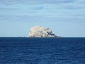
 Bass Rock from Milsey Bay - geograph.org.uk - 3545855.jpg 2.560 × 1.920; 1,98 MB
-
 Bass Rock from Milsey Bay - geograph.org.uk - 3545931.jpg 2.560 × 1.920; 1,97 MB
-
 Bass Rock from Milsey Bay, North Berwick - geograph.org.uk - 5516098.jpg 1.024 × 682; 184 KB
-
 Bass Rock from Milsey Bay, North Berwick - geograph.org.uk - 5516185.jpg 1.024 × 682; 152 KB
-
 Bass Rock from the harbour rocks - geograph.org.uk - 3545720.jpg 2.517 × 1.912; 615 KB
-
 Bass Rock from the seafront, East Bay - geograph.org.uk - 3545730.jpg 2.505 × 1.920; 1,56 MB
-
 Bass Rock from the west - geograph.org.uk - 5547607.jpg 1.024 × 767; 209 KB
-
 Bass Rock North Berwick Scotland United Kingdom (106347761).jpeg 1.200 × 675; 410 KB
-
 Beach after a storm - geograph.org.uk - 5879680.jpg 1.024 × 576; 388 KB
-
 Beach and Law - geograph.org.uk - 945222.jpg 640 × 480; 62 KB
-
 Beach at Milsey Bay North Berwick - geograph.org.uk - 5907660.jpg 2.048 × 1.536; 1,47 MB
-
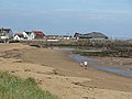 Beach at North Berwick - geograph.org.uk - 1327937.jpg 640 × 480; 65 KB
-
 Beach at North Berwick - geograph.org.uk - 3752060.jpg 1.024 × 678; 184 KB
-
 Beach at North Berwick - geograph.org.uk - 6177820.jpg 4.592 × 3.448; 2,07 MB
-
 Beach at North Berwick Bay - geograph.org.uk - 5763074.jpg 800 × 531; 121 KB
-
 Beach closeups (18377276703).jpg 4.928 × 3.264; 2,61 MB
-
 Beach closeups (18971714286).jpg 4.928 × 3.264; 1,97 MB
-
 Beach closeups (18971715146).jpg 4.928 × 3.264; 1,79 MB
-
 Beach closeups (18992509372).jpg 4.928 × 3.264; 2,37 MB
-
 Beach closeups (18992513552).jpg 4.928 × 3.264; 1,72 MB
-
 Beach closeups (18992515872).jpg 4.928 × 3.264; 2,24 MB
-
 Beach closeups (33155843790).jpg 4.946 × 3.278; 7,76 MB
-
 Beach closeups (33410892691).jpg 4.946 × 3.278; 7,41 MB
-
 Beach closeups April, 2014 - Walk along the Beach to Tantallon Castle (13893801492).jpg 4.928 × 3.264; 2,5 MB
-
 Beach closeups fungi and lichen (15974473683).jpg 4.928 × 3.264; 2,9 MB
-
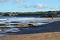
 Beach off North Berwick - geograph.org.uk - 5532531.jpg 1.024 × 683; 288 KB
-
 Beach, North Berwick - panoramio.jpg 1.280 × 960; 619 KB
-
 Beach, North Berwick Bay - geograph.org.uk - 1367996.jpg 640 × 480; 120 KB
-
 Beach, North Berwick Bay - geograph.org.uk - 945227.jpg 640 × 439; 51 KB
-
 Beach, west of North Berwick - geograph.org.uk - 5532535.jpg 1.024 × 683; 238 KB
-
 Behind the Shop - geograph.org.uk - 781205.jpg 640 × 480; 113 KB
-
 Bonnington - geograph.org.uk - 802901.jpg 640 × 480; 39 KB
-
 Bonnington Farm - geograph.org.uk - 916241.jpg 640 × 427; 147 KB
-
 Bridges, West Links - geograph.org.uk - 945210.jpg 640 × 480; 102 KB
-
 Broad Sands - geograph.org.uk - 1014813.jpg 640 × 412; 72 KB
-
 Broad Sands - geograph.org.uk - 1368003.jpg 640 × 360; 74 KB
-
 Broad Sands - geograph.org.uk - 1521901.jpg 640 × 421; 186 KB
-
 Broad Sands - geograph.org.uk - 944582.jpg 640 × 359; 39 KB
-
 Broad Sands - geograph.org.uk - 944584.jpg 640 × 359; 32 KB
-
 Broad Sands at Yellowcraig - geograph.org.uk - 1247854.jpg 640 × 480; 39 KB
-
 Broad Sands, west of North Berwick - geograph.org.uk - 1011497.jpg 640 × 426; 93 KB
-
 Bus Shelter Tescos North Berwick (13428612144).jpg 1.840 × 1.232; 616 KB
-
 Cabbages, Woodlea - geograph.org.uk - 964986.jpg 640 × 359; 79 KB
-
 Canty Bay - geograph.org.uk - 138140.jpg 640 × 480; 114 KB
-
 Car Park In North Berwick - geograph.org.uk - 1431537.jpg 640 × 480; 80 KB
-
 Carperstane - geograph.org.uk - 802894.jpg 640 × 480; 71 KB
-
 Chickweed - geograph.org.uk - 405691.jpg 622 × 640; 409 KB
-
 Clear day North Berwick.jpg 1.920 × 1.080; 666 KB
-
 Cloud over the Bass Rock (16408405609).jpg 4.670 × 2.524; 1,68 MB
-
 Coastal East Lothian , A Cold Blow at North Berwick - geograph.org.uk - 2790917.jpg 1.600 × 1.200; 246 KB
-

-
 Coastal East Lothian , Beached at North Berwick - geograph.org.uk - 3083930.jpg 1.600 × 1.200; 360 KB
-

-

-
 Coastal East Lothian , Crag 'n' Bass - geograph.org.uk - 2407904.jpg 2.560 × 1.920; 3,03 MB
-
 Coastal East Lothian , Danger Drop at North Berwick - geograph.org.uk - 2407915.jpg 2.560 × 1.920; 3,15 MB
-
 Coastal East Lothian , Darkness On The Edge of Town - geograph.org.uk - 2832751.jpg 1.600 × 1.200; 189 KB
-
 Coastal East Lothian , Fidra and The Lamb - geograph.org.uk - 2832727.jpg 1.600 × 1.200; 208 KB
-
 Coastal East Lothian , Friday Afternoon In North Berwick - geograph.org.uk - 3076732.jpg 1.600 × 1.200; 311 KB
-
 Coastal East Lothian , Getting To The Point at North Berwick - geograph.org.uk - 2407901.jpg 2.560 × 1.920; 3,18 MB
-
 Coastal East Lothian , Giant Steps at North Berwick - geograph.org.uk - 2832801.jpg 1.600 × 1.200; 197 KB
-
 Coastal East Lothian , Green Rocks, North Berwick Bay - geograph.org.uk - 2685357.jpg 1.600 × 1.200; 274 KB
-
 Coastal East Lothian , Here Comes The Orange Tractor - geograph.org.uk - 3083957.jpg 1.600 × 1.200; 444 KB
-
 Coastal East Lothian , Hi Viz At North Berwick - geograph.org.uk - 4620163.jpg 1.600 × 1.200; 386 KB
-

-

-
 Coastal East Lothian , Lasers at North Berwick - geograph.org.uk - 3077656.jpg 1.600 × 1.200; 317 KB
-
 Coastal East Lothian , Late Afternoon at North Berwick Bay - geograph.org.uk - 2138855.jpg 2.560 × 1.920; 3,04 MB
-
 Coastal East Lothian , Life's A Beach at North Berwick - geograph.org.uk - 3077680.jpg 1.600 × 1.200; 380 KB
-
 Coastal East Lothian , Low Tide at North Berwick - geograph.org.uk - 2685367.jpg 1.600 × 1.200; 244 KB
-
 Coastal East Lothian , Marine Parade, North Berwick - geograph.org.uk - 2321459.jpg 2.560 × 1.920; 2,88 MB
-
 Coastal East Lothian , Milsey Bay, North Berwick - geograph.org.uk - 2322984.jpg 2.560 × 1.920; 2,33 MB
-
 Coastal East Lothian , Moorings In North Berwick Bay - geograph.org.uk - 2685528.jpg 1.600 × 1.200; 241 KB
-

-

-
-
 Coastal East Lothian , North Berwick Bay - geograph.org.uk - 2338007.jpg 2.560 × 1.920; 2,59 MB
-
 Coastal East Lothian , North Berwick Bay - geograph.org.uk - 2685513.jpg 1.600 × 1.200; 317 KB
-

-
 Coastal East Lothian , North Berwick Harbour Lights - geograph.org.uk - 2840675.jpg 1.200 × 1.600; 300 KB
-
 Coastal East Lothian , North Berwick Seen From Milsey Bay - geograph.org.uk - 2322991.jpg 2.560 × 1.920; 2,67 MB
-
 Coastal East Lothian , North Berwick seen from the harbour - geograph.org.uk - 2321438.jpg 2.560 × 1.920; 3,19 MB
-
 Coastal East Lothian , On The Rocks at North Berwick - geograph.org.uk - 2407906.jpg 2.560 × 1.920; 3,22 MB
-
 Coastal East Lothian , On The Rocks at North Berwick - geograph.org.uk - 3075972.jpg 1.600 × 1.200; 451 KB
-
 Coastal East Lothian , Orange Friday at North Berwick - geograph.org.uk - 3083968.jpg 1.600 × 1.200; 404 KB
-

-

-

-

-
 Coastal East Lothian , Smile, Orange at North Berwick - geograph.org.uk - 2407818.jpg 2.560 × 1.920; 3,21 MB
-
 Coastal East Lothian , Still Water at North Berwick - geograph.org.uk - 2444780.jpg 2.560 × 1.920; 2,42 MB
-
 Coastal East Lothian , Stone Grooves at North Berwick - geograph.org.uk - 2790909.jpg 1.600 × 1.200; 418 KB
-
 Coastal East Lothian , The East End of North Berwick Bay - geograph.org.uk - 2407804.jpg 2.560 × 1.920; 3,2 MB
-

-

-
 Coastal East Lothian , The Sands Of North Berwick Bay - geograph.org.uk - 2407790.jpg 2.560 × 1.920; 3,21 MB
-
 Coastal East Lothian , The West End of North Berwick Bay - geograph.org.uk - 2338004.jpg 2.560 × 1.920; 3,1 MB
-
 Coastal East Lothian , Yellow Boat at North Berwick - geograph.org.uk - 3083924.jpg 1.600 × 1.200; 356 KB
-
 Coastal properties at North Berwick - geograph.org.uk - 1376883.jpg 640 × 480; 95 KB
-

-
 Cowton Rocks - geograph.org.uk - 6141117.jpg 640 × 480; 245 KB
-
 Cowton Rocks at North Berwick - geograph.org.uk - 2749414.jpg 640 × 427; 207 KB
-
 Cowton Rocks at North Berwick - geograph.org.uk - 3332264.jpg 3.264 × 2.448; 5,33 MB
-
 Cowton Rocks towards Bass Rock - geograph.org.uk - 5547627.jpg 1.024 × 768; 217 KB
-
 Cowton Rocks towards Lamb - geograph.org.uk - 5547604.jpg 1.024 × 768; 237 KB
-
 Craigleith - geograph.org.uk - 2831011.jpg 640 × 480; 54 KB
-
 Craigleith - geograph.org.uk - 3448328.jpg 640 × 480; 318 KB
-
 Craigleith - geograph.org.uk - 3448333.jpg 640 × 480; 297 KB
-
 Craigleith - geograph.org.uk - 3448345.jpg 640 × 339; 206 KB
-
 Craigleith - geograph.org.uk - 3448355.jpg 640 × 413; 233 KB
-
 Craigleith - geograph.org.uk - 3605428.jpg 640 × 480; 267 KB
-
 Craigleith and North Berwick.jpg 2.048 × 1.536; 2,09 MB
-
 Craigleith and Yacht - geograph.org.uk - 781234.jpg 640 × 394; 32 KB
-
 Craigleith from East Bay - geograph.org.uk - 3545939.jpg 2.560 × 1.920; 2,02 MB
-
 Craigleith from Milsey Bay - geograph.org.uk - 3545921.jpg 2.560 × 1.920; 2,14 MB
-
 Craigleith from Milsey Bay, North Berwick - geograph.org.uk - 5516094.jpg 1.024 × 682; 204 KB
-
 Craigleith from Milsey Bay, North Berwick - geograph.org.uk - 5516183.jpg 1.024 × 682; 129 KB
-
 Craigleith from the Rugged Knowes - geograph.org.uk - 2747854.jpg 3.264 × 2.448; 4,23 MB
-
 Csinos házak (Pretty houses) - panoramio.jpg 1.600 × 1.200; 821 KB
-
 Danger cliff drop (18992507352).jpg 4.928 × 3.264; 1,98 MB
-
 Dinghies at North Berwick - geograph.org.uk - 2951576.jpg 640 × 467; 238 KB
-
 Driftwood, North Berwick - geograph.org.uk - 5879682.jpg 1.024 × 576; 330 KB
-

-
 East Bay from the Scottish Seabird Centre - geograph.org.uk - 3545713.jpg 3.964 × 2.248; 2,79 MB
-
 East Beach, North Berwick - geograph.org.uk - 3605400.jpg 640 × 480; 274 KB
-
 East Beach, North Berwick - geograph.org.uk - 6525149.jpg 4.148 × 2.765; 3,2 MB
-
 East Links - geograph.org.uk - 964070.jpg 640 × 359; 55 KB
-

-
 East Lothian, UK - panoramio (1).jpg 3.264 × 2.448; 1,49 MB
-
 East Lothian, UK - panoramio (10).jpg 3.264 × 2.448; 1,33 MB
-
 Eastern beach, North Berwick - geograph.org.uk - 964081.jpg 640 × 480; 93 KB
-
 Eider, North Berwick - geograph.org.uk - 1367998.jpg 640 × 480; 107 KB
-
 Farm buildings at Heugh Farm - geograph.org.uk - 1034026.jpg 640 × 480; 82 KB
-
 Farmland at Bonnington - geograph.org.uk - 916198.jpg 640 × 427; 151 KB
-
 Farmland at Bonnington - geograph.org.uk - 916232.jpg 427 × 631; 170 KB
-
 Forth St, North Berwick EH39 4JD, UK - panoramio.jpg 1.408 × 1.056; 517 KB
-

-
 Galloway Pier, North Berwick - geograph.org.uk - 310663.jpg 640 × 480; 84 KB
-
 Gannet over the Coast of Craigleith - geograph.org.uk - 5422811.jpg 2.656 × 1.992; 4,67 MB
-
 Gates at Glen Golf Course - geograph.org.uk - 1463329.jpg 640 × 480; 66 KB
-
 Gilsland Fields - geograph.org.uk - 1626405.jpg 640 × 480; 96 KB
-
 Harbour - geograph.org.uk - 2443278.jpg 640 × 414; 390 KB
-
 Harbour Entrance - geograph.org.uk - 2443270.jpg 412 × 640; 392 KB
-
 Herefords, Bonnington - geograph.org.uk - 1316070.jpg 640 × 480; 101 KB
-
 Herring gulls at North Berwick - geograph.org.uk - 2951565.jpg 640 × 427; 229 KB
-
 Heugh - geograph.org.uk - 1322340.jpg 640 × 480; 110 KB
-
 High Street, North Berwick - geograph.org.uk - 1034399.jpg 640 × 480; 70 KB
-
 Houses North Berwick.jpg 640 × 480; 54 KB
-
 Houses, North Berwick - geograph.org.uk - 1500719.jpg 640 × 480; 135 KB
-
 Hummel Ridges - geograph.org.uk - 1368000.jpg 640 × 480; 72 KB
-
 Inshore Rescue Boats,North Berwick Bay - geograph.org.uk - 5516256.jpg 1.024 × 681; 144 KB
-
-
 Into the sunset (4401657387).jpg 3.648 × 2.736; 1,23 MB
-
 Island of Craigleith - geograph.org.uk - 5523675.jpg 1.024 × 683; 222 KB
-
 Jetty at North Berwick - geograph.org.uk - 3332451.jpg 3.264 × 2.448; 4,49 MB
-
 John Blackadder's tombstone, North Berwick Kirkyard.jpg 3.264 × 2.250; 1,86 MB
-
 Kayaking in Milsey Bay, North Berwick - geograph.org.uk - 5516169.jpg 1.024 × 682; 145 KB
-
 Kite flyers - geograph.org.uk - 3545774.jpg 1.920 × 2.560; 1,85 MB
-
 Kite flyers at North Berwick - geograph.org.uk - 3545768.jpg 2.560 × 1.920; 1,65 MB
-
 Kite flying, West Links - geograph.org.uk - 945220.jpg 640 × 480; 49 KB
-
 Kittiwakes (Rissa tridactyla), Craigleith - geograph.org.uk - 5516284.jpg 1.024 × 684; 234 KB
-
 Kontraszt (Contrast) - panoramio.jpg 1.200 × 1.600; 1.000 KB
-
-

-
 Lane, Woodlea - geograph.org.uk - 964987.jpg 640 × 359; 90 KB
-
 Large rock in Milsey Bay, North Berwick - geograph.org.uk - 5516175.jpg 1.024 × 682; 118 KB
-
 Law Rocks and Lamb from North Berwick harbour - geograph.org.uk - 5515780.jpg 1.024 × 681; 104 KB
-
 Lochbridge Road - geograph.org.uk - 767812.jpg 640 × 480; 91 KB
-
 Lochbridge Road, North Berwick - geograph.org.uk - 1034080.jpg 640 × 480; 60 KB
-
 Longskelly Point - geograph.org.uk - 1247883.jpg 640 × 480; 44 KB
-
 Looking across the Forth from North Berwick - geograph.org.uk - 5907670.jpg 2.048 × 1.536; 1,42 MB
-
 Looking out to Milsey Bay, North Berwick - geograph.org.uk - 2665112.jpg 640 × 480; 279 KB
-
 Lookout at North Berwick - geograph.org.uk - 2443215.jpg 640 × 416; 395 KB
-
 Low Tide at Milsey Bay North Berwick - geograph.org.uk - 6177829.jpg 4.592 × 3.448; 2,34 MB
-
 Low tide at North Berwick - geograph.org.uk - 3332442.jpg 3.264 × 2.448; 3,98 MB


.jpg)
.jpg)
.jpg)
.jpg)
_-_panoramio_-_Gyula_P%C3%A9ter.jpg)
_-_panoramio.jpg)

_-_panoramio.jpg)
_-_panoramio.jpg)


_-_panoramio.jpg)


.jpg)

.jpg)
.jpg)


.jpeg)


.jpg)
.jpg)
.jpg)
.jpg)
.jpg)
.jpg)
.jpg)
.jpg)
.jpg)
.jpg)


.jpg)


.jpg)


_-_geograph.org.uk_-_2407793.jpg)
_-_geograph.org.uk_-_2407799.jpg)


_-_panoramio.jpg)
.jpg)


.jpg)
.jpg)


.jpg)


,_Craigleith_-_geograph.org.uk_-_5516284.jpg)
_-_panoramio.jpg)
,_RP-F-F01135-CP.jpg)


