Category:North Leigh
Aller à la navigation
Aller à la recherche
localité britannique du comté anglais d'Oxfordshire  | |||||
| Téléverser des médias | |||||
| Nature de l’élément | |||||
|---|---|---|---|---|---|
| Lieu | West Oxfordshire, Oxfordshire, Angleterre du Sud-Est, Angleterre | ||||
| site officiel | |||||
 | |||||
English: North Leigh is a village and civil parish northeast of Witney in Oxfordshire. It includes the hamlet of East End.
Sous-catégories
Cette catégorie comprend 7 sous-catégories, dont les 7 ci-dessous.
E
- East End, Oxfordshire (3 F)
M
N
- North Leigh Roman Villa (76 F)
- North Leigh War Memorial (3 F)
W
- North Leigh Windmill (3 F)
Média dans la catégorie « North Leigh »
Cette catégorie comprend 187 fichiers, dont les 187 ci-dessous.
-
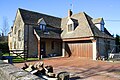
 'Hereford House', Church Road - geograph.org.uk - 5007396.jpg 1 024 × 683 ; 194 kio
-
 'Providence Cottage', New Yatt Road - geograph.org.uk - 4833190.jpg 1 024 × 683 ; 276 kio
-
 A poppy by the Roman Villa - geograph.org.uk - 3628380.jpg 2 700 × 1 798 ; 335 kio
-
 A small white butterfly on brambles - geograph.org.uk - 3611489.jpg 1 169 × 1 500 ; 196 kio
-
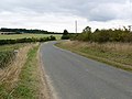
 A4095 approaching Common Road turn into North Leigh - geograph.org.uk - 4823917.jpg 1 024 × 683 ; 248 kio
-
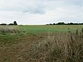
 Arable fields by Ashford Mill Farm - geograph.org.uk - 3615363.jpg 1 500 × 999 ; 245 kio
-
 Ashford Bridge over River Evenlode - geograph.org.uk - 4247372.jpg 1 024 × 683 ; 240 kio
-
 Belclose Cottage - geograph.org.uk - 5007688.jpg 670 × 1 024 ; 213 kio
-
 Bench by the footpath - geograph.org.uk - 3611425.jpg 1 500 × 999 ; 282 kio
-
 Benchmark on 'Hereford House' - geograph.org.uk - 5007389.jpg 1 024 × 683 ; 325 kio
-
 Benchmark on Belclose Cottage - geograph.org.uk - 5007668.jpg 671 × 1 024 ; 295 kio
-
 Benchmark on North Leigh trig point - geograph.org.uk - 4833228.jpg 667 × 1 024 ; 232 kio
-
 Benchmark on Paddock House outbuilding - geograph.org.uk - 4991326.jpg 1 024 × 683 ; 308 kio
-
 Benchmark on pump house beside A4095 - geograph.org.uk - 5007727.jpg 683 × 1 024 ; 247 kio
-
 Benchmark on St Mary's Church - geograph.org.uk - 5007433.jpg 683 × 1 024 ; 240 kio
-
 Benchmark on the east parapet of Ashford Bridge - geograph.org.uk - 4247334.jpg 683 × 1 024 ; 318 kio
-
 Benchmark on the Methodist Chapel - geograph.org.uk - 4923765.jpg 683 × 1 024 ; 266 kio
-
 Benchmark on ^1 New Yatt Road - geograph.org.uk - 4833284.jpg 683 × 1 024 ; 256 kio
-
 Benchmark on ^36 Common Road - geograph.org.uk - 5007523.jpg 655 × 1 024 ; 168 kio
-
 Benchmark on ^6 Common Road - geograph.org.uk - 4923822.jpg 659 × 1 024 ; 244 kio
-
 Benchmarked milestone beside A4095 east of North Leigh - geograph.org.uk - 4823942.jpg 683 × 1 024 ; 245 kio
-
 Between North Leigh and Stonesfield - geograph.org.uk - 6104292.jpg 5 472 × 3 648 ; 2,75 Mio
-
 Bridge over the River Evenlode - geograph.org.uk - 2772102.jpg 640 × 480 ; 75 kio
-
 Bridgefield Barn - geograph.org.uk - 4247447.jpg 1 024 × 683 ; 225 kio
-
 Bridgefield Bridge and minor road junction - geograph.org.uk - 4247553.jpg 1 024 × 683 ; 161 kio
-
 Bridleway to Holly Court Farm - geograph.org.uk - 2337354.jpg 640 × 480 ; 65 kio
-
 Bridleway to Stonesfield - geograph.org.uk - 3611461.jpg 1 500 × 999 ; 341 kio
-
 Common Farm, Common Road - geograph.org.uk - 5007642.jpg 1 024 × 654 ; 141 kio
-
 Cottage on north side of New Yatt Road - geograph.org.uk - 4833373.jpg 1 024 × 683 ; 211 kio
-
 Crossroads at Wilcote - geograph.org.uk - 1104283.jpg 640 × 427 ; 97 kio
-
 Culvert for stream under Church Road - geograph.org.uk - 5007490.jpg 683 × 1 024 ; 323 kio
-
 Dancers at The Masons Arms - geograph.org.uk - 5775783.jpg 5 472 × 3 648 ; 3,15 Mio
-
 East Gate - geograph.org.uk - 3207049.jpg 640 × 427 ; 217 kio
-

-
 Evening Sunlight at North Leigh - geograph.org.uk - 5775800.jpg 4 496 × 2 520 ; 1,01 Mio
-
-
 Farmland near North Leigh - geograph.org.uk - 6104027.jpg 5 472 × 3 648 ; 6,98 Mio
-
 Fields near Wilcote - geograph.org.uk - 3423190.jpg 2 592 × 1 944 ; 1,56 Mio
-
 Fields south of Stonesfield - geograph.org.uk - 3423264.jpg 2 592 × 1 944 ; 1,63 Mio
-
 Footbridge over Evenlode during flood - geograph.org.uk - 2668436.jpg 1 600 × 1 200 ; 495 kio
-
 Footpath between the houses - geograph.org.uk - 3611443.jpg 1 500 × 999 ; 272 kio
-
 Footpath by Holly Court Farm - geograph.org.uk - 2772138.jpg 640 × 480 ; 112 kio
-
 Footpath entering East End - geograph.org.uk - 2772122.jpg 640 × 480 ; 88 kio
-
 Footpath from the Wychwood Way to East End - geograph.org.uk - 2831610.jpg 640 × 480 ; 89 kio
-
 Footpath on the common - geograph.org.uk - 3611427.jpg 1 500 × 999 ; 373 kio
-
 Footpath to Ramsden - geograph.org.uk - 2777561.jpg 640 × 480 ; 68 kio
-
 Footpath-road junction south of Stonesfield - geograph.org.uk - 4247275.jpg 1 024 × 683 ; 153 kio
-
 Foundations of the North Leigh Roman Villa - geograph.org.uk - 3628297.jpg 1 500 × 999 ; 341 kio
-
 Foundations of the North Leigh Roman Villa - geograph.org.uk - 3628361.jpg 1 500 × 999 ; 365 kio
-
 Foundations of the North Leigh Roman Villa - geograph.org.uk - 3628370.jpg 1 500 × 999 ; 343 kio
-
 Grassland on North Leigh Common - geograph.org.uk - 3611421.jpg 1 500 × 999 ; 174 kio
-
 Houses on Common Road - geograph.org.uk - 5007533.jpg 1 024 × 669 ; 162 kio
-
 Interior of St Peter, Wilcote looking east - geograph.org.uk - 5557696.jpg 640 × 360 ; 36 kio
-
 Junction below Ashford Mill Cottages - geograph.org.uk - 2772164.jpg 640 × 480 ; 88 kio
-
 Kissing gate by the Roman Villa - geograph.org.uk - 3628385.jpg 1 500 × 999 ; 329 kio
-
 Kissing gate on the footpath - geograph.org.uk - 3626779.jpg 1 500 × 999 ; 271 kio
-
 Lady Well Spring - geograph.org.uk - 2772158.jpg 640 × 480 ; 80 kio
-
 Looking over the Evenlode valley - geograph.org.uk - 3611484.jpg 1 500 × 999 ; 267 kio
-
 Lords and ladies by the bridleway - geograph.org.uk - 3628394.jpg 1 027 × 1 500 ; 140 kio
-
 Masons Arms, 5 Park Road, North Leigh, near Witney, Oxon - geograph.org.uk - 4598487.jpg 1 024 × 678 ; 157 kio
-
 Meadows near Stonesfield - geograph.org.uk - 2831634.jpg 640 × 480 ; 46 kio
-
 Methodist Chapel, Chapel Lane - geograph.org.uk - 4923772.jpg 1 024 × 683 ; 183 kio
-
 Middle Lodge - geograph.org.uk - 3207065.jpg 640 × 427 ; 216 kio
-
 Minor road to Ashford Bridge, East End, Witney - geograph.org.uk - 1515021.jpg 640 × 480 ; 155 kio
-

-
 Near Little Green Farm - geograph.org.uk - 3207060.jpg 640 × 427 ; 202 kio
-
 Railway cutting - geograph.org.uk - 406591.jpg 480 × 640 ; 125 kio
-
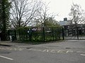 North Leigh C. of E. primary School - geograph.org.uk - 2327371.jpg 640 × 480 ; 99 kio
-
 North Leigh Garden Centre - geograph.org.uk - 1459912.jpg 640 × 427 ; 78 kio
-
 North Leigh Memorial Hall - geograph.org.uk - 2327365.jpg 640 × 480 ; 66 kio
-
 North Leigh Roman Villa - geograph.org.uk - 3628303.jpg 1 500 × 999 ; 307 kio
-
 North Leigh Roman Villa - geograph.org.uk - 3628352.jpg 1 500 × 999 ; 315 kio
-
 North Leigh Roman Villa - geograph.org.uk - 5141696.jpg 1 024 × 683 ; 294 kio
-
 North Leigh Roman Villa - geograph.org.uk - 5141751.jpg 1 024 × 683 ; 345 kio
-
 North Leigh Roman Villa - geograph.org.uk - 5141756.jpg 1 024 × 683 ; 286 kio
-
 North Leigh Roman Villa from above - geograph.org.uk - 3340287.jpg 1 600 × 1 066 ; 152 kio
-
 North Leigh Roman Villa from the bridleway - geograph.org.uk - 3611491.jpg 1 500 × 999 ; 216 kio
-
 North Leigh trig point beside muddy footpath - geograph.org.uk - 4833242.jpg 1 024 × 683 ; 357 kio
-
 North Leigh Windmill - geograph.org.uk - 5775796.jpg 4 414 × 3 136 ; 1,94 Mio
-

-
 North Leigh, Common Road - geograph.org.uk - 2017075.jpg 1 024 × 768 ; 244 kio
-
 North Leigh, Cuckoo Lane - geograph.org.uk - 5196333.jpg 3 428 × 2 220 ; 7,32 Mio
-
 North Leigh, St. Mary's Church - geograph.org.uk - 5201725.jpg 3 678 × 2 456 ; 4,88 Mio
-
 North Leigh, St. Mary's Church southern aspect - geograph.org.uk - 5206502.jpg 4 860 × 3 101 ; 7,41 Mio
-

-
 North Leigh, St. Mary's Church, Fan vaulted Wilcote Chapel - geograph.org.uk - 5206514.jpg 4 486 × 2 504 ; 5,74 Mio
-
 North Leigh, St. Mary's Church, Fan vaulted Wilcote Chapel - geograph.org.uk - 5206524.jpg 3 575 × 2 359 ; 4,74 Mio
-
 North Leigh, St. Mary's Church, Fan vaulted Wilcote Chapel - geograph.org.uk - 5206527.jpg 3 172 × 2 015 ; 3,5 Mio
-

-

-

-

-

-

-

-
 North Lodge of Eynsham Hall - geograph.org.uk - 321156.jpg 640 × 480 ; 90 kio
-
 NorthLeigh WindmillCottage MasonsArms.jpg 1 280 × 565 ; 320 kio
-
 Old vicarage and St Mary's, North Leigh - geograph.org.uk - 5357657.jpg 640 × 360 ; 61 kio
-
 Paddock House outbuilding, New Yatt Road - geograph.org.uk - 4991394.jpg 1 024 × 666 ; 154 kio
-

-
 Path by Wilcote Grange - geograph.org.uk - 2772162.jpg 640 × 480 ; 116 kio
-
 Paths on North Leigh Common - geograph.org.uk - 1013794.jpg 640 × 480 ; 74 kio
-
 Perrot aisle detail, St Mary's, North Leigh - geograph.org.uk - 5357665.jpg 360 × 640 ; 46 kio
-
 Perrotts Hill Farm, North Leigh - panoramio.jpg 2 500 × 1 875 ; 2,96 Mio
-
 Pump house beside A4095 south of North Leigh - geograph.org.uk - 5007784.jpg 1 024 × 683 ; 276 kio
-
 Railway Bridge near Combe - geograph.org.uk - 1950778.jpg 3 648 × 2 736 ; 3,03 Mio
-
 Railway bridge over the Evenlode - geograph.org.uk - 2831628.jpg 640 × 480 ; 44 kio
-
 River Evenlode - geograph.org.uk - 2979119.jpg 2 007 × 1 334 ; 1 018 kio
-
 Road junction near Stonesfield - geograph.org.uk - 1056987.jpg 640 × 426 ; 69 kio
-
 Road out of Wilcote - geograph.org.uk - 1982541.jpg 640 × 480 ; 95 kio
-
 Road to Ashford Bridge - geograph.org.uk - 1982547.jpg 640 × 480 ; 118 kio
-
 Road to Wilcote - geograph.org.uk - 2337343.jpg 640 × 480 ; 65 kio
-
 Road to Wilcote Manor - geograph.org.uk - 6105962.jpg 5 162 × 3 642 ; 4,9 Mio
-
 Roman Ruins, North Leigh - geograph.org.uk - 2790732.jpg 1 600 × 1 200 ; 647 kio
-
 Roman Villa at North Leigh - geograph.org.uk - 2790720.jpg 1 600 × 1 200 ; 625 kio
-
 Shallows on the Evenlode - geograph.org.uk - 1950764.jpg 3 648 × 2 736 ; 2,63 Mio
-
 South side of St Peter, Wilcote - geograph.org.uk - 5557703.jpg 640 × 360 ; 80 kio
-
 St Mary's Church - geograph.org.uk - 5007454.jpg 683 × 1 024 ; 179 kio
-
 St Mary's Church - geograph.org.uk - 5007460.jpg 1 024 × 683 ; 169 kio
-
 St Mary's church, North Leigh - geograph.org.uk - 5357712.jpg 640 × 360 ; 67 kio
-
 St Mary's North Leigh, view west - geograph.org.uk - 5357704.jpg 360 × 640 ; 46 kio
-
 St Mary's, North Leigh - geograph.org.uk - 5357691.jpg 640 × 360 ; 53 kio
-
 St Mary's, North Leigh from the north-west - geograph.org.uk - 5357707.jpg 640 × 360 ; 66 kio
-
 St Mary's, North Leigh, east elevation - geograph.org.uk - 5357715.jpg 640 × 360 ; 72 kio
-
 St Mary, North Leigh, view east - geograph.org.uk - 5357681.jpg 640 × 360 ; 46 kio
-
 St Peter's church, Wilcote - geograph.org.uk - 3423204.jpg 2 592 × 1 944 ; 1,4 Mio
-
 St Peter's church, Wilcote - geograph.org.uk - 3423221.jpg 2 592 × 1 944 ; 2,08 Mio
-
 Stables near East End - geograph.org.uk - 3611469.jpg 1 500 × 999 ; 285 kio
-
 Stone Wall with Daffodils - geograph.org.uk - 6104339.jpg 4 898 × 3 642 ; 3,08 Mio
-
 Sturt Copse - geograph.org.uk - 2831620.jpg 640 × 480 ; 131 kio
-
 The A4095 to Witney - geograph.org.uk - 3955489.jpg 1 800 × 917 ; 148 kio
-
 The A4095 to Witney - geograph.org.uk - 3955493.jpg 1 800 × 910 ; 171 kio
-
 The bridleway to Stonesfield - geograph.org.uk - 3628388.jpg 999 × 1 500 ; 381 kio
-
 The Cotswold Line from Grintleyhill Bridge - geograph.org.uk - 2831586.jpg 640 × 480 ; 53 kio
-
 The footpath to Combe - geograph.org.uk - 3628373.jpg 1 500 × 999 ; 303 kio
-
 The footpath to Combe - geograph.org.uk - 3628377.jpg 1 500 × 999 ; 222 kio
-
 The line heading to Combe - geograph.org.uk - 2772110.jpg 640 × 480 ; 69 kio
-
 The Masons Arms, North Leigh - geograph.org.uk - 2337319.jpg 640 × 480 ; 53 kio
-
 The mosaic at the North Leigh Roman Villa - geograph.org.uk - 3628359.jpg 1 500 × 999 ; 171 kio
-
 The mosaic shed at North Leigh Roman Villa - geograph.org.uk - 3628366.jpg 1 500 × 999 ; 225 kio
-
 The Perrot Aisle in St Mary's, North Leigh - geograph.org.uk - 5357663.jpg 640 × 360 ; 52 kio
-
 The River Evenlode - geograph.org.uk - 3423234.jpg 2 592 × 1 944 ; 2,06 Mio
-

-
 The road past Ashford Mill Cottages - geograph.org.uk - 3615362.jpg 1 500 × 999 ; 248 kio
-
 The road past Bridewell Farm Cottages - geograph.org.uk - 3615366.jpg 1 500 × 999 ; 328 kio
-
 The road through East End - geograph.org.uk - 3611435.jpg 1 500 × 999 ; 187 kio
-
 The road to Stonesfield - geograph.org.uk - 3423241.jpg 2 592 × 1 944 ; 1,42 Mio
-
 The road to Wilcote Manor - geograph.org.uk - 1720175.jpg 1 500 × 965 ; 232 kio
-
 The Wilcote Chapel, St Mary's, North Leigh - geograph.org.uk - 5357661.jpg 360 × 640 ; 56 kio
-
 The Woodman, North Leigh - geograph.org.uk - 2337328.jpg 640 × 480 ; 56 kio
-
 Threatening Skies over New Yatt Farm - geograph.org.uk - 5066280.jpg 640 × 360 ; 59 kio
-
 Towards Bridewell Farm - geograph.org.uk - 6104282.jpg 5 472 × 3 648 ; 3,47 Mio
-
 Towards North Leigh Church - geograph.org.uk - 6104040.jpg 1 600 × 1 067 ; 495 kio
-
 Track from East End to Abel Wood - geograph.org.uk - 2831615.jpg 640 × 480 ; 57 kio
-
 Track up to ^6 and ^6a Common Road - geograph.org.uk - 4923839.jpg 1 024 × 683 ; 192 kio
-
 Traditional Hedge Laying at Bridewell Farm - geograph.org.uk - 6104304.jpg 5 472 × 3 648 ; 3,58 Mio
-
 View from a Didcot-Worcester train - Bridgefield Brake - geograph.org.uk - 5550084.jpg 1 600 × 1 200 ; 530 kio
-

-

-

-
 Vineyard at Bridewell Farm - geograph.org.uk - 6104301.jpg 4 690 × 3 100 ; 2,92 Mio
-
 Whitehill Bridge - geograph.org.uk - 2979075.jpg 3 008 × 2 000 ; 3,09 Mio
-
 Wilcote Manor - geograph.org.uk - 6105936.jpg 4 143 × 2 538 ; 2,63 Mio
-
 Woodland beside A4095 opposite North Leigh Business Park - geograph.org.uk - 4823967.jpg 1 024 × 683 ; 370 kio
-
 Wychwood Way - geograph.org.uk - 5667026.jpg 640 × 480 ; 142 kio
-
 Wychwood Way - geograph.org.uk - 5667083.jpg 640 × 480 ; 74 kio
-
 Wychwood Way - geograph.org.uk - 5667092.jpg 640 × 480 ; 146 kio
-
 Clear footpath - geograph.org.uk - 413676.jpg 640 × 480 ; 94 kio
-
 Cottage - geograph.org.uk - 401272.jpg 640 × 480 ; 107 kio
-
 Cottages near Yockletts Farm - geograph.org.uk - 389819.jpg 640 × 480 ; 120 kio
-
 Cuckoo Lane towards sunset - geograph.org.uk - 321171.jpg 640 × 480 ; 136 kio
-
 Dean Farm - geograph.org.uk - 389822.jpg 640 × 480 ; 77 kio
-
 Doghouse Farm - geograph.org.uk - 413679.jpg 640 × 480 ; 94 kio
-
 Gate to footpath - geograph.org.uk - 395495.jpg 640 × 480 ; 130 kio
-
 Green Farm - geograph.org.uk - 103816.jpg 640 × 480 ; 32 kio
-
 Hill Farm, from the bridge over the A40 - geograph.org.uk - 349806.jpg 640 × 427 ; 86 kio
-
 Home Farm, New Yatt - geograph.org.uk - 319397.jpg 640 × 480 ; 80 kio
-
 Ittinge Farm - geograph.org.uk - 389823.jpg 640 × 480 ; 83 kio
-
 Lodgehill Clump - geograph.org.uk - 395496.jpg 640 × 480 ; 122 kio
-
 Looking North - geograph.org.uk - 92025.jpg 640 × 481 ; 66 kio
-
 Nurseries at North Leigh - geograph.org.uk - 336884.jpg 640 × 480 ; 85 kio
-
 Old A40 at sunset - geograph.org.uk - 321180.jpg 640 × 480 ; 98 kio
-
 The A40 between Witney and Barnard Gate - geograph.org.uk - 349808.jpg 640 × 449 ; 101 kio
-
 The Boot Inn - geograph.org.uk - 321177.jpg 640 × 480 ; 92 kio
-
 The edge of the estate - geograph.org.uk - 401274.jpg 640 × 480 ; 115 kio
-

-
 ^1 New Yatt Road - geograph.org.uk - 4833318.jpg 1 024 × 683 ; 195 kio


_from_Drakes_Lane_-_geograph.org.uk_-_4923803.jpg)


