Category:North Muskham
Aller à la navigation
Aller à la recherche
English: North Muskham is a village located between the River Trent and the A1 road near Newark-upon-Trent, in Nottinghamshire, England. It is close to the border with Lincolnshire.The village appears in the Domesday Book as Muscham. There is a medieval parish church dedicated to St Wilfrid.
village britannique  | |||||
| Téléverser des médias | |||||
| Nature de l’élément | |||||
|---|---|---|---|---|---|
| Lieu | Newark and Sherwood, Nottinghamshire, Midlands de l'Est, Angleterre | ||||
| Réputé identique à | North Muskham (page en doublon, paroisse civile) | ||||
 | |||||
Sous-catégories
Cette catégorie comprend seulement la sous-catégorie ci-dessous.
W
Média dans la catégorie « North Muskham »
Cette catégorie comprend 181 fichiers, dont les 181 ci-dessous.
-
 45km navigation post - geograph.org.uk - 3917979.jpg 1 024 × 768 ; 157 kio
-
 66166 , North Muskham.jpg 3 000 × 2 048 ; 5,53 Mio
-
 A1 - approaching exit for North Muskham - geograph.org.uk - 2643468.jpg 640 × 428 ; 90 kio
-
 A1 - junction for B6325 - geograph.org.uk - 4397545.jpg 640 × 428 ; 99 kio
-
 A1 approaching Cromwell - geograph.org.uk - 2643445.jpg 640 × 428 ; 87 kio
-
 A1 at North Muskham - geograph.org.uk - 4095137.jpg 1 280 × 960 ; 278 kio
-
 A1 north - geograph.org.uk - 5158973.jpg 1 024 × 683 ; 177 kio
-
 A1 northbound - geograph.org.uk - 3768750.jpg 640 × 399 ; 41 kio
-
 A1 northbound - geograph.org.uk - 3768756.jpg 640 × 503 ; 45 kio
-
 A1 northbound - geograph.org.uk - 4960437.jpg 1 956 × 1 188 ; 1,32 Mio
-
 A1 southbound - geograph.org.uk - 4029664.jpg 800 × 533 ; 53 kio
-
 A1 Southbound North Muskham flyover - geograph.org.uk - 1327393.jpg 640 × 480 ; 40 kio
-
 A1, northbound - geograph.org.uk - 3195206.jpg 640 × 375 ; 33 kio
-
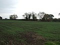
 Abandoned field - geograph.org.uk - 3917972.jpg 1 024 × 768 ; 159 kio
-
 Above Cromwell Lock - geograph.org.uk - 3161601.jpg 640 × 427 ; 175 kio
-
 Across the Trent - geograph.org.uk - 590638.jpg 640 × 427 ; 48 kio
-
 Approaching Cromwell Lock - geograph.org.uk - 2760917.jpg 3 648 × 2 736 ; 2,55 Mio
-
 Arable land south of Cromwell - geograph.org.uk - 2760571.jpg 3 648 × 2 736 ; 3,38 Mio
-
 B6325 exit from A1 - geograph.org.uk - 2643486.jpg 640 × 428 ; 88 kio
-
 Bathley Lane Crossing and signal box - geograph.org.uk - 4094757.jpg 1 280 × 863 ; 248 kio
-
 Bathley Lane SB ECML.jpg 5 059 × 3 529 ; 2,03 Mio
-
 Bathley Lane signal box - geograph.org.uk - 2780573.jpg 3 648 × 2 736 ; 2,32 Mio
-
 Bench mark, North Muskham Church - geograph.org.uk - 4094783.jpg 960 × 1 280 ; 417 kio
-
 Boat on the R Trent, N of Holme - geograph.org.uk - 4754319.jpg 1 024 × 768 ; 198 kio
-

-
 Cattle watering by the River Trent - geograph.org.uk - 4094928.jpg 1 280 × 824 ; 287 kio
-
 Church gates at St Wilfrid's - geograph.org.uk - 3229100.jpg 3 648 × 2 736 ; 3,44 Mio
-
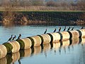 Cormorants - geograph.org.uk - 4303287.jpg 1 024 × 768 ; 234 kio
-
 Cormorants at Cromwell Lock - geograph.org.uk - 2770536.jpg 3 648 × 2 736 ; 1,65 Mio
-
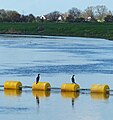 Cormorants on a boom - geograph.org.uk - 5123937.jpg 752 × 800 ; 133 kio
-
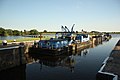
 Cromwell Lock - 1 - geograph.org.uk - 2760937.jpg 3 648 × 2 736 ; 2,53 Mio
-
 Cromwell Lock - geograph.org.uk - 3052456.jpg 640 × 427 ; 89 kio
-
 Cromwell Lock - geograph.org.uk - 3052462.jpg 640 × 427 ; 59 kio
-
 Cromwell Lock - geograph.org.uk - 4303257.jpg 1 024 × 768 ; 181 kio
-
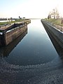
 Cromwell Lock and Weir - geograph.org.uk - 152301.jpg 640 × 428 ; 107 kio
-
 Cromwell Lock approach - geograph.org.uk - 3050566.jpg 640 × 427 ; 92 kio
-
 Cromwell Lock approach - geograph.org.uk - 4303259.jpg 768 × 1 024 ; 160 kio
-
 Cromwell weir - geograph.org.uk - 2343132.jpg 640 × 427 ; 57 kio
-
 Cromwell Weir - geograph.org.uk - 3160759.jpg 640 × 427 ; 166 kio
-
 Cromwell Weir - Nottinghamshire (Geograph 2561867 by Jonathan Thacker).jpg 1 024 × 768 ; 200 kio
-
 Cromwell Weir and Lock - geograph.org.uk - 4847223.jpg 800 × 600 ; 145 kio
-
 Cromwell Weir on the River Trent - geograph.org.uk - 5125183.jpg 800 × 535 ; 160 kio
-
 Crossing keeper's cottage, Bathley Lane - geograph.org.uk - 4094768.jpg 1 280 × 960 ; 460 kio
-
 Curving northwards - geograph.org.uk - 4094762.jpg 1 280 × 910 ; 229 kio
-
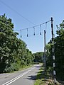
 Cycle lane by the A1 - geograph.org.uk - 3321769.jpg 640 × 427 ; 73 kio
-
 Cycle path blocked - geograph.org.uk - 6119195.jpg 1 024 × 683 ; 166 kio
-
 East Coast main railway line crossing North Muskham - geograph.org.uk - 3383721.jpg 1 024 × 630 ; 82 kio
-
 Entering North Muskham - geograph.org.uk - 4791465.jpg 3 696 × 2 448 ; 2,12 Mio
-
 Farmland between the ECML and A1 - geograph.org.uk - 4231057.jpg 640 × 349 ; 32 kio
-
 Farmland near the A1 - geograph.org.uk - 2659419.jpg 800 × 600 ; 53 kio
-
 Farmland, Mousehole Corner - geograph.org.uk - 2692552.jpg 640 × 480 ; 69 kio
-
 Ferry Lane in North Muskham - geograph.org.uk - 2655412.jpg 3 648 × 2 736 ; 2,27 Mio
-
 Footpath to the Trent - geograph.org.uk - 3918136.jpg 1 024 × 768 ; 143 kio
-
 Former Crown Inn - geograph.org.uk - 4173931.jpg 1 024 × 683 ; 160 kio
-
 Garden of the Muskham Ferry - geograph.org.uk - 2695826.jpg 3 648 × 2 736 ; 2,37 Mio
-
 Gauging cableway over the Trent - geograph.org.uk - 1120321.jpg 640 × 480 ; 55 kio
-
 Grazing land, North Muskham - geograph.org.uk - 2659410.jpg 1 600 × 995 ; 230 kio
-
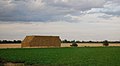 Hay bales - geograph.org.uk - 4231060.jpg 640 × 353 ; 30 kio
-
 Holme from across the Trent - geograph.org.uk - 3917982.jpg 1 024 × 768 ; 140 kio
-
 Holme Holme and Holme Church - geograph.org.uk - 4094949.jpg 1 280 × 960 ; 411 kio
-
 Jingle bells - geograph.org.uk - 4094759.jpg 960 × 1 280 ; 313 kio
-
 Junction to Bathley - geograph.org.uk - 4095154.jpg 1 280 × 960 ; 331 kio
-
 Lodge Farm next to the River Trent - geograph.org.uk - 5123884.jpg 682 × 800 ; 116 kio
-
 Main Street at North Muskham - geograph.org.uk - 2695797.jpg 3 501 × 2 634 ; 3,18 Mio
-
 Main Street, North Muskham - geograph.org.uk - 4095100.jpg 1 280 × 960 ; 406 kio
-
 Mill Lane Farm by the A1 - geograph.org.uk - 2405431.jpg 640 × 430 ; 26 kio
-
 Mousehole Corner - geograph.org.uk - 2525152.jpg 640 × 427 ; 92 kio
-
 Muskham Lake in winter - geograph.org.uk - 2991323.jpg 3 648 × 2 736 ; 3,16 Mio
-
 Muskham Services (A1 Southbound) - geograph.org.uk - 4932315.jpg 640 × 480 ; 409 kio
-

-
 Narrowboat "Muskham Lady" - geograph.org.uk - 4847176.jpg 800 × 600 ; 152 kio
-
 Nelson Lane North Muskham - geograph.org.uk - 1280382.jpg 640 × 480 ; 59 kio
-
 New housing at Holme - geograph.org.uk - 2715228.jpg 3 648 × 2 736 ; 2,82 Mio
-
 North Muskham - gravestones and Trent floodplain - geograph.org.uk - 1955429.jpg 1 600 × 1 200 ; 464 kio
-
 North Muskham - view across River Trent - geograph.org.uk - 1955426.jpg 1 600 × 1 200 ; 399 kio
-
 North Muskham cross - geograph.org.uk - 2533336.jpg 480 × 640 ; 131 kio
-
 North Muskham Cross - geograph.org.uk - 4095129.jpg 1 280 × 960 ; 584 kio
-
 North Muskham Lake Nature Reserve - 1 - geograph.org.uk - 2715242.jpg 3 648 × 2 736 ; 3,57 Mio
-
 North Muskham Lake Nature Reserve - 2 - geograph.org.uk - 2715322.jpg 3 648 × 2 736 ; 3,07 Mio
-
 North Muskham Methodist Church - geograph.org.uk - 1451666.jpg 640 × 426 ; 88 kio
-
 North Muskham near the River Trent - geograph.org.uk - 5123549.jpg 800 × 554 ; 122 kio
-
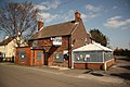
 North Muskham Services - geograph.org.uk - 1450060.jpg 640 × 426 ; 53 kio
-
 North Muskham slipway - geograph.org.uk - 4094941.jpg 1 280 × 1 280 ; 563 kio
-
 North Road Farm - geograph.org.uk - 2359252.jpg 640 × 430 ; 36 kio
-
 North Road Farm - geograph.org.uk - 2405435.jpg 640 × 216 ; 19 kio
-
 North Road Farm - geograph.org.uk - 4231046.jpg 640 × 311 ; 32 kio
-
 North Road Farm - geograph.org.uk - 4231051.jpg 640 × 430 ; 50 kio
-
 Northbound A1 - geograph.org.uk - 4929821.jpg 640 × 427 ; 308 kio
-
 Northbound A1 near to North Muskham - geograph.org.uk - 4932334.jpg 640 × 427 ; 291 kio
-
 Northbound A1, Sign for Cromwell Services - geograph.org.uk - 4929840.jpg 640 × 427 ; 329 kio
-
 Northroad Farm - houses - geograph.org.uk - 6271835.jpg 1 024 × 512 ; 165 kio
-
 Norwell Crossing, North Muskham - geograph.org.uk - 4095144.jpg 1 280 × 960 ; 270 kio
-
 Norwell Crossing, North Muskham - geograph.org.uk - 4095150.jpg 1 280 × 960 ; 418 kio
-
 Once upon a time there was a ferry here. - geograph.org.uk - 4813265.jpg 3 072 × 1 728 ; 1,85 Mio
-
 Open land north of North Muskham - geograph.org.uk - 2715233.jpg 3 648 × 2 736 ; 3,91 Mio
-
 Ordnance Survey Cut Mark - geograph.org.uk - 4982728.jpg 640 × 507 ; 92 kio
-
 Ploughed and planted field by the A1 - geograph.org.uk - 3995919.jpg 3 872 × 2 592 ; 2,73 Mio
-
 Potato field by North Muskham - geograph.org.uk - 3996048.jpg 3 872 × 2 592 ; 4,57 Mio
-
 Potato field near North Muskham - geograph.org.uk - 3996031.jpg 3 872 × 2 592 ; 4,42 Mio
-
 Public footpath at the back of St Wilfrid's Church - geograph.org.uk - 3229112.jpg 3 491 × 2 663 ; 2,72 Mio
-
 Pylons near North Muskham - geograph.org.uk - 3383427.jpg 1 024 × 768 ; 112 kio
-
 Remote back scratcher - geograph.org.uk - 4812517.jpg 3 072 × 1 728 ; 1,45 Mio
-
 River Trent - geograph.org.uk - 2533340.jpg 480 × 640 ; 116 kio
-
 River Trent - geograph.org.uk - 3742690.jpg 800 × 533 ; 143 kio
-
 River Trent - geograph.org.uk - 3742693.jpg 800 × 533 ; 70 kio
-
 River Trent - geograph.org.uk - 4303279.jpg 1 024 × 768 ; 149 kio
-
 River Trent - geograph.org.uk - 590654.jpg 640 × 427 ; 63 kio
-
 River Trent at Holme - geograph.org.uk - 4813230.jpg 3 072 × 1 728 ; 3,37 Mio
-
 River Trent at North Muskham - geograph.org.uk - 2695804.jpg 3 648 × 2 736 ; 2,68 Mio
-
 River Trent at North Muskham - geograph.org.uk - 3742682.jpg 800 × 533 ; 152 kio
-
 River Trent at North Muskham - geograph.org.uk - 4094920.jpg 1 280 × 960 ; 527 kio
-
 River Trent from garden of The Muskham Ferry, North Muskham - geograph.org.uk - 4825444.jpg 3 072 × 1 728 ; 1,24 Mio
-
 River Trent in flood - geograph.org.uk - 6119203.jpg 1 024 × 683 ; 99 kio
-
 River Trent in flood - geograph.org.uk - 6119205.jpg 1 024 × 683 ; 82 kio
-
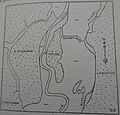 River Trent map (02).jpg 1 792 × 1 716 ; 453 kio
-
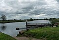
 River Trent near Cromwell Lock and weir - geograph.org.uk - 5123928.jpg 800 × 552 ; 93 kio
-
 Safe cycling - geograph.org.uk - 1450054.jpg 640 × 426 ; 72 kio
-
 Sign along the River Trent - geograph.org.uk - 5123960.jpg 800 × 600 ; 117 kio
-
 Sign on the Trent river bank - geograph.org.uk - 5123923.jpg 800 × 553 ; 109 kio
-
 Snow figures at Corner Cottage - geograph.org.uk - 2991298.jpg 3 648 × 2 736 ; 2,72 Mio
-
 Snowy day at the Muskham Ferry - geograph.org.uk - 2991259.jpg 3 523 × 2 656 ; 2,45 Mio
-
 Southbound A1 - geograph.org.uk - 4929810.jpg 640 × 480 ; 392 kio
-
 Southbound A1 near to North Muskham - geograph.org.uk - 4932338.jpg 640 × 480 ; 367 kio
-
 Southbound A1, Exit and Bridge at North Muskham - geograph.org.uk - 4932323.jpg 640 × 480 ; 297 kio
-
 Southbound A1, Layby near North Muskham - geograph.org.uk - 4929816.jpg 640 × 427 ; 321 kio
-
 St Wilfrid's Church, North Muskham - geograph.org.uk - 5833485.jpg 1 600 × 1 200 ; 693 kio
-
 Swans on the Trent - geograph.org.uk - 2695816.jpg 3 450 × 2 548 ; 2,06 Mio
-
 The A1 approaching North Muskham - geograph.org.uk - 2741046.jpg 3 648 × 2 736 ; 3,16 Mio
-
 The A1 at North Muskham, from the railway - geograph.org.uk - 4712914.jpg 1 600 × 670 ; 109 kio
-
 The A1 south of Cromwell - geograph.org.uk - 2760574.jpg 3 648 × 2 736 ; 2,46 Mio
-
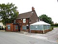
 The Crown Inn - geograph.org.uk - 1451668.jpg 640 × 426 ; 68 kio
-
 The Crown Inn - geograph.org.uk - 2533406.jpg 640 × 480 ; 93 kio
-
 The Crown Inn - geograph.org.uk - 2879813.jpg 640 × 427 ; 91 kio
-
 The Crown Inn - geograph.org.uk - 3742676.jpg 800 × 533 ; 159 kio
-
 The Muskham Ferry - geograph.org.uk - 2553184.jpg 640 × 480 ; 93 kio
-
 The Muskham Ferry - geograph.org.uk - 3161608.jpg 640 × 439 ; 182 kio
-
 The Muskham Ferry - geograph.org.uk - 3161609.jpg 640 × 427 ; 207 kio
-
 The Muskham Ferry - geograph.org.uk - 4094932.jpg 1 280 × 960 ; 272 kio
-
 The Muskham Ferry - geograph.org.uk - 4847173.jpg 800 × 600 ; 101 kio
-
 The Muskham Ferry at North Muskham - geograph.org.uk - 4825426.jpg 3 072 × 1 728 ; 1,25 Mio
-
 The Muskham Ferry pub - geograph.org.uk - 831806.jpg 640 × 438 ; 74 kio
-
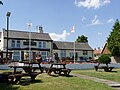
 The Muskham Ferry public house - geograph.org.uk - 5123842.jpg 800 × 671 ; 152 kio
-
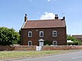
 The Old Hall, North Muskham.jpg 1 024 × 768 ; 181 kio
-
 The Oven - geograph.org.uk - 3050563.jpg 640 × 427 ; 86 kio
-
 The River Trent at Holme - geograph.org.uk - 4847181.jpg 800 × 600 ; 102 kio
-
 The River Trent at North Muskham - geograph.org.uk - 4802117.jpg 640 × 439 ; 58 kio
-
 The River Trent near North Muskham - geograph.org.uk - 5123759.jpg 800 × 725 ; 163 kio
-
 The Shades, North Muskham - geograph.org.uk - 4095106.jpg 1 280 × 960 ; 302 kio
-
 The sign of the Crown Inn - geograph.org.uk - 1451671.jpg 426 × 640 ; 45 kio
-
 Track between the ponds - geograph.org.uk - 3917966.jpg 1 024 × 768 ; 327 kio
-
 Track to Foxholes Farm - geograph.org.uk - 4791460.jpg 3 696 × 2 448 ; 2,28 Mio
-
 Traffic on the A1 - geograph.org.uk - 4231031.jpg 640 × 430 ; 48 kio
-
 Traffic on The Great North Road (A1) - geograph.org.uk - 2359255.jpg 640 × 430 ; 32 kio
-
 Trent Bank House - geograph.org.uk - 3752696.jpg 800 × 533 ; 157 kio
-
 Trent Farm at North Muskham - geograph.org.uk - 4813257.jpg 3 072 × 1 728 ; 3,55 Mio
-
 Trentside dyke with St Wilfrid's church - geograph.org.uk - 4094902.jpg 1 280 × 960 ; 375 kio
-
 Trentside path - geograph.org.uk - 3050434.jpg 640 × 427 ; 117 kio
-
 Up the Trent - geograph.org.uk - 3161619.jpg 640 × 427 ; 169 kio
-
 Vicarage Lane Bridge (A1) - geograph.org.uk - 2405436.jpg 640 × 246 ; 20 kio
-
-

-
 Vicarage Lane overbridge, A1 - geograph.org.uk - 2513335.jpg 640 × 396 ; 30 kio
-
 View across Slough Dyke towards Cromwell Lock - geograph.org.uk - 2561885.jpg 1 024 × 768 ; 317 kio
-
 View near Mousehole Corner (2) - geograph.org.uk - 2206780.jpg 1 024 × 768 ; 193 kio
-
 View near Mousehole Corner - geograph.org.uk - 2206778.jpg 1 024 × 768 ; 187 kio
-
 View nr Foxholes farm - geograph.org.uk - 1993907.jpg 640 × 423 ; 53 kio
-
 View of North Muskham from Holme meadows - geograph.org.uk - 1876385.jpg 1 600 × 1 200 ; 485 kio
-
 View to North Muskham - geograph.org.uk - 590756.jpg 640 × 427 ; 69 kio
-
 View towards Lodge Farm - geograph.org.uk - 3918157.jpg 1 024 × 768 ; 130 kio
-
 Virgin Mary graffiti - geograph.org.uk - 5229007.jpg 1 024 × 683 ; 258 kio
-
 Weeping willows by the Trent - geograph.org.uk - 3918121.jpg 1 024 × 768 ; 199 kio
-
 Weir boom - geograph.org.uk - 4303272.jpg 1 024 × 768 ; 180 kio
-

-
 Wintry scene by the Trent - geograph.org.uk - 2991327.jpg 3 648 × 2 736 ; 2,84 Mio
-
 Woolhouse Cottages - geograph.org.uk - 4095120.jpg 1 280 × 960 ; 356 kio
-
 Approaching North Muskham - geograph.org.uk - 241142.jpg 640 × 480 ; 73 kio
-
 Curious house by the river - geograph.org.uk - 679457.jpg 640 × 458 ; 97 kio
-
 Holme - geograph.org.uk - 590621.jpg 640 × 427 ; 74 kio
-
 Paddock and Pylons - geograph.org.uk - 188654.jpg 640 × 480 ; 101 kio
-
 Poppies and Pylons - geograph.org.uk - 188658.jpg 640 × 480 ; 92 kio
-
 Trent Valley Way crossing Slough Dyke - geograph.org.uk - 152293.jpg 640 × 427 ; 144 kio


.jpg)


_-_geograph.org.uk_-_4932315.jpg)


.jpg)


_-_geograph.org.uk_-_2359255.jpg)


_-_geograph.org.uk_-_2359237.jpg)


_-_geograph.org.uk_-_2206780.jpg)


_-_geograph.org.uk_-_2405436.jpg)