Category:North Ockendon
Aller à la navigation
Aller à la recherche
village au Royaume-Uni  | |||||
| Téléverser des médias | |||||
| Nature de l’élément | |||||
|---|---|---|---|---|---|
| Lieu | Borough londonien d'Havering, Grand Londres, Londres, Angleterre | ||||
 | |||||
English: North Ockendon is an outlying settlement of northeast London, England and part of the London Borough of Havering. It is located east northeast of Charing Cross and consists of a dispersed settlement within the metropolitan green belt. It was historically an ancient parish in the county of Essex, that was abolished for civil purposes in 1934 when it became part of the former Hornchurch Urban District. The area is notable for forming the only part of Greater London that is outside the bounds of the orbital M25 motorway.
Nederlands: North Ockendon is een wijk in het Londense bestuurlijke gebied Havering, in de regio Groot-Londen.
Sous-catégories
Cette catégorie comprend seulement la sous-catégorie ci-dessous.
M
Média dans la catégorie « North Ockendon »
Cette catégorie comprend 40 fichiers, dont les 40 ci-dessous.
-
 A view from the bridge - geograph.org.uk - 3915214.jpg 1 600 × 1 064 ; 330 kio
-
 B186, North Ockenden - geograph.org.uk - 2635000.jpg 640 × 430 ; 103 kio
-
 C2c train near West Horndon - geograph.org.uk - 5582501.jpg 640 × 480 ; 92 kio
-
 Church Lane, North Ockendon, Essex - geograph.org.uk - 22608.jpg 640 × 480 ; 74 kio
-
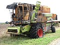 Defunct Combine Harvester - geograph.org.uk - 147840.jpg 640 × 482 ; 110 kio
-
 Drainage Ditch off Fen Lane, Bulphan, Essex - geograph.org.uk - 22350.jpg 640 × 480 ; 88 kio
-
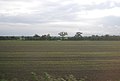
 Farmland, West Horndon - geograph.org.uk - 4441536.jpg 640 × 483 ; 36 kio
-
 Fen Lane - geograph.org.uk - 2635025.jpg 640 × 430 ; 72 kio
-
 Fen Lane - geograph.org.uk - 2635033.jpg 640 × 430 ; 80 kio
-
 Fen Lane - geograph.org.uk - 2635039.jpg 640 × 430 ; 73 kio
-
 Fen Lane, North Ockenden - geograph.org.uk - 2635013.jpg 640 × 430 ; 85 kio
-
 Fen Lane, North Ockendon - geograph.org.uk - 5515700.jpg 640 × 480 ; 99 kio
-
 Fen Lane, North Ockendon, Essex - geograph.org.uk - 22348.jpg 480 × 640 ; 74 kio
-
 Fenlands Nursery - geograph.org.uk - 1763772.jpg 640 × 428 ; 64 kio
-
 Flat farmland south of the railway line - geograph.org.uk - 3804889.jpg 640 × 430 ; 42 kio
-
 Footpath, North Ockendon - geograph.org.uk - 3915130.jpg 1 600 × 1 064 ; 326 kio
-
 Grazing north of St Mary's Lane - geograph.org.uk - 6150833.jpg 800 × 600 ; 117 kio
-
 Greville, Fen Lane - geograph.org.uk - 2635029.jpg 640 × 430 ; 102 kio
-
 Houses on St Mary's Lane - geograph.org.uk - 6150834.jpg 640 × 365 ; 56 kio
-
 Little Warley Hall Lane, near West Horndon - geograph.org.uk - 5582504.jpg 640 × 480 ; 66 kio
-
 Meadowland, North Ockendon, Essex - geograph.org.uk - 22611.jpg 640 × 480 ; 63 kio
-
 Memorial bungalows, North Ockenden - geograph.org.uk - 2635026.jpg 640 × 388 ; 85 kio
-
 North Ockendon Village - geograph.org.uk - 22346.jpg 640 × 480 ; 92 kio
-
 North Ockendon, London - geograph.org.uk - 2602034.jpg 640 × 428 ; 87 kio
-
 Ockendon Road, North Ockendon - geograph.org.uk - 5515709.jpg 640 × 480 ; 58 kio
-
 Restoration Project on Footpath 232 - geograph.org.uk - 59982.jpg 640 × 482 ; 128 kio
-
 Road junction, North Ockendon - geograph.org.uk - 5515654.jpg 640 × 480 ; 78 kio
-
 Russell Cottage - geograph.org.uk - 2634997.jpg 640 × 430 ; 85 kio
-
 St Cedd's Well and Moat - geograph.org.uk - 1657505.jpg 640 × 428 ; 90 kio
-
 St Mary's Lane towards West Horndon - geograph.org.uk - 6150838.jpg 800 × 600 ; 147 kio
-
 St. Marys Lane, Cranham, Essex - geograph.org.uk - 22403.jpg 640 × 498 ; 54 kio
-
 Thames Chase Forest Centre - geograph.org.uk - 686671.jpg 640 × 363 ; 52 kio
-
 The farmhouse at White Post Farm - geograph.org.uk - 688772.jpg 640 × 433 ; 69 kio
-
 The Ockendon to Bulphan Footpath - geograph.org.uk - 40842.jpg 482 × 640 ; 117 kio
-
 The Old White Horse - geograph.org.uk - 1657540.jpg 640 × 428 ; 58 kio
-
 Thomas Pointz memorial, North Ockendon.png 379 × 403 ; 87 kio
-
 Warley Hall Lane near West Horndon - geograph.org.uk - 6085763.jpg 1 872 × 1 204 ; 1,45 Mio
-
 Footpath sign, Bulphan Fen, Bulphan, Essex - geograph.org.uk - 26792.jpg 640 × 480 ; 86 kio
-
 Kemps Farm Mast - geograph.org.uk - 38590.jpg 482 × 640 ; 59 kio
-
 On Guard^ It's My Footpath^ - geograph.org.uk - 36166.jpg 640 × 482 ; 79 kio


