Category:North Stoneham
Aller à la navigation
Aller à la recherche
village britannique  | |||||
| Téléverser des médias | |||||
| Nature de l’élément | |||||
|---|---|---|---|---|---|
| Lieu | Eastleigh Town, Eastleigh, Hampshire, Angleterre du Sud-Est, Angleterre | ||||
 | |||||
English: North Stoneham is a settlement and ecclesiastical parish in south Hampshire, England. It was formerly an ancient estate and manor. Until the nineteenth century, it was a rural community comprising a number of scattered hamlets, including Middle Stoneham, North End, and Bassett Green, and characterised by large areas of woodland.
Sous-catégories
Cette catégorie comprend 2 sous-catégories, dont les 2 ci-dessous.
S
- Stoneham WWI Shrine (4 F)
Média dans la catégorie « North Stoneham »
Cette catégorie comprend 33 fichiers, dont les 33 ci-dessous.
-
 Avenue Park, North Stoneham - geograph.org.uk - 1164448.jpg 640 × 427 ; 65 kio
-
 Avenue Park, North Stoneham - geograph.org.uk - 1236634.jpg 640 × 427 ; 268 kio
-
 Channels Farmhouse - geograph.org.uk - 1345481.jpg 640 × 480 ; 151 kio
-
 North Stoneham Park 2011.jpg 1 000 × 728 ; 164 kio
-
 Playing Field south of Chestnut Avenue - geograph.org.uk - 1236683.jpg 640 × 427 ; 174 kio
-

-
 River Itchen - geograph.org.uk - 156991.jpg 640 × 480 ; 78 kio
-
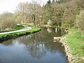 River Itchen - geograph.org.uk - 157001.jpg 640 × 480 ; 69 kio
-
 Roundabout leading to Mitchell Way, Eastleigh - geograph.org.uk - 501082.jpg 640 × 408 ; 131 kio
-
 Southern Damselfly (Coenagrion mercuriale) - geograph.org.uk - 430506.jpg 280 × 640 ; 24 kio
-
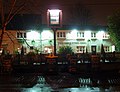 The Cricketers Arms - geograph.org.uk - 1138891.jpg 640 × 490 ; 78 kio
-

-
 WW2 Memorial to cremated war dead - geograph.org.uk - 40942.jpg 640 × 480 ; 103 kio
-
 Amphitheatre in Lakeside Country Park - geograph.org.uk - 1110495.jpg 640 × 427 ; 171 kio
-

-

-
 Avenue Park - geograph.org.uk - 815893.jpg 640 × 480 ; 98 kio
-
 Bend in Locksley Road - geograph.org.uk - 1620951.jpg 640 × 480 ; 52 kio
-
 Burns Close - geograph.org.uk - 1620964.jpg 640 × 480 ; 46 kio
-
 Ditch in Itchen Valley Country Park - geograph.org.uk - 157006.jpg 640 × 480 ; 80 kio
-
 Early winter in Burns Close - geograph.org.uk - 1620976.jpg 640 × 480 ; 69 kio
-
 Farmland - North Stoneham - geograph.org.uk - 109238.jpg 640 × 480 ; 79 kio
-
 Houses in Burns Road - geograph.org.uk - 1620963.jpg 640 × 480 ; 64 kio
-
 Looking eastwards along Locksley Road - geograph.org.uk - 1620943.jpg 640 × 480 ; 53 kio
-
 Looking from Locksley Road into Burns Road - geograph.org.uk - 1620953.jpg 480 × 640 ; 50 kio
-
 Monks Brook, Fleming Park, Eastleigh - geograph.org.uk - 1161066.jpg 640 × 427 ; 197 kio
-
 Offices at the end of George Curl Way, Eastleigh - geograph.org.uk - 501063.jpg 640 × 427 ; 140 kio
-
 Rare visitor-Southampton Airport 1 - geograph.org.uk - 701598.jpg 640 × 392 ; 29 kio
-
 Rare visitor-Southampton Airport 2 - geograph.org.uk - 701628.jpg 640 × 386 ; 41 kio
-
 Reservoir - geograph.org.uk - 156972.jpg 640 × 480 ; 34 kio
-
 Royal Mail's Southampton Mail Centre, Eastleigh - geograph.org.uk - 502096.jpg 640 × 426 ; 133 kio
-
 Skate park, Fleming Park, Eastleigh - geograph.org.uk - 1161079.jpg 640 × 427 ; 165 kio
-
 Southampton Airport Control Tower - geograph.org.uk - 28103.jpg 640 × 480 ; 80 kio


_-_geograph.org.uk_-_430506.jpg)


