Category:Norton, Doncaster
Vai alla navigazione
Vai alla ricerca
paese della contea del South Yorkshire, in Inghilterra | |||||
| Carica un file multimediale | |||||
| Istanza di | |||||
|---|---|---|---|---|---|
| Luogo | Doncaster, South Yorkshire, Yorkshire e Humber, Inghilterra | ||||
 | |||||
Sottocategorie
Questa categoria contiene le 5 sottocategorie indicate di seguito, su un totale di 5.
File nella categoria "Norton, Doncaster"
Questa categoria contiene 200 file, indicati di seguito, su un totale di 289.
(pagina precedente) (pagina successiva)-
 "Baps and Wraps" in Norton - geograph.org.uk - 5785857.jpg 5 044 × 3 635; 4,2 MB
-
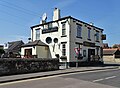 "The Royal Hotel" in Norton - geograph.org.uk - 5787141.jpg 4 975 × 3 630; 3,18 MB
-
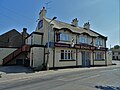 "The School Boy" public house in Norton - geograph.org.uk - 5785858.jpg 5 067 × 3 801; 3,1 MB
-
 A poor field of sugar beet - geograph.org.uk - 5889343.jpg 1 024 × 768; 251 KB
-
 A Stranger in Barnsdale Wood - geograph.org.uk - 3918226.jpg 4 608 × 3 456; 3,47 MB
-
 A1 South of Barnsdale Bar - geograph.org.uk - 4830388.jpg 640 × 480; 337 KB
-
 A19 Selby Road at Ings Dike - geograph.org.uk - 5718366.jpg 1 600 × 1 065; 461 KB
-
 A19 towards Doncaster - geograph.org.uk - 2593689.jpg 1 600 × 1 200; 367 KB
-
 A19, Selby Road towards Askern - geograph.org.uk - 5718355.jpg 1 600 × 1 065; 495 KB
-
 A19, Selby Road towards Askern - geograph.org.uk - 5718392.jpg 1 600 × 1 065; 596 KB
-
 A19, Selby Road towards Askern - geograph.org.uk - 5718467.jpg 1 600 × 1 065; 557 KB
-
 A19, Selby Road towards Askern - geograph.org.uk - 5718470.jpg 1 600 × 1 065; 607 KB
-
 Across the fields to the old mill. - geograph.org.uk - 5811906.jpg 1 024 × 550; 150 KB
-
 Aged Willow Trees near the River Went - geograph.org.uk - 5321018.jpg 4 608 × 3 456; 3,63 MB
-
 Approaching Highfield Farm - geograph.org.uk - 5320685.jpg 1 600 × 1 200; 441 KB
-
 Ashburnham Close, Station Road, Norton - geograph.org.uk - 5708105.jpg 1 600 × 1 065; 434 KB
-
 Autumnal path - geograph.org.uk - 5895159.jpg 1 024 × 768; 323 KB
-
 Back Lane, Norton - geograph.org.uk - 2527474.jpg 800 × 600; 321 KB
-
 Bare field with a long flat hose - geograph.org.uk - 2567652.jpg 1 024 × 768; 167 KB
-
 Barnsdale Bar cabbages - geograph.org.uk - 2567712.jpg 1 024 × 768; 145 KB
-
 Barnsdale Bar cabbages - geograph.org.uk - 2567841.jpg 1 024 × 768; 229 KB
-
 Barnsdale Bar landfill, west of Long Lane - geograph.org.uk - 2567766.jpg 1 024 × 768; 148 KB
-
 Barnsdale Bar Quarry - geograph.org.uk - 2567774.jpg 1 024 × 768; 190 KB
-
 Barnsdale Bar Quarry - geograph.org.uk - 2567832.jpg 1 024 × 768; 154 KB
-
 Benchmark in Kirk Smeaton - geograph.org.uk - 2225960.jpg 2 472 × 3 296; 1,79 MB
-
 Benchmark on Campsall Church - geograph.org.uk - 3618623.jpg 1 600 × 1 200; 932 KB
-
 Beyond the Barley - geograph.org.uk - 5785668.jpg 4 966 × 3 718; 4,81 MB
-
 Brick Railway Arch - geograph.org.uk - 2225981.jpg 2 472 × 2 968; 1,54 MB
-
 Bridleway and Access Road to Barnsdale Quarry - geograph.org.uk - 5218628.jpg 4 469 × 3 326; 3,55 MB
-
 Bull Close, near Campsmount Home Farm - geograph.org.uk - 2567306.jpg 1 024 × 768; 151 KB
-
 Bungalows on the A19, Selby Road towards Askern - geograph.org.uk - 5718475.jpg 1 600 × 1 065; 482 KB
-
 Burghwallis Lane - geograph.org.uk - 2602467.jpg 1 600 × 1 200; 423 KB
-
 Burghwallis Lane Campsall - geograph.org.uk - 3111184.jpg 1 024 × 700; 108 KB
-
 Burghwallis Road near Campsall - geograph.org.uk - 4793610.jpg 4 608 × 3 456; 4,1 MB
-

-
 Cabbages behind Barnsdale Cottages - geograph.org.uk - 2567642.jpg 1 024 × 768; 207 KB
-
 Can only be a sail-less tower windmill - geograph.org.uk - 2567138.jpg 1 024 × 768; 147 KB
-
 Cereal field near Little Smeaton - geograph.org.uk - 4133892.jpg 1 024 × 680; 123 KB
-
 Church Field Road - geograph.org.uk - 2602544.jpg 1 600 × 1 200; 570 KB
-
 Church Field Road near Campsall - geograph.org.uk - 4793737.jpg 4 608 × 3 456; 3,65 MB
-
 Church of St Mary Magdalene in Campsall - geograph.org.uk - 4793731.jpg 4 550 × 3 310; 3,45 MB
-
 Cliff Hill Farm - geograph.org.uk - 2602563.jpg 1 600 × 1 200; 359 KB
-
 Clough Lane - geograph.org.uk - 420170.jpg 640 × 480; 103 KB
-
 Common Lane, Norton - geograph.org.uk - 5889329.jpg 1 024 × 768; 201 KB
-
 Corner of a field near Windmill Farm - geograph.org.uk - 2567167.jpg 1 024 × 768; 173 KB
-

-
 Corner of ploughed field - geograph.org.uk - 2567299.jpg 1 024 × 768; 148 KB
-
 Crop Field at Park Closes - geograph.org.uk - 5320684.jpg 4 608 × 3 456; 3,77 MB
-
 Crossroads at Ryecroft Road - geograph.org.uk - 2567210.jpg 1 024 × 768; 184 KB
-
 Discover the spirit - geograph.org.uk - 2567725.jpg 1 024 × 768; 70 KB
-
 Doncaster Road - geograph.org.uk - 6119613.jpg 1 600 × 1 065; 872 KB
-
 Entering North Yorkshire - geograph.org.uk - 2602570.jpg 1 600 × 1 200; 647 KB
-
 Entering Norton on Norton Common Road - geograph.org.uk - 2527451.jpg 800 × 600; 241 KB
-

-
 Entrance to Barnsdale Bar Quarry - geograph.org.uk - 701753.jpg 640 × 480; 59 KB
-
 Entrance to Country Park - geograph.org.uk - 2602543.jpg 1 600 × 1 200; 563 KB
-
 Farm track (footpath) near Cliff Hill Farm - geograph.org.uk - 2602564.jpg 1 600 × 1 200; 539 KB
-
 Farm track off Stubbs Lane - geograph.org.uk - 5708174.jpg 1 600 × 1 065; 853 KB
-
 Farmland at South Field - geograph.org.uk - 5218681.jpg 4 608 × 3 456; 4,04 MB
-
 Farmland near Campsall - geograph.org.uk - 2602539.jpg 1 600 × 1 200; 600 KB
-
 Farmland near Campsmount Home Farm - geograph.org.uk - 2602547.jpg 1 600 × 1 200; 530 KB
-
 Farmland near Little Smeaton - geograph.org.uk - 4756603.jpg 4 608 × 3 456; 3,8 MB
-
 Farmland near the River Went. - geograph.org.uk - 5811913.jpg 1 024 × 768; 149 KB
-
 Farmland of Whiteley Road - geograph.org.uk - 2602560.jpg 1 600 × 1 200; 410 KB
-
 Farmland off Greengate Road - geograph.org.uk - 2602562.jpg 1 600 × 1 200; 369 KB
-
 Farmland off Whiteley Road - geograph.org.uk - 2602556.jpg 1 600 × 1 200; 366 KB
-
 Farmland off Woodfield Road - geograph.org.uk - 2602551.jpg 2 592 × 1 944; 909 KB
-
 Farmland on Norton Common - geograph.org.uk - 5320571.jpg 4 467 × 3 302; 3,89 MB
-
 Farmland, Lady Gap - geograph.org.uk - 2602468.jpg 1 600 × 1 200; 510 KB
-
 Farmland, Longland Field - geograph.org.uk - 2602550.jpg 1 600 × 1 200; 569 KB
-
 Farmland, Norton Common - geograph.org.uk - 2593687.jpg 1 600 × 1 200; 333 KB
-
 Field of order and chaos - geograph.org.uk - 2567614.jpg 1 024 × 768; 211 KB
-
 Field of Vegetables at Campsall - geograph.org.uk - 4793620.jpg 4 608 × 3 456; 4,01 MB
-
 Field south of Rye Croft Field - geograph.org.uk - 2567178.jpg 1 024 × 768; 137 KB
-
 Field Viewed from White Ley Road - geograph.org.uk - 5218651.jpg 4 608 × 3 456; 4,46 MB
-
 Fields near Burghwallis - geograph.org.uk - 4728589.jpg 4 608 × 3 456; 4,11 MB
-
 Fields Viewed from White Leys Road - geograph.org.uk - 5218655.jpg 4 608 × 3 456; 4,17 MB
-
 Flea Lane (a public bridleway) - geograph.org.uk - 2566937.jpg 1 024 × 768; 148 KB
-
 Flea Lane - geograph.org.uk - 3226157.jpg 2 048 × 1 536; 620 KB
-
 Flea Lane Bridle Path - geograph.org.uk - 1484106.jpg 640 × 480; 135 KB
-
 Flea Lane in May - geograph.org.uk - 5785645.jpg 4 966 × 3 887; 6,38 MB
-
 Flea Lane, Bridle Path - geograph.org.uk - 280189.jpg 640 × 480; 62 KB
-

-
 Flea lane. - geograph.org.uk - 5811899.jpg 1 024 × 768; 335 KB
-
 Footbridge Crossing Dryhurst Drain - geograph.org.uk - 5320702.jpg 4 608 × 3 456; 3,63 MB
-
 Footbridge on a footpath near Little Moor Common - geograph.org.uk - 3618631.jpg 1 600 × 1 200; 468 KB
-
 Footbridge over the River Went at Park Closes - geograph.org.uk - 5708859.jpg 1 600 × 1 065; 735 KB
-
 Footbridge over the River Went at Park Closes - geograph.org.uk - 5708860.jpg 1 600 × 1 065; 712 KB
-
 Footbridge over the Went - geograph.org.uk - 2225737.jpg 2 448 × 3 264; 2,69 MB
-
 Footpath crossing the railway southeast of Norton - geograph.org.uk - 3618607.jpg 1 600 × 1 200; 911 KB
-
 Footpath to Greengate Road - geograph.org.uk - 5889333.jpg 1 024 × 768; 128 KB
-
 Footpath to Selby Road - geograph.org.uk - 5889251.jpg 1 024 × 768; 350 KB
-
 Footpath to South Field - geograph.org.uk - 2567158.jpg 1 024 × 768; 191 KB
-
 Footpath to the East of Norton - geograph.org.uk - 5320637.jpg 4 608 × 3 456; 3,71 MB
-
 Footpath to Willow Bridge - geograph.org.uk - 4825501.jpg 1 024 × 768; 165 KB
-
 Footpath towards Norton - geograph.org.uk - 5320676.jpg 1 600 × 1 200; 581 KB
-
 Footpath towards Park Lane - geograph.org.uk - 5708187.jpg 1 600 × 1 065; 647 KB
-
 Footpath towards South Field from Greengate Road - geograph.org.uk - 5320680.jpg 1 600 × 1 200; 611 KB
-
 Former railway station, Norton - geograph.org.uk - 5889197.jpg 1 024 × 768; 189 KB
-
 Former spoil heap near Askern - geograph.org.uk - 5895163.jpg 1 024 × 768; 226 KB
-
 Freestone Quarry Plantation - geograph.org.uk - 2567364.jpg 1 024 × 768; 141 KB
-
 Gate to Private Road - geograph.org.uk - 3011650.jpg 640 × 480; 65 KB
-
 Gated public footpath - geograph.org.uk - 2566998.jpg 1 024 × 768; 115 KB
-
 Gatepost with a Bench Mark - geograph.org.uk - 2226074.jpg 2 472 × 3 296; 2,22 MB
-
 Georgian Postbox at Toll House on the A19 Selby Road - geograph.org.uk - 5718399.jpg 1 065 × 1 600; 403 KB
-
 Great Common Drain - geograph.org.uk - 2593691.jpg 1 600 × 1 200; 485 KB
-
 Green Doncaster - geograph.org.uk - 2567215.jpg 1 024 × 768; 151 KB
-
 Greengate Road at White Ley Plantation - geograph.org.uk - 5785653.jpg 4 913 × 3 742; 5,8 MB
-

-
 Greengate Road, closed for resurfacing - geograph.org.uk - 2566916.jpg 1 024 × 768; 129 KB
-
 Hawke Close, Station Road, Norton - geograph.org.uk - 5708089.jpg 1 600 × 1 065; 466 KB
-
 Heavy going, Kirk Smeaton - geograph.org.uk - 2225777.jpg 2 448 × 3 264; 2,26 MB
-
 Hedgerow on south side of New Road - geograph.org.uk - 2567285.jpg 1 024 × 768; 171 KB
-
 High Street, Campsall - geograph.org.uk - 2567225.jpg 1 024 × 768; 160 KB
-
 High Street, Campsall - geograph.org.uk - 2567266.jpg 1 024 × 768; 110 KB
-
 Highfield Farm - geograph.org.uk - 5287245.jpg 4 896 × 3 672; 6,76 MB
-
 House on Station Road, Norton - geograph.org.uk - 2602567.jpg 1 600 × 1 200; 392 KB
-
 Houses on High Street, Campsall - geograph.org.uk - 2567229.jpg 1 024 × 768; 136 KB
-
 Houses on the A19, Selby Road towards Askern - geograph.org.uk - 5718607.jpg 1 600 × 1 065; 459 KB
-
 In Barnsdale Wood - geograph.org.uk - 5218637.jpg 4 608 × 3 456; 3,98 MB
-
 Ings Dike - geograph.org.uk - 5718369.jpg 1 600 × 1 065; 642 KB
-
 Ings Lane - geograph.org.uk - 5889314.jpg 1 024 × 768; 214 KB
-
 Lady Gap Lane between Burghwallis and Sutton - geograph.org.uk - 5320666.jpg 1 600 × 1 200; 517 KB
-
 Large buildings at Cliff Hill - geograph.org.uk - 2566949.jpg 1 024 × 768; 112 KB
-
 Large field east of Long Lane - geograph.org.uk - 2567787.jpg 1 024 × 768; 133 KB
-
-
 Limestone Quarry near Campsall - geograph.org.uk - 1466478.jpg 640 × 480; 80 KB
-
 Long Lane - geograph.org.uk - 2567748.jpg 1 024 × 768; 130 KB
-
 Long Lane, Barnsdale Bar - geograph.org.uk - 2567737.jpg 1 024 × 768; 127 KB
-
 Long Lane, looking south - geograph.org.uk - 2567779.jpg 1 024 × 768; 104 KB
-
 Longland Lane - geograph.org.uk - 4377242.jpg 640 × 480; 81 KB
-
 Longland Lane - geograph.org.uk - 5320671.jpg 1 600 × 1 200; 1,02 MB
-
 Low field paddocks. - geograph.org.uk - 4377221.jpg 640 × 480; 66 KB
-
 Lowfield Level Crossing near Norton - geograph.org.uk - 5708181.jpg 1 600 × 1 065; 676 KB
-
 Lowfield Level Crossing near Norton - geograph.org.uk - 5708184.jpg 1 600 × 1 065; 544 KB
-
 Main street through Norton. - geograph.org.uk - 5811923.jpg 1 024 × 768; 155 KB
-
 Milestone by Went Bridge.jpg 480 × 640; 480 KB
-
 Mill Court, Campsall - geograph.org.uk - 2567261.jpg 1 024 × 768; 148 KB
-
 Mill Stream ^ Medieval Fish Ponds - geograph.org.uk - 2226103.jpg 3 296 × 2 472; 1,95 MB
-
 Missed this bit - geograph.org.uk - 2567793.jpg 1 024 × 768; 164 KB
-
 New Road junction with New Close lane - geograph.org.uk - 3111177.jpg 1 024 × 768; 180 KB
-
 New Road, about to drop into Campsall - geograph.org.uk - 2567292.jpg 1 024 × 768; 163 KB
-
 New Road, Norton - geograph.org.uk - 5708011.jpg 1 600 × 1 065; 517 KB
-
 No access to the windmill - geograph.org.uk - 2567152.jpg 1 024 × 768; 169 KB
-
 No longer a bridge - geograph.org.uk - 5287247.jpg 4 896 × 3 672; 6,56 MB
-
 No Through Road, off High Street - geograph.org.uk - 2567242.jpg 1 024 × 768; 157 KB
-
 No unauthorised access - geograph.org.uk - 2566976.jpg 1 024 × 768; 203 KB
-

-
 Norton Common Farm, A19 Selby Road - geograph.org.uk - 5718360.jpg 1 600 × 1 065; 457 KB
-
 Norton Common Road (track) - geograph.org.uk - 2593695.jpg 640 × 480; 59 KB
-
 Norton Common Road Level Crossing - geograph.org.uk - 1594773.jpg 640 × 480; 63 KB
-
 Norton Common Road, Norton - geograph.org.uk - 2527455.jpg 800 × 600; 197 KB
-
 Norton Coronation Club - geograph.org.uk - 234852.jpg 640 × 423; 56 KB
-
 Norton Coronation Club - geograph.org.uk - 2602565.jpg 1 600 × 1 200; 346 KB
-
 Norton Coronation Club - geograph.org.uk - 4756664.jpg 4 015 × 2 971; 2,82 MB
-
 Norton Ings - geograph.org.uk - 3618612.jpg 1 600 × 1 200; 607 KB
-
 Norton ings footpath. - geograph.org.uk - 4377229.jpg 640 × 480; 141 KB
-
 Norton Junior and Infant School - geograph.org.uk - 280662.jpg 640 × 480; 89 KB
-
 Norton Mill Lane - geograph.org.uk - 2225729.jpg 2 448 × 3 264; 2,63 MB
-
 Norton Mill lane off Spittlerush Lane - geograph.org.uk - 2527481.jpg 800 × 600; 231 KB
-
 Norton Post Office - geograph.org.uk - 234856.jpg 634 × 440; 192 KB
-
 Norton Priory Farm - geograph.org.uk - 2225718.jpg 3 264 × 2 448; 2,44 MB
-
 Norton Signal Box - geograph.org.uk - 3799541.jpg 1 280 × 895; 275 KB
-
 Norton Tower Mill framed by May blossom - geograph.org.uk - 5785696.jpg 3 604 × 4 701; 4,34 MB
-
 Norton Windmill.jpg 4 971 × 3 750; 5,89 MB
-
 Old Post Cottage, High Street - geograph.org.uk - 2567251.jpg 1 024 × 768; 143 KB
-
 Old Walled Garden - geograph.org.uk - 2161476.jpg 1 083 × 768; 126 KB
-
 Old windmill framed by hawthorn blossom - geograph.org.uk - 5787147.jpg 4 618 × 3 514; 3,57 MB
-
 One got left behind - geograph.org.uk - 2567168.jpg 1 024 × 768; 145 KB
-
 Park Lane north of Norton - geograph.org.uk - 5785860.jpg 4 806 × 3 677; 4,37 MB
-
 Pasture Gardens off Station Road, Norton - geograph.org.uk - 5708163.jpg 1 600 × 1 065; 506 KB
-
 Path alongside Stream Dike - geograph.org.uk - 6119616.jpg 1 600 × 1 065; 809 KB
-
 Path alongside the River Went - geograph.org.uk - 5708857.jpg 1 600 × 1 065; 566 KB
-
 Path leading to Rushy Moor Plantation - geograph.org.uk - 6119620.jpg 1 600 × 1 065; 673 KB
-
 Path leading to Station Road, Norton - geograph.org.uk - 5707999.jpg 1 600 × 1 065; 914 KB
-
 Path leading to Station Road, Norton - geograph.org.uk - 5708002.jpg 1 600 × 1 065; 698 KB
-
 Path leading to Station Road, Norton - geograph.org.uk - 5708006.jpg 1 600 × 1 065; 888 KB
-
 Post box on Station Road, Norton - geograph.org.uk - 5708099.jpg 1 065 × 1 600; 421 KB
-
 Power lines crossing Burghwallis Lane - geograph.org.uk - 3111189.jpg 633 × 1 024; 102 KB
-
 Power lines crossing New Road - geograph.org.uk - 3111169.jpg 1 024 × 717; 139 KB
-
 Probable gin house at Norton Priory - geograph.org.uk - 3799538.jpg 1 280 × 960; 442 KB
-
 Protecting the edge of Barnsdale Bar Quarry - geograph.org.uk - 2567821.jpg 1 024 × 768; 157 KB
-
 Public footpath at Park Closes - geograph.org.uk - 5708851.jpg 1 600 × 1 065; 525 KB
-
 Public footpath near Cliff Hill, Norton - geograph.org.uk - 4133900.jpg 1 024 × 768; 188 KB
-
 Pylon near the A19 - geograph.org.uk - 2593881.jpg 1 136 × 1 600; 299 KB
-
 Pylons crossing Wood Field - geograph.org.uk - 2567342.jpg 1 024 × 768; 141 KB
-
 Railway crossing ahead on Station Road, Norton - geograph.org.uk - 4133905.jpg 1 024 × 768; 128 KB
-
 River Went - geograph.org.uk - 2602569.jpg 1 600 × 1 200; 544 KB
-
 River Went at Park Closes - geograph.org.uk - 5708862.jpg 1 600 × 1 065; 702 KB
-
 River Went at Went Bridge, A19 Selby Road - geograph.org.uk - 5718065.jpg 1 600 × 1 065; 796 KB
-
 Road works on White Ley Road - geograph.org.uk - 2567598.jpg 1 024 × 768; 116 KB
-
 Route with public access, south of Norton - geograph.org.uk - 2567188.jpg 1 024 × 768; 153 KB
-
 Rye Croft Field (1) - geograph.org.uk - 2567198.jpg 1 024 × 768; 148 KB
-
 Rye Croft Field (2) - geograph.org.uk - 2567201.jpg 1 024 × 768; 175 KB
-
 Ryecroft Road - geograph.org.uk - 2567174.jpg 1 024 × 768; 125 KB
-
 School playing field view - geograph.org.uk - 5785721.jpg 4 912 × 3 169; 3,51 MB
-
 Selby Road A19 near Norton Common Farm - geograph.org.uk - 4133913.jpg 1 024 × 768; 98 KB
-
 Signpost at the crossroads - geograph.org.uk - 2566927.jpg 1 024 × 768; 144 KB
-
 Site of Former Well near Norton - geograph.org.uk - 5320595.jpg 4 608 × 3 456; 3,82 MB
-
 Small valley in a large field - geograph.org.uk - 2567311.jpg 1 024 × 768; 170 KB


_near_Cliff_Hill_Farm_-_geograph.org.uk_-_2602564.jpg)


_-_geograph.org.uk_-_2566937.jpg)


_-_geograph.org.uk_-_2593695.jpg)


_-_geograph.org.uk_-_2567198.jpg)
_-_geograph.org.uk_-_2567201.jpg)


