Category:Norton, Northamptonshire
Aller à la navigation
Aller à la recherche
English: Norton is a village in the district of West Northamptonshire in the English County of Northamptonshire. The village is about to the east. Near the village, on Watling Street, is the Roman settlement of Bannaventa.
Nederlands: Norton is een dorp in het district West Northamptonshire in Northamptonshire. Het ligt ongeveer 3 kilometer ten oosten van Daventry en 11 kilometer ten zuidoosten van Northampton. Norton heeft 363 inwoners (2001). De snelweg M1 en de autoweg A5 lopen langs de oostkant van het dorp.
village britannique  | |||||
| Téléverser des médias | |||||
| Nature de l’élément | |||||
|---|---|---|---|---|---|
| Lieu | West Northamptonshire, Northamptonshire, Midlands de l'Est, Angleterre | ||||
| Population |
| ||||
| Superficie |
| ||||
| Réputé identique à | Norton (page en doublon, paroisse civile) | ||||
 | |||||
Sous-catégories
Cette catégorie comprend 3 sous-catégories, dont les 3 ci-dessous.
B
- Bannaventa (4 F)
S
Média dans la catégorie « Norton, Northamptonshire »
Cette catégorie comprend 327 fichiers, dont les 200 ci-dessous.
(page précédente) (page suivante)-
 A gate in the middle of two other gates - geograph.org.uk - 3320530.jpg 2 560 × 1 920 ; 1 015 kio
-

-
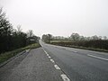
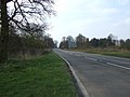 A5 heading north - geograph.org.uk - 3907655.jpg 640 × 480 ; 74 kio
-
 A5 heading north - geograph.org.uk - 5647533.jpg 640 × 428 ; 109 kio
-
 A5 heading north - geograph.org.uk - 5647544.jpg 640 × 428 ; 89 kio
-
 A5 heading north - geograph.org.uk - 5647550.jpg 640 × 428 ; 94 kio
-
 A5 lay-by - geograph.org.uk - 5633949.jpg 640 × 480 ; 50 kio
-
 A5 near the site of Bannaventa - geograph.org.uk - 4875901.jpg 640 × 480 ; 46 kio
-
 A5 northbound near Ivy House Farm - geograph.org.uk - 4873215.jpg 640 × 480 ; 47 kio
-
 A5 northbound near Watling Lodge - geograph.org.uk - 4875890.jpg 640 × 480 ; 42 kio
-
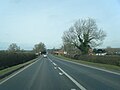
 A5 past Heart of the Shires shopping village - geograph.org.uk - 5647539.jpg 640 × 428 ; 99 kio
-
 A5 southbound - geograph.org.uk - 5633943.jpg 640 × 480 ; 77 kio
-
 Above Buckby Top Lock, 1976 - geograph.org.uk - 5457450.jpg 640 × 427 ; 118 kio
-
 All Saints' Church - geograph.org.uk - 6129441.jpg 1 600 × 1 066 ; 526 kio
-
 Allotments on the edge of Norton - geograph.org.uk - 6129498.jpg 1 600 × 1 066 ; 517 kio
-
 Alms houses, Norton - geograph.org.uk - 4141987.jpg 4 320 × 3 240 ; 3,99 Mio
-
 Braunston 4 Miles sign - geograph.org.uk - 5073993.jpg 3 102 × 4 656 ; 3,91 Mio
-
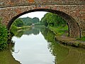
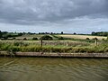
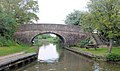
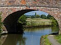
 Bridge 1 Norton Junction, Grand Union Canal - geograph.org.uk - 5073853.jpg 3 860 × 2 898 ; 2,38 Mio
-
 Bridge 1, (Old) Grand Union Canal - geograph.org.uk - 2754960.jpg 4 000 × 3 000 ; 4,59 Mio
-
 Bridge 10 - geograph.org.uk - 3108363.jpg 3 014 × 1 952 ; 1,52 Mio
-
 Bridge 10, Grand Junction Canal - geograph.org.uk - 2754981.jpg 4 000 × 3 000 ; 5,17 Mio
-
 Bridge 11, Grand Junction Canal - A5 - geograph.org.uk - 2754691.jpg 4 000 × 3 000 ; 4,76 Mio
-
 Bridge 16, Grand Junction Canal - geograph.org.uk - 3077522.jpg 4 000 × 3 000 ; 4,57 Mio
-
 Bridge 17, Grand Junction Canal - geograph.org.uk - 3077553.jpg 4 000 × 3 000 ; 4,67 Mio
-
 Bridge 18 - geograph.org.uk - 2058859.jpg 640 × 424 ; 109 kio
-
 Bridge 18, Grand Junction Canal - geograph.org.uk - 3077647.jpg 4 000 × 3 000 ; 4,66 Mio
-
 Bridge 7 - geograph.org.uk - 3108333.jpg 3 072 × 2 048 ; 1,79 Mio
-
 Bridge 7, Grand Junction Canal - geograph.org.uk - 3077498.jpg 4 000 × 3 000 ; 4,88 Mio
-
 Bridge 8 - geograph.org.uk - 3108345.jpg 2 963 × 1 962 ; 1,03 Mio
-
 Bridge 8, Grand Junction Canal - geograph.org.uk - 3077502.jpg 4 000 × 3 000 ; 4,71 Mio
-
 Bridge 9 - geograph.org.uk - 3108353.jpg 3 072 × 2 048 ; 1,6 Mio
-
 Bridge 9, Grand Junction Canal - geograph.org.uk - 3077508.jpg 4 000 × 3 000 ; 4,57 Mio
-
 Bridge No 10, from the west, at Norton Junction - geograph.org.uk - 5537697.jpg 1 024 × 768 ; 197 kio
-
 Bridge No 9, from the west - geograph.org.uk - 5537691.jpg 1 024 × 768 ; 169 kio
-
 Bridge over the Grand Union Canal - geograph.org.uk - 3866298.jpg 640 × 430 ; 57 kio
-
 Bridge over the Grand Union Canal - geograph.org.uk - 4911496.jpg 640 × 426 ; 56 kio
-
 Bridge under the railway - geograph.org.uk - 4737534.jpg 800 × 582 ; 147 kio
-
 Bridge, Grand Union Canal - geograph.org.uk - 2846271.jpg 640 × 430 ; 62 kio
-
 Bridleway heading out of Norton - geograph.org.uk - 6129484.jpg 1 066 × 1 600 ; 492 kio
-
 Bridleway into Norton - geograph.org.uk - 6129475.jpg 1 600 × 1 066 ; 576 kio
-
 Bridleway off the Grand Union Canal - geograph.org.uk - 5216239.jpg 640 × 480 ; 145 kio
-
 Bridleway to Muscott - geograph.org.uk - 1705372.jpg 640 × 480 ; 114 kio
-
 Bridleway towards the A5 - geograph.org.uk - 6129241.jpg 1 600 × 1 066 ; 550 kio
-
 Bridleway towards the canal - geograph.org.uk - 6129472.jpg 1 600 × 1 066 ; 628 kio
-
 Brockhall-Gazewell Farm - geograph.org.uk - 1714634.jpg 640 × 480 ; 61 kio
-
 Buckby Field Bridge No 16 - geograph.org.uk - 4737563.jpg 800 × 600 ; 145 kio
-
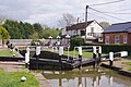
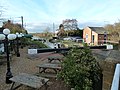
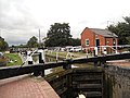
 Buckby Top Lock - geograph.org.uk - 2102967.jpg 960 × 623 ; 212 kio
-
 Buckby Top Lock - geograph.org.uk - 4662346.jpg 1 280 × 851 ; 375 kio
-
 Buckby Top Lock - geograph.org.uk - 4663931.jpg 1 280 × 851 ; 410 kio
-
 Buckby Top Lock - geograph.org.uk - 4665011.jpg 1 280 × 851 ; 360 kio
-
 Buckby Top Lock - geograph.org.uk - 6143463.jpg 1 280 × 851 ; 450 kio
-
 Buckby Top Lock No 7 on the Grand Union Canal - geograph.org.uk - 4735461.jpg 800 × 585 ; 144 kio
-
 Buckby Top Lock, 1976 - geograph.org.uk - 2456908.jpg 640 × 428 ; 107 kio
-
 Buckby Top Lock, Grand Union Canal - geograph.org.uk - 5871393.jpg 851 × 1 280 ; 374 kio
-

-
-
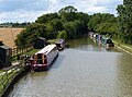
 Canal at Norton Junction in Northamptonshire - geograph.org.uk - 5855457.jpg 1 280 × 960 ; 1,21 Mio
-
 Canal at Norton Junction in Northamptonshire - geograph.org.uk - 5857385.jpg 1 280 × 839 ; 1,08 Mio
-
 Canal north of Norton in Northamptonshire - geograph.org.uk - 5853896.jpg 1 280 × 898 ; 1,14 Mio
-
 Canal north of Norton in Northamptonshire - geograph.org.uk - 5853899.jpg 1 280 × 960 ; 1,49 Mio
-

-
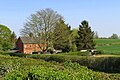
 Converted farm buildings at Brockhall Farm - geograph.org.uk - 6370254.jpg 800 × 533 ; 116 kio
-
 Cottage in Norton - geograph.org.uk - 3907628.jpg 640 × 480 ; 45 kio
-
 Cottages and lane near Muscott - geograph.org.uk - 4734218.jpg 800 × 581 ; 161 kio
-
 Country lane near Muscott - geograph.org.uk - 4734216.jpg 800 × 661 ; 161 kio
-
 Country lane to Muscott and the A5 - geograph.org.uk - 4734221.jpg 800 × 602 ; 155 kio
-
-
 Daventry Road and wall - geograph.org.uk - 6129444.jpg 1 600 × 1 066 ; 389 kio
-
 Daventry Road heading east - geograph.org.uk - 3907645.jpg 640 × 480 ; 107 kio
-
 Daventry Road, Norton - geograph.org.uk - 3907630.jpg 640 × 480 ; 64 kio
-
 Daventry-Borough Hill - geograph.org.uk - 1544200.jpg 640 × 480 ; 87 kio
-
 Dead tree by Borough Hill Farm - geograph.org.uk - 3320551.jpg 2 560 × 1 920 ; 1,01 Mio
-
 Dirt track by the railway track - geograph.org.uk - 6128578.jpg 1 600 × 1 066 ; 517 kio
-
 Dodford transmitter fixings - geograph.org.uk - 4478033.jpg 480 × 640 ; 85 kio
-
 Door in the churchyard wall - geograph.org.uk - 6129443.jpg 1 600 × 1 066 ; 712 kio
-
 Effigy of Lady Elizabeth (Seymour) Knightley - geograph.org.uk - 6221730.jpg 1 024 × 680 ; 192 kio
-
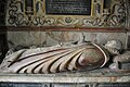 Effigy of Lady Elizabeth (Seymour) Knightley - geograph.org.uk - 6221736.jpg 1 024 × 680 ; 208 kio
-
 Entering Buckby Top Lock - geograph.org.uk - 5872056.jpg 1 280 × 851 ; 457 kio
-
 Entering Norton - geograph.org.uk - 3907619.jpg 640 × 480 ; 59 kio
-
 Entrance to Norton Lodge Farm - geograph.org.uk - 4735383.jpg 800 × 607 ; 166 kio
-
 Entrance to the shopping village - geograph.org.uk - 6129249.jpg 1 600 × 1 066 ; 488 kio
-
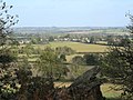
 Fallow fields near Burnt Walls - geograph.org.uk - 4141928.jpg 4 320 × 3 240 ; 3,62 Mio
-
 Farm buildings at Muscott House Farm - geograph.org.uk - 6370255.jpg 800 × 533 ; 153 kio
-
 Farm track with trees by the stream - geograph.org.uk - 6129471.jpg 1 600 × 1 066 ; 414 kio
-
 Farmland by the West Coast Main Line - geograph.org.uk - 2496435.jpg 640 × 430 ; 42 kio
-
 Farmland by the West Coast Main Line - geograph.org.uk - 2734968.jpg 640 × 393 ; 31 kio
-
 Farmland by the West Coast Main Line - geograph.org.uk - 4761651.jpg 640 × 426 ; 42 kio
-
 Farmland near Weedon Bec - geograph.org.uk - 1801809.jpg 640 × 480 ; 48 kio
-
 Farmland next to the Grand Union Canal - geograph.org.uk - 4601665.jpg 800 × 559 ; 115 kio
-
 Farmland next to the Grand Union Canal - geograph.org.uk - 4601739.jpg 800 × 600 ; 143 kio
-
 Farmland towards the A5 - geograph.org.uk - 6129452.jpg 1 600 × 1 066 ; 394 kio
-
 Farmland west of Norton Junction - geograph.org.uk - 5537695.jpg 1 024 × 614 ; 98 kio
-

-
 Field boundary near Norton - geograph.org.uk - 5172001.jpg 1 024 × 768 ; 144 kio
-
 Field by Grand Union Canal - geograph.org.uk - 5075330.jpg 5 184 × 3 456 ; 5,52 Mio
-
 Field by Grand Union Canal - geograph.org.uk - 5075332.jpg 5 184 × 3 456 ; 5,92 Mio
-
 Field from the bridleway looking into Norton - geograph.org.uk - 6129479.jpg 1 600 × 1 067 ; 361 kio
-
 Field of sheep by Noborough Lodge - geograph.org.uk - 6129255.jpg 1 600 × 1 066 ; 457 kio
-
 Field Road to Dodford - geograph.org.uk - 4478026.jpg 480 × 640 ; 92 kio
-
 Field Road to Dodford - geograph.org.uk - 4478028.jpg 480 × 640 ; 78 kio
-
 Field Road to Dodford - geograph.org.uk - 4478030.jpg 480 × 640 ; 62 kio
-
 Fields east of the M1 - geograph.org.uk - 2413660.jpg 640 × 480 ; 53 kio
-
 Fields near Noborough Lodge farm - geograph.org.uk - 2490673.jpg 640 × 480 ; 99 kio
-
 Fields near Noborough Lodge farm - geograph.org.uk - 2490675.jpg 640 × 480 ; 109 kio
-
 Fields near Norton Junction - geograph.org.uk - 5075326.jpg 5 184 × 3 456 ; 7,79 Mio
-
 Fog Cottage - geograph.org.uk - 5708526.jpg 640 × 426 ; 51 kio
-
 Font in Norton church - geograph.org.uk - 6223187.jpg 680 × 1 024 ; 172 kio
-
 Footpath near Norton Junction - geograph.org.uk - 5075328.jpg 5 000 × 3 333 ; 4,39 Mio
-
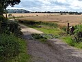
 Gated road to Norton - geograph.org.uk - 5196359.jpg 1 024 × 768 ; 136 kio
-
 Grand Union and Oxford Canal - geograph.org.uk - 5073860.jpg 5 184 × 3 456 ; 6,79 Mio
-
 Grand Union and Oxford Canal - geograph.org.uk - 5073864.jpg 5 184 × 3 456 ; 6,61 Mio
-
 Grand Union and Oxford Canal - geograph.org.uk - 5073866.jpg 5 000 × 3 333 ; 4,41 Mio
-
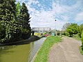
 Grand Union Canal - geograph.org.uk - 3640227.jpg 640 × 430 ; 46 kio
-
 Grand Union Canal - geograph.org.uk - 5073980.jpg 4 734 × 3 160 ; 3,63 Mio
-
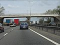
 Grand Union Canal and M1 - geograph.org.uk - 3866301.jpg 640 × 430 ; 74 kio
-
 Grand Union Canal and M1, south of Whilton - geograph.org.uk - 4269469.jpg 1 600 × 677 ; 158 kio
-
 Grand Union Canal and M1, south of Whilton - geograph.org.uk - 4269477.jpg 1 600 × 879 ; 222 kio
-
 Grand Union Canal and Muscott bridge - geograph.org.uk - 6128577.jpg 1 600 × 1 066 ; 689 kio
-
 Grand Union Canal and Oxford Canal - geograph.org.uk - 5073868.jpg 5 184 × 3 456 ; 7,47 Mio
-
 Grand Union Canal at Norton Junction - geograph.org.uk - 5073891.jpg 5 184 × 3 456 ; 6,29 Mio
-
 Grand Union Canal at Norton Junction in Northamptonshire - geograph.org.uk - 5856768.jpg 1 600 × 974 ; 1,5 Mio
-
 Grand Union Canal Bridge 10 - geograph.org.uk - 2067317.jpg 640 × 381 ; 89 kio
-
 Grand Union Canal Leicester Section - geograph.org.uk - 3522958.jpg 640 × 427 ; 69 kio
-
 Grand Union Canal near Buckby Field Bridge No 16 - geograph.org.uk - 4737575.jpg 800 × 612 ; 198 kio
-
 Grand Union Canal near Muscott - geograph.org.uk - 4737626.jpg 800 × 595 ; 176 kio
-
 Grand Union Canal near Muscott - geograph.org.uk - 6129227.jpg 1 600 × 1 066 ; 597 kio
-
 Grand Union Canal near Norton Junction - geograph.org.uk - 4601657.jpg 800 × 593 ; 142 kio
-
 Grand Union Canal near Norton Junction - geograph.org.uk - 4601689.jpg 600 × 800 ; 192 kio
-
 Grand Union Canal near Norton Junction - geograph.org.uk - 5073629.jpg 3 065 × 2 047 ; 1,94 Mio
-
 Grand Union Canal near Norton Junction - geograph.org.uk - 5073631.jpg 5 184 × 3 456 ; 5,35 Mio
-
 Grand Union Canal north of Norton in Northamptonshire - geograph.org.uk - 5853901.jpg 1 280 × 1 280 ; 2 Mio
-
 Grand Union Canal north of Norton in Northamptonshire - geograph.org.uk - 5853903.jpg 1 440 × 938 ; 1,66 Mio
-
 Grand Union Canal north-east of Daventry in Northamptonshire - geograph.org.uk - 5853089.jpg 1 280 × 960 ; 1,18 Mio
-
 Grand Union Canal north-east of Daventry in Northamptonshire - geograph.org.uk - 5853761.jpg 1 280 × 852 ; 1,04 Mio
-
 Grand Union Canal south-east of Welton in Northamptonshire - geograph.org.uk - 5852655.jpg 1 280 × 830 ; 1,22 Mio
-
 Grand Union Canal south-east of Welton, Northamptonshire - geograph.org.uk - 5852645.jpg 1 440 × 909 ; 1,6 Mio
-
 Grand Union Canal south-east of Welton, Northamptonshire - geograph.org.uk - 5853070.jpg 1 280 × 1 280 ; 1,86 Mio
-
 Grand Union Canal towpath - geograph.org.uk - 5216231.jpg 640 × 480 ; 64 kio
-
 Grand Union Canal towpath - geograph.org.uk - 5216232.jpg 640 × 480 ; 58 kio
-
 Grand Union Canal towpath - geograph.org.uk - 5216233.jpg 480 × 640 ; 94 kio
-
 Grand Union Canal towpath - geograph.org.uk - 5216235.jpg 640 × 480 ; 79 kio
-
 Grand Union Canal towpath - geograph.org.uk - 5216237.jpg 640 × 480 ; 79 kio
-
 Grand Union Canal towpath - geograph.org.uk - 5216240.jpg 640 × 480 ; 97 kio
-
 Grand Union Canal towpath near Lords Bridge No 8 - geograph.org.uk - 4601748.jpg 800 × 671 ; 160 kio
-
 Grand Union Canal Walk - geograph.org.uk - 5233684.jpg 640 × 480 ; 58 kio
-
 Grand Union Canal Walk - geograph.org.uk - 5233720.jpg 640 × 480 ; 66 kio
-
 Grand Union Canal Walk - geograph.org.uk - 5233727.jpg 640 × 480 ; 115 kio
-
 Grand Union Canal ^ M1 - geograph.org.uk - 3645749.jpg 640 × 303 ; 33 kio
-

-
 Grand Union Canal, Bridge No. 10 - geograph.org.uk - 3522953.jpg 640 × 427 ; 113 kio
-

-

-

-
 Grand Union Canal, Bridge Number 7 - geograph.org.uk - 3389896.jpg 640 × 480 ; 93 kio
-

-

-
 Grand Union Canal, Norton Junction - geograph.org.uk - 4664022.jpg 1 280 × 851 ; 326 kio
-
 Grand Union Canal, Reach near Muscott - geograph.org.uk - 3218618.jpg 640 × 480 ; 113 kio
-
 Grand Union Canal, Reach near Welton - geograph.org.uk - 3228146.jpg 640 × 480 ; 73 kio
-
 Grand Union Canal-Norton Junction - geograph.org.uk - 1956772.jpg 640 × 480 ; 75 kio
-
 Grand Union Canal-Norton Junction - geograph.org.uk - 2061594.jpg 640 × 480 ; 78 kio
-
 Grand Union Canal-Norton Junction - geograph.org.uk - 2068673.jpg 640 × 480 ; 76 kio
-
 Grass triangle road junction - geograph.org.uk - 3737704.jpg 640 × 428 ; 86 kio
-
 Grazing and woodland - geograph.org.uk - 3907643.jpg 640 × 480 ; 86 kio
-
 Grazing by Noborough Lodge - geograph.org.uk - 6129243.jpg 1 600 × 1 066 ; 246 kio
-
 Grazing by Norton Junction, Northamptonshire - geograph.org.uk - 868776.jpg 640 × 320 ; 112 kio
-
 Hatchments in All Saints church, Norton - geograph.org.uk - 6222238.jpg 1 024 × 680 ; 181 kio
-
 Hay Barn, Watling Lodge - geograph.org.uk - 4849109.jpg 640 × 386 ; 49 kio
-
 Heart of the Shires - geograph.org.uk - 2058867.jpg 640 × 480 ; 103 kio
-
 Heart of the shires shopping village Norton 22,04,2007.JPG 2 560 × 1 920 ; 1,17 Mio
-
 Interior of All Saints church, Norton - geograph.org.uk - 6222194.jpg 1 024 × 680 ; 194 kio
-
 Ivy House Cottages and paddocks - geograph.org.uk - 6129251.jpg 1 600 × 1 066 ; 554 kio
-
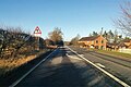
 Junction of Daventry Road with the A5 - geograph.org.uk - 3907650.jpg 640 × 480 ; 41 kio
-
 Lane near Noborough Lodge farm - geograph.org.uk - 2490679.jpg 640 × 480 ; 77 kio
-
 Lane to A5 - geograph.org.uk - 2490663.jpg 640 × 480 ; 108 kio
-
 Lane towards Thrupp Lodge - geograph.org.uk - 6129259.jpg 1 600 × 1 066 ; 648 kio
-
 Large canalside house at Norton Junction in Northamptonshire - geograph.org.uk - 5856770.jpg 1 280 × 1 280 ; 1,64 Mio
-
 Leicester Section Bridge 1 - geograph.org.uk - 3108534.jpg 3 072 × 2 048 ; 1,31 Mio
-
 Lock 7, Grand Junction Canal - Buckby Top Lock - geograph.org.uk - 2754477.jpg 4 000 × 3 000 ; 5,16 Mio
-
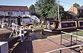
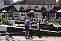
 Lock beside the pub - geograph.org.uk - 2041066.jpg 640 × 480 ; 102 kio
-
 Lock on the Grand Union Canal - geograph.org.uk - 3907680.jpg 478 × 640 ; 55 kio
-
 Long Buckby Top Lock 7 - geograph.org.uk - 2067311.jpg 640 × 480 ; 89 kio
-
 Long Buckby, Bridge No 1 - geograph.org.uk - 4944310.jpg 1 024 × 768 ; 163 kio
-
 Long Buckby, Lock No 7 - geograph.org.uk - 4944294.jpg 1 024 × 768 ; 175 kio
-
 Long Buckby, Norton Junction - geograph.org.uk - 4944302.jpg 1 024 × 768 ; 136 kio
-
 Lord Bridge (No 8), from the west - geograph.org.uk - 5537689.jpg 1 024 × 768 ; 186 kio
-
 Lords Bridge No 8 crossing the Grand Union Canal - geograph.org.uk - 4601753.jpg 800 × 600 ; 175 kio
-
 Lords Bridge south-east of Welton in Northamptonshire - geograph.org.uk - 5853085.jpg 1 280 × 960 ; 1,31 Mio
-
 Lords Bridge, Grand Union Canal - geograph.org.uk - 4661983.jpg 1 280 × 851 ; 378 kio
-
 M1 and Grand Union Canal - geograph.org.uk - 2846297.jpg 640 × 422 ; 49 kio
-
 M1 motorway - Muscott bridge - geograph.org.uk - 2899413.jpg 640 × 480 ; 68 kio
-
 M1 motorway curving near Muscott - geograph.org.uk - 2899415.jpg 640 × 480 ; 53 kio
-
 M1 motorway from Muscott bridge - geograph.org.uk - 6128574.jpg 1 600 × 1 066 ; 254 kio
-
 M1 Motorway near Muscott - geograph.org.uk - 4737636.jpg 800 × 600 ; 136 kio
-
 M1 near Muscott - geograph.org.uk - 4318914.jpg 640 × 412 ; 61 kio
-
 M1, southbound - geograph.org.uk - 4694846.jpg 640 × 390 ; 39 kio
-
 Memorial brass - geograph.org.uk - 6222178.jpg 680 × 1 024 ; 139 kio
-
 Memorial bust of Elizabeth Breton - geograph.org.uk - 6221765.jpg 680 × 1 024 ; 153 kio
-
 Memorial bust of Nicholas Breton - geograph.org.uk - 6221758.jpg 680 × 1 024 ; 159 kio
-
 Memorial busts of Nicholas Breton and Elizabeth - geograph.org.uk - 6221755.jpg 1 024 × 680 ; 163 kio


_Grand_Union_Canal_-_geograph.org.uk_-_2754960.jpg)


_Knightley_-_geograph.org.uk_-_6221730.jpg)
_Knightley_-_geograph.org.uk_-_6221736.jpg)


,_from_the_west_-_geograph.org.uk_-_5537689.jpg)


