Category:Oakley, Bedfordshire
Naar navigatie springen
Naar zoeken springen
Bedfordshire .jpg) | |||||
| Media uploaden | |||||
| Is een | |||||
|---|---|---|---|---|---|
| Locatie | Bedford, Bedfordshire, East of England, Engeland | ||||
 | |||||
English: Oakley is a village in northern Bedfordshire, England, about four miles north west of the county town of Bedford and lies by the River Great Ouse. It has a population of around 2,500 and is near the villages of Bromham, Milton Ernest, Clapham, Radwell, and Felmersham.
Ondercategorieën
Deze categorie bevat de volgende 2 subcategorieën, van de 2 in totaal.
M
- St Mary's church, Oakley (14 B)
O
- Oakley Bridge (6 B)
Media in categorie "Oakley, Bedfordshire"
Deze categorie bevat de volgende 57 bestanden, van in totaal 57.
-
 A road to ................. (4675153579).jpg 2.048 × 1.365; 1,03 MB
-
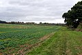
 Arable field - geograph.org.uk - 4786170.jpg 640 × 426; 38 kB
-
 Bedford Clanger - geograph.org.uk - 2311434.jpg 768 × 1.024; 183 kB
-
 Bedford Road, Oakley - geograph.org.uk - 6292612.jpg 1.920 × 1.280; 743 kB
-
 Bridleway off Twinwood Road - geograph.org.uk - 4188850.jpg 1.600 × 1.066; 697 kB
-
 Bridleway to Red Gate Farm - geograph.org.uk - 4188853.jpg 1.200 × 1.600; 539 kB
-
 Bridleway to the Bedford Road by the Long Spinney - geograph.org.uk - 4188846.jpg 1.600 × 1.068; 412 kB
-
 Brown's Wood - geograph.org.uk - 4188843.jpg 1.600 × 1.067; 503 kB
-
 Church Lane - geograph.org.uk - 5524234.jpg 1.600 × 1.066; 530 kB
-
 Church Lane, Oakley - geograph.org.uk - 4872646.jpg 3.264 × 2.448; 4,03 MB
-
 Cottage on Church Lane (geograph 7332369).jpg 640 × 480; 93 kB
-
 Cows by College Farm - geograph.org.uk - 5524237.jpg 1.600 × 1.066; 389 kB
-
 Farmland in the Great Ouse Valley - geograph.org.uk - 4741136.jpg 640 × 440; 46 kB
-
 FieldsNearOakleyBridge.JPG 2.816 × 2.112; 2,68 MB
-
 Flow restrictor on The River Great Ouse - geograph.org.uk - 4877824.jpg 3.264 × 2.448; 5,43 MB
-
 Footpath into Oakley - geograph.org.uk - 5524186.jpg 1.600 × 1.066; 466 kB
-
 Footpath into Oakley - geograph.org.uk - 5524198.jpg 1.063 × 1.600; 425 kB
-
 Footpath to Oakley - geograph.org.uk - 3134812.jpg 640 × 480; 69 kB
-
 Footpath to Oakley Bridge - geograph.org.uk - 5524190.jpg 1.600 × 1.066; 414 kB
-
 Footpath to Stafford Bridge - geograph.org.uk - 4188822.jpg 1.600 × 1.071; 403 kB
-
 Footpath under the railway bridge - geograph.org.uk - 4188812.jpg 1.600 × 1.070; 528 kB
-
 Going with the flow... - geograph.org.uk - 2475035.jpg 2.592 × 1.944; 3,28 MB
-
 Great Ouse by the Ouse Valley Way - geograph.org.uk - 5604571.jpg 1.600 × 1.066; 463 kB
-
 Great Ouse from Stafford Bridge - geograph.org.uk - 4188806.jpg 1.600 × 1.068; 398 kB
-
 Great Ouse heading to Pavenham - geograph.org.uk - 5604578.jpg 1.600 × 1.066; 481 kB
-
 New churchyard at St Mary's - geograph.org.uk - 5524235.jpg 1.600 × 1.066; 666 kB
-
 Oakley - Explored -) (15689049561).jpg 3.500 × 2.333; 9,11 MB
-
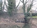
 Oakley Bridge - geograph.org.uk - 5524179.jpg 1.600 × 1.066; 441 kB
-
-
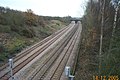
 Pair of railway bridges go over the Great Ouse - geograph.org.uk - 4188818.jpg 1.200 × 1.600; 503 kB
-
 Parent swans and three cygnets - geograph.org.uk - 2475032.jpg 2.592 × 1.944; 3,31 MB
-
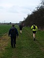
 Paula Radcliffe Way at Oakley Hill - geograph.org.uk - 2475041.jpg 2.592 × 1.944; 2,08 MB
-
 Railway cottages - geograph.org.uk - 82570.jpg 640 × 480; 78 kB
-
 River Great Ouse - geograph.org.uk - 4741134.jpg 640 × 440; 53 kB
-
 River Great Ouse at Oakley - geograph.org.uk - 311308.jpg 640 × 480; 105 kB
-
 River Great Ouse in Trees - geograph.org.uk - 4786169.jpg 640 × 426; 32 kB
-
 River Great Ouse near Pavenham - geograph.org.uk - 3907210.jpg 640 × 427; 77 kB
-
 River Ouse - Oakley (4592947536).jpg 2.048 × 1.365; 990 kB
-
 River Ouse - Oakley (6858733357).jpg 2.048 × 1.365; 790 kB
-
 River Ouse - Oakley (6877796511).jpg 2.048 × 1.365; 828 kB
-
 Road Verge Nature Reserve - geograph.org.uk - 2464336.jpg 2.592 × 1.944; 2,97 MB
-
 Sheep at Oakley - geograph.org.uk - 4872754.jpg 3.264 × 2.448; 4,16 MB
-
 Stevington windmill - geograph.org.uk - 4549446.jpg 4.320 × 3.240; 4,2 MB
-
 The edge of Oakley - geograph.org.uk - 2475064.jpg 2.592 × 1.944; 3,47 MB
-
 The edge of Oakley - geograph.org.uk - 4741137.jpg 640 × 315; 46 kB
-
 The John Bunyan Trail - geograph.org.uk - 5093021.jpg 2.000 × 1.500; 344 kB
-
 The Ouse Valley - geograph.org.uk - 2475062.jpg 2.592 × 1.944; 2,93 MB
-
 The Ouse Valley at Oakley - geograph.org.uk - 2475030.jpg 2.592 × 1.944; 2,23 MB
-
 The River Great Ouse at Oakley - geograph.org.uk - 2475026.jpg 2.592 × 1.944; 3 MB
-
 The road to Twinwood - geograph.org.uk - 2464355.jpg 2.592 × 1.944; 2,71 MB
-
 Vanessa atalanta (8015348045).jpg 2.048 × 1.365; 256 kB
-
 Vanessa atalanta (8015348669).jpg 2.048 × 1.366; 297 kB
-
 Weir at River Great Ouse - geograph.org.uk - 393167.jpg 640 × 480; 132 kB
-
 Weir on Great Ouse - geograph.org.uk - 5524176.jpg 1.600 × 1.066; 360 kB
-
 Weir on the Great Ouse - geograph.org.uk - 4549460.jpg 4.320 × 3.240; 4,98 MB
-
 Weir on the River Great Ouse - geograph.org.uk - 4879590.jpg 3.264 × 2.448; 5,09 MB
-
 Willow on the Great Ouse - geograph.org.uk - 5524183.jpg 1.066 × 1.600; 368 kB
.jpg)


.jpg)


_(15689049561).jpg)


.jpg)
.jpg)
.jpg)


.jpg)
.jpg)


