Category:Oberstdorf
Vai alla navigazione
Vai alla ricerca

comune tedesco    | |||||
| Carica un file multimediale | |||||
| Audio della pronuncia | |||||
|---|---|---|---|---|---|
| Istanza di |
| ||||
| Parte di |
| ||||
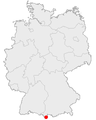
| Luogo | circondario dell'Alta Algovia, distretto della Svevia, Baviera, Germania | ||||
| Capitale |
| ||||
| Popolazione |
| ||||
| Superficie |
| ||||
| Altezza sul mare |
| ||||
| sito web ufficiale | |||||
 | |||||
Sottocategorie
Questa categoria contiene le 20 sottocategorie indicate di seguito, su un totale di 20.
Pagine nella categoria "Oberstdorf"
Questa categoria contiene un'unica pagina, indicata di seguito.
File nella categoria "Oberstdorf"
Questa categoria contiene 190 file, indicati di seguito, su un totale di 190.
-
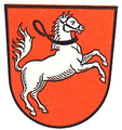
 Wappen Markt Oberstdorf.svg 747 × 856; 14 KB
-
 Wappen von Oberstdorf.png 196 × 208; 71 KB
-
 20150728 xl P1000829 Kleinwindkraftanlag in Oberstdorf Bayern.JPG 3 672 × 4 896; 6,06 MB
-
 20150728 xl P1000832 Kleinwindkraftanlage in Oberstdorf Bayern.jpg 4 896 × 3 672; 5,43 MB
-
 20150804 xl P1010425 Oberstdorf.JPG 4 896 × 3 672; 5,66 MB
-
 214 Koenig Ludwig III 100365 2 1900x1900.png 600 × 400; 291 KB
-
-
 Allgäuer Alpen - panoramio (5).jpg 2 816 × 2 120; 1,47 MB
-
 Alpe Schlappold - panoramio.jpg 2 621 × 1 814; 1,59 MB
-
 Altes Zeug - panoramio.jpg 5 108 × 3 414; 2,91 MB
-
 Am Gaißberg oberhalb Tiefenbach - panoramio (1).jpg 2 048 × 1 536; 760 KB
-
 Am Gaißberg oberhalb Tiefenbach - panoramio.jpg 2 048 × 1 536; 1,35 MB
-
 An der Baumgrenze Oberstdorf Alpen - panoramio.jpg 3 072 × 2 304; 3,32 MB
-
 An der Baumgrenze Oberstdorf Aplen - panoramio.jpg 3 072 × 2 304; 3,18 MB
-
 An der Felswand - panoramio.jpg 2 816 × 2 120; 1,5 MB
-
 An der Kletterwand - panoramio.jpg 2 816 × 2 120; 1,56 MB
-
 An der Rohrmoosstraße - panoramio.jpg 4 206 × 2 946; 3,38 MB
-
 Antiquitäten - panoramio (2).jpg 5 168 × 3 440; 2,89 MB
-
 Ausblick - panoramio (12).jpg 3 072 × 1 929; 3,45 MB
-
 Ausblick Richtung Kleinwalsertal - panoramio.jpg 3 072 × 2 304; 1 014 KB
-

-

-
 Ausblick von der Alpe Dornach - panoramio.jpg 3 072 × 2 304; 5,01 MB
-
 Ausblick von der Alpe Dornach Richtung Oberstdorf - panoramio.jpg 3 072 × 1 833; 3,39 MB
-
 Ausblick zum Freibergsee - panoramio.jpg 2 304 × 3 072; 5,67 MB
-
 Ausblick zur Möserbahn (Bergstation) - panoramio.jpg 3 072 × 2 304; 1,18 MB
-
 Ausgang - panoramio (12).jpg 2 816 × 2 120; 1,44 MB
-
 Aussichtsterasse - panoramio.jpg 2 816 × 2 120; 1,44 MB
-
 Bank in einer Nische - panoramio.jpg 2 816 × 2 120; 1,46 MB
-
 Baumschatten - panoramio.jpg 2 816 × 2 120; 1,47 MB
-
 Bei Obermaiselstein - panoramio.jpg 2 816 × 2 120; 1,45 MB
-
 Berggasthof Schönblick - panoramio.jpg 3 072 × 2 304; 3,24 MB
-
 Bergwiese am Haldenwanger Eck - geo.hlipp.de - 20662.jpg 640 × 426; 115 KB
-
 Blaue Piste Söllerecktalabfahrt - panoramio (1).jpg 3 072 × 1 993; 3,81 MB
-
 Blick auf Fischen - panoramio - Mayer Richard.jpg 2 816 × 2 120; 1,43 MB
-
 Blick auf Fischen - panoramio.jpg 2 816 × 2 120; 1,29 MB
-
 Blick ins abendliche Tal - panoramio.jpg 3 872 × 2 592; 444 KB
-
 Blick ins Tal - panoramio (2).jpg 2 816 × 2 120; 1,22 MB
-
 Blick nach Süden aus der Allgäubahn von Ulm nach Oberstdorf - panoramio.jpg 3 072 × 910; 1,27 MB
-
 Blick Richtung Möserbahn (Bergstation) - panoramio.jpg 3 072 × 2 304; 929 KB
-
 Blick Richtung Nebelhorn - panoramio.jpg 3 072 × 2 304; 4,56 MB
-
 Blick Richtung Sonthofen - panoramio.jpg 3 072 × 2 304; 3,42 MB
-
 Blick vom Gaißalphorn auf Oberstdorf.jpg 3 264 × 2 448; 2,03 MB
-
 Blick vom Gaißberg Richtung Nordosten - panoramio.jpg 2 048 × 1 536; 600 KB
-
 Blick vom Nebelhorn in Oberstdorf (8523605753).jpg 1 600 × 614; 508 KB
-
 Breitachglamm - Oberstdorf - panoramio.jpg 426 × 640; 338 KB
-
 Bröckliger Fels - panoramio.jpg 2 816 × 2 120; 1,42 MB
-
 Bühne am Kurpark in Oberstdorf - panoramio.jpg 1 944 × 1 497; 1,59 MB
-
De-Oberstdorf.ogg 1,8 s; 22 KB
-
 Diagonale 2016 (155479817).jpeg 2 048 × 1 356; 472 KB
-
 Eule-wildes-maennle.jpg 6 000 × 4 000; 6,13 MB
-
 Fiderescharte - geo.hlipp.de - 15691.jpg 640 × 480; 85 KB
-
 Flight over Oberstdorf (11781451635).jpg 800 × 1 200; 1,03 MB
-
 Flight over Oberstdorf (11781850464).jpg 1 200 × 799; 950 KB
-
 Flight over Oberstdorf (11781885964).jpg 1 200 × 799; 1,22 MB
-
 Friedhof - panoramio (113).jpg 2 816 × 2 120; 1,49 MB
-
 Gebirge - panoramio.jpg 2 816 × 2 120; 1,48 MB
-
 Gebirgsbach Oberstdorf Alpen - panoramio.jpg 3 072 × 2 304; 2,96 MB
-
 Gleitschirm - panoramio.jpg 2 816 × 2 120; 1,46 MB
-
 Going home (Unsplash).jpg 4 896 × 3 264; 1,15 MB
-
 Griestaler Spitze - panoramio.jpg 3 872 × 2 592; 946 KB
-

-
 Heini-Klopfer-Schanze 2018.jpg 1 678 × 2 980; 2,59 MB
-
 Hotel Baur.jpg 800 × 859; 185 KB
-
 Höfats Blick - panoramio.jpg 2 816 × 2 120; 1,36 MB
-
 Höhleneingang - panoramio.jpg 2 816 × 2 120; 1,5 MB
-
 Höhlenwohnung vor 10000 Jahren - panoramio.jpg 2 816 × 2 120; 1,52 MB
-
 Hörnergruppe - panoramio.jpg 2 816 × 2 120; 1,46 MB
-
 Im Hintergrund der Grünten - panoramio.jpg 2 816 × 2 120; 1,42 MB
-
 Im Rappenalptal - panoramio.jpg 3 872 × 2 592; 1 003 KB
-
 J. Marschall Oberstdorf.jpg 555 × 356; 67 KB
-
 Kirche in Wasach - panoramio.jpg 2 528 × 1 510; 2,23 MB
-
 Kletterhaken - panoramio (1).jpg 2 816 × 2 120; 1,46 MB
-
 Kletterwand - panoramio (2).jpg 2 816 × 2 120; 1,49 MB
-
 Kneipp-Anlage Oberstdorf Mühlenweg 2022-07-26 MTh.jpg 4 624 × 2 600; 6,7 MB
-

-
 Krempel - panoramio.jpg 4 718 × 3 450; 2,23 MB
-
 Landratsamt Vorschriften - panoramio.jpg 2 816 × 2 120; 1,49 MB
-
 Langer Schatten - panoramio (1).jpg 2 816 × 2 120; 1,48 MB
-

-
 Lawinenverbauung - panoramio (1).jpg 2 816 × 2 120; 1,48 MB
-
 Lawinenverbauung - panoramio.jpg 2 816 × 2 120; 1,44 MB
-
 Lechtaler alpen - panoramio.jpg 2 048 × 1 536; 658 KB
-
 Links zu Arthur M.Miller - panoramio.jpg 2 816 × 2 120; 2,22 MB
-
 Maderhalm - panoramio - Mayer Richard.jpg 2 816 × 2 120; 1,45 MB
-
 Maderhalm - panoramio.jpg 2 816 × 2 120; 996 KB
-
 Miller Haus - panoramio.jpg 2 816 × 2 120; 1,46 MB
-
 Mittagsonne im November - panoramio.jpg 2 816 × 2 120; 1,52 MB
-
 Mostly Cloudy (224660733).jpeg 1 695 × 2 048; 400 KB
-
 Mädelegabel, Hochfrottspitze, Bockkarkopf ^ Rothgundspitze - panoramio (1).jpg 3 872 × 2 592; 6,52 MB
-
 Mädelegabel, Hochfrottspitze, Bockkarkopf ^ Rothgundspitze - panoramio.jpg 3 872 × 2 437; 638 KB
-
 Mühsamer Weg auf Wurzelknoten und Felsbrocken - panoramio.jpg 2 816 × 2 120; 1,5 MB
-
 Nach Rohrmoos - panoramio.jpg 5 318 × 3 590; 2,15 MB
-
 Naturerlebnispfad Söllereck - panoramio.jpg 3 072 × 2 304; 4,75 MB
-
 Nebelhorn hiker (Unsplash).jpg 4 272 × 2 848; 1,02 MB
-
 Nebelhorn, Oberstdorf, Germany (Unsplash knyGcCk4kOw).jpg 4 501 × 3 376; 10,63 MB
-
 Nähe Rappenseehütte - 3. Tag (9800502155).jpg 3 968 × 2 976; 1,81 MB
-
 Obermaiselstein - panoramio.jpg 2 816 × 2 120; 1,45 MB
-
 Obersdorf - panoramio.jpg 2 592 × 1 944; 590 KB
-
 Oberstdorf (Unsplash).jpg 5 472 × 3 648; 11,96 MB
-
 Oberstdorf - Anatswald v N 011212.jpg 2 256 × 1 496; 884 KB
-
 Oberstdorf - Kühberg und Schneck über dem Oytal.JPG 5 472 × 3 080; 3,02 MB
-
 Oberstdorf - panoramio (1).jpg 3 072 × 1 890; 3,35 MB
-
 Oberstdorf - panoramio (2).jpg 3 072 × 2 304; 4,34 MB
-
 Oberstdorf - panoramio (3).jpg 3 072 × 2 304; 4,34 MB
-
 Oberstdorf - panoramio (4).jpg 2 816 × 2 120; 1,69 MB
-
 Oberstdorf - panoramio.jpg 2 816 × 2 120; 1,41 MB
-
 Oberstdorf HS235.jpg 2 784 × 4 176; 2,16 MB
-
 Oberstdorf in der Abenddämmerung - panoramio.jpg 3 072 × 2 002; 6,09 MB
-
 Oberstdorf Landscape and Village.jpg 5 153 × 1 156; 912 KB
-
 Oberstdorf Litho nach Compton um 1900.jpg 1 024 × 719; 257 KB
-
 Oberstdorf mit Schattenbergschanze von W 2009-09.jpg 2 136 × 1 598; 2,45 MB
-
 Oberstdorf Morgan-Treffen.jpg 3 240 × 4 320; 3,02 MB
-
 Oberstdorf Nebelhornbahn.jpg 4 080 × 3 072; 5,47 MB
-

-
 Oberstdorf vom Sattelkopf - geo.hlipp.de - 1309.jpg 640 × 434; 93 KB
-
 Oberstdorf von W 2009-09.jpg 2 288 × 1 712; 2,68 MB
-
 Oberstdorf Wiesen.jpg 2 048 × 1 536; 872 KB
-
 Oberstdorf, Bavaria, Germany-LCCN2002696202.jpg 3 655 × 2 800; 2,76 MB
-
 Oberstdorf, Germany - panoramio (2).jpg 1 600 × 900; 378 KB
-
 Oberstdorf, Germany - panoramio (3).jpg 2 852 × 2 156; 2,12 MB
-
 Oberstdorf, Germany - panoramio (4).jpg 1 600 × 1 067; 512 KB
-
 Oberstdorf, im Hintergrund Nebelhorn - panoramio.jpg 3 072 × 2 304; 4,08 MB
-
 Oberstdorf- Ortseingang - geo.hlipp.de - 20658.jpg 640 × 426; 110 KB
-
 Oberstdorf-1.jpg 4 000 × 3 000; 4,63 MB
-
 Oberstdorf-2.jpg 4 000 × 3 000; 4,49 MB
-
 Oberstdorf-JR-E-6033-6040-2022-06-23.jpg 10 061 × 2 490; 14,09 MB
-
 Oberstdorf-JR-E-6073-2022-06-25.jpg 4 762 × 3 169; 8,61 MB
-
 Oberstdorf-JR-E-6429-2022-09-13.jpg 4 762 × 3 169; 8,93 MB
-
 Oberstdorf-Kühberg01.jpg 2 304 × 1 728; 3,08 MB
-
 Oberstdorf-Position.png 188 × 235; 5 KB
-
 Oberstdorfer-Tageszeitung-1935.jpg 3 709 × 2 782; 4,89 MB
-
 Oststrasse Oberstdorf.JPG 3 648 × 2 736; 2,08 MB
-
 Panorama in der Nähe des Söllerkopf.jpg 17 101 × 3 292; 47,9 MB
-
 Panoramic of Oberstdorf.jpg 13 080 × 2 742; 4,83 MB
-
 Pfarrer Johannes Schiebel erschloss 1904 die Breitachklamm - panoramio.jpg 2 304 × 3 072; 4,63 MB
-
 PitztalerJoechel.JPG 4 000 × 3 000; 3,39 MB
-
 Prinzregent mit 3 Hirschen 100523 4 1900x1900.png 600 × 400; 289 KB
-
 Rappenalpenbach - geo.hlipp.de - 20683.jpg 480 × 640; 101 KB
-
 Rote Piste Nr 5 Höllwiesabfahrt am Söllereck - panoramio.jpg 3 072 × 2 304; 5,76 MB
-
 Rubi Allgäuer Alpen Entschenkopf 2043 m über dem Meeresspiegel - panoramio.jpg 2 816 × 2 120; 1,43 MB
-
 Rubi Bachverbauung - panoramio.jpg 2 816 × 2 120; 1,41 MB
-
 Rubi Rubihorn - panoramio.jpg 2 623 × 2 120; 731 KB
-
 Schatten - panoramio (2).jpg 2 850 × 2 154; 1,14 MB
-
 Schiabfahrt am 23.04.2011 - panoramio.jpg 2 816 × 2 120; 1,4 MB
-
 Schlappold - panoramio.jpg 2 816 × 2 120; 1,75 MB
-
 Schrofenpass - panoramio (4).jpg 2 537 × 1 573; 1,56 MB
-
 Schrofenpass - panoramio (5).jpg 4 608 × 3 456; 4,63 MB
-
 Schrofenpass - panoramio (8).jpg 4 608 × 3 456; 6,37 MB
-
 Schwimmteich Alpe Dornach - panoramio.jpg 3 072 × 2 304; 4,92 MB
-
 Skiflug - panoramio.jpg 2 611 × 1 807; 1,42 MB
-
 Sonnen im November - panoramio.jpg 2 816 × 2 120; 1,52 MB
-
 Sonnenterrasse - panoramio.jpg 2 816 × 2 120; 1,53 MB
-
 Sonnenuntergang über dem Kleinen Walsertal - panoramio (1).jpg 2 697 × 1 536; 1,93 MB
-
 Sonnenuntergang über dem Kleinen Walsertal - panoramio (2).jpg 2 356 × 1 536; 1,61 MB
-
 Sonnenuntergang über dem Kleinen Walsertal - panoramio (3).jpg 2 550 × 1 536; 1,86 MB
-
 Sonnenuntergang über dem Kleinen Walsertal - panoramio.jpg 3 072 × 1 536; 2,14 MB
-
 South view of Oberstdorf in February 20220205 1.jpg 8 156 × 4 588; 10,09 MB
-
 Staatsgrenzstein 159 - geo.hlipp.de - 9771.jpg 640 × 425; 119 KB
-
 Steilwand - panoramio (2).jpg 2 816 × 2 120; 1,49 MB
-
 Steinzeitfunde - panoramio.jpg 2 816 × 2 120; 1,46 MB
-
 Steinzeitliche Höhle - panoramio.jpg 2 816 × 2 120; 1,51 MB
-
 Stillachtal - panoramio (1).jpg 3 072 × 2 304; 4 MB
-
 Stillachtal - panoramio.jpg 3 072 × 2 304; 3,69 MB
-
 Stillachtal in Oberstdorf - panoramio (2).jpg 3 200 × 1 024; 1,77 MB
-
 Sunset at the Edmund-Probst-Haus (Unsplash).jpg 6 000 × 3 376; 6,69 MB
-
 Söllereck Rodelbahn - panoramio.jpg 3 072 × 2 304; 4,45 MB
-
 Taufersbergalpe- Felsen - geo.hlipp.de - 10385.jpg 640 × 425; 159 KB
-
 Tourismus-Marketing-Logo Markt Oberstdorf 2023.jpg 3 116 × 984; 727 KB
-
 Trettach vor Spielmannsau - geo.hlipp.de - 14054.jpg 640 × 480; 78 KB
-

-
 Untere Biber-Alpe - geo.hlipp.de - 20688.jpg 640 × 480; 130 KB
-
 Verbauung am Bacherlochbach - geo.hlipp.de - 20681.jpg 480 × 640; 140 KB
-
 Vorsicht Skifahrer am Söllereck - panoramio.jpg 3 072 × 2 304; 5,65 MB
-
 Wald - panoramio (3).jpg 3 072 × 2 304; 4,85 MB
-
 Walsertal - panoramio (2).jpg 2 553 × 1 771; 1,39 MB
-
 Wanderweg bei der Breitachklamm - panoramio.jpg 3 072 × 2 304; 6,64 MB
-
 Wanderweg Söllereck - panoramio (1).jpg 3 072 × 2 304; 5,3 MB
-
 Wanderweg Söllereck - panoramio.jpg 3 072 × 2 304; 5,29 MB
-
 Wanderweg vom Fellhorn zur Kanzelwand - panoramio.jpg 2 668 × 2 098; 1,56 MB
-
 Wanderweg zum Freibergsee - panoramio (1).jpg 3 072 × 2 304; 5,56 MB
-
 Wanderweg zum Freibergsee - panoramio.jpg 3 072 × 2 304; 4,58 MB
-
 WASA - panoramio.jpg 2 844 × 2 148; 1,93 MB
-
 Wasa - panoramio.jpg 2 868 × 2 172; 2,35 MB
-
 Wasa Reha - panoramio.jpg 2 816 × 2 120; 1,69 MB
-
 Weg zum Haldenwanger Eck - geo.hlipp.de - 20685.jpg 640 × 480; 100 KB
-
 Weg zur unteren Biber-Alpe - geo.hlipp.de - 20684.jpg 640 × 480; 107 KB
-
 Wiese bei Schoellang - geo.hlipp.de - 1300.jpg 640 × 439; 100 KB
-
 Windfahne am Nebelhorn - panoramio.jpg 2 816 × 2 120; 1,49 MB
-
 Zur Kanzelwand - panoramio.jpg 2 816 × 2 120; 1,76 MB


.jpg)


.jpg)


.jpg)
.jpg)

.jpg)


_-_panoramio.jpg)
.jpg)


.jpg)


.jpg)
_-_panoramio.jpg)


.jpeg)


.jpg)
.jpg)
.jpg)
.jpg)


.jpg)

.jpg)


.jpg)
.jpg)


.jpg)

.jpg)


.jpeg)
.jpg)


.jpg)
.jpg)
.jpg)


.jpg)


.jpg)
.jpg)
.jpg)
.jpg)


_-_geo.hlipp.de_-_24888.jpg)


.jpg)
.jpg)
.jpg)


.jpg)


.jpg)
.jpg)
.jpg)


.jpg)
.jpg)
.jpg)


.jpg)


.jpg)

.jpg)


.jpg)
.jpg)

.jpg)


.jpg)


.jpg)
.jpg)