Category:Ocala National Forest
Zur Navigation springen
Zur Suche springen
second largest National Forest in Florida  | |||||
| Medium hochladen | |||||
| Ist ein(e) | |||||
|---|---|---|---|---|---|
| Ort | Florida | ||||
| Betreiber | |||||
| Schutzgebietkategorie der IUCN | |||||
| Datum der Gründung, Erstellung, Entstehung, Erbauung |
| ||||
| Fläche |
| ||||
| offizielle Website | |||||
 | |||||
English: Ocala National Forest — located in northeastern Florida.
- The second largest National Forest in Florida.
Unterkategorien
Es werden 13 von insgesamt 13 Unterkategorien in dieser Kategorie angezeigt:
In Klammern die Anzahl der enthaltenen Kategorien (K), Seiten (S), Dateien (D)
A
- Alexander Springs (10 D)
B
- Bryant Ranger Station (1 D)
F
- Fungi of Ocala National Forest (22 D)
J
K
M
S
- Signs in Ocala National Forest (35 D)
- Silver Glen Springs (13 D)
W
- Wells Pond (Ocala) (4 D)
Medien in der Kategorie „Ocala National Forest“
Folgende 94 Dateien sind in dieser Kategorie, von 94 insgesamt.
-
 Farles Prairie.jpg 1.600 × 1.071; 1,23 MB
-
 595(14) & High Tension Rd (03) Ocala Forest - panoramio.jpg 600 × 450; 46 KB
-
 Animal Habitat Improvement - Florida - DPLA - 9ccac95dcc7d59b792bda6e515f973c8.jpg 5.004 × 4.164; 1,5 MB
-
 Backwoods Trail.jpg 176 × 398; 14 KB
-
 Brown Pond Off High Tension Rd Ocala Forest - panoramio.jpg 3.072 × 2.304; 1,48 MB
-
 Campers in Ocala National Forest (6944250458).jpg 600 × 796; 101 KB
-
 Forest atlas of the national forests of the United States. Ocala folio (IA CAT31299603).pdf 143 × 197, 14 Seiten; 147,82 MB
-
 Central Fire Tower; Ocala National Forest-1.jpg 3.648 × 2.736; 2,09 MB
-
 Central Fire Tower; Ocala National Forest-2.jpg 3.648 × 2.736; 2,05 MB
-
 Crescent Stadt - panoramio (1).jpg 3.056 × 2.304; 3,68 MB
-
 Crescent Stadt - panoramio.jpg 4.576 × 3.414; 4,45 MB
-
 EB FL 40; JCT FL 19 in the Fog.jpg 3.648 × 2.736; 2,05 MB
-
 Fire Road at Ocala (49070491966).jpg 3.000 × 2.023; 1,96 MB
-
 FL Scenic Hwy 19; Black Bear Begins.jpg 3.648 × 2.736; 2,1 MB
-
 FL Scenic Hwy 19; Black Bear Ends.jpg 3.648 × 2.736; 2,06 MB
-
 FL SR 19 Bridge over Juniper Creek; FDOT Number.jpg 3.648 × 2.736; 2,03 MB
-
 FL SR 19 Bridge; NW Fog over Juniper Creek.jpg 3.648 × 2.736; 2,08 MB
-
 FL SR 19 Bridge; SE Fog over Juniper Creek.jpg 3.648 × 2.736; 2,06 MB
-
 FL SR 19; Pittman Visitors Billboard; ONF.jpg 3.648 × 2.736; 2,1 MB
-
 Florida Black Bear @ FL 19 & NFR 62-1.jpg 3.648 × 2.736; 2,02 MB
-
 Florida Black Bear @ FL 19 & NFR 62-2.jpg 3.648 × 2.736; 2,03 MB
-
 Florida Black Bear @ FL 19 & NFR 62-3.jpg 3.648 × 2.736; 2,04 MB
-
 Florida Black Bear @ FL 19 & NFR 62-4.jpg 3.648 × 2.736; 2,01 MB
-
 Florida Black Bear @ FL 19 & NFR 62-5.jpg 3.648 × 2.736; 2,1 MB
-
 Florida Black Bear @ FL 19 & NFR 62-6.jpg 3.648 × 2.736; 2,06 MB
-
 Florida Black Bear Scenic Byway - Hikers on the Yearling Trail - NARA - 7718416.jpg 3.300 × 2.209; 1,16 MB
-
 Forest Road 51 from FL 19 to Pat's Island Trailhead.jpg 3.648 × 2.736; 2,14 MB
-
 GRASSY PRAIRIE OCALA NATIONAL FOREST 579 ^ 569 - panoramio.jpg 3.072 × 2.304; 1,59 MB
-
 HALFMOON BOAT RAMP PARKING - panoramio.jpg 3.072 × 2.304; 1,54 MB
-
 HALFMOON RAMP AND LAKE - panoramio.jpg 3.072 × 2.304; 1,24 MB
-
 Hidden Pond Juniper Prairie Wilderness Ocala National Forest.jpg 4.160 × 3.120; 2,3 MB
-
 HopkinsPrairiePerimiterIlexOpacaArenicola.jpg 1.400 × 2.100; 2,57 MB
-
 Juniper Prairie Wilderness entrance 2018.jpg 3.195 × 2.867; 2,11 MB
-
 Juniper Wayside Bathrooms.jpg 3.648 × 2.736; 2,06 MB
-
 Juniperprairiewilderness2006.jpg 1.700 × 1.100; 371 KB
-
 Juniperprairiewildernessyearlingtrail2006.jpg 1.152 × 1.728; 400 KB
-
 Lake George Ranger Station; ONF, FL-3.jpg 3.648 × 2.149; 1,71 MB
-
 LONG POND - panoramio.jpg 3.072 × 2.304; 1,66 MB
-
 National Forest 02.jpg 1.000 × 652; 188 KB
-
 National Forest 03.jpg 1.000 × 702; 238 KB
-
 National Forest 04.jpg 1.000 × 667; 205 KB
-
 National Forest 05.jpg 1.000 × 667; 131 KB
-
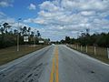
 NB FL 19 (ONF) @ Lake CR 445A.jpg 3.648 × 2.736; 2,05 MB
-
 NB FL 19 (ONF) @ Lake-Marion County Line.jpg 3.648 × 2.736; 2,12 MB
-
 NB FL 19 (ONF) @ Railroad Grade Road.jpg 3.648 × 2.736; 2,07 MB
-
 NB FL 19 (ONF) near Lake CR 445.jpg 3.648 × 2.736; 2,12 MB
-
 NB FL 19 (ONF) near Lake CR 445A.jpg 3.648 × 2.736; 2,07 MB
-
 NB FL 19 (ONF); 4-H and Fire Control Areas.jpg 3.648 × 2.736; 2,12 MB
-
 NB FL 19 (ONF); FL 40; Directional Sign.jpg 3.648 × 2.736; 2,1 MB
-
 NB FL 19 (ONF); FL 40; Half-Mile Away.jpg 3.648 × 2.736; 2,11 MB
-
 NB FL 19 (ONF); JCT FL 40.jpg 3.648 × 2.736; 2,04 MB
-
 NB FL 19 (ONF); Salt Springs 16; Palatka 41.jpg 3.648 × 2.736; 2,08 MB
-
 NB FL 19 at Rodman Campground-Kirkpatrick Dam.jpg 3.648 × 2.736; 2,03 MB
-
 NB FL 19 sign North of FL 40.jpg 3.648 × 2.736; 2,06 MB
-
 NB FL SR 19; Fog over Juniper Creek Bridge.jpg 3.648 × 2.736; 2,06 MB
-
 NB Freaky FL 19 Sign on Ocklawaha River Bridge.jpg 3.648 × 2.736; 1,52 MB
-
 NB Misspelled FL 19 Ocklawaha River Sign.jpg 3.648 × 2.736; 1,74 MB
-

-
-
 Near Salt Springs - Flickr - pellaea.jpg 3.648 × 2.736; 2,92 MB
-
 Ocala National Forest - panoramio.jpg 4.608 × 2.304; 4,03 MB
-
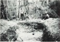 Ocala National Forest Midden No. 2 during excavation.png 408 × 284; 283 KB
-
 OcalaNF Sunset.jpg 800 × 534; 82 KB
-
 ONF Clearwater Lake01.jpg 3.264 × 2.448; 3,4 MB
-
 ONF Pittman Visitor's Center.jpg 3.648 × 2.736; 2,03 MB
-
 ONF Pittman Work Center Driveway-1.jpg 3.648 × 2.736; 2,06 MB
-
 Pinus clausa USDAFS.jpg 2.700 × 4.076; 12,46 MB
-
 Pinus palustris Ocala USDAFS.jpg 4.111 × 2.700; 12,77 MB
-
 Pinus palustris USDAFS.jpg 2.700 × 3.983; 12,91 MB
-
 Pittman FL ONF Work Center pano01.jpg 3.846 × 1.720; 3,3 MB
-
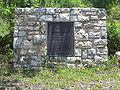 Pittman FL ONF Work Center plaque01.jpg 3.264 × 2.448; 3,67 MB
-
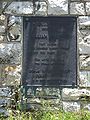 Pittman FL ONF Work Center plaque02.jpg 2.448 × 3.264; 2,24 MB
-
 Pittman FL ONF Work Center01.jpg 3.133 × 2.448; 3,37 MB
-
 Recreation Improvements - Florida - DPLA - add408b417a720b79b0e482c6d8e6960.jpg 4.717 × 3.786; 1,64 MB
-
 Recreation Organization - Florida - DPLA - 91c51093d165a9e7cddd37896548aba2.jpg 4.806 × 3.798; 2,59 MB
-
 REDWATER LAKE OCALA FOREST - panoramio.jpg 3.072 × 2.304; 1,32 MB
-
 Rosemary Bald - Flickr - pellaea.jpg 2.736 × 3.648; 4 MB
-
 Salt Springs Observation Trail - panoramio.jpg 3.957 × 1.470; 648 KB
-
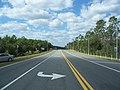
 SB FL 19 (ONF); FL 40; Half-Mile Away.jpg 3.648 × 2.736; 2,11 MB
-
 SB FL 19 (ONF); South of Yellow Bluff.jpg 3.648 × 2.736; 2,08 MB
-
 SB Misspelled FL 19 Ocklawaha River Sign.jpg 3.648 × 2.736; 2,06 MB
-
 Silver Glen Springs.jpg 4.032 × 3.024; 5,09 MB
-
 SQUAW POND - panoramio.jpg 3.072 × 2.304; 1,29 MB
-
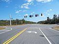 SR 19 and 40 intersection east01.jpg 3.264 × 2.448; 1,68 MB
-
 SR 19 and 40 intersection east02.jpg 3.264 × 2.448; 1,37 MB
-
 SR 19 and 40 intersection north01.jpg 3.264 × 2.448; 1,5 MB
-
 SR 19 and 40 intersection north02.jpg 3.264 × 2.448; 1,29 MB
-
 SR 19 and 40 intersection south01.jpg 3.264 × 2.448; 1,31 MB
-
 SR 19 and 40 intersection west01.jpg 3.264 × 2.448; 1,59 MB
-
 TROUT LAKE ON FOREST RD 14-0.3A - panoramio.jpg 3.072 × 2.304; 1,09 MB
-
 Umatilla FL Seminole Ranger Station01.jpg 3.264 × 2.448; 2,54 MB
-
 Water Sports - Florida - DPLA - 7ef68b94658edf0e4678d68d2ce87dca.jpg 4.757 × 3.795; 2,2 MB
-
 Wildcat Lake ONF Campground.jpg 3.648 × 2.736; 2,09 MB
-
 Wilderness RV Resort Gateway; ONF, FL.jpg 3.648 × 2.736; 2,04 MB
_%26_High_Tension_Rd_(03)_Ocala_Forest_-_panoramio.jpg)


.jpg)


.jpg)


.jpg)


_@_Lake_CR_445A.jpg)
_@_Lake-Marion_County_Line.jpg)
_@_Railroad_Grade_Road.jpg)
_near_Lake_CR_445.jpg)
_near_Lake_CR_445A.jpg)
;_4-H_and_Fire_Control_Areas.jpg)
;_FL_40;_Directional_Sign.jpg)
;_FL_40;_Half-Mile_Away.jpg)
;_JCT_FL_40.jpg)
;_Salt_Springs_16;_Palatka_41.jpg)


.jpg)
.jpg)


;_FL_40;_Half-Mile_Away.jpg)
;_South_of_Yellow_Bluff.jpg)


Kategorien:
- National Forests of Florida
- Parks in Lake County, Florida
- Parks in Marion County, Florida
- Parks in Putnam County, Florida
- Parks in Seminole County, Florida
- Ocala, Florida
- 1908 establishments in the United States
- National Forests of the United States by name
- Southeast United States Conifer Savannas Ecoregion (One Earth)