Category:Odsherred Kommune
Salta a la navigazzion
Và a cercà

comune danese   | |||||
| Carega su un fail audio / video | |||||
| L'è un(a) | |||||
|---|---|---|---|---|---|
| Ciàpa ol nòm da |
| ||||
| Sit | Sìłand, Danimarca | ||||
| Capital | |||||
| Capo de governo |
| ||||
| Data de creazzion o de fondazzion |
| ||||
| Popolazzion |
| ||||
| Area |
| ||||
| Altezza in sul mar |
| ||||
| El renpiasa a |
| ||||
| sit ofizzial | |||||
 | |||||
Sotocategorie
Quella categoria chì la gh'ha 39 sot-categorie chì de sota, su un numer complessiv de 39.
A
- Odsherred Kommune in art (19 F)
- Asnæs Indelukke (2 F)
B
E
- Esterhøj (8 F)
F
G
H
K
- Klintebjerg (Odsherred) (4 F)
L
N
O
- Odsherred Lokalarkiv (2 F)
- Ordrup Næs (17 F)
P
- Parishes in Odsherred Kommune (14 F)
R
S
- Skamlebæk Radio (8 F)
- Skamlebæk strand (5 F)
- Skansehage (4 F)
T
- Trundholm Mose (5 F)
U
- Ulvsborg Historisk Værksted (11 F)
V
- Veddinge (2 F)
- Vejrhøj (14 F)
- Vig Festival (13 F)
Fail in la categoria "Odsherred Kommune"
Quella categoria chì la gh'ha denter 27 i fail riportad chì de sota, su un total de 27.
-
 Alter Grenzstein eines Jagdgebiets am Fuße des Esterhoj.JPG 1 166 × 1 818; 555 KByte
-
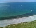
 Beach terrain, Sejrøbugten.jpg 3 980 × 2 781; 9,82 MByte
-
 Bondegård - panoramio.jpg 1 280 × 1 024; 515 KByte
-
 Bræddevej Korevlerne ved Højby Lyng Strand.jpg 4 032 × 3 024; 5,63 MByte
-
 Damm von Avdebo.JPG 3 008 × 2 000; 1,49 MByte
-
 Dejligheden-feb2021.jpg 2 100 × 1 200; 1 010 KByte
-
 Efter høhøsten - After the haymaking - panoramio.jpg 4 592 × 3 056; 4,29 MByte
-
 General Carte over det kongl. Gods udi Ods herret efter den den seneste Indeeling.jpg 5 259 × 4 673; 5,55 MByte
-
 Geopark ods.gif 213 × 180; 4 KByte
-
 Holtes marker med udsigt til skoven.jpg 3 072 × 4 096; 2,14 MByte
-
 Hove-2009.jpg 2 048 × 1 536; 1,1 MByte
-
 Iskile fra Højby.JPG 1 914 × 2 560; 1,17 MByte
-
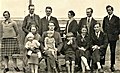 Karl Nielsen mit Familie, Toftegård, Stenstrup, 1929.jpg 572 × 348; 93 KByte
-
 Map DK Odsherred.PNG 465 × 550; 19 KByte
-
 Megawal43.png 581 × 354; 13 KByte
-
 Odeherred Kommune seal.JPEG 435 × 550; 31 KByte
-
 Ods Herred Old Map 1768.jpg 745 × 847; 101 KByte
-
 Ordrup Strand Steg.JPG 3 008 × 2 000; 1,48 MByte
-
 Salicornia europaea Thue 2.JPG 5 184 × 3 456; 13,59 MByte
-
 SteenGallerietS.jpg 3 000 × 1 768; 1,24 MByte
-
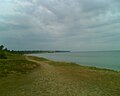
 Strand - Gudmindrup.jpg 1 600 × 1 063; 1,22 MByte
-
 Strand in Ordrup - panoramio.jpg 3 648 × 2 056; 4,03 MByte
-
 Uroksen fra Vig 2.jpg 1 600 × 1 200; 370 KByte
-
 Vandet v. Klint - panoramio.jpg 1 280 × 1 024; 381 KByte
-
 View towards Ebbeløkke - panoramio.jpg 1 280 × 1 024; 304 KByte
-
 View towards Klint - panoramio.jpg 1 280 × 1 024; 355 KByte
-
 ÅrbySogn.png 248 × 233; 6 KByte


