Category:Ordnance Survey
Zur Navigation springen
Zur Suche springen
Behörde für die nationale Landesvermessung des Vereinigten Königreiches | |||||
| Medium hochladen | |||||
| Ist ein(e) |
| ||||
|---|---|---|---|---|---|
| Ort |
| ||||
| Hauptverwaltung |
| ||||
| Datum der Gründung, Erstellung, Entstehung, Erbauung |
| ||||
| Verschieden von | |||||
| offizielle Website | |||||
| |||||
Unterkategorien
Es werden 14 von insgesamt 14 Unterkategorien in dieser Kategorie angezeigt:
In Klammern die Anzahl der enthaltenen Kategorien (K), Seiten (S), Dateien (D)
B
C
J
L
- Charles Whybrow Ligar (1 D)
M
- Martin Hotine (2 D)
N
- Ordnance Survey National Grid (12 D)
O
- Ordnance Survey map covers (22 D)
- Ordnance Survey map numbering (24 D)
Medien in der Kategorie „Ordnance Survey“
Folgende 83 Dateien sind in dieser Kategorie, von 83 insgesamt.
-
 1869 Ordnance Survey of the Peninsula of Sinai.jpg 8.429 × 6.117; 5,19 MB
-
 1891 map of Windhill West Yorks.jpg 1.500 × 1.069; 1,65 MB
-
 3foottheodoliteramsden.jpg 2.057 × 2.474; 3,03 MB
-
 Acton Green OS map 1894.png 260 × 256; 84 KB
-

-
 Bodleian Libraries, Crawley.jpg 1.000 × 675; 180 KB
-
 Cannon muzzle and Monument - geograph.org.uk - 1284868.jpg 427 × 640; 117 KB
-

-
 Cardigan station.JPG 374 × 358; 37 KB
-

-
 Colonel William Yolland.webp 777 × 1.024; 92 KB
-
 Exeter-20may44.jpg 600 × 555; 79 KB
-
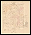
 Fifth Edition Ordnance Survey one-inch map numbers.jpg 1.514 × 879; 89 KB
-

-
 Jebel Musa in the 1869 Ordnance Survey of the Peninsula of Sinai (cropped).jpg 1.331 × 1.091; 351 KB
-
 Llyn Peninsula and Bardsey Island Geological map 1850.jpg 13.196 × 9.684; 17,14 MB
-
 Map image of Nether Langwith.PNG 276 × 205; 128 KB
-
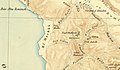
 Maps.nls.uk 7440 74400863 100 native.jpg 11.968 × 9.392; 17,37 MB
-
 Ordnance House, Ennis, Co.Clare (5587062410).jpg 600 × 452; 42 KB
-
 Ordnance Survey 1 inch Nottingham 1947.jpg 2.550 × 3.600; 7,95 MB
-
 Ordnance Survey Christmas card 1918, Ellis Martin.jpg 2.226 × 708; 325 KB
-
 Ordnance Survey Cut Mark (geograph 4212132).jpg 4.000 × 3.000; 4,35 MB
-
 Ordnance Survey Cut Mark (geograph 5411914).jpg 640 × 446; 69 KB
-
 Ordnance Survey Map - 1945 - Southend on Sea (cropped).jpg 1.307 × 1.165; 715 KB
-
 Ordnance Survey Map - 1945 - Southend on Sea.jpg 5.209 × 6.226; 11,48 MB
-
 Ordnance Survey of Jerusalem 1865.pdf 1.497 × 1.912, 206 Seiten; 45,01 MB
-
 Ordnance Survey plaque (28078937385).jpg 2.304 × 4.096; 1,2 MB
-
 Ordnance Survey Rivet - geograph.org.uk - 2775103.jpg 4.000 × 3.000; 4,18 MB
-
 Ordnance Survey Rivet with Cut Mark - geograph.org.uk - 3221348.jpg 3.264 × 2.448; 2,29 MB
-
 Ordnance Survey Surveyor - geograph.org.uk - 92314.jpg 426 × 640; 72 KB
-
 Ordnance Survey text logo.png 803 × 332; 23 KB
-
 Ordnance Survey, Abda (FL35468093 2367583).jpg 13.339 × 15.897; 289,93 MB
-
 Ordnance Survey, Beersheba (FL35468211 2367598).jpg 13.657 × 15.926; 276,02 MB
-
 Ordnance Survey, Bodhia (FL35468096 2367586).jpg 14.288 × 15.659; 280,43 MB
-
 Ordnance Survey, El Arish (FL35468250 2367591).jpg 14.188 × 19.053; 363,04 MB
-
 Ordnance Survey, El Kossaima (FL35468160 2367588).jpg 13.090 × 15.780; 268,46 MB
-
 Ordnance Survey, El Mayein (FL33121422 2367595).jpg 15.035 × 16.400; 286,37 MB
-
 Ordnance Survey, El Themed (FL35468114 2367584).jpg 13.656 × 16.113; 279,41 MB
-
 Ordnance Survey, Gebel Harun +Index 01 (FL35468169 2367582).jpg 15.212 × 16.982; 322,57 MB
-
 Ordnance Survey, Gebel Harun +Index 02-index (FL35468172 2367582).jpg 7.191 × 5.064; 45,46 MB
-
 Ordnance Survey, Giddi (FL35468200 2367590).jpg 13.622 × 15.914; 283,64 MB
-
 Ordnance Survey, Great Bitter Lake (FL35468246 2367593).jpg 13.656 × 18.233; 295,07 MB
-
 Ordnance Survey, Ismailia (FL35468277 2367601).jpg 14.088 × 15.680; 285,36 MB
-
 Ordnance Survey, Little Bitter Lake (FL35468220 2367592).jpg 14.921 × 17.316; 314,77 MB
-
 Ordnance Survey, Map of Roman Britain 00-map (FL37660708 2582616).jpg 15.610 × 21.345; 484,49 MB
-
 Ordnance Survey, Map of Roman Britain 01-idnex-cover (FL37660710 2582616).jpg 2.744 × 3.742; 11,53 MB
-
 Ordnance Survey, Map of Roman Britain 02-index-p (FL37660718 2582616).jpg 4.397 × 3.744; 13,66 MB
-
 Ordnance Survey, Map of Roman Britain 03-index-9 (FL37660725 2582616).jpg 4.683 × 3.744; 12,98 MB
-
 Ordnance Survey, Map of Roman Britain 04-index-p (FL37660734 2582616).jpg 4.659 × 3.715; 14,65 MB
-
 Ordnance Survey, Map of Roman Britain 05-index-p (FL37660741 2582616).jpg 4.725 × 3.733; 13,72 MB
-
 Ordnance Survey, Map of Roman Britain 06-index-p (FL37660746 2582616).jpg 4.731 × 3.744; 12,98 MB
-
 Ordnance Survey, Map of Roman Britain 07-index-p (FL37660751 2582616).jpg 4.665 × 3.733; 13,78 MB
-
 Ordnance Survey, Map of Roman Britain 08-index-p (FL37660754 2582616).jpg 4.713 × 3.721; 14,03 MB
-
 Ordnance Survey, Map of Roman Britain 09-index-p (FL37660760 2582616).jpg 4.671 × 3.727; 13,86 MB
-
 Ordnance Survey, Map of Roman Britain 10-index-p (FL37660766 2582616).jpg 2.502 × 3.688; 6,83 MB
-
 Ordnance Survey, Nekhl (FL35468107 2367585).jpg 13.956 × 16.221; 274,68 MB
-
 Ordnance Survey, Port Said (FL35468243 2367602).jpg 14.539 × 15.935; 299,7 MB
-
 Ordnance Survey, Proposed boundary between Jaffa and Tel Aviv (FL25570682 2760895).jpg 15.591 × 20.551; 410,18 MB
-
 Ordnance Survey, RAFA (FL35468229 2367597).jpg 13.989 × 15.963; 276,36 MB
-
 Ordnance Survey, Sabkhet el Bardawil (FL33121435 2367596).jpg 15.835 × 19.980; 444,29 MB
-
 Ordnance Survey, Suez (FL35468138 2367587).jpg 14.288 × 15.558; 283,79 MB
-
 Ordnance Survey, The A plan of partition (FL17237373 2760683).jpg 3.377 × 5.102; 16,82 MB
-
 Ordnance Survey, The boundaries of Jaffa (FL37481831 2760775).jpg 6.780 × 8.794; 76,08 MB
-
 Ordnance Survey, Wadi el Jeib (FL35468145 2367580).jpg 16.341 × 15.372; 304,09 MB
-
 Ordnance Survey, Wadi Fai (FL35468319 2367599).jpg 15.121 × 16.201; 315,7 MB
-
 Ordnance Survey, Wadi Geraia (FL33121420 2367581).jpg 14.806 × 16.062; 304,96 MB
-
 Ordnance Survey, Wadi Jerafi (FL35468287 2367594).jpg 14.921 × 16.078; 299,97 MB
-
 Ordnance Survey, Yelleg east (FL35468213 2367589).jpg 14.435 × 16.294; 268,04 MB
-
 OSMAP RisingSun.png 399 × 199; 179 KB
-
 Ramsden's zenith telescope.png 443 × 720; 180 KB
-

-
-
 Site of Landseer Park, 1902.jpg 1.034 × 403; 68 KB
-

-
 Skeletal Map of Tropical Africa Showing Distribution of Tsetse Flies.jpg 500 × 354; 133 KB
-
 Small Isles Ordnance Survey Map 1896.jpg 8.676 × 6.558; 8,17 MB
-

-
 Title page of Notes on the parallel roads of Glen Roy.pdf 1.239 × 1.754; 926 KB
-
 Title page of report on theExtension of the Principle Triangulation to Belgium 1863.pdf 1.239 × 1.754; 492 KB
-
 Title page of the Principal Triangulation 1858.pdf 1.239 × 1.754; 2,09 MB
-
 Triangulation Pillar Symbol green.svg 354 × 354; 408 Bytes
-
 Triangulation Pillar Symbol.svg 354 × 354; 408 Bytes
-
 Triangulation station.JPG 448 × 383; 23 KB


.jpg)


.jpg)

.jpg)
.jpg)
.jpg)

.jpg)


.jpg)
.jpg)
.jpg)
.jpg)
.jpg)
.jpg)
.jpg)
.jpg)
.jpg)
.jpg)
.jpg)
.jpg)
.jpg)
.jpg)
.jpg)
.jpg)
.jpg)
.jpg)
.jpg)
.jpg)
.jpg)
.jpg)
.jpg)
.jpg)
.jpg)
.jpg)
.jpg)
.jpg)
.jpg)
.jpg)
.jpg)
.jpg)
.jpg)
.jpg)
.jpg)
.jpg)
.jpg)


.jpg)


