Category:Osgathorpe
Aller à la navigation
Aller à la recherche
English: The small village of Osgathorpe lies in a fold of the hills in North West Leicestershire, England.

localité britannique du comté anglais de Leicestershire  | |||||
| Téléverser des médias | |||||
| Nature de l’élément | |||||
|---|---|---|---|---|---|
| Lieu | North West Leicestershire, Leicestershire, Midlands de l'Est, Angleterre | ||||
 | |||||
Sous-catégories
Cette catégorie comprend seulement la sous-catégorie ci-dessous.
O
- St Mary's church, Osgathorpe (6 F)
Média dans la catégorie « Osgathorpe »
Cette catégorie comprend 49 fichiers, dont les 49 ci-dessous.
-
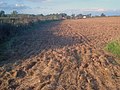 Arable land at Stordon Grange - geograph.org.uk - 1536644.jpg 640 × 480 ; 144 kio
-
 Arable land near West End - geograph.org.uk - 1536667.jpg 640 × 480 ; 169 kio
-
 Bend in Stordon Lane - geograph.org.uk - 1536629.jpg 640 × 480 ; 115 kio
-
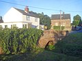 Bridge over the stream at Osgathorpe - geograph.org.uk - 1538118.jpg 640 × 480 ; 112 kio
-
 Brookside Farmhouse - geograph.org.uk - 1976500.jpg 1 200 × 900 ; 236 kio
-
 CharnwoodForestCanal 02.jpg 1 000 × 697 ; 591 kio
-
 Cycle Route 6 along Breedon Lane - geograph.org.uk - 2895698.jpg 4 000 × 3 000 ; 4,63 Mio
-
 Dawson's Road leaving Osgathorpe - geograph.org.uk - 2895669.jpg 4 000 × 3 000 ; 4,69 Mio
-
 Dry Canal Bed - geograph.org.uk - 1976402.jpg 1 200 × 900 ; 235 kio
-
 Entering Osgathorpe on Cycle Route 6 - geograph.org.uk - 2894291.jpg 4 000 × 3 000 ; 4,43 Mio
-
 Entrance to Breedon Lane - geograph.org.uk - 2895680.jpg 4 000 × 3 000 ; 4,7 Mio
-
 Entrance to Snarrows Sewage Works - geograph.org.uk - 1540829.jpg 640 × 480 ; 108 kio
-
 Footbridge over Westmeadow or Thringston Brook - geograph.org.uk - 4433229.jpg 1 200 × 900 ; 345 kio
-
 Hallington House in Osgathorpe.jpg 2 799 × 1 868 ; 2 Mio
-
 Junction House - geograph.org.uk - 1976424.jpg 1 200 × 900 ; 261 kio
-
 Main Street Osgathorpe - geograph.org.uk - 1536680.jpg 640 × 480 ; 72 kio
-
 Meadows around Elms Farm - geograph.org.uk - 1536572.jpg 640 × 480 ; 103 kio
-
 Old canal bridge - geograph.org.uk - 1976456.jpg 1 200 × 900 ; 192 kio
-
 Osgathorpe Parish Cemetery - geograph.org.uk - 2895694.jpg 4 000 × 3 000 ; 4,84 Mio
-
 Osgathorpe Parish Council Jubilee Wood - geograph.org.uk - 4433209.jpg 1 200 × 900 ; 314 kio
-
 Osgathorpe Sewage Pumping Station - geograph.org.uk - 4433201.jpg 1 200 × 900 ; 285 kio
-
 Path junction near Stordon Grange - geograph.org.uk - 1536657.jpg 640 × 480 ; 153 kio
-

-
 Public footpath near Storton Grange - geograph.org.uk - 1536659.jpg 640 × 480 ; 151 kio
-

-
 Snarrow's Road - geograph.org.uk - 1540772.jpg 640 × 480 ; 103 kio
-
 Snarrows Sewage Works - 1 - geograph.org.uk - 1540801.jpg 640 × 480 ; 122 kio
-
 Snarrows Sewage Works - 2 - geograph.org.uk - 1540816.jpg 640 × 480 ; 112 kio
-
 Stordon Lane - geograph.org.uk - 1536626.jpg 640 × 480 ; 126 kio
-
 The Barrow Hill Arm of the Charnwood Forest Canal - geograph.org.uk - 4433194.jpg 1 200 × 900 ; 143 kio
-
 The George and Dragon - geograph.org.uk - 1976480.jpg 1 200 × 900 ; 177 kio
-
 The George and Dragon inn on A512 - geograph.org.uk - 3195896.jpg 1 024 × 768 ; 578 kio
-
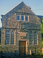 The headmaster's house - geograph.org.uk - 1538268.jpg 474 × 640 ; 129 kio
-
 The Old Rectory - geograph.org.uk - 1298637.jpg 640 × 426 ; 94 kio
-
 The Old Rectory, Osgathorpe (geograph 7069011).jpg 1 024 × 768 ; 179 kio
-
 The Residence, Osgathorpe (geograph 7069010).jpg 763 × 1 024 ; 194 kio
-
 The Stock Yard - geograph.org.uk - 1229008.jpg 640 × 480 ; 61 kio
-
 The Stock Yard - geograph.org.uk - 1298681.jpg 640 × 426 ; 89 kio
-
 The Stock Yard - geograph.org.uk - 1298693.jpg 640 × 426 ; 80 kio
-
 The Storey Arms at Osgathorpe - geograph.org.uk - 1536677.jpg 640 × 480 ; 95 kio
-
 View from St Mary's towards Church Lane, Osgathorpe - geograph.org.uk - 2895650.jpg 4 000 × 3 000 ; 4,58 Mio
-
 Woodside Farm - geograph.org.uk - 4433382.jpg 1 200 × 900 ; 147 kio
-
 Breedon Lane, Osgathorpe - geograph.org.uk - 370094.jpg 640 × 428 ; 111 kio
-
 Corner Pub - geograph.org.uk - 187071.jpg 640 × 480 ; 74 kio
-
 Elms Farm - geograph.org.uk - 239868.jpg 640 × 480 ; 92 kio
-
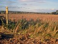
 Fields - geograph.org.uk - 239870.jpg 640 × 480 ; 101 kio
-
 Finger Post - geograph.org.uk - 239871.jpg 640 × 480 ; 50 kio
-
 Osgathorpe - geograph.org.uk - 192318.jpg 640 × 480 ; 76 kio
-
 Road to Osgathorpe - geograph.org.uk - 239874.jpg 640 × 480 ; 86 kio


.jpg)
.jpg)


