Category:Otterburn, North Yorkshire
Aller à la navigation
Aller à la recherche
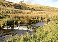
localité britannique du comté anglais de North Yorkshire  Otterburn Beck, north of Otterburn. | |||||
| Téléverser des médias | |||||
| Nature de l’élément | |||||
|---|---|---|---|---|---|
| Lieu | Craven, Yorkshire du Nord, Yorkshire-et-Humber, Angleterre | ||||
 | |||||
English: Otterburn is a village and civil parish in the Craven district of North Yorkshire, England. It is at OS Grid Reference SD8857, near Airton, Calton and the A65.
Sous-catégories
Cette catégorie comprend seulement la sous-catégorie ci-dessous.
D
- Dacre Lane, Otterburn (2 F)
Média dans la catégorie « Otterburn, North Yorkshire »
Cette catégorie comprend 96 fichiers, dont les 96 ci-dessous.
-
 'Common Nook', NE of Otterburn - geograph.org.uk - 4667733.jpg 1 024 × 683 ; 200 kio
-
 Benchmark on Crane Field Laithe - geograph.org.uk - 4669563.jpg 683 × 1 024 ; 320 kio
-
 Benchmark on Otterburn Bridge - geograph.org.uk - 4669579.jpg 1 024 × 683 ; 355 kio
-
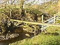
 Bridge below Reek House Hill - geograph.org.uk - 6284985.jpg 1 024 × 768 ; 238 kio
-
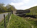
 Bridge over Otterburn Beck - geograph.org.uk - 2060582.jpg 640 × 480 ; 139 kio
-
 Bridge over Otterburn Beck - geograph.org.uk - 5854939.jpg 1 600 × 1 067 ; 621 kio
-
 Country Lane Otterburn - geograph.org.uk - 1893392.jpg 4 224 × 3 168 ; 6,32 Mio
-
 Crake Moor Covert - geograph.org.uk - 1214038.jpg 640 × 480 ; 131 kio
-
 Crane Field Beck and Laithe - geograph.org.uk - 5810347.jpg 1 024 × 768 ; 68 kio
-
 Crane Field Beck passing through sheep pasture - geograph.org.uk - 3944115.jpg 1 024 × 768 ; 104 kio
-
 Crane Field Hill - geograph.org.uk - 5091461.jpg 5 184 × 3 193 ; 1,79 Mio
-
 Crane Field Laithe - geograph.org.uk - 3944111.jpg 1 024 × 768 ; 79 kio
-
 Crane Field Laithe - geograph.org.uk - 4669571.jpg 1 024 × 683 ; 147 kio
-
 Crane Field Laithe - geograph.org.uk - 5092042.jpg 4 972 × 3 042 ; 1,6 Mio
-
 Dacre Lane - geograph.org.uk - 1214149.jpg 640 × 480 ; 139 kio
-
 Dacre Lane - geograph.org.uk - 1214157.jpg 640 × 480 ; 156 kio
-
 Dacre Lane - geograph.org.uk - 2837518.jpg 3 072 × 2 304 ; 1,54 Mio
-
 Dacre Lane, Otterburn - geograph.org.uk - 2838217.jpg 3 072 × 2 304 ; 1,62 Mio
-
 Disused postbox and marker stone, Otterburn - geograph.org.uk - 618773.jpg 478 × 640 ; 114 kio
-
 Dowber Syke - geograph.org.uk - 5092043.jpg 3 456 × 3 335 ; 2 Mio
-
 Entrance road to Hurries Farm - geograph.org.uk - 6196752.jpg 1 024 × 683 ; 152 kio
-
 Entrance to Hurries Farm - geograph.org.uk - 5854932.jpg 1 600 × 1 067 ; 449 kio
-

-
 Farmland, South Field Hill - geograph.org.uk - 4659440.jpg 640 × 426 ; 62 kio
-
 Field boundary - geograph.org.uk - 4659447.jpg 640 × 426 ; 39 kio
-
 Field off the Bell Busk road - geograph.org.uk - 619038.jpg 640 × 458 ; 65 kio
-
 Ford, Otterburn - geograph.org.uk - 619085.jpg 640 × 480 ; 118 kio
-
 Gate near Hurries Farm - geograph.org.uk - 5855516.jpg 1 600 × 1 067 ; 634 kio
-
 Gateways near Hurries Farm - geograph.org.uk - 4668731.jpg 1 024 × 683 ; 234 kio
-
 Gnarled hawthorn near Otterburn Beck - geograph.org.uk - 5854944.jpg 1 600 × 983 ; 481 kio
-
 Hawthorn trunks and roots, Otterburn - geograph.org.uk - 619101.jpg 640 × 480 ; 168 kio
-
 Hillside grazing, Reek House Hill - geograph.org.uk - 3806448.jpg 640 × 469 ; 52 kio
-
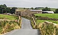
 Hurries Farm - geograph.org.uk - 1893379.jpg 4 224 × 3 168 ; 5,99 Mio
-
 Hurries Farm - geograph.org.uk - 2838218.jpg 3 072 × 2 304 ; 1,09 Mio
-
 Hurries Farm - geograph.org.uk - 5092044.jpg 5 184 × 2 678 ; 1,81 Mio
-
 Hurries Farm - geograph.org.uk - 5217914.jpg 1 600 × 1 200 ; 756 kio
-
 Langber Lane - geograph.org.uk - 965966.jpg 640 × 416 ; 99 kio
-
 Lilac bales at daybreak, Hurries Farm - geograph.org.uk - 5854945.jpg 800 × 533 ; 98 kio
-
 Log piles in Weningber Plantation - geograph.org.uk - 4667738.jpg 1 024 × 683 ; 230 kio
-
 Old seat with lamp post and pump. - geograph.org.uk - 379568.jpg 640 × 480 ; 166 kio
-
 Otterburn - geograph.org.uk - 5092052.jpg 5 184 × 2 941 ; 1,77 Mio
-
 Otterburn - geograph.org.uk - 966536.jpg 640 × 480 ; 96 kio
-
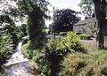 Otterburn and the Otterburn Beck - geograph.org.uk - 965979.jpg 640 × 459 ; 164 kio
-
 Otterburn Beck - geograph.org.uk - 2060581.jpg 640 × 480 ; 131 kio
-
 Otterburn Beck - geograph.org.uk - 2060583.jpg 640 × 480 ; 143 kio
-
 Otterburn Beck - geograph.org.uk - 543213.jpg 640 × 480 ; 223 kio
-
 Otterburn Beck - geograph.org.uk - 5854941.jpg 1 600 × 1 067 ; 361 kio
-
 Otterburn Beck - geograph.org.uk - 5855509.jpg 1 600 × 1 067 ; 415 kio
-
 Otterburn Beck, east of Reek House Hill - geograph.org.uk - 3944137.jpg 1 024 × 768 ; 131 kio
-
 Otterburn Beck, south of the village - geograph.org.uk - 6284959.jpg 1 024 × 768 ; 276 kio
-
 Otterburn Beck.jpg 640 × 480 ; 70 kio
-
 Otterburn Bridge - geograph.org.uk - 1213991.jpg 480 × 640 ; 129 kio
-
 Otterburn Bridge - geograph.org.uk - 4669585.jpg 1 024 × 683 ; 159 kio
-
 Pasture land, Bonber Hill - geograph.org.uk - 4659436.jpg 640 × 426 ; 47 kio
-
 Phragmites in Otterburn Beck - geograph.org.uk - 5855503.jpg 1 600 × 1 067 ; 558 kio
-
 Pole and rock strata, Otterburn - geograph.org.uk - 619110.jpg 640 × 480 ; 147 kio
-
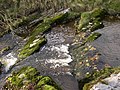 Rapids, Otterburn - geograph.org.uk - 619150.jpg 640 × 480 ; 145 kio
-
 River bed, Otterburn - geograph.org.uk - 619115.jpg 640 × 480 ; 175 kio
-
 Road closed at Otterburn cross roads - geograph.org.uk - 4669593.jpg 1 024 × 683 ; 171 kio
-
 Sheep and lambs alongside Crane Field Beck - geograph.org.uk - 3944091.jpg 1 024 × 768 ; 115 kio
-
 Sheep and lambs alongside Crane Field Beck - geograph.org.uk - 3944119.jpg 1 024 × 768 ; 123 kio
-
 Sheep grazing by issues and sinks, Otterburn valley - geograph.org.uk - 3944216.jpg 1 024 × 615 ; 101 kio
-
 Sheep grazing near Otterburn - geograph.org.uk - 6284971.jpg 1 024 × 768 ; 89 kio
-
 Sheep grazing, Crane Field Hill - geograph.org.uk - 4659449.jpg 640 × 426 ; 54 kio
-
 Sheep grazing, east side of Reek House Hill - geograph.org.uk - 3944131.jpg 1 024 × 614 ; 105 kio
-
 Sheep grazing, South Field Hill - geograph.org.uk - 4659445.jpg 640 × 426 ; 47 kio
-
 Sheepfold , Otterburn - geograph.org.uk - 618767.jpg 640 × 474 ; 125 kio
-
 Slopes of Crane Field Hill - geograph.org.uk - 4659452.jpg 640 × 426 ; 47 kio
-
 South Field Hill - geograph.org.uk - 4659443.jpg 640 × 426 ; 73 kio
-
 Stone barn at Hurries Farm - geograph.org.uk - 5854935.jpg 1 600 × 1 067 ; 579 kio
-
 The bridge at Otterburn - geograph.org.uk - 618734.jpg 640 × 495 ; 121 kio
-
 The eastern approach to a ford, Otterburn - geograph.org.uk - 618739.jpg 640 × 480 ; 171 kio
-
 The end of a ridge, Otterburn - geograph.org.uk - 618755.jpg 640 × 526 ; 120 kio
-
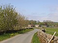
 The lane to Long Preston, Otterburn - geograph.org.uk - 618744.jpg 640 × 390 ; 121 kio
-
 The track to Kendal House, east of Otterburn - geograph.org.uk - 3944124.jpg 1 024 × 768 ; 102 kio
-
 The western approach to a ford, Otterburn - geograph.org.uk - 618735.jpg 640 × 480 ; 152 kio
-
 Track alongside the Otterburn Beck - geograph.org.uk - 965974.jpg 640 × 412 ; 97 kio
-
 Track and ash tree, Otterburn - geograph.org.uk - 619094.jpg 640 × 441 ; 73 kio
-
 Track from Park House - geograph.org.uk - 966533.jpg 640 × 480 ; 113 kio
-
 Track from Park House, Otterburn - geograph.org.uk - 619153.jpg 640 × 480 ; 140 kio
-
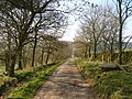
 Track north of Otterburn - geograph.org.uk - 4442410.jpg 2 592 × 1 944 ; 1,69 Mio
-
 Track to Park House, Otterburn - geograph.org.uk - 619067.jpg 640 × 480 ; 89 kio
-
 Track to Park House, Otterburn - geograph.org.uk - 619124.jpg 640 × 472 ; 92 kio
-
 Track to Park House, Otterburn - geograph.org.uk - 619131.jpg 640 × 471 ; 94 kio
-
 Track to Park House, Otterburn - geograph.org.uk - 619156.jpg 640 × 470 ; 97 kio
-
 Track, Otterburn - geograph.org.uk - 619060.jpg 640 × 469 ; 108 kio
-
 Tree roots near Park House, Otterburn - geograph.org.uk - 619167.jpg 640 × 492 ; 146 kio
-
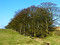
 Trees, Otterburn - geograph.org.uk - 619042.jpg 640 × 480 ; 99 kio
-
 Triple culvert - geograph.org.uk - 6285005.jpg 1 024 × 768 ; 162 kio
-
 View towards Crane Field Hill - geograph.org.uk - 4659451.jpg 640 × 426 ; 53 kio
-
 View towards Kendal Hill - geograph.org.uk - 6285012.jpg 1 024 × 768 ; 107 kio
-
 View towards Otterburn on a fine spring day - geograph.org.uk - 6284952.jpg 1 024 × 768 ; 195 kio
-
 Waterfall, Otterburn - geograph.org.uk - 619074.jpg 640 × 470 ; 116 kio
-
 Waterlogged grazing - geograph.org.uk - 3803444.jpg 640 × 480 ; 40 kio
-
 Wenningber Hill - geograph.org.uk - 966551.jpg 640 × 480 ; 59 kio
-
 Which way to go^ - geograph.org.uk - 1213995.jpg 640 × 480 ; 100 kio


