Category:Overseal
Aller à la navigation
Aller à la recherche
localité britannique du comté anglais de Derbyshire  | |||||
| Téléverser des médias | |||||
| Nature de l’élément | |||||
|---|---|---|---|---|---|
| Lieu | South Derbyshire, Derbyshire, Midlands de l'Est, Angleterre | ||||
 | |||||
Sous-catégories
Cette catégorie comprend 2 sous-catégories, dont les 2 ci-dessous.
S
- Short Heath, Derbyshire (5 F)
- St Matthew Church, Overseal (2 F)
Média dans la catégorie « Overseal »
Cette catégorie comprend 57 fichiers, dont les 57 ci-dessous.
-
 44541 &44591 Overseal MPD 17-3-63 (38759952824).jpg 2 455 × 1 637 ; 1,89 Mio
-
 Acresford Road, Overseal - geograph.org.uk - 6203815.jpg 800 × 600 ; 189 kio
-
 Bend in Gunby Hill Road - geograph.org.uk - 1800381.jpg 640 × 480 ; 108 kio
-
 Broomfield Wood near Overseal - geograph.org.uk - 2389909.jpg 3 296 × 2 472 ; 1,06 Mio
-
 Burton Road, Overseal - geograph.org.uk - 6203831.jpg 800 × 521 ; 90 kio
-
 Burton Road, Overseal - geograph.org.uk - 6205789.jpg 640 × 480 ; 72 kio
-

-

-
 Cycle Route 63 entering Swainspark Wood - geograph.org.uk - 6081259.jpg 3 776 × 2 520 ; 4,16 Mio
-
 Derbyshire UK parish map highlighting Overseal.svg 888 × 1 308 ; 2,35 Mio
-
 Elizabeth II postbox on Burton Road, Overseal - geograph.org.uk - 6205765.jpg 3 123 × 3 593 ; 3,16 Mio
-
 Elizabeth II postbox on Burton Road, Overseal - geograph.org.uk - 6205787.jpg 1 979 × 2 959 ; 1,46 Mio
-
 Footpath and Wheat Field near Linton Heath - geograph.org.uk - 4648757.jpg 4 000 × 3 000 ; 2,26 Mio
-
 Footpath passes by Grange Farm - geograph.org.uk - 4144673.jpg 1 600 × 1 068 ; 519 kio
-
 Footpath to Gorsey Leys - geograph.org.uk - 4144683.jpg 1 200 × 1 600 ; 868 kio
-
 Grange Farm on the A444 at Overseal - geograph.org.uk - 373835.jpg 640 × 480 ; 86 kio
-
 Grazing off Burton Road, Overseal - geograph.org.uk - 6203827.jpg 800 × 600 ; 114 kio
-
 Green Lane at Overseal - geograph.org.uk - 4648751.jpg 4 000 × 3 000 ; 2,48 Mio
-
 Horse field and stables - geograph.org.uk - 374716.jpg 481 × 640 ; 62 kio
-
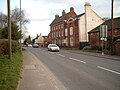
 House on Main Street, Overseal - geograph.org.uk - 6203816.jpg 800 × 600 ; 100 kio
-
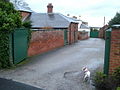
 House on Moira Road, Gorsey Leys - geograph.org.uk - 6203798.jpg 800 × 526 ; 82 kio
-
 Houses on Burton Road, Overseal - geograph.org.uk - 6205768.jpg 5 184 × 3 888 ; 4,27 Mio
-
 Main Street, Overseal - geograph.org.uk - 6203818.jpg 800 × 600 ; 89 kio
-
 Middle Hayes Farm - geograph.org.uk - 369176.jpg 640 × 480 ; 144 kio
-
 Moira Road, Gorsey Leys - geograph.org.uk - 6203799.jpg 800 × 600 ; 119 kio
-
 Muddy Path to woods - geograph.org.uk - 364323.jpg 640 × 480 ; 128 kio
-
 Nearly in Leicestershire - geograph.org.uk - 5566125.jpg 2 000 × 1 333 ; 1,8 Mio
-
 Original end - geograph.org.uk - 557690.jpg 640 × 480 ; 102 kio
-
 Overseal 324471 cfb23c75.jpg 640 × 480 ; 122 kio
-
 Overseal carnival 2006 - geograph.org.uk - 368677.jpg 640 × 480 ; 96 kio
-
 Overseal housing - geograph.org.uk - 5566693.jpg 2 000 × 1 333 ; 1,71 Mio
-
 Overseal MPD 17-03-63 (28580311504).jpg 2 553 × 1 701 ; 860 kio
-
 Overseal Post Office - geograph.org.uk - 5566695.jpg 2 000 × 1 333 ; 1,72 Mio
-
 Overseale House on Acresford Road (geograph 3171595).jpg 3 912 × 2 880 ; 1,85 Mio
-
 Path at the edge of Gunby Lea Wood - geograph.org.uk - 1800492.jpg 640 × 480 ; 95 kio
-
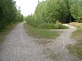
 Path into Overseal - geograph.org.uk - 4144676.jpg 1 200 × 1 600 ; 532 kio
-
 Path through Gunby Lea Wood - geograph.org.uk - 1800508.jpg 640 × 465 ; 97 kio
-
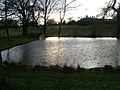
 Ponds near Overseal - geograph.org.uk - 4144686.jpg 1 600 × 1 067 ; 435 kio
-
 Coalville, Overseal & Moira & Hugglescote Fleetwood RJD 115.jpg 2 861 × 1 890 ; 928 kio
-
 Railway near Overseal - geograph.org.uk - 797889.jpg 640 × 456 ; 83 kio
-
 Road Junction at Gorsey Leys - geograph.org.uk - 3171501.jpg 3 850 × 2 790 ; 2,07 Mio
-
 Round the back - geograph.org.uk - 365772.jpg 640 × 480 ; 124 kio
-
 Runway - geograph.org.uk - 369188.jpg 640 × 467 ; 103 kio
-

-
 Stile on the path to Cadborough Farm - geograph.org.uk - 4144678.jpg 1 600 × 1 067 ; 681 kio
-
 Swansong - geograph.org.uk - 337196.jpg 640 × 480 ; 120 kio
-
 The brook by Woodville Road - geograph.org.uk - 4144760.jpg 1 600 × 1 066 ; 784 kio
-
 The path to Valley Road by Cadborough Hill Wood - geograph.org.uk - 4144671.jpg 1 600 × 1 067 ; 542 kio
-
 The Robin Hood public house, Overseal - geograph.org.uk - 6203821.jpg 800 × 545 ; 69 kio
-
 The Robin Hood.jpg 2 304 × 1 728 ; 780 kio
-
 Tradesmans Entrance - geograph.org.uk - 337189.jpg 640 × 480 ; 104 kio
-
 Up the junction - geograph.org.uk - 555535.jpg 640 × 480 ; 123 kio
-
 What Reservoir - geograph.org.uk - 364387.jpg 640 × 480 ; 144 kio
-
 Wheat Field Overlooking Linton Heath - geograph.org.uk - 4648761.jpg 4 000 × 3 000 ; 2,52 Mio
-
 Woodland for sale - geograph.org.uk - 5566120.jpg 2 000 × 1 333 ; 2,49 Mio
-
 A444 Acresford Road lay-by - geograph.org.uk - 1119991.jpg 640 × 397 ; 40 kio
-
 Cadborough Wood - geograph.org.uk - 365721.jpg 640 × 480 ; 134 kio
.jpg)


.jpg)

.jpg)


