Category:Overton, Lancashire
Aller à la navigation
Aller à la recherche
English: Overton is a village and civil parish within the City of Lancaster in Lancashire, England. It is located to the south west of Lancaster, between Heysham and the estuary of the River Lune. Neighbouring villages include Middleton and Sunderland Point; Glasson is on the opposite side of the river. The parish had a population of 1,015 recorded in the 2001 census. (→Overton, Lancashire)
Nederlands: Overton is een plaats en civil parish in het bestuurlijke gebied Lancaster, in het Engelse graafschap Lancashire met 1.015 inwoners. (→Overton (Lancashire))
Polski: Overton – wieś w Anglii, w hrabstwie Lancashire, w dystrykcie Lancaster. Leży 74 km na północny zachód od miasta Manchester i 334 km na północny zachód od Londynu. W 2001 miejscowość liczyła 1015 mieszkańców. (→Overton (Lancashire))
village et paroisse civile anglaise dans le Lancashire  | |||||
| Téléverser des médias | |||||
| Nature de l’élément | |||||
|---|---|---|---|---|---|
| Lieu | cité de Lancaster, Lancashire, Angleterre du Nord-Ouest, Angleterre | ||||
 | |||||
Sous-catégories
Cette catégorie comprend 6 sous-catégories, dont les 6 ci-dessous.
Média dans la catégorie « Overton, Lancashire »
Cette catégorie comprend 243 fichiers, dont les 200 ci-dessous.
(page précédente) (page suivante)-
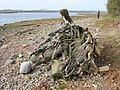
 'Sol's Gate', Overton - geograph.org.uk - 5082107.jpg 654 × 480 ; 101 kio
-
 A boat on the shore, Sunderland - geograph.org.uk - 3443842.jpg 600 × 800 ; 221 kio
-
 A boat on the shore, Sunderland - geograph.org.uk - 3443865.jpg 800 × 600 ; 196 kio
-
 Access Lane to Bazil - geograph.org.uk - 4580970.jpg 1 600 × 1 067 ; 538 kio
-
 Awaiting the returning tide, Sunderland Point - geograph.org.uk - 940271.jpg 640 × 480 ; 83 kio
-
 Bazil Point, near Overton - geograph.org.uk - 1206633.jpg 640 × 427 ; 120 kio
-
 Bird hide, Sunderland - geograph.org.uk - 6069275.jpg 1 280 × 850 ; 382 kio
-
 Bird in the shallows - geograph.org.uk - 5076259.jpg 1 280 × 959 ; 700 kio
-
 Boat at Sunderland - geograph.org.uk - 3894707.jpg 640 × 423 ; 302 kio
-
 Boats at Sunderland - geograph.org.uk - 3790690.jpg 640 × 425 ; 141 kio
-
 Boats at Sunderland - geograph.org.uk - 3894724.jpg 640 × 425 ; 117 kio
-
 Building between Old Hall and Second Terrace - geograph.org.uk - 3009559.jpg 640 × 480 ; 155 kio
-
 Capturing the scene at Glasson - geograph.org.uk - 5851707.jpg 720 × 960 ; 141 kio
-
 Cattle, Lades Marsh - geograph.org.uk - 5080605.jpg 800 × 600 ; 157 kio
-
 Causeway road at Sunderland at low tide - geograph.org.uk - 5703779.jpg 4 732 × 2 819 ; 2,5 Mio
-
 Chapel Lane, Overton - geograph.org.uk - 1210083.jpg 640 × 427 ; 83 kio
-
 Chapel Point, Overton - geograph.org.uk - 5076151.jpg 2 669 × 1 997 ; 2,9 Mio
-
 Choice Of Route - geograph.org.uk - 3282128.jpg 1 600 × 1 200 ; 1,1 Mio
-
 Coastal marsh near Sunderland point - geograph.org.uk - 1722072.jpg 2 592 × 1 944 ; 1,24 Mio
-
 Coastal path at Sunderland - geograph.org.uk - 5076261.jpg 4 000 × 3 000 ; 6,45 Mio
-
 Coastal scene at Sunderland - geograph.org.uk - 5076154.jpg 1 280 × 960 ; 749 kio
-
 Colloway Marsh - geograph.org.uk - 4294859.jpg 3 758 × 2 527 ; 1,88 Mio
-
 Cows Grazing near Sunderland Brows - geograph.org.uk - 6167048.jpg 800 × 600 ; 579 kio
-
 Creek at Middleton - geograph.org.uk - 1902529.jpg 640 × 480 ; 57 kio
-
 Crook Cottage - geograph.org.uk - 3009552.jpg 640 × 480 ; 109 kio
-
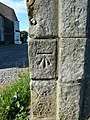
 Cut benchmark on gatepost, Overton - geograph.org.uk - 5079237.jpg 480 × 640 ; 160 kio
-
 Dam-boards, First Terrace - geograph.org.uk - 3835910.jpg 640 × 427 ; 138 kio
-
 Distressed Fence at Bazil Point - geograph.org.uk - 4581167.jpg 1 600 × 1 067 ; 677 kio
-
 Electricity pylons bridge the River Lune - geograph.org.uk - 6203564.jpg 4 494 × 2 991 ; 7,95 Mio
-
 Electricity pylons crossing the River Lune - geograph.org.uk - 6212554.jpg 4 220 × 2 808 ; 5,22 Mio
-
 End of the road - geograph.org.uk - 3540086.jpg 4 000 × 2 666 ; 1,67 Mio
-
 Erosion control near Old Hall - geograph.org.uk - 3231655.jpg 640 × 425 ; 340 kio
-
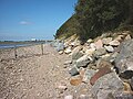 Erosion control, Bazil Point - geograph.org.uk - 5080626.jpg 640 × 480 ; 145 kio
-
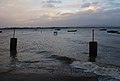
 Evening falls over Sunderland - geograph.org.uk - 2574948.jpg 800 × 410 ; 64 kio
-
 Farm, Yenham Lane - geograph.org.uk - 6167268.jpg 800 × 533 ; 558 kio
-
 Farmland near Overton - geograph.org.uk - 6167199.jpg 800 × 533 ; 424 kio
-
 Farmland near Sunderland - geograph.org.uk - 2558520.jpg 640 × 425 ; 274 kio
-
 Ferry Cottage, Bazil Point - geograph.org.uk - 1206193.jpg 640 × 427 ; 90 kio
-
 First Terrace and The Lane, Sunderland - geograph.org.uk - 3009565.jpg 480 × 640 ; 67 kio
-
 First Terrace and The Lane, Sunderland - geograph.org.uk - 3009569.jpg 640 × 480 ; 120 kio
-
 First Terrace and The Lane, Sunderland - geograph.org.uk - 3009570.jpg 640 × 480 ; 101 kio
-
 First Terrace, Sunderland - geograph.org.uk - 1211853.jpg 640 × 427 ; 105 kio
-
 First Terrace, Sunderland - geograph.org.uk - 3835905.jpg 640 × 425 ; 137 kio
-
 First Terrace, Sunderland - geograph.org.uk - 3894713.jpg 640 × 425 ; 151 kio
-
 Fishing boat at Sunderland - geograph.org.uk - 3894716.jpg 640 × 585 ; 217 kio
-
 Fishing boat at Sunderland - geograph.org.uk - 3894732.jpg 640 × 425 ; 181 kio
-
 Fishing boats at Sunderland - geograph.org.uk - 2544043.jpg 640 × 425 ; 263 kio
-
 Fishing boats Lune Estuary, Sunderland Point - geograph.org.uk - 1068583.jpg 600 × 450 ; 234 kio
-
 Fishing boats on the Lune Estuary - geograph.org.uk - 1076813.jpg 640 × 480 ; 80 kio
-
 Fiskes Point - geograph.org.uk - 1206581.jpg 640 × 427 ; 94 kio
-
 Footpath along the shore - geograph.org.uk - 1206561.jpg 640 × 480 ; 79 kio
-
 Footpath between Bazil Point and Overton - geograph.org.uk - 4580975.jpg 1 600 × 1 067 ; 580 kio
-

-
 Footpath from Old Hall to Sunderland Point - geograph.org.uk - 3009542.jpg 640 × 480 ; 150 kio
-
 Footpath to Bazil Point - geograph.org.uk - 1211858.jpg 640 × 480 ; 81 kio
-
 Footpath to Bazil Point - geograph.org.uk - 4580963.jpg 1 600 × 1 067 ; 412 kio
-
 Footpath to Overton - geograph.org.uk - 1210055.jpg 640 × 427 ; 120 kio
-
 Footpath up the hill - geograph.org.uk - 1210070.jpg 640 × 427 ; 100 kio
-
 Foreshore at Old Hall, Sunderland - geograph.org.uk - 3835926.jpg 640 × 453 ; 196 kio
-
 Foreshore at Potts Corner - geograph.org.uk - 2508733.jpg 2 592 × 1 944 ; 1,69 Mio
-
 Foreshore at Sunderland - geograph.org.uk - 3009486.jpg 640 × 480 ; 135 kio
-
 Foreshore at Sunderland Point - geograph.org.uk - 3835931.jpg 640 × 438 ; 208 kio
-
 Foreshore near Old Hall, Sunderland - geograph.org.uk - 3009533.jpg 640 × 480 ; 147 kio
-
 Foreshore near Old Hall, Sunderland - geograph.org.uk - 3009545.jpg 640 × 480 ; 138 kio
-
 Foreshore towards Sunderland Point from Old Hall - geograph.org.uk - 3009548.jpg 640 × 480 ; 130 kio
-
 Former Primitive Methodist chapel, Overton, Lancashire.jpg 3 196 × 2 397 ; 3,76 Mio
-
 Gate on the flood defences at Overton - geograph.org.uk - 1210395.jpg 640 × 427 ; 105 kio
-
 Gateway near Downy Field Farm - geograph.org.uk - 3637047.jpg 640 × 425 ; 238 kio
-
 Glebe Farmhouse.jpg 4 608 × 3 456 ; 3,61 Mio
-
 Grazing land near Sunderland - geograph.org.uk - 3790674.jpg 640 × 497 ; 214 kio
-
 Grazing land near Trailholme - geograph.org.uk - 3626744.jpg 640 × 425 ; 154 kio
-
 Grazing Land to the east of Middleton Road - geograph.org.uk - 6167197.jpg 800 × 533 ; 493 kio
-
 Hall End Skear - geograph.org.uk - 3702590.jpg 640 × 425 ; 166 kio
-
 Hall End Skear and Sunderland Point - geograph.org.uk - 3702586.jpg 640 × 425 ; 186 kio
-
 Herd of cows on the River Lune mudflats - geograph.org.uk - 5911293.jpg 640 × 425 ; 42 kio
-
 High tide at Sunderland - geograph.org.uk - 3835918.jpg 640 × 435 ; 145 kio
-
 High tide near Sunderland Brows - geograph.org.uk - 3834569.jpg 640 × 425 ; 185 kio
-
 Horizon Line Chamber, Sunderland - geograph.org.uk - 6069265.jpg 1 280 × 862 ; 480 kio
-
 Horizon Line Chamber, Sunderland - geograph.org.uk - 6069269.jpg 1 280 × 850 ; 395 kio
-
 Horizon Line Chamber, Sunderland - geograph.org.uk - 6105290.jpg 850 × 1 280 ; 422 kio
-
 Horizon Line Chamber, Sunderland - geograph.org.uk - 6105293.jpg 1 280 × 1 280 ; 345 kio
-
 Horizon Line Chamber, Sunderland - geograph.org.uk - 6105294.jpg 640 × 640 ; 46 kio
-
 Lades Bridge - geograph.org.uk - 1167603.jpg 640 × 480 ; 47 kio
-
 Lades Marsh - geograph.org.uk - 1167608.jpg 640 × 480 ; 42 kio
-
 Lades Marsh - geograph.org.uk - 1167612.jpg 640 × 480 ; 54 kio
-
 Lades Marsh - geograph.org.uk - 1206745.jpg 640 × 419 ; 99 kio
-
 Lades Marsh - geograph.org.uk - 1208184.jpg 427 × 640 ; 114 kio
-
 Litter bin at Potts Corner - geograph.org.uk - 3352792.jpg 640 × 410 ; 137 kio
-
 Looking over the Lune - geograph.org.uk - 1167592.jpg 640 × 480 ; 62 kio
-
 Looking towards Lades Marsh - geograph.org.uk - 1206715.jpg 640 × 480 ; 101 kio
-
 Looking west from Sambo's grave - geograph.org.uk - 5076270.jpg 2 669 × 1 998 ; 3,67 Mio
-
 Lune estuary at Sunderland - geograph.org.uk - 3627970.jpg 640 × 554 ; 131 kio
-
 Lune estuary at Sunderland - geograph.org.uk - 3702595.jpg 640 × 425 ; 109 kio
-
 Lune estuary at Sunderland - geograph.org.uk - 3790683.jpg 640 × 431 ; 116 kio
-
 Lune estuary at Sunderland - geograph.org.uk - 3894727.jpg 640 × 425 ; 160 kio
-
 Lune estuary from Sunderland at low tide - geograph.org.uk - 5703783.jpg 5 202 × 3 465 ; 3,65 Mio
-
 Lune estuary near Wood Bridge - geograph.org.uk - 3627982.jpg 640 × 425 ; 92 kio
-
 Main Outlet Channel for Lades Pool - geograph.org.uk - 4581109.jpg 1 600 × 1 067 ; 182 kio
-
 Main Street, Overton - geograph.org.uk - 6167207.jpg 800 × 600 ; 605 kio
-
 Memorial Hall, Overton, Lancashire.jpg 3 567 × 2 378 ; 3,13 Mio
-
 Middleton Road approaching Overton - geograph.org.uk - 6167193.jpg 800 × 533 ; 463 kio
-
 Middleton Sands - geograph.org.uk - 1902554.jpg 640 × 480 ; 34 kio
-
 Middleton Sands, Car Park at Potts Corner - geograph.org.uk - 6167031.jpg 800 × 600 ; 505 kio
-
 Moss Lane - geograph.org.uk - 4584818.jpg 1 600 × 1 067 ; 547 kio
-
 Muddy track, Overton - geograph.org.uk - 1210061.jpg 640 × 427 ; 92 kio
-
 North Farmhouse.jpg 4 608 × 3 456 ; 5,09 Mio
-
 Odd cloud over Sunderland - geograph.org.uk - 4986554.jpg 600 × 800 ; 50 kio
-
 Old boat at Sunderland - geograph.org.uk - 3627950.jpg 640 × 425 ; 126 kio
-
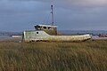 Old boat at Sunderland - geograph.org.uk - 3790680.jpg 640 × 425 ; 128 kio
-
 Old boat at Sunderland - geograph.org.uk - 3834567.jpg 640 × 425 ; 110 kio
-
 Old boat at Sunderland - geograph.org.uk - 5141323.jpg 640 × 640 ; 206 kio
-
 Old boats at Sunderland - geograph.org.uk - 3834563.jpg 640 × 446 ; 123 kio
-
 Old Hall, Sunderland - geograph.org.uk - 3009539.jpg 640 × 480 ; 156 kio
-
 Old Hall, Sunderland Point - geograph.org.uk - 4583573.jpg 1 600 × 1 067 ; 558 kio
-
 Old pillbox, west shore of Sunderland Point - geograph.org.uk - 3443625.jpg 640 × 480 ; 76 kio
-
 Old tram near Sunderland - geograph.org.uk - 3834575.jpg 640 × 425 ; 195 kio
-
 Old tram near Sunderland - geograph.org.uk - 6104236.jpg 1 280 × 850 ; 546 kio
-
 Old tree roots on the shore - geograph.org.uk - 1206736.jpg 640 × 480 ; 146 kio
-
 On Lades Bridge - geograph.org.uk - 1167605.jpg 640 × 480 ; 43 kio
-
 On Middleton Sands - geograph.org.uk - 1902547.jpg 640 × 480 ; 45 kio
-
 On Middleton Sands - geograph.org.uk - 1902560.jpg 640 × 480 ; 30 kio
-
 On the edge of Lades Marsh - geograph.org.uk - 1208097.jpg 640 × 427 ; 90 kio
-
 On the flood bank by Lades Marsh - geograph.org.uk - 1208107.jpg 640 × 427 ; 80 kio
-
 On the Foreshore - geograph.org.uk - 1902534.jpg 640 × 480 ; 67 kio
-
 On the saltmarsh north of Sunderland Point - geograph.org.uk - 3443594.jpg 640 × 480 ; 79 kio
-
-
 Overton (1) - geograph.org.uk - 4580989.jpg 1 600 × 1 067 ; 525 kio
-
 Overton (2) - geograph.org.uk - 4581099.jpg 1 600 × 1 067 ; 499 kio
-
 Overton - geograph.org.uk - 1208222.jpg 640 × 427 ; 89 kio
-
 Overton - geograph.org.uk - 4878577.jpg 5 184 × 3 456 ; 1,75 Mio
-
 Overton - geograph.org.uk - 4878907.jpg 5 184 × 2 577 ; 1,84 Mio
-
 Overton across the Lune from Glasson - geograph.org.uk - 1415563.jpg 640 × 480 ; 62 kio
-
 Overton dyke - geograph.org.uk - 1210390.jpg 640 × 427 ; 82 kio
-
 Overton dyke tidal flap - geograph.org.uk - 1210388.jpg 640 × 427 ; 96 kio
-
 Overton from the air - geograph.org.uk - 2730378.jpg 640 × 427 ; 181 kio
-
 Overton Hall, Overton, Lancashire.jpg 2 548 × 2 548 ; 2,75 Mio
-
 Overton Trig - geograph.org.uk - 3283048.jpg 1 600 × 1 200 ; 799 kio
-
 Overton, Bazil Lane - geograph.org.uk - 6167261.jpg 800 × 600 ; 721 kio
-
 Overton, Church Grove - geograph.org.uk - 6167233.jpg 800 × 600 ; 623 kio
-
 Overton, Lancaster Road - geograph.org.uk - 6167218.jpg 800 × 533 ; 443 kio
-
 Overton, The Road to Sunderland - geograph.org.uk - 6167289.jpg 800 × 533 ; 497 kio
-

-
 Pasture and pylons - geograph.org.uk - 2431947.jpg 640 × 480 ; 79 kio
-
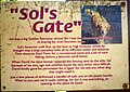 Plaque at 'Sol's Gate', Overton - geograph.org.uk - 5079245.jpg 720 × 512 ; 138 kio
-
 Potts Corner - geograph.org.uk - 1902524.jpg 640 × 480 ; 43 kio
-
 Potts Corner - geograph.org.uk - 6167033.jpg 800 × 600 ; 588 kio
-
 Receding tide at Bazil Point - geograph.org.uk - 1206540.jpg 640 × 427 ; 73 kio
-
 River Lune - geograph.org.uk - 1328198.jpg 640 × 480 ; 46 kio
-
 River Lune - geograph.org.uk - 4199376.jpg 4 608 × 3 456 ; 3,45 Mio
-
 River Lune - geograph.org.uk - 811024.jpg 640 × 480 ; 55 kio
-
 River Lune near Stodday - geograph.org.uk - 1962126.jpg 3 072 × 2 304 ; 2,55 Mio
-
 Sailing by Sunderland - geograph.org.uk - 3941388.jpg 800 × 578 ; 53 kio
-
 Saltmarsh - geograph.org.uk - 1902527.jpg 640 × 480 ; 70 kio
-
 Sambo's Grave (in 1974) - geograph.org.uk - 2292122.jpg 1 600 × 1 023 ; 358 kio
-
 Sambo's Grave - geograph.org.uk - 6069250.jpg 1 280 × 875 ; 663 kio
-
 Sambo's Grave - geograph.org.uk - 6069254.jpg 1 280 × 1 024 ; 811 kio
-
 Sambo's Grave, Sunderland Point - geograph.org.uk - 3540109.jpg 3 854 × 2 550 ; 3,08 Mio
-
 Sea wall near Sunderland Point - geograph.org.uk - 6105284.jpg 1 280 × 850 ; 511 kio
-
 Second Terrace, Sunderland - geograph.org.uk - 3009562.jpg 640 × 480 ; 160 kio
-
 Second Terrace, Sunderland - geograph.org.uk - 3009563.jpg 640 × 480 ; 129 kio
-
 Ship Hotel, Overton - geograph.org.uk - 2727250.jpg 640 × 425 ; 138 kio
-
 Ship Hotel, Overton, Lancashire.jpg 2 741 × 3 653 ; 4,3 Mio
-
 Shore on Bazil Point - geograph.org.uk - 1206731.jpg 640 × 427 ; 130 kio
-
 Silhouettes on the sand at Potts Corner - geograph.org.uk - 1710864.jpg 2 555 × 1 889 ; 1,31 Mio
-
 Slipway at Sunderland - geograph.org.uk - 5704471.jpg 5 202 × 3 465 ; 3,94 Mio
-
 Small boats at Sunderland - geograph.org.uk - 3894721.jpg 640 × 471 ; 210 kio
-
 Small boats at Sunderland - geograph.org.uk - 3894730.jpg 640 × 425 ; 136 kio
-
 St Helen's Church, Overton - geograph.org.uk - 5079232.jpg 800 × 600 ; 170 kio
-
 St Helen's Church, Overton - geograph.org.uk - 6167230.jpg 800 × 601 ; 830 kio
-
 St. Helen's Church, Overton - geograph.org.uk - 4580954.jpg 1 600 × 1 067 ; 586 kio
-
 St. Helen's, Overton - geograph.org.uk - 5076143.jpg 1 280 × 960 ; 1,02 Mio
-
 Step-ladder stile - geograph.org.uk - 1208202.jpg 640 × 427 ; 127 kio
-
 Still floating . . . - geograph.org.uk - 1206597.jpg 640 × 427 ; 84 kio
-
 Stone post by the Lune, Sunderland - geograph.org.uk - 3443809.jpg 800 × 600 ; 143 kio
-
 Sunderland (1) - geograph.org.uk - 4583599.jpg 1 600 × 1 067 ; 592 kio
-
 Sunderland (2) - geograph.org.uk - 4584012.jpg 1 600 × 1 067 ; 751 kio
-
 Sunderland (3) - geograph.org.uk - 4584019.jpg 1 600 × 1 067 ; 702 kio
-
 Sunderland - geograph.org.uk - 4295525.jpg 3 888 × 2 592 ; 1,39 Mio
-
 Sunderland Bank - geograph.org.uk - 6167053.jpg 800 × 600 ; 595 kio
-
 Sunderland Brows Farm - geograph.org.uk - 3834574.jpg 640 × 425 ; 171 kio
-
 Sunderland Point - geograph.org.uk - 2335193.jpg 800 × 533 ; 341 kio
-
 Sunderland Point - geograph.org.uk - 3314947.jpg 640 × 846 ; 127 kio
-
 Sunderland Point - geograph.org.uk - 4583583.jpg 1 600 × 1 067 ; 611 kio
-
 Sunderland Point from Glasson - geograph.org.uk - 1415544.jpg 640 × 480 ; 74 kio
-
 Sunderland Point Tidal Road - geograph.org.uk - 4289476.jpg 3 872 × 2 592 ; 3,42 Mio
-
 Sunset over Sunderland and the Lune estuary - geograph.org.uk - 2437664.jpg 1 024 × 393 ; 58 kio
-
 The Coastal Path towards Sunderland - geograph.org.uk - 6167056.jpg 800 × 600 ; 671 kio
-
 The Cotton Tree (in 1974) - geograph.org.uk - 2292130.jpg 1 600 × 1 084 ; 285 kio
-
 The east side of Sunderland Point (in 1974) - geograph.org.uk - 2292135.jpg 1 600 × 1 064 ; 317 kio
-
 The end of The Lane, Sunderland - geograph.org.uk - 3009499.jpg 640 × 480 ; 116 kio
-
 The Foreshore at Sunderland Point - geograph.org.uk - 1130196.jpg 640 × 480 ; 313 kio
-
 The Globe Hotel, Overton - geograph.org.uk - 6167203.jpg 800 × 533 ; 558 kio
-
 The Lane at Sunderland - geograph.org.uk - 5076263.jpg 4 000 × 3 000 ; 5,92 Mio
-
 The Lane, Sunderland - geograph.org.uk - 3009494.jpg 640 × 480 ; 142 kio
-
 The Lane, Sunderland - geograph.org.uk - 3835893.jpg 640 × 425 ; 166 kio
-
 The Lune estuary at Bazil Point - geograph.org.uk - 5079223.jpg 800 × 600 ; 185 kio
-
 The Lune estuary east of Glasson Dock - geograph.org.uk - 6202179.jpg 4 395 × 2 925 ; 7,91 Mio
-
 The Old Chapel.jpg 4 503 × 3 377 ; 2,98 Mio
-
 The Parish Church of St Helen, Overton - geograph.org.uk - 6167244.jpg 800 × 600 ; 828 kio
-


_-_geograph.org.uk_-_4580989.jpg)
_-_geograph.org.uk_-_4581099.jpg)


_-_geograph.org.uk_-_2292122.jpg)


_-_geograph.org.uk_-_4583599.jpg)
_-_geograph.org.uk_-_4584012.jpg)
_-_geograph.org.uk_-_4584019.jpg)


_-_geograph.org.uk_-_2292130.jpg)
_-_geograph.org.uk_-_2292135.jpg)


