Category:Oxspring
Vai alla navigazione
Vai alla ricerca
English: Oxspring is a village and civil parish in the Metropolitan Borough of Barnsley in South Yorkshire, England. At the 2001 census it had a population of 1,048.
Nederlands: Oxspring is een dorp (village) en civil parish in het bestuurlijke gebied Barnsley, in het Engelse graafschap South Yorkshire. De civil parish telt
village in the United Kingdom  | |||||
| Carica un file multimediale | |||||
| Istanza di | |||||
|---|---|---|---|---|---|
| Luogo | Barnsley, South Yorkshire, Yorkshire e Humber, Inghilterra | ||||
| sito web ufficiale | |||||
 | |||||
Sottocategorie
Questa categoria contiene le 3 sottocategorie indicate di seguito, su un totale di 3.
File nella categoria "Oxspring"
Questa categoria contiene 177 file, indicati di seguito, su un totale di 177.
-
 "The Travellers' Inn" at Four Lane End - geograph.org.uk - 3659788.jpg 3 420 × 2 565; 1,59 MB
-
 "The Waggon and Horses", Oxspring - geograph.org.uk - 2958140.jpg 4 344 × 2 896; 2,72 MB
-
 A Mini-Vista of Birch Trees - geograph.org.uk - 2313361.jpg 2 464 × 3 296; 1,13 MB
-
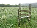 A stile to nowhere - geograph.org.uk - 4002276.jpg 1 024 × 768; 281 KB
-
 A629 road at Jockey Hill - geograph.org.uk - 3775987.jpg 4 000 × 3 000; 2,96 MB
-
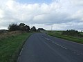 A629 towards Huddersfield - geograph.org.uk - 4193108.jpg 640 × 480; 39 KB
-
 Abandoned stone water trough - geograph.org.uk - 924614.jpg 480 × 640; 124 KB
-
 At Root House Farm, Roughbirchworth - geograph.org.uk - 2958125.jpg 2 931 × 4 396; 2,7 MB
-

-
 Bench near Willow Lane Top - geograph.org.uk - 5091100.jpg 1 600 × 1 087; 739 KB
-
 Benchmark on a gatepost opposite Kirkwood Close - geograph.org.uk - 2878131.jpg 3 072 × 2 304; 1,12 MB
-
 Benchmark on a wall at Bower Hill - geograph.org.uk - 2878108.jpg 3 072 × 2 304; 1,45 MB
-
 Benchmark on the high wall near Kirkwood Bridge - geograph.org.uk - 2881880.jpg 3 072 × 2 304; 1,11 MB
-
 Bridge over River Don - geograph.org.uk - 26223.jpg 640 × 480; 80 KB
-
 Bridges over the Trans-Pennine Trail at Oxspring - geograph.org.uk - 2374980.jpg 3 296 × 2 472; 1,86 MB
-

-
 Bus stop at Oxsping on the B6462 near Penistone - geograph.org.uk - 3056387.jpg 1 024 × 687; 103 KB
-
 Bus stop outside the school - geograph.org.uk - 924607.jpg 640 × 480; 126 KB
-

-
 Castle dam on Long lane Penistone - geograph.org.uk - 1056903.jpg 640 × 480; 50 KB
-
 Castle Dam ^ Castle Hill House near Penistone - geograph.org.uk - 2958119.jpg 4 608 × 3 072; 3,08 MB
-
 Clays House Farm, Jockey Hill - geograph.org.uk - 5090995.jpg 1 600 × 1 065; 624 KB
-
 Corner of Bower Hill Road, Oxspring - geograph.org.uk - 924372.jpg 640 × 480; 68 KB
-

-

-
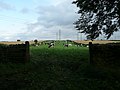
 Cows outside Wraith House Farm - geograph.org.uk - 948731.jpg 640 × 480; 80 KB
-
 Downhill to Four Lane End - geograph.org.uk - 4192752.jpg 640 × 464; 66 KB
-
 Dry stone wall boundaries - geograph.org.uk - 929424.jpg 640 × 398; 53 KB
-
 Dry stone wall field boundaries - geograph.org.uk - 929391.jpg 640 × 412; 54 KB
-
-
-
 Entering Oxspring from Bower Hill - geograph.org.uk - 927034.jpg 640 × 480; 73 KB
-

-
 Far Coates seen from Maggot Lane - geograph.org.uk - 6015934.jpg 5 058 × 3 544; 4,04 MB
-

-
 Farmland off Long Lane - geograph.org.uk - 4864011.jpg 640 × 480; 63 KB
-
 Farmland on Roughbirchwood Common - geograph.org.uk - 1777339.jpg 3 296 × 2 472; 1,01 MB
-
 Field entrance off Long Lane - geograph.org.uk - 4864010.jpg 640 × 480; 80 KB
-
 Finger post at Castle Green, Penistone - geograph.org.uk - 5091179.jpg 1 600 × 1 065; 827 KB
-
 Footpath towards Oxspring - geograph.org.uk - 4193032.jpg 640 × 480; 88 KB
-
 Four Lane Ends, Oxspring - geograph.org.uk - 932164.jpg 640 × 480; 63 KB
-
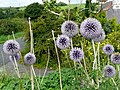
 Foxgloves for Memories.JPG 4 288 × 2 848; 6,83 MB
-
 Grazing and power lines - geograph.org.uk - 4193038.jpg 640 × 387; 36 KB
-
 Grazing off Coates Lane (B6449) - geograph.org.uk - 4192750.jpg 640 × 480; 54 KB
-
 Grazing towards White field Farm - geograph.org.uk - 4193041.jpg 640 × 480; 51 KB
-
 Grazing, Willow Lane Top - geograph.org.uk - 4193033.jpg 640 × 480; 49 KB
-
 Guidepost for the packhorse trail - geograph.org.uk - 924635.jpg 480 × 640; 119 KB
-
 Haigh Cottages - geograph.org.uk - 2770995.jpg 1 024 × 768; 232 KB
-
 Hang on are we going the right way - geograph.org.uk - 5090933.jpg 1 600 × 1 065; 628 KB
-

-
 Heading for Tunnel Top - geograph.org.uk - 948696.jpg 640 × 480; 73 KB
-
 High Oxspring Farm - geograph.org.uk - 948678.jpg 640 × 480; 58 KB
-
 House on Long Lane, Roughbirchworth - geograph.org.uk - 2853618.jpg 3 072 × 2 304; 1,36 MB
-
 Houses at the end of Manor Lane - geograph.org.uk - 926963.jpg 640 × 480; 89 KB
-
 Housing on Roughbirchworth Lane - geograph.org.uk - 2770993.jpg 1 024 × 768; 163 KB
-
 Jockey House - geograph.org.uk - 948722.jpg 640 × 480; 99 KB
-
 Jockey House at Jockey Hill near Oxspring - geograph.org.uk - 5091000.jpg 1 600 × 1 065; 633 KB
-
 Junction of Upper Don and Transpennine trails - geograph.org.uk - 2958049.jpg 4 608 × 3 072; 3,08 MB
-
 Lindley Dike, Lindley Wood - geograph.org.uk - 2801017.jpg 3 240 × 4 320; 3,05 MB
-
 Lindley Wood, near Silkstone Common - geograph.org.uk - 2801032.jpg 4 320 × 3 240; 2,89 MB
-
 Long Lane - geograph.org.uk - 4864009.jpg 640 × 480; 74 KB
-
 Long Lane - geograph.org.uk - 4864012.jpg 640 × 480; 42 KB
-
 Looking towards Penistone on the Trans-Pennine Trail - geograph.org.uk - 2374974.jpg 3 296 × 2 472; 1,87 MB
-
 Maggot Lane and Far Coates - geograph.org.uk - 5557573.jpg 1 024 × 768; 185 KB
-

-
 Mayfield Court, Oxspring - geograph.org.uk - 2958135.jpg 4 239 × 2 826; 2,48 MB
-
 Middle Farm, Roughbirchworth - geograph.org.uk - 2958129.jpg 4 318 × 2 879; 2,65 MB
-
 Millstones housing development, Oxspring - geograph.org.uk - 2958144.jpg 4 288 × 2 859; 2,59 MB
-

-
 Novice^ - geograph.org.uk - 1194928.jpg 640 × 345; 60 KB
-
 Old barn at Root House Farm - geograph.org.uk - 929187.jpg 640 × 390; 77 KB
-

-

-

-

-
 Over the bridge^ - geograph.org.uk - 924682.jpg 480 × 640; 117 KB
-
 Oxspring - bridlepath to Willow Bridge - geograph.org.uk - 2519536.jpg 1 600 × 1 200; 1 016 KB
-
 Oxspring - footpath to Bower Hill - geograph.org.uk - 2519529.jpg 1 600 × 1 200; 737 KB
-
 Oxspring - Viaduct (Geograph-2519542-by-Dave-Bevis).jpg 1 600 × 1 200; 873 KB
-
 Oxspring - Waggon ^ Horses - geograph.org.uk - 2519549.jpg 640 × 487; 94 KB
-
 Oxspring bridge (closed to traffic) - geograph.org.uk - 1194957.jpg 494 × 640; 130 KB
-
 Oxspring Bridge - geograph.org.uk - 2878106.jpg 3 072 × 2 304; 1,48 MB
-
 Oxspring Bridge.jpg 4 143 × 2 762; 2,39 MB
-
 Oxspring Croft - geograph.org.uk - 926952.jpg 640 × 480; 56 KB
-
 Oxspring Lane (A629) - geograph.org.uk - 4193043.jpg 640 × 480; 52 KB
-
 Oxspring Panorama - geograph.org.uk - 927121.jpg 640 × 275; 34 KB
-
 Oxspring Post Office - geograph.org.uk - 924596.jpg 640 × 480; 86 KB
-
 Oxspring Post Office 2016.jpg 2 592 × 1 944; 2,02 MB
-
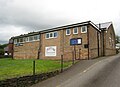
 Oxspring Primary School - geograph.org.uk - 924604.jpg 640 × 480; 73 KB
-

-
 Oxspring Sports Ground - geograph.org.uk - 929148.jpg 640 × 343; 86 KB
-
 Oxspring Viaduct - geograph.org.uk - 926906.jpg 640 × 480; 83 KB
-
 Oxspring viaduct.jpg 760 × 494; 41 KB
-

-
 Oxspring, the post office - geograph.org.uk - 2984952.jpg 640 × 480; 101 KB
-
 Oxsprings viaduct over the River Don - geograph.org.uk - 3920459.jpg 1 800 × 1 197; 608 KB
-
 Path leading to Coates Lane - geograph.org.uk - 5299952.jpg 1 200 × 799; 360 KB
-
 Path leading to Storrs Lane - geograph.org.uk - 5299950.jpg 1 200 × 799; 241 KB
-
 Penistone Rail Trail at Jockey Road - geograph.org.uk - 5090946.jpg 1 600 × 1 065; 565 KB
-
 Penistone Rail Trail at Sheffield Road - geograph.org.uk - 5091157.jpg 1 600 × 1 065; 748 KB
-
 Penistone Rail Trail at Willow Lane Top - geograph.org.uk - 5091009.jpg 1 600 × 1 065; 572 KB
-
 Penistone Rail Trail at Wraith House Farm - geograph.org.uk - 5090950.jpg 1 600 × 1 065; 663 KB
-
 Penistone Rail Trail leaves The Willows - geograph.org.uk - 5091167.jpg 1 600 × 1 065; 771 KB
-
 Penistone Rail Trail off Maggot Lane - geograph.org.uk - 5090906.jpg 1 600 × 1 065; 641 KB
-
 Penistone Rail Trail towards Oxspring - geograph.org.uk - 5091104.jpg 1 600 × 1 065; 959 KB
-
 Penistone Rail Trail towards Oxspring - geograph.org.uk - 5091115.jpg 1 600 × 1 065; 962 KB
-
 Penistone Rail Trail towards Penistone - geograph.org.uk - 5091170.jpg 1 600 × 1 065; 888 KB
-
 Penistone Rail Trail towards Penistone - geograph.org.uk - 5091173.jpg 1 600 × 1 065; 874 KB
-
 Penistone Rail Trail towards Willow Bridge - geograph.org.uk - 5091049.jpg 1 600 × 1 065; 1 007 KB
-
 Penistone Rail Trail towards Wraith House Farm - geograph.org.uk - 5090939.jpg 1 600 × 1 065; 546 KB
-
 Poppies at Oxpring.JPG 4 288 × 2 848; 4,05 MB
-
 Preparing for Le Tour - geograph.org.uk - 4045301.jpg 560 × 1 024; 151 KB
-
 Psalters Drive off The Willows, Oxspring - geograph.org.uk - 5091165.jpg 1 600 × 1 065; 681 KB
-
 Public Footpath near Bower Hill - geograph.org.uk - 3127905.jpg 4 000 × 3 000; 2,2 MB
-
 Rainbow over Oxspring - geograph.org.uk - 929272.jpg 640 × 480; 54 KB
-
 Rainbow over Willow Lane Top - geograph.org.uk - 3127877.jpg 3 750 × 2 766; 1,86 MB
-
 River Don from Willow Bridge - geograph.org.uk - 5091111.jpg 1 600 × 1 065; 1 015 KB
-
 Roughbirchworth Lane Haigh cottages.jpg 2 081 × 1 488; 1,53 MB
-
 Sheffield Road, Oxspring - geograph.org.uk - 5091159.jpg 1 600 × 1 065; 693 KB
-
 Sign at the entrance to the Pinfold - geograph.org.uk - 924353.jpg 640 × 480; 97 KB
-

-

-
 Silkstone Junction geograph-2140340.jpg 1 024 × 595; 278 KB
-
 Site of an Iron Age Camp - geograph.org.uk - 929386.jpg 640 × 358; 40 KB
-
 Site of the Oxspring Manor House - geograph.org.uk - 926882.jpg 640 × 480; 92 KB
-
 St Aidans Oxspring 2016 view 01.jpg 2 463 × 1 776; 1,7 MB
-
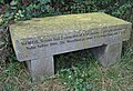
 Sveinn Worth marker - geograph.org.uk - 3045916.jpg 1 024 × 768; 283 KB
-

-
 The old Oxspring Bridge facing Bower Hill - geograph.org.uk - 927062.jpg 640 × 480; 111 KB
-
 The Oxspring pinfold today - geograph.org.uk - 924360.jpg 640 × 480; 123 KB
-
 The River Don at Oxspring - geograph.org.uk - 1194938.jpg 640 × 480; 131 KB
-
 The Trans Pennine Trail - geograph.org.uk - 4192755.jpg 640 × 480; 49 KB
-
 The Trans Pennine Trail - geograph.org.uk - 4192759.jpg 640 × 480; 51 KB
-
 The Trans Pennine Trail near Oxspring - geograph.org.uk - 4162078.jpg 1 024 × 768; 316 KB
-
 The Travellers Inn - geograph.org.uk - 6113108.jpg 1 024 × 855; 156 KB
-
 The Travellers Inn at Four Lane End - geograph.org.uk - 2888991.jpg 2 848 × 2 144; 1,48 MB
-
 The Travellers Inn, Four Lane End - geograph.org.uk - 4192753.jpg 640 × 480; 51 KB
-
 The Travellers Public House - geograph.org.uk - 948800.jpg 640 × 480; 74 KB
-
 The Waggon and Horses - geograph.org.uk - 924367.jpg 640 × 480; 106 KB
-
 The Waggon ^ Horses Inn - geograph.org.uk - 2374963.jpg 2 565 × 1 583; 865 KB
-
 The Willows, Oxspring - geograph.org.uk - 5091162.jpg 1 600 × 1 065; 540 KB
-
 The Willows, Oxspring - geograph.org.uk - 926934.jpg 640 × 480; 84 KB
-
 Time for a rest^ - geograph.org.uk - 924654.jpg 480 × 640; 140 KB
-

-
 Toll Bar Farm - geograph.org.uk - 924390.jpg 640 × 480; 76 KB
-
 TPT sign - geograph.org.uk - 3649558.jpg 721 × 1 024; 286 KB
-

-
 Track and footpath near Clays House - geograph.org.uk - 2322175.jpg 3 296 × 2 472; 963 KB
-
 Track and Kirkwood Beck head under the railway - geograph.org.uk - 2881868.jpg 3 072 × 2 304; 1,58 MB
-
 Trans Pennine Trail (Jockey Road) - geograph.org.uk - 4193028.jpg 640 × 480; 44 KB
-
 Trans Pennine Trail - geograph.org.uk - 2544378.jpg 2 736 × 3 648; 4,33 MB
-
 Trans Pennine Trail at Castle Green - geograph.org.uk - 4019764.jpg 4 000 × 2 666; 3,2 MB
-
 Trans Pennine Trail near Oxspring - geograph.org.uk - 4019769.jpg 4 000 × 2 666; 2,7 MB
-
 Trans Pennine Trail Sign near Oxspring - geograph.org.uk - 5090997.jpg 1 600 × 1 065; 452 KB
-
 Trans Pennine Trail sign, Oxspring - geograph.org.uk - 4192756.jpg 480 × 640; 55 KB
-
 Trans Pennine Trail signage - geograph.org.uk - 4020059.jpg 2 666 × 4 000; 2,85 MB
-

-
 Trans Pennine Trail towards Clay House - geograph.org.uk - 5090942.jpg 1 600 × 1 065; 739 KB
-
 Trans Pennine Trail towards Willow Lane Top - geograph.org.uk - 5091003.jpg 1 600 × 1 065; 556 KB
-
-

-

-
 View north along Long Lane - geograph.org.uk - 929420.jpg 640 × 350; 39 KB
-
 View through holly (Holly Lane) - geograph.org.uk - 924749.jpg 640 × 480; 88 KB
-
 Which way now^ - geograph.org.uk - 1124578.jpg 640 × 480; 77 KB
-
 White Field Farm - geograph.org.uk - 4193045.jpg 640 × 480; 47 KB
-
 White Field Farm - geograph.org.uk - 948670.jpg 640 × 480; 68 KB
-
 Willow Bridge over the River Don - geograph.org.uk - 5091109.jpg 1 600 × 1 065; 948 KB
-
 Willow Lane Packhorse Trail - geograph.org.uk - 924642.jpg 640 × 480; 110 KB
-
 Willow Lane Top Farm near Oxspring - geograph.org.uk - 5091005.jpg 1 600 × 1 065; 622 KB
-
 Wraith House Farm - geograph.org.uk - 5090976.jpg 1 600 × 1 065; 950 KB
-
 Wraith House Farm - geograph.org.uk - 5553853.jpg 1 024 × 768; 157 KB
-
 Wraith House Farm - geograph.org.uk - 932167.jpg 640 × 368; 38 KB
-
 Young crop field, Birkonbrae - geograph.org.uk - 4864008.jpg 640 × 480; 79 KB
-
 Four Lane End Pub (The Travellers Inn) - geograph.org.uk - 18743.jpg 640 × 480; 84 KB
-
 Oxspring Inn - geograph.org.uk - 18968.jpg 640 × 480; 106 KB
-
 Towards Blackmoor Common - geograph.org.uk - 161420.jpg 640 × 480; 149 KB


,_Clays_House_Farm_-_geograph.org.uk_-_4192761.jpg)


_-_geograph.org.uk_-_4192750.jpg)


.jpg)

_-_geograph.org.uk_-_1194957.jpg)


_-_geograph.org.uk_-_4193043.jpg)


_-_geograph.org.uk_-_924749.jpg)


_-_geograph.org.uk_-_18743.jpg)


_-_geograph.org.uk_-_4193028.jpg)