Category:Palos Verdes
Vai alla navigazione
Vai alla ricerca
English: Palos Verdes and the Palos Verdes Peninsula — a headlands 'peninsula' formed by the Palos Verdes Hills, located on the southern coast of Los Angeles County, in Southern California.
- The location of: affluent South Bay suburban communities, including Palos Verdes Estates, Rancho Palos Verdes, gated Rolling Hills, and Rolling Hills Estates; and the Los Angeles County South Coast Botanic Garden.
- The Palos Verdes Hills are the 'landed' end of the California Channel Islands mountains formation, of the Transverse Ranges System.
località statunitense .jpg) | |||||
| Carica un file multimediale | |||||
| Istanza di | |||||
|---|---|---|---|---|---|
| Luogo | contea di Los Angeles, California, Stati del Pacifico | ||||
| Situato sul mare / lago / fiume | |||||
 | |||||
Sottocategorie
Questa categoria contiene le 8 sottocategorie indicate di seguito, su un totale di 8.
File nella categoria "Palos Verdes"
Questa categoria contiene 48 file, indicati di seguito, su un totale di 48.
-
 Palos Verdes (aerial view).jpg 2 304 × 1 728; 1,05 MB
-
 6505-ShipWreck-PalosVerdesPeninsula-1965.jpg 1 794 × 730; 1,13 MB
-
 Artist Nobuo Sekine facing away from the Pacific Ocean, ca. 2014.tiff 2 140 × 2 733, 2 pagine; 8,17 MB
-
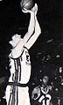 Bill Laimbeer 1975 Palos Verdes HS.jpg 148 × 245; 14 KB
-
 Cattle brand Rancho Palos Verdes Diego Sepulveda 1839.jpg 347 × 231; 38 KB
-
 Chapel of the Wayfarer, Palos Verdes CA.jpg 800 × 531; 485 KB
-
 Korean Peace Memorial (4005513217) (2).jpg 3 888 × 2 592; 3,64 MB
-
 LAX Freeway 405 & Freeway 105 (14361978959).jpg 4 752 × 3 168; 2,73 MB
-
 Los Angeles satellite map.jpg 576 × 854; 87 KB
-
 Los Angeles tiny eddy.jpg 420 × 420; 56 KB
-
 6506-MarineLand-PalosVerdesPeninsula.jpg 1 799 × 1 201; 1,65 MB
-

-
 Murphy (3298027696).jpg 3 888 × 2 592; 2,45 MB
-
 Must Be Nice (3297221075).jpg 3 888 × 2 592; 4,43 MB
-
 Nanchang CJ-6A Airplane over California Coastline N4183E 20110219.jpg 1 600 × 900; 1 005 KB
-
 Our Host (3297225199).jpg 3 888 × 2 592; 2,24 MB
-
 Palos Verdes (30985930512).jpg 3 264 × 2 448; 1,94 MB
-
 Palos Verdes (3297223611).jpg 3 888 × 2 592; 3,95 MB
-
 Palos Verdes (3298025952).jpg 3 888 × 2 592; 2,75 MB
-
 Palos Verdes (4361106481).jpg 3 884 × 2 600; 6,05 MB
-
 Palos Verdes (4361109207).jpg 3 884 × 2 600; 6,06 MB
-
 Palos Verdes (4361113013).jpg 3 884 × 2 600; 9,77 MB
-
 Palos Verdes banner.jpg 3 884 × 557; 1,83 MB
-
 Palos Verdes, CA.jpg 1 440 × 1 800; 841 KB
-
 Palos Verdes, California (51084644997).jpg 2 048 × 1 536; 1,12 MB
-
 Palos Verdes, South Bay Penninsula (4204743275).jpg 3 216 × 2 136; 2,12 MB
-
 PalosVerdesPortuguesePoint.jpg 970 × 688; 90 KB
-
 Peninsula Center Library.jpg 3 872 × 2 592; 5,49 MB
-
 Portuguese Bend in California.jpg 2 816 × 2 112; 1,91 MB
-
 Portuguese Bend Landslide and Nature Preserve, Rancho Palos Verdes, California.jpg 5 999 × 3 345; 6,96 MB
-
 PV Lighthouse (3297206517).jpg 3 888 × 2 592; 3,5 MB
-
 Rancho Palos Verdes, United States (Unsplash).jpg 5 127 × 3 418; 1,51 MB
-
 Red Brick Pizza - panoramio.jpg 2 006 × 1 480; 999 KB
-
 AMC Rolling Hills.jpg 550 × 502; 135 KB
-
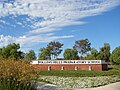 RollingHills Prep entry sign.jpg 450 × 339; 96 KB
-
 San Pedro by satellite.png 1 024 × 688; 931 KB
-
 Shipwreck01.jpg 500 × 342; 96 KB
-
 The Chasan Villa - Top View.jpg 1 434 × 1 132; 200 KB
-
 Trumps Beach - panoramio.jpg 2 592 × 3 872; 4,67 MB
-
 Upset earth in the Portuguese Bend Landslide, March 12, 2016.jpg 6 000 × 4 000; 13,74 MB
-
 View northwest from Point Vincente - Flickr - pellaea.jpg 3 648 × 2 736; 2,88 MB
-
 We're Goin Down (3297202705).jpg 3 888 × 2 592; 2,33 MB
-
 We're Goin Down (3297204151).jpg 3 888 × 2 592; 2,2 MB
-
 Wood Elem 08' 011.jpg 1 280 × 960; 743 KB
-
 CA 33 certified.pdf 1 275 × 1 650; 867 KB
-
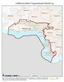
 California US Congressional District 33 (since 2013).tif 2 016 × 998; 2,95 MB
-
 CAMap-doton-Rolling Hills Estates.png 800 × 530; 106 KB
-
 LA County Incorporated Areas Rolling Hills highlighted.svg 950 × 780; 262 KB


_(2).jpg)
.jpg)


.jpg)
.jpg)

.jpg)
.jpg)
.jpg)
.jpg)
.jpg)
.jpg)
.jpg)

.jpg)
.jpg)


.jpg)
.jpg)


.jpg)
.jpg)


