Category:Paramaribo District
Vai alla navigazione
Vai alla ricerca
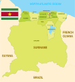
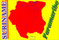
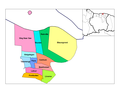
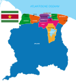
English: Paramaribo is a district of Suriname, encompassing the city of Paramaribo and the surrounding area.
distretto surinamese   | |||||
| Carica un file multimediale | |||||
| Istanza di | |||||
|---|---|---|---|---|---|
| Luogo | Suriname | ||||
| Capitale | |||||
| Popolazione |
| ||||
| Superficie |
| ||||
 | |||||
Sottocategorie
Questa categoria contiene un'unica sottocategoria, indicata di seguito.
P
File nella categoria "Paramaribo District"
Questa categoria contiene 37 file, indicati di seguito, su un totale di 37.
-
 Bamboe op Tourtonne. (titel op object), NG-1994-65-1-3-3.jpg 3 624 × 5 062; 3,41 MB
-
 Districten kaart van Suriname.svg 842 × 1 108; 1,42 MB
-
 Districts of Suriname with Capital Cities.svg 1 074 × 1 252; 203 KB
-
 Districtscommissariaat Paramaribo Noord-Oost.jpg 4 000 × 3 000; 2,96 MB
-
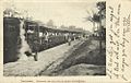
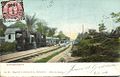 Koffiedjompo Railway Station with Steam Train (1906).jpg 1 000 × 642; 134 KB
-
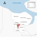
 Locator Map Beekhuizen - Paramaribo Suriname.png 7 940 × 7 941; 1,12 MB
-
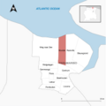
 Locator Map Blauwgrond - Paramaribo Suriname.png 7 941 × 7 940; 1,12 MB
-
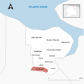
 Locator Map Centrum - Paramaribo Suriname.png 7 941 × 7 941; 1,12 MB
-
 Locator Map Flora - Paramaribo Suriname.png 7 941 × 7 941; 1,13 MB
-
 Locator Map Latour - Paramaribo Suriname.png 7 941 × 7 941; 1,12 MB
-
 Locator Map Livorno - Paramaribo Suriname.png 7 940 × 7 941; 1,12 MB
-
 Locator Map Munder - Paramaribo Suriname.png 7 941 × 7 940; 1,12 MB
-
 Locator Map Pontbuiten - Paramaribo Suriname.png 7 941 × 7 941; 1,12 MB
-
 Locator Map Rainville - Paramaribo Suriname.png 7 941 × 7 940; 1,13 MB
-
 Locator Map Tammenga - Paramaribo Suriname.png 7 941 × 7 941; 1,12 MB
-
 Locator Map Weg naar Zee - Paramaribo Suriname.png 7 940 × 7 940; 1,12 MB
-
 Locator Map Welgelegen - Paramaribo Suriname.png 7 940 × 7 941; 1,12 MB
-
 Map of Suriname - Paramaribo Highlight.png 2 310 × 2 593; 216 KB
-
 Map of Suriname showing Districts and the capital cities.svg 1 448 × 1 572; 330 KB
-
 Palmentuin, Paramaribo (titel op object), NG-1994-65-2-8-3.jpg 3 510 × 4 500; 3,35 MB
-
 Paramaribo (1).png 2 000 × 2 047; 235 KB
-
 Paramaribo (2).png 1 281 × 878; 159 KB
-
 Paramaribo - Suriname.png 5 952 × 6 123; 686 KB
-
 Paramaribo District.jpg 3 840 × 2 160; 654 KB
-
 Paramaribo Resorts.svg 842 × 595; 264 KB
-
 Paramaribo Ressorts Suriname Neutral.png 8 419 × 5 953; 782 KB
-
 Paramaribo Suriname Ressorts 2023.png 1 056 × 816; 27 KB
-
 Paramaribo.png 2 000 × 2 047; 275 KB
-
 Resorts in Paramaribo, Suriname - 20061227.png 1 056 × 816; 26 KB
-
 Stadsdistrict Paramaribo - Suriname - Location Map.png 7 920 × 6 120; 884 KB
-
 Suriname Map of Regions and Provinces.svg 876 × 950; 305 KB
-
 Suriname-Paramaribo.png 200 × 205; 4 KB
-
 Suriname-Paramaribo.svg 595 × 558; 154 KB
-
 Suriname. Aankomst van den trein te station Koffiedjompo (cropped).jpg 780 × 568; 102 KB
-
 Suriname. Aankomst van den trein te station Koffiedjompo.jpg 1 000 × 635; 105 KB
-
 Tourtonne (titel op object), NG-1994-65-2-18-2.jpg 4 996 × 3 660; 4,06 MB
-
 View of Brokopondo Reservoir (33537725195).jpg 4 896 × 2 752; 737 KB
,_NG-1994-65-1-3-3.jpg)


.jpg)


,_NG-1994-65-2-8-3.jpg)
.png)
.png)


.jpg)

,_NG-1994-65-2-18-2.jpg)
.jpg)