Category:Parkeston, Essex
Aller à la navigation
Aller à la recherche
English: Parkeston is a North Sea port village in Essex, England, near Dovercourt and Harwich. It was built in the 1800s on reclaimed land that once was known as Ray Island.Parkeston was named after Charles Parkes of the Great Eastern Railway. Most of the terraced housing in Parkeston was built for railway employees. It is known locally as "Spike island" or "Cinder city".
localité britannique  | |||||
| Téléverser des médias | |||||
| Nature de l’élément | |||||
|---|---|---|---|---|---|
| Lieu | Ramsey and Parkeston, Tendring, Essex, Angleterre de l'Est, Angleterre | ||||
 | |||||
Sous-catégories
Cette catégorie comprend 4 sous-catégories, dont les 4 ci-dessous.
Média dans la catégorie « Parkeston, Essex »
Cette catégorie comprend 32 fichiers, dont les 32 ci-dessous.
-
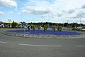 A roundabout made of glass - geograph.org.uk - 1405443.jpg 640 × 427 ; 69 kio
-
 Boarding the Harwich ferry - geograph.org.uk - 6176537.jpg 3 264 × 2 448 ; 1,37 Mio
-
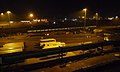 Commuter train stabled at Parkeston Quay sidings - geograph.org.uk - 4173373.jpg 1 024 × 615 ; 91 kio
-

-
 Crane at Harwich International Port - geograph.org.uk - 5894468.jpg 1 600 × 1 065 ; 395 kio
-
 Ferry and oil drilling rig, Harwich International Port - geograph.org.uk - 5896158.jpg 1 280 × 960 ; 328 kio
-
 Freight ferry unloading at Parkeston Quay, Harwich - geograph.org.uk - 4172793.jpg 1 024 × 614 ; 76 kio
-
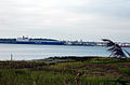
 Harwich Harbour - geograph.org.uk - 3610840.jpg 1 600 × 1 200 ; 534 kio
-

-
 Harwich International Port - linkspan - geograph.org.uk - 4204141.jpg 640 × 480 ; 70 kio
-

-
 Loading the Holland ferry, Harwich - geograph.org.uk - 5896091.jpg 1 280 × 960 ; 353 kio
-
 Oil drilling rig at Parkeston Quay, Harwich - geograph.org.uk - 5895521.jpg 960 × 1 280 ; 298 kio
-
 Parkeston Open Space - geograph.org.uk - 1405436.jpg 640 × 427 ; 103 kio
-
 Parkeston Quay, Harwich - geograph.org.uk - 5895556.jpg 1 280 × 960 ; 326 kio
-
 Parkeston Quay, Harwich International Port - geograph.org.uk - 5896150.jpg 1 280 × 853 ; 384 kio
-
 Pier and oil refinery at Parkeston - geograph.org.uk - 5369272.jpg 640 × 480 ; 212 kio
-
 Prospector 5 - geograph.org.uk - 6496835.jpg 683 × 1 024 ; 177 kio
-
 Prospector 5 at Parkeston Quay - geograph.org.uk - 6496882.jpg 683 × 1 024 ; 140 kio
-
 Restocking fresh food on the Marco Polo Cruise Ship - geograph.org.uk - 5894465.jpg 1 600 × 1 065 ; 718 kio
-
 Stena Hollandica, open deck - geograph.org.uk - 5896099.jpg 1 280 × 960 ; 287 kio
-
 Svitzer Kent Tug Boat - geograph.org.uk - 5894473.jpg 1 600 × 1 065 ; 761 kio
-
 Tanker at the jetty off Parkeston refinery - geograph.org.uk - 3576531.jpg 3 648 × 2 736 ; 2,06 Mio
-
 The Gray Test Tug Boat at Harwich - geograph.org.uk - 5873738.jpg 1 600 × 1 065 ; 589 kio
-
 The Stena Hollandica at Harwich International Ferry Post - geograph.org.uk - 5894479.jpg 1 600 × 1 065 ; 540 kio
-
 Tug at Parkeston Quay, Harwich - geograph.org.uk - 5896140.jpg 1 280 × 960 ; 493 kio
-
 Footpath from Ramsey to Parkeston - geograph.org.uk - 1405424.jpg 640 × 427 ; 101 kio
-
 Harwich International Port - geograph.org.uk - 411414.jpg 640 × 422 ; 95 kio
-
 Morrisons Petrol Station - geograph.org.uk - 539639.jpg 640 × 480 ; 92 kio
-
 Morrisons supermarket, Harwich - geograph.org.uk - 538574.jpg 640 × 480 ; 92 kio
-
 The entrance to Dovercourt Cemetery - geograph.org.uk - 422113.jpg 640 × 480 ; 103 kio
-
 The Old Hall, Dovercourt - geograph.org.uk - 53417.jpg 640 × 407 ; 71 kio


