Category:Pateley Bridge
Vai alla navigazione
Vai alla ricerca
English: Pateley Bridge is a small market town in Nidderdale in the Borough of Harrogate, North Yorkshire, England, on the River Nidd.
Italiano: Pateley Bridge è un paese di 2.000 abitanti della contea del North Yorkshire, in Inghilterra.
town in Nidderdale in the borough of Harrogate, North Yorkshire, England .JPG) | |||||
| Carica un file multimediale | |||||
| Istanza di | |||||
|---|---|---|---|---|---|
| Luogo | High and Low Bishopside, Harrogate, North Yorkshire, Yorkshire e Humber, Inghilterra | ||||
 | |||||
Sottocategorie
Questa categoria contiene le 13 sottocategorie indicate di seguito, su un totale di 13.
File nella categoria "Pateley Bridge"
Questa categoria contiene 124 file, indicati di seguito, su un totale di 124.
-
 1GL Bolt Bench Mark, Pateley Bridge - geograph.org.uk - 2748313.jpg 1 024 × 681; 288 KB
-
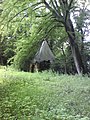 A Ruined Folly, Castlesteads - geograph.org.uk - 482677.jpg 480 × 640; 146 KB
-
 An NHS dentist in Pateley Bridge - geograph.org.uk - 3103303.jpg 800 × 600; 109 KB
-
 B6165 approaching Pateley Bridge - geograph.org.uk - 3750831.jpg 640 × 413; 62 KB
-
 B6265 near Braithwaite Syke - geograph.org.uk - 118499.jpg 640 × 480; 56 KB
-
 B6265 towards Pateley Bridge - geograph.org.uk - 2465790.jpg 1 600 × 1 200; 428 KB
-
 B6265 towards Pateley Bridge - geograph.org.uk - 2465804.jpg 1 600 × 1 200; 358 KB
-
 B6265 towards Pateley Bridge - geograph.org.uk - 2465807.jpg 1 600 × 1 200; 385 KB
-
 B6265 towards Pateley Bridge - geograph.org.uk - 2465817.jpg 1 600 × 1 200; 478 KB
-
 B6265 towards Pateley Bridge - geograph.org.uk - 2465822.jpg 1 600 × 1 200; 506 KB
-
 Bowling green, Pateley Bridge - geograph.org.uk - 3527759.jpg 1 024 × 680; 232 KB
-
 Brimham Rocks MSH collection (4).jpg 4 872 × 3 092; 2,56 MB
-
 Caravans and mobile homes west of Pateley Bridge. - geograph.org.uk - 2299357.jpg 3 072 × 2 048; 1,77 MB
-
 Coldstones Cut - panoramio (3).jpg 1 499 × 1 536; 379 KB
-
 Concrete Track over Green Brackens - geograph.org.uk - 288284.jpg 640 × 480; 53 KB
-
 Cost Cutter, Pateley Bridge - geograph.org.uk - 3527770.jpg 1 024 × 680; 235 KB
-
 Court in Pateley Bridge - geograph.org.uk - 4169013.jpg 640 × 480; 91 KB
-
 Crocodile Rock - geograph.org.uk - 37215.jpg 640 × 480; 107 KB
-
 Crocodile Rock and Pateley Bridge - geograph.org.uk - 885992.jpg 480 × 640; 97 KB
-
 Cut Bench Mark, Former School, Pateley Bridge - geograph.org.uk - 2748322.jpg 1 024 × 681; 278 KB
-
 Faded old wall murals - geograph.org.uk - 2022715.jpg 2 304 × 1 704; 1,56 MB
-
 Far Side near Greenhow - geograph.org.uk - 3878877.jpg 1 600 × 1 200; 494 KB
-
 Flowerbed in Pateley Bridge - geograph.org.uk - 3527743.jpg 1 024 × 680; 266 KB
-
 Flush Bracket Bench Mark, Pateley Bridge - geograph.org.uk - 2748334.jpg 681 × 1 024; 249 KB
-
 Footbridge over the Nidd - geograph.org.uk - 829730.jpg 640 × 480; 98 KB
-

-
 Foxes Head Well, Pateley Bridge - geograph.org.uk - 506038.jpg 640 × 480; 154 KB
-
 George V Postbox, Pateley Bridge - geograph.org.uk - 2748456.jpg 682 × 1 024; 119 KB
-
 Graveyard - panoramio (13).jpg 1 582 × 1 536; 439 KB
-
 Graveyard - panoramio (14).jpg 1 282 × 1 222; 390 KB
-
 Green Lane over Pateley Moor - geograph.org.uk - 118507.jpg 640 × 480; 83 KB
-
 Guise Cliff, nr. Pateley Bridge - geograph.org.uk - 1529507.jpg 426 × 640; 105 KB
-
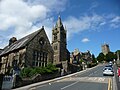
 High St, Pateley Bridge - geograph.org.uk - 4235769.jpg 640 × 430; 91 KB
-
 High Street, Pateley Bridge - geograph.org.uk - 2748351.jpg 1 024 × 681; 181 KB
-
 High Street, Pateley Bridge - geograph.org.uk - 4169000.jpg 4 000 × 2 252; 4,63 MB
-

-
 Incline at Pateley Bridge 2.jpg 2 700 × 1 500; 990 KB
-
 Incline at Pateley Bridge.jpg 2 700 × 1 500; 3,01 MB
-
 King Street, Pateley Bridge - geograph.org.uk - 4169002.jpg 3 974 × 2 422; 4,35 MB
-
 Near Pateley Bridge - panoramio.jpg 1 294 × 1 335; 561 KB
-
 Near-Pateley-Bridge-01.JPG 2 048 × 1 536; 1,62 MB
-
 Near-Pateley-Bridge-02.JPG 2 048 × 1 536; 1,55 MB
-
 Near-Pateley-Bridge-03.JPG 2 048 × 1 536; 1,58 MB
-
 Near-Pateley-Bridge-04.JPG 2 048 × 1 536; 1,59 MB
-
 Near-Pateley-Bridge-05.JPG 2 048 × 1 536; 1,51 MB
-
 Near-Pateley-Bridge-06.JPG 2 048 × 1 536; 1,52 MB
-
 Near-Pateley-Bridge-07.JPG 2 048 × 1 536; 1,7 MB
-

-
 Nidd Bridge in Pateley Bridge - panoramio.jpg 1 159 × 1 145; 292 KB
-
 Nidd river in Pateley Bridge - panoramio.jpg 1 313 × 1 310; 358 KB
-
 Nidderdale and Pateley Bridge, North Yorkshire - geograph.org.uk - 2098445.jpg 2 640 × 1 980; 1,24 MB
-
 Nidderdale near Pateley Bridge - geograph.org.uk - 484583.jpg 640 × 429; 72 KB
-
 Nidderdale Way - geograph.org.uk - 1505537.jpg 640 × 480; 81 KB
-

-
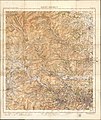 Ordnance Survey One-Inch Tourist Map of Ilkley District, Published 1935.jpg 13 058 × 15 538; 24,8 MB
-
 Overlooking Pateley Bridge - geograph.org.uk - 888954.jpg 566 × 640; 69 KB
-
 Panorama Walk, Pateley Bridge - geograph.org.uk - 2748360.jpg 1 024 × 681; 272 KB
-
 Pateley Bridge (29255258648).jpg 3 014 × 2 621; 6,93 MB
-
 Pateley Bridge (29255259788).jpg 3 648 × 2 736; 6,76 MB
-
 Pateley Bridge (42408619904).jpg 2 736 × 3 648; 5,23 MB
-
 Pateley Bridge (42408620434).jpg 3 648 × 2 123; 5,06 MB
-
 Pateley Bridge (42408621094).jpg 3 648 × 2 736; 8,35 MB
-
 Pateley Bridge - geograph.org.uk - 1232546.jpg 640 × 480; 93 KB
-
 Pateley Bridge - geograph.org.uk - 2065669.jpg 640 × 480; 292 KB
-
 Pateley Bridge - geograph.org.uk - 2131997.jpg 640 × 480; 50 KB
-
 Pateley Bridge Cemetery - geograph.org.uk - 2363969.jpg 3 872 × 2 592; 4,21 MB
-
 Pateley Bridge from the bridge - geograph.org.uk - 353541.jpg 640 × 480; 113 KB
-
 Pateley Bridge from the lower end of Ladies Riggs - geograph.org.uk - 2363886.jpg 3 872 × 2 592; 3,82 MB
-
 Pateley Bridge from the west - geograph.org.uk - 2490359.jpg 640 × 461; 98 KB
-
 Pateley Bridge from Yorke's Folly - geograph.org.uk - 2605593.jpg 4 320 × 3 240; 2,77 MB
-
 Pateley Bridge livestock market - geograph.org.uk - 2363986.jpg 3 872 × 2 592; 4,42 MB
-
 Pateley Bridge MMB 05.jpg 3 906 × 2 679; 2,65 MB
-
 Pateley Bridge Recreation Ground - geograph.org.uk - 1467544.jpg 640 × 480; 69 KB
-

-
 Path beside the River Nidd - geograph.org.uk - 303929.jpg 640 × 480; 97 KB
-
 Path into Pateley Bridge - geograph.org.uk - 1467322.jpg 480 × 640; 104 KB
-
 Path to Harefield Hall - geograph.org.uk - 303907.jpg 640 × 480; 155 KB
-
 Patley-Bridge-01.JPG 2 048 × 1 536; 1,52 MB
-
 Patley-Bridge-02.JPG 2 048 × 1 536; 1,6 MB
-
 Patley-Bridge-03.JPG 2 048 × 1 536; 1,58 MB
-
 Patley-Bridge-16.JPG 2 048 × 1 536; 1,62 MB
-
 Patley-Bridge-18.JPG 2 048 × 1 536; 1,56 MB
-
 Patley-Bridge-19.JPG 2 048 × 1 536; 1,61 MB
-
 Patley-Bridge-20.JPG 2 048 × 1 536; 1,48 MB
-
 Patley-Bridge-22.JPG 1 536 × 2 048; 1,56 MB
-
 Patley-Bridge-26.JPG 1 536 × 2 048; 1,53 MB
-
 Rabbit on the Water Meadow - geograph.org.uk - 1351628.jpg 640 × 480; 133 KB
-
 River Nidd - geograph.org.uk - 1299039.jpg 640 × 480; 82 KB
-
 River Nidd - geograph.org.uk - 974655.jpg 640 × 480; 97 KB
-
 River Nidd at Castlestead - geograph.org.uk - 303878.jpg 640 × 480; 109 KB
-
 River Nidd Footbridge - geograph.org.uk - 1505523.jpg 640 × 331; 63 KB
-
 River Nidd Footbridge - geograph.org.uk - 1505532.jpg 640 × 480; 118 KB
-
 River Nidd, Pateley Bridge - geograph.org.uk - 1939194.jpg 1 280 × 853; 607 KB
-
 River Nidd, Pateley Bridge - geograph.org.uk - 2465830.jpg 1 600 × 1 200; 613 KB
-
 Riverside Meadow, Pateley Bridge - geograph.org.uk - 1939185.jpg 1 280 × 853; 491 KB
-
 Riverside path, Pateley Bridge - geograph.org.uk - 2892376.jpg 640 × 480; 120 KB
-
 Rolling Mill, Pateley Bridge - geograph.org.uk - 2548737.jpg 3 615 × 2 552; 6,98 MB
-
 Shops and houses in Pateley Bridge - geograph.org.uk - 4169005.jpg 3 916 × 2 250; 4,24 MB
-
 Shops in Pateley Bridge - geograph.org.uk - 3527673.jpg 1 024 × 680; 166 KB
-
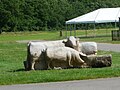
 Suffolk sheep at Pateley Bridge Livestock Market - geograph.org.uk - 2364017.jpg 3 872 × 2 592; 5,6 MB
-
 The Crown, Pateley Bridge - geograph.org.uk - 1506056.jpg 640 × 485; 88 KB
-
 The Crown, Pateley Bridge - geograph.org.uk - 829782.jpg 640 × 589; 96 KB
-
 The Memorial Hall - geograph.org.uk - 829738.jpg 640 × 480; 76 KB
-
 The weir on the Nidd - geograph.org.uk - 847852.jpg 640 × 480; 91 KB
-
 Wall postbox, Pateley Bridge - geograph.org.uk - 2070504.jpg 2 448 × 3 264; 1,31 MB
-
 Window in Pateley Bridge 01.JPG 1 536 × 2 048; 1,49 MB
-
 Window in Pateley Bridge 02.JPG 1 536 × 2 048; 1,57 MB
-
 Window in Pateley Bridge 03.JPG 2 048 × 1 536; 1,54 MB
-
 Wooden stile - geograph.org.uk - 37202.jpg 640 × 480; 107 KB
-
 Yorke's Folly above Pateley Bridge - geograph.org.uk - 1046073.jpg 640 × 480; 64 KB
-
 Abandoned Barn near Riggs House - geograph.org.uk - 1027546.jpg 640 × 480; 95 KB
-
 Bark Cabin Wood - geograph.org.uk - 1322.jpg 512 × 640; 80 KB
-
 Blazefield - geograph.org.uk - 76718.jpg 640 × 480; 116 KB
-
 Castlestead - geograph.org.uk - 56636.jpg 480 × 640; 99 KB
-
 Fields and Sheep near Blazefield - geograph.org.uk - 68174.jpg 640 × 480; 108 KB
-
 Gargoyles - geograph.org.uk - 528669.jpg 640 × 427; 88 KB
-
 Guisecliff and Guisecliff Wood - geograph.org.uk - 56634.jpg 640 × 480; 103 KB
-
 High Wild Carr - geograph.org.uk - 76722.jpg 640 × 480; 87 KB
-
 Long Green Head Farm - geograph.org.uk - 51401.jpg 640 × 480; 116 KB
-
 Moorland and Fields - geograph.org.uk - 68179.jpg 640 × 480; 113 KB
-
 North Oaks - geograph.org.uk - 68175.jpg 480 × 640; 105 KB
-
 River Nidd near Wilsill - geograph.org.uk - 180002.jpg 640 × 480; 145 KB
-

-
 The noisy cow - geograph.org.uk - 68176.jpg 640 × 480; 125 KB


.jpg)

.jpg)


.jpg)
.jpg)


.jpg)


.jpg)
.jpg)
.jpg)
.jpg)
.jpg)


