Category:Pavenham
Vai alla navigazione
Vai alla ricerca
village and civil parish in Bedfordshire, UK .jpg) | |||||
| Carica un file multimediale | |||||
| Istanza di | |||||
|---|---|---|---|---|---|
| Luogo | Bedford, Bedfordshire, Est dell'Inghilterra, Inghilterra | ||||
 | |||||
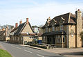
English: Pavenham is a small village and civil parish on the River Great Ouse in the Bedford district of Bedfordshire, England, about north-west of Bedford. Village amenities consist of a pub, Village hall, tennis Club, and golf club. The village is home to many clubs and societies including an active WI.
Sottocategorie
Questa categoria contiene le 2 sottocategorie indicate di seguito, su un totale di 2.
P
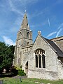
- St Peter's church, Pavenham (6 F)
- Pavenham Osier Beds (3 F)
File nella categoria "Pavenham"
Questa categoria contiene 62 file, indicati di seguito, su un totale di 62.
-
 Bench and bus shelter on Pavenham Road - geograph.org.uk - 6231536.jpg 1 600 × 1 066; 480 KB
-
 Canoe station - geograph.org.uk - 536623.jpg 640 × 426; 168 KB
-
 Evening view across the River Great Ouse - geograph.org.uk - 535542.jpg 640 × 426; 132 KB
-
 Farm track going towards The Spinney - geograph.org.uk - 5604539.jpg 1 600 × 1 067; 404 KB
-
 Farm track towards Pavenham - geograph.org.uk - 5604605.jpg 1 600 × 1 066; 317 KB
-
 Floodplain fields - geograph.org.uk - 86500.jpg 640 × 480; 57 KB
-
 Footpath by Stafford Bridge - geograph.org.uk - 4188798.jpg 1 200 × 1 600; 585 KB
-
 Footpath by the church - geograph.org.uk - 5604857.jpg 1 600 × 1 066; 502 KB
-
 Footpath into Pavenham - geograph.org.uk - 5604590.jpg 1 600 × 1 066; 360 KB
-
 Footpath into Pavenham - geograph.org.uk - 5604848.jpg 1 600 × 1 066; 215 KB
-
 Footpath on Pavenham Park Golf Course - geograph.org.uk - 6231539.jpg 1 600 × 1 066; 450 KB
-
 Footpath to River Great Ouse - geograph.org.uk - 469422.jpg 640 × 428; 142 KB
-
 Going with the flow... - geograph.org.uk - 2475035.jpg 2 592 × 1 944; 3,28 MB
-
 Great Ouse by the Ouse Valley Way - geograph.org.uk - 5604571.jpg 1 600 × 1 066; 463 KB
-
 Great Ouse from Stafford Bridge - geograph.org.uk - 4188806.jpg 1 600 × 1 068; 398 KB
-
 Great Ouse heading to Pavenham - geograph.org.uk - 5604578.jpg 1 600 × 1 066; 481 KB
-
 Green's Spinney - geograph.org.uk - 3907490.jpg 640 × 427; 82 KB
-
 High Street, Pavenham (geograph 3907265).jpg 640 × 439; 80 KB
-
 Hill Barn Farm - geograph.org.uk - 3907482.jpg 640 × 427; 80 KB
-
 HorseTroughPavenham.JPG 4 000 × 3 000; 4,35 MB
-
 Hurdlefoot House - geograph.org.uk - 4755307.jpg 640 × 480; 63 KB
-
 Mobile homes, Rose Crescent - geograph.org.uk - 4755301.jpg 640 × 480; 66 KB
-
 OldSchoolBuildingPavenham.JPG 2 816 × 2 112; 2,39 MB
-
 Ouse Valley Way goes into the woods - geograph.org.uk - 5604595.jpg 1 600 × 1 066; 525 KB
-
 Ouse Valley Way heading back to the river - geograph.org.uk - 6231545.jpg 1 600 × 1 066; 415 KB
-
 Ouse Valley Way near Pavenham - geograph.org.uk - 5604860.jpg 1 600 × 1 066; 349 KB
-
 Pair of railway bridges go over the Great Ouse - geograph.org.uk - 4188818.jpg 1 200 × 1 600; 503 KB
-
 Haystack in a Pavenham barn - geograph.org.uk - 83080.jpg 640 × 480; 93 KB
-
 Pavenham Road - geograph.org.uk - 5604864.jpg 1 600 × 1 066; 424 KB
-
 Pavenham Road by The Spinney - geograph.org.uk - 5604534.jpg 1 600 × 1 200; 460 KB
-
 Pavenham war memorial - geograph.org.uk - 5604839.jpg 1 600 × 1 200; 560 KB
-
 Pavenham, St Peter - geograph.org.uk - 5472801.jpg 3 456 × 4 608; 3,93 MB
-
 Pavenham-Golf-Course-entrance.jpg 1 000 × 665; 263 KB
-
 Pavenham-High-Street.jpg 1 000 × 665; 187 KB
-
 PhoneBoxPavenham.JPG 2 816 × 2 112; 2,73 MB
-
 River Great Ouse near Pavenham - geograph.org.uk - 3907210.jpg 640 × 427; 77 KB
-
 Riverside Holiday Park - geograph.org.uk - 4755310.jpg 480 × 640; 71 KB
-
 Road between Pavenham and Oakley - geograph.org.uk - 4543212.jpg 4 316 × 3 234; 5,28 MB
-
 SP9955 pavenham.jpg 768 × 1 024; 91 KB
-
 Spinney near Hill Barn, Pavenham - geograph.org.uk - 3907465.jpg 640 × 427; 92 KB
-
 St Peter's Church - geograph.org.uk - 5604846.jpg 1 600 × 1 200; 362 KB
-
 St Peter's church, Pavenham from the north-east (geograph 7570962).jpg 1 024 × 768; 271 KB
-
 Stafford Bridge over the Great Ouse - geograph.org.uk - 4188804.jpg 1 600 × 1 071; 421 KB
-
 Swinging on the River - geograph.org.uk - 536620.jpg 640 × 426; 166 KB
-
 Thatched cottage on High Street (geograph 7332446).jpg 640 × 422; 64 KB
-
 The Great Ouse - geograph.org.uk - 6231526.jpg 1 600 × 1 066; 529 KB
-
 The Great Ouse - geograph.org.uk - 6231530.jpg 1 600 × 1 066; 409 KB
-
 The Lodge, Pavenham - geograph.org.uk - 4551082.jpg 4 320 × 3 240; 4,87 MB
-
 The Old Post Office on High Street (geograph 7334339).jpg 640 × 480; 67 KB
-
 The Ouse Valley Way - geograph.org.uk - 5604584.jpg 1 600 × 1 066; 453 KB
-
 The Ouse Valley Way - geograph.org.uk - 6231552.jpg 1 600 × 1 066; 546 KB
-
 The River Great Ouse at Oakley - geograph.org.uk - 2475026.jpg 2 592 × 1 944; 3 MB
-
 The road down to Pavenham - geograph.org.uk - 5604869.jpg 1 600 × 1 067; 429 KB
-
 The road out of Pavenham - geograph.org.uk - 5604546.jpg 1 600 × 1 067; 467 KB
-
 Track through field - geograph.org.uk - 4543178.jpg 4 320 × 3 240; 5,34 MB
-
 Track to Hill Barn Farm - geograph.org.uk - 5604598.jpg 1 600 × 1 066; 329 KB
-
 Bridleway into the distance - geograph.org.uk - 472356.jpg 640 × 480; 106 KB
-
 Footbridge near River Ouse - geograph.org.uk - 507381.jpg 640 × 480; 127 KB
-
 Footpath to Odell - geograph.org.uk - 469426.jpg 640 × 428; 101 KB
-
 Green's Spinney - geograph.org.uk - 507410.jpg 640 × 417; 66 KB
-

-
 Road into Pavenham - geograph.org.uk - 472184.jpg 640 × 425; 84 KB


.jpg)


.jpg)


.jpg)


