Category:Penarth, Vale of Glamorgan
Zur Navigation springen
Zur Suche springen

Italiano: Penarth è una città nel distretto di Vale of Glamorgan; si trova a 8,4 km a sud-ovest di Cardiff, la capitale del Galles, ed è situata sulla sponda settentrionale dell'estuario del Severn, all'estremità meridionale della baia di Cardiff. Penarth è la seconda maggiore città nel Vale of Glamorgan, superata soltanto dal centro amministrativo di Barry.
Stadt in Wales   | |||||
| Medium hochladen | |||||
| Ist ein(e) | |||||
|---|---|---|---|---|---|
| Ort | Vale of Glamorgan, Wales | ||||
| Liegt am oder im Gewässer | |||||
| offizielle Website | |||||
 | |||||
Unterkategorien
Es werden 16 von insgesamt 16 Unterkategorien in dieser Kategorie angezeigt:
In Klammern die Anzahl der enthaltenen Kategorien (K), Seiten (S), Dateien (D)
A
- Aitor Ariño (4 D)
B
- Penarth Beach (108 D)
G
H
M
- Maps of Penarth (4 D)
- Penarth Marina (41 D)
P
- Pont y Werin (16 D)
S
- Skytown Gateway (19 D)
- Sports in Penarth (5 D)
- Street furniture in Penarth (14 D)
T
- The Dingle, Penarth (7 D)
Medien in der Kategorie „Penarth, Vale of Glamorgan“
Folgende 200 Dateien sind in dieser Kategorie, von 660 insgesamt.
(vorherige Seite) (nächste Seite)-

-
 A Head ahead - Penarth, Glamorgan - geograph.org.uk - 5682546.jpg 640 × 420; 30 KB
-
 A4055 road bridge, Ely River - geograph.org.uk - 5889222.jpg 5.184 × 3.456; 7,65 MB
-
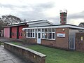
 Albert Primary School, Penarth - geograph.org.uk - 6170212.jpg 4.000 × 3.000; 2,5 MB
-
 Albert Road Methodist Church, Penarth - geograph.org.uk - 3753366.jpg 800 × 537; 120 KB
-
 Albert Road Methodist Church, Penarth - geograph.org.uk - 6170218.jpg 4.000 × 3.000; 2,45 MB
-
 Albert Road Surgery, Penarth - geograph.org.uk - 3753352.jpg 800 × 615; 140 KB
-
 Alexandra Park aviary , Penarth - geograph.org.uk - 3785033.jpg 800 × 515; 136 KB
-
 Alexandra Park, Penarth - geograph.org.uk - 4323554.jpg 3.296 × 2.472; 1,93 MB
-

-
 An angler on Penarth Pier - geograph.org.uk - 5600531.jpg 1.024 × 768; 1,01 MB
-
 Andrew Road bungalows, Penarth - geograph.org.uk - 5205752.jpg 800 × 676; 112 KB
-
 Andrew Road houses, Penarth - geograph.org.uk - 5205750.jpg 800 × 769; 115 KB
-
 AngelofGriefMonumentPenarthCemetery.jpg 1.024 × 1.024; 308 KB
-
 Anglers on Penarth Pier - geograph.org.uk - 5606313.jpg 1.024 × 768; 1,09 MB
-
 Apartment block on The Esplanade, Penarth - geograph.org.uk - 5528783.jpg 5.184 × 3.456; 7,72 MB
-
 Apartments at Penarth Marina - geograph.org.uk - 3113765.jpg 640 × 480; 447 KB
-
 Apartments by the bay - geograph.org.uk - 2944320.jpg 640 × 427; 57 KB
-
 Apartments ^ path by Ely River - geograph.org.uk - 5888595.jpg 5.184 × 3.456; 6,95 MB
-
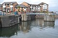
 Approach to Cardiff Bay sea locks, Penarth - geograph.org.uk - 3269547.jpg 1.024 × 553; 125 KB
-

-
 Archers Road Bridge - geograph.org.uk - 836440.jpg 640 × 480; 144 KB
-

-
 Arrival from Cardiff Central - geograph.org.uk - 5511186.jpg 1.024 × 768; 174 KB
-
 Art Gallery - geograph.org.uk - 5285863.jpg 2.701 × 1.962; 1,18 MB
-

-
 B4267 westbound at Charteris Close - geograph.org.uk - 5249169.jpg 640 × 511; 82 KB
-
 Bae Caerdydd - geograph.org.uk - 1434012.jpg 640 × 480; 48 KB
-
 Balcony Detail - geograph.org.uk - 4791490.jpg 2.788 × 1.728; 591 KB
-

-
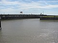
 Bascule bridge operating on the Cardiff Bay Barrage - geograph.org.uk - 2103208.jpg 2.048 × 1.536; 1,59 MB
-
 Bascule bridge rising at Cardiff Bay - geograph.org.uk - 6170171.jpg 4.000 × 3.000; 2,41 MB
-

-

-
 Beacon, Cardiff Bay - geograph.org.uk - 3113674.jpg 480 × 640; 426 KB
-
 Beacon, eastern breakwater, Cardiff Bay - geograph.org.uk - 5886174.jpg 5.184 × 3.456; 7 MB
-
 Beechwood Drive, Penarth - geograph.org.uk - 5062537.jpg 800 × 722; 144 KB
-
 Belle Vue Park, Penarth - geograph.org.uk - 3753220.jpg 800 × 601; 125 KB
-
 Belle Vue Park, Penarth - geograph.org.uk - 6170215.jpg 3.869 × 2.903; 3 MB
-

-
 BendrickDinosaurFootprints.JPG 1.200 × 1.600; 718 KB
-
-

-
 Black-headed Gull - Cosmeston Lakes - geograph.org.uk - 2017710.jpg 2.000 × 1.600; 2,49 MB
-
 Black-headed Gull - Cosmeston Lakes - geograph.org.uk - 2017716.jpg 2.000 × 1.500; 1,48 MB
-
 Black-headed Gulls - Cosmeston Lakes - geograph.org.uk - 2017701.jpg 2.560 × 1.920; 1,97 MB
-
 Boat in lock, Cardiff Bay Barrage - geograph.org.uk - 5887097.jpg 5.184 × 3.456; 6,66 MB
-
 Boat leaving Cardiff Bay - geograph.org.uk - 1446248.jpg 640 × 480; 69 KB
-

-
 Breakwater, Cardiff Bay Barrage - geograph.org.uk - 3113671.jpg 640 × 481; 465 KB
-
 Breakwater, Cardiff Bay Barrage - geograph.org.uk - 3113732.jpg 640 × 481; 416 KB
-

-
 Bridges over entrance locks, Cardiff Bay Barrage - geograph.org.uk - 6081150.jpg 1.024 × 683; 127 KB
-
 Bristol Channel - geograph.org.uk - 6338309.jpg 1.536 × 2.048; 1,08 MB
-

-
 Bro Designer off Penarth Head - geograph.org.uk - 3480629.jpg 4.000 × 3.000; 2,27 MB
-
 Broad steps up to Queen's Road, Penarth - geograph.org.uk - 3737460.jpg 800 × 600; 109 KB
-
 Bute Lane, Penarth - geograph.org.uk - 5212898.jpg 800 × 727; 191 KB
-
 ButtercupsI, at Victoria Square Gardens, Penarth, Vale of Glamorgan, Wales.jpg 4.000 × 3.000; 3,37 MB
-
 Cae Canol, Lower Penarth - geograph.org.uk - 5862429.jpg 1.024 × 768; 161 KB
-
 Cardiff Bay - geograph.org.uk - 3113761.jpg 640 × 480; 479 KB
-
 Cardiff Bay Barrage - geograph.org.uk - 2101387.jpg 2.048 × 1.536; 1,76 MB
-
 Cardiff Bay Barrage - geograph.org.uk - 2103172.jpg 2.048 × 1.536; 1,48 MB
-
 Cardiff bay barrage - geograph.org.uk - 2477432.jpg 640 × 480; 98 KB
-
 Cardiff Bay Barrage - geograph.org.uk - 3113755.jpg 640 × 481; 496 KB
-
 Cardiff Bay Barrage - geograph.org.uk - 6404347.jpg 640 × 477; 72 KB
-
 Cardiff Bay Barrage and the Old Customs House - geograph.org.uk - 2103192.jpg 2.048 × 1.536; 2,22 MB
-
 Cardiff Bay barrage by day - geograph.org.uk - 5891159.jpg 2.853 × 2.016; 1.013 KB
-
 Cardiff Bay Barrage by night - geograph.org.uk - 5891156.jpg 2.928 × 2.106; 862 KB
-
 Cardiff Bay Barrage lock - geograph.org.uk - 15862.jpg 640 × 425; 162 KB
-
 Cardiff Bay barrage lock - geograph.org.uk - 2103202.jpg 2.048 × 1.536; 1,37 MB
-
 Cardiff Bay Barrage Lock - geograph.org.uk - 572114.jpg 480 × 640; 75 KB
-
 Cardiff Bay Barrage lock.jpg 571 × 403; 100 KB
-
 Cardiff Bay Barrage locks - geograph.org.uk - 569741.jpg 640 × 480; 56 KB
-
 Cardiff Bay Barrage, Sea Locks - geograph.org.uk - 3113668.jpg 640 × 480; 445 KB
-
 Cardiff Bay Barrage-2006.jpg 489 × 269; 54 KB
-

-
 Cardiff Bay Waterbus Approaching Penarth - geograph.org.uk - 3113760.jpg 640 × 481; 466 KB
-
 Cardiff Bay, Jetty at Penarth - geograph.org.uk - 3113758.jpg 640 × 481; 465 KB
-
 Cardiff Half Marathon 2015 - geograph.org.uk - 4685258.jpg 3.616 × 2.712; 2,57 MB
-

-
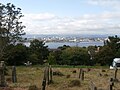 Cardiff, seen from St Augustine's churchyard, Penarth - geograph.org.uk - 5025492.jpg 3.264 × 2.448; 1,94 MB
-
 Cars and houses, Rhos Ddu, Lower Penarth - geograph.org.uk - 5062598.jpg 800 × 674; 117 KB
-
 Caynham Avenue bungalows, Cosmeston - geograph.org.uk - 2185428.jpg 640 × 477; 68 KB
-

-
 Cefn Mably Hotel - geograph.org.uk - 4791459.jpg 2.920 × 2.270; 1,05 MB
-
 Cefn Mably Hotel, Penarth - geograph.org.uk - 5054468.jpg 786 × 800; 132 KB
-
 Chandlers Quay, Penarth - geograph.org.uk - 2184311.jpg 640 × 445; 65 KB
-

-
 Channel Islands - geograph.org.uk - 6170163.jpg 4.000 × 3.000; 2,38 MB
-

-
 Children's playground, Owain Close, Penarth - geograph.org.uk - 1950852.jpg 3.296 × 2.472; 1,87 MB
-
 Church of St Peter, Old Cogan - geograph.org.uk - 2762832.jpg 4.000 × 3.000; 1,84 MB
-
 Cliff Hill in Penarth - geograph.org.uk - 1973806.jpg 1.500 × 982; 154 KB
-
 Cliff Street, Penarth - geograph.org.uk - 3737406.jpg 800 × 600; 79 KB
-
 Cliff top beacon, Penarth - geograph.org.uk - 2192766.jpg 640 × 628; 65 KB
-

-
 Cliff Walk at Penarth - geograph.org.uk - 2434252.jpg 1.024 × 646; 159 KB
-
 Cliff Walk, Penarth - geograph.org.uk - 5827190.jpg 1.280 × 851; 375 KB
-
 Cliff Walk, Penarth - geograph.org.uk - 5827769.jpg 851 × 1.280; 409 KB
-
 Clifftop Walk at Whitcliffe Drive - geograph.org.uk - 836036.jpg 640 × 480; 110 KB
-
 Clifftops, Penarth, Vale of Glamorgan,, Wales.jpg 4.000 × 3.000; 3,36 MB
-
 Clinton Road, Penarth - geograph.org.uk - 5054366.jpg 800 × 660; 169 KB
-
 Clive Place, Penarth - geograph.org.uk - 5249157.jpg 640 × 512; 91 KB
-
 Clos yr Erw, Lower Penarth - geograph.org.uk - 5862483.jpg 1.024 × 798; 201 KB
-
 Coal train at Cogan - geograph.org.uk - 5182198.jpg 3.521 × 2.641; 3,77 MB
-
 Coal train at Cogan - geograph.org.uk - 5182203.jpg 4.000 × 3.000; 3,63 MB
-
-
 Coastguard Cottage, Marine Parade, Penarth.jpg 800 × 560; 98 KB
-

-
 Cogan , Post Office 1881 inscription - geograph.org.uk - 2185231.jpg 640 × 492; 52 KB
-
 Cogan Hall marker, Dinas Road, Penarth, July 2018 01.jpg 1.536 × 2.048; 983 KB
-
 Cogan Hall marker, Dinas Road, Penarth, July 2018 02.jpg 1.536 × 2.048; 908 KB
-
 Cogan Hall marker, Dinas Road, Penarth, July 2018 03.jpg 4.032 × 3.024; 3,77 MB
-
 Cogan railway station - geograph.org.uk - 6258088.jpg 1.024 × 807; 244 KB
-

-
 Cornerswell Place, Penarth - geograph.org.uk - 3345737.jpg 640 × 356; 57 KB
-
 Cosmeston Flora - geograph.org.uk - 1953793.jpg 1.200 × 1.600; 830 KB
-
 Crossroads in suburban Penarth - geograph.org.uk - 5054362.jpg 800 × 529; 136 KB
-
 Crowds on the Esplanade - geograph.org.uk - 5805212.jpg 3.137 × 2.352; 1,55 MB
-
 Cwrt Jubilee, Plymouth Road, Penarth - geograph.org.uk - 5096547.jpg 800 × 600; 121 KB
-
 Cwrt Tŷ Mawr, Lower Penarth - geograph.org.uk - 5062551.jpg 800 × 547; 93 KB
-
 Cwrt-Y-Vil Recreation Ground, Penarth - geograph.org.uk - 1950940.jpg 3.296 × 2.472; 1,82 MB
-
 Cwrt-y-Vil Road, Penarth - geograph.org.uk - 5054334.jpg 800 × 586; 147 KB
-

-

-

-
 Dads 94th birthday cake (50029082512).jpg 1.960 × 2.249; 1,7 MB
-
 Daleks attack in Penarth! (7961881448).jpg 4.000 × 2.672; 3,63 MB
-
 Danger - cliff edge, Penarth - geograph.org.uk - 2192367.jpg 640 × 577; 147 KB
-
 DavidJohnHarries.jpg 761 × 1.052; 104 KB
-
 Denbigh Court, Penarth - geograph.org.uk - 5054411.jpg 800 × 599; 130 KB
-
 Dinas Road semis, Penarth - geograph.org.uk - 5062510.jpg 800 × 584; 107 KB
-

-

-
-
 Distances from Penarth - geograph.org.uk - 3628883.jpg 800 × 647; 126 KB
-
 Distinctive frontage, Cae Canol, Lower Penarth - geograph.org.uk - 5862475.jpg 1.024 × 807; 153 KB
-

-
 Drake and pub table in matching colours. - geograph.org.uk - 1900239.jpg 3.296 × 2.472; 1,87 MB
-
 Dredger by Cardiff Bay Barrage - geograph.org.uk - 5044895.jpg 4.000 × 3.000; 4,12 MB
-
 Dredger in Cardiff Barrage Outer Harbour - geograph.org.uk - 5042596.jpg 4.000 × 3.000; 2,81 MB
-
 Dredger in Cardiff Barrage Outer Harbour - geograph.org.uk - 5042604.jpg 3.915 × 2.936; 2,75 MB
-
 Dredger in Cardiff Barrage Outer Harbour - geograph.org.uk - 5042610.jpg 3.000 × 4.000; 2,87 MB
-
 Dôl Gwartheg, Lower Penarth - geograph.org.uk - 5062572.jpg 800 × 737; 135 KB
-
 East along Heol Neuadd Cogan, Lower Penarth - geograph.org.uk - 5862431.jpg 1.024 × 768; 156 KB
-
 East side of Penarth Leisure Centre - geograph.org.uk - 5205791.jpg 800 × 647; 165 KB
-
 Eastern end of Dinas Road, Penarth - geograph.org.uk - 5062525.jpg 798 × 800; 128 KB
-

-
 Electric milk float in Penarth - geograph.org.uk - 5054459.jpg 800 × 774; 131 KB
-
 Entrance to Cogan railway station - geograph.org.uk - 2184120.jpg 640 × 480; 76 KB
-

-

-
 Entrance to Penarth Marina - geograph.org.uk - 3428850.jpg 3.872 × 2.592; 2,72 MB
-
 Entrance to Penarth railway station - geograph.org.uk - 6329623.jpg 1.600 × 1.140; 305 KB
-
 Entrance to Portway Marina - geograph.org.uk - 6081169.jpg 1.024 × 683; 170 KB
-
 Entrance to St Cyres School, Penarth - geograph.org.uk - 1950823.jpg 3.296 × 2.472; 1,89 MB
-

-
 Esplanade on a Grey Day - geograph.org.uk - 1826962.jpg 1.600 × 899; 318 KB
-
 Etc... Penarth - geograph.org.uk - 5096423.jpg 571 × 800; 105 KB
-
 Exit from Cardiff Bay Barrage - geograph.org.uk - 2429002.jpg 640 × 480; 52 KB
-

-
 Farewell to Stavros S Niarchos - geograph.org.uk - 1916944.jpg 640 × 480; 70 KB
-

-

-
 Fire Station - geograph.org.uk - 4791449.jpg 3.264 × 2.448; 1,68 MB
-

-
 Fishermen and the pink hut - geograph.org.uk - 6160375.jpg 4.000 × 3.000; 2,32 MB
-
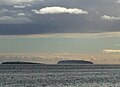 Flat Holm and Steep Holm - geograph.org.uk - 4791485.jpg 2.834 × 2.058; 527 KB
-
 Flat Holm and Steep Holm - geograph.org.uk - 5937300.jpg 3.012 × 1.746; 794 KB
-
 Flat Holm and Steep Holm - geograph.org.uk - 5999096.jpg 3.061 × 1.208; 602 KB
-
 Flat Holm and Steep Holm - geograph.org.uk - 6170196.jpg 4.000 × 3.000; 2,43 MB
-
 Flat Holm and Steep Holm - geograph.org.uk - 6338338.jpg 2.048 × 1.536; 658 KB
-
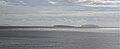 Flatholm and Steepholm Islands from Penarth, Vale of Glamorgan.jpg 4.162 × 1.696; 734 KB
-
 Footpath beside Sully Terrace, Penarth - geograph.org.uk - 1905081.jpg 640 × 480; 138 KB
-
 Footpath beside Ysgol Erw'r Delyn, Penarth - geograph.org.uk - 1950837.jpg 3.296 × 2.472; 1,82 MB
-
 Footpath from Marine Parade to the Esplanade, Penarth - geograph.org.uk - 1952146.jpg 3.296 × 2.472; 1,87 MB
-
 Footpath in Penarth - geograph.org.uk - 1905091.jpg 480 × 640; 114 KB
-
 Footpath to Windsor Road, Penarth - geograph.org.uk - 3254094.jpg 640 × 480; 118 KB
-

-

-
 Former Billybanks estate, Penarth - geograph.org.uk - 1972945.jpg 640 × 480; 98 KB
-
 Former Billybanks estate, Penarth - geograph.org.uk - 1972949.jpg 640 × 480; 76 KB
-
 Former route of the B4267 in Penarth - geograph.org.uk - 5094068.jpg 800 × 553; 102 KB
-

-
 Forrest Rd bridge over cycle and footpath, Penarth - geograph.org.uk - 1950970.jpg 3.296 × 2.472; 1,83 MB
-
 Forrest Road bridge, Penarth - geograph.org.uk - 1905066.jpg 640 × 480; 139 KB
-
 Forrest Road, Penarth - geograph.org.uk - 2192813.jpg 640 × 480; 75 KB
-
-
 Foxy's deli and cafe in Penarth - geograph.org.uk - 5052738.jpg 800 × 796; 165 KB
-

-

-

-
 Gin 64 Penarth - geograph.org.uk - 6329610.jpg 1.565 × 1.600; 492 KB
-

-
 Glamorgan Classic Cars, Penarth - geograph.org.uk - 5096557.jpg 800 × 600; 109 KB
-
 Glass by Design, Penarth - geograph.org.uk - 5052755.jpg 800 × 647; 144 KB
-
 Glebe Street, Penarth - geograph.org.uk - 5823434.jpg 1.280 × 851; 390 KB
-
 Glendale Hotel - geograph.org.uk - 5285727.jpg 3.264 × 2.448; 2,06 MB
-


.jpg)
.jpg)


