Category:Pencaitland
Aller à la navigation
Aller à la recherche
village britannique .jpg) | |||||
| Téléverser des médias | |||||
| Nature de l’élément | |||||
|---|---|---|---|---|---|
| Lieu |
| ||||
| Population |
| ||||
 | |||||
English: Pencaitland is a village in East Lothian, Scotland, about east of Ormiston. The small village of Peaston can also be found nearby.
Sous-catégories
Cette catégorie comprend 3 sous-catégories, dont les 3 ci-dessous.
P
- Pencaitland Church (3 F)
S
- Spilmersford Bridge (10 F)
Média dans la catégorie « Pencaitland »
Cette catégorie comprend 118 fichiers, dont les 118 ci-dessous.
-
 120°, Samuelston Loanhead. - geograph.org.uk - 59857.jpg 640 × 480 ; 76 kio
-
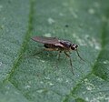
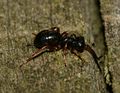 A flightless Ichneumon sp. (female).jpg 1 096 × 852 ; 349 kio
-
 A flightless Ichneumon sp. (female)2.jpg 1 286 × 1 002 ; 416 kio
-
 A young newt.jpg 2 089 × 1 630 ; 409 kio
-
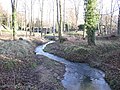 Blackford Burn - geograph.org.uk - 1134761.jpg 640 × 480 ; 152 kio
-
 Bridge over the Dean Burn at Winton - geograph.org.uk - 1800203.jpg 1 024 × 768 ; 233 kio
-
 Cock Pheasant - Flickr - S. Rae.jpg 1 907 × 2 282 ; 1,03 Mio
-
 Cottage in the trees - geograph.org.uk - 1800205.jpg 1 024 × 768 ; 262 kio
-
 Cottages by the main road, Pencaitland (geograph 3280389).jpg 800 × 562 ; 142 kio
-
 Drepanosiphum - newly hatched aphids on sycamore bud - Flickr - S. Rae.jpg 1 717 × 1 188 ; 307 kio
-
 Driveway to Burnbank - geograph.org.uk - 1579764.jpg 640 × 480 ; 110 kio
-

-
 Entrance lodge to Winton House (geograph 2079201).jpg 3 072 × 2 304 ; 1,03 Mio
-
 European Goldfinch (Carduelis carduelis) - Flickr - S. Rae.jpg 2 406 × 1 703 ; 688 kio
-
 Former Railway Bridge - geograph.org.uk - 405690.jpg 640 × 480 ; 138 kio
-
 Fountainhall station site geograph-3881901-by-Ben-Brooksbank.jpg 2 392 × 1 430 ; 4,29 Mio
-
 Geomyza tripunctata - Opomyzidae - Flickr - S. Rae.jpg 1 048 × 975 ; 383 kio
-
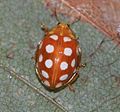 Halyzia 16-guttata (Orange ladybird) - Flickr - S. Rae.jpg 1 495 × 1 394 ; 753 kio
-
 Halyzia sedecimguttata (Orange ladybird) - Flickr - S. Rae (2).jpg 1 683 × 1 425 ; 1,15 Mio
-
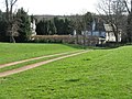 Houses at Easter Pencaitland - geograph.org.uk - 1800210.jpg 1 024 × 768 ; 187 kio
-
 Huntlaw Road, Pencaitland.jpg 640 × 480 ; 65 kio
-
 Hydroporus palustris - Flickr - S. Rae (2).jpg 734 × 687 ; 181 kio
-
 Hydroporus palustris - Flickr - S. Rae (3).jpg 1 646 × 1 459 ; 1,34 Mio
-
 Ilybius fuliginosus - Flickr - S. Rae.jpg 994 × 832 ; 430 kio
-
 Ilybius or Agabus sp. - Flickr - S. Rae (6).jpg 2 180 × 1 868 ; 1 015 kio
-
 Linneidea aenea - Flickr - S. Rae.jpg 1 503 × 1 390 ; 343 kio
-
 Lonchoptera sp. - Lonchopteridae - Flickr - S. Rae.jpg 891 × 834 ; 289 kio
-
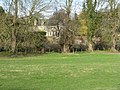
 Looking northeastwards from the roof of Winton House - geograph.org.uk - 1800260.jpg 1 024 × 768 ; 209 kio
-
 Mercat Cross, Wester Pencaitland - geograph.org.uk - 11226.jpg 640 × 480 ; 88 kio
-
 Mercat cross, Wester Pencaitland.jpg 1 884 × 2 553 ; 377 kio
-
 O.S.A. Population Table Pencaitland.jpg 1 205 × 1 914 ; 526 kio
-
 Open gate - geograph.org.uk - 76090.jpg 640 × 480 ; 160 kio
-
 Path between Ormiston and Pencaitland - geograph.org.uk - 1134771.jpg 640 × 480 ; 150 kio
-
 Pencaitland Bridge (geograph 2538301).jpg 3 456 × 2 304 ; 2,36 Mio
-
 Pencaitland Bridge - geograph.org.uk - 662409.jpg 640 × 480 ; 128 kio
-
 Pencaitland Cross - geograph.org.uk - 2363794.jpg 472 × 640 ; 69 kio
-
 Pencaitland Manse - geograph.org.uk - 1800253.jpg 1 024 × 768 ; 216 kio
-
 Pencaitland Parish Church Sundial - geograph.org.uk - 220195.jpg 480 × 640 ; 81 kio
-
 Pencaitland, The winged skull - geograph.org.uk - 1001329.jpg 640 × 480 ; 649 kio
-
 Pilmuir Doocot - geograph.org.uk - 770340.jpg 640 × 421 ; 104 kio
-
 Replanting - geograph.org.uk - 410679.jpg 480 × 640 ; 131 kio
-
 Road to Nowhere - geograph.org.uk - 220198.jpg 480 × 640 ; 106 kio
-
 Sheep, Clerkington - geograph.org.uk - 59692.jpg 640 × 480 ; 59 kio
-
 The Dean Burn at Winton - geograph.org.uk - 1800208.jpg 1 024 × 768 ; 272 kio
-
 The drive of Winton House - geograph.org.uk - 1800258.jpg 1 024 × 768 ; 194 kio
-
 The road to Redmains - geograph.org.uk - 1800211.jpg 1 024 × 768 ; 194 kio
-
 Tranent - Pencaitland road - geograph.org.uk - 1135952.jpg 640 × 480 ; 95 kio
-
 Tyne Water - geograph.org.uk - 662464.jpg 640 × 480 ; 138 kio
-

-
 Water Boatman - Corixa or Sigara sp. - Flickr - S. Rae.jpg 1 009 × 804 ; 282 kio
-
 Wester Pencaitland Doocot - geograph.org.uk - 174190.jpg 640 × 480 ; 89 kio
-
 Winter cereals at Winton - geograph.org.uk - 1800204.jpg 1 024 × 768 ; 204 kio
-
 Winton Arms - geograph.org.uk - 1059363.jpg 640 × 372 ; 55 kio
-
 Winton Arms - geograph.org.uk - 1760894.jpg 3 264 × 2 448 ; 2,6 Mio
-
 Winton Arms, Pencaitland (geograph 2284530).jpg 640 × 359 ; 184 kio
-
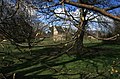
 Winton House roofscape - geograph.org.uk - 1800273.jpg 1 024 × 768 ; 158 kio
-
 A 'back' entrance to Glenkinchie Distillery - geograph.org.uk - 1137346.jpg 640 × 480 ; 84 kio
-
 A view from the roof - geograph.org.uk - 1800271.jpg 1 024 × 768 ; 182 kio
-
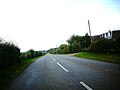 A6093 heading to Pencaitland. - geograph.org.uk - 1018215.jpg 640 × 480 ; 52 kio
-
 Arable land, Tynemount. - geograph.org.uk - 73378.jpg 640 × 480 ; 53 kio
-
 Baird's maltings - geograph.org.uk - 19326.jpg 640 × 480 ; 65 kio
-
 Bale stacks, Penston - geograph.org.uk - 73658.jpg 636 × 396 ; 43 kio
-
 Barley and its fate - geograph.org.uk - 19695.jpg 640 × 413 ; 43 kio
-
 Barley Field, Saltoun Hall Mains. - geograph.org.uk - 19333.jpg 640 × 480 ; 43 kio
-
 Baxter Johnston - geograph.org.uk - 410740.jpg 640 × 480 ; 76 kio
-
 Birns Water - geograph.org.uk - 19332.jpg 640 × 480 ; 108 kio
-
 Boggs Holdings. - geograph.org.uk - 73655.jpg 640 × 400 ; 39 kio
-
 Bottle Bank - geograph.org.uk - 101492.jpg 640 × 480 ; 151 kio
-
 Car Parking Area on a Former Colliery Site - geograph.org.uk - 405624.jpg 640 × 480 ; 122 kio
-
 Cattle near Keith Mains - geograph.org.uk - 76088.jpg 640 × 480 ; 101 kio
-
 Country road - geograph.org.uk - 76092.jpg 640 × 480 ; 156 kio
-
 Farm lane, Tynemount. - geograph.org.uk - 73389.jpg 640 × 480 ; 70 kio
-
 Farmland, Fountainhall - geograph.org.uk - 410802.jpg 640 × 480 ; 103 kio
-
 Footbridge on the Railway Walk - geograph.org.uk - 405685.jpg 640 × 480 ; 171 kio
-
 Fountainhall private road - geograph.org.uk - 410810.jpg 480 × 640 ; 98 kio
-
 Gateway to Salton Hall - geograph.org.uk - 667970.jpg 640 × 480 ; 54 kio
-
 Glenkinchie Distillery - geograph.org.uk - 27170.jpg 640 × 480 ; 91 kio
-
 Glenkinchie Distillery - geograph.org.uk - 30624.jpg 640 × 480 ; 107 kio
-
 Houses by Milton Bridge - geograph.org.uk - 76093.jpg 640 × 480 ; 128 kio
-
 Huntlaw Farmhouse - geograph.org.uk - 77975.jpg 640 × 435 ; 379 kio
-
 Lempock Wells - geograph.org.uk - 19323.jpg 640 × 445 ; 64 kio
-
 Lime kiln at Spilmersford - geograph.org.uk - 333753.jpg 640 × 480 ; 135 kio
-
 Lime kilns, Spilmersford - geograph.org.uk - 361794.jpg 640 × 480 ; 168 kio
-
 Long straight - geograph.org.uk - 410790.jpg 640 × 480 ; 84 kio
-
 Maltings - geograph.org.uk - 405699.jpg 640 × 480 ; 83 kio
-
 Market Garden, Boggs Holdings - geograph.org.uk - 244907.jpg 640 × 384 ; 81 kio
-
 Milton House - geograph.org.uk - 76109.jpg 640 × 480 ; 167 kio
-
 Moor Track - geograph.org.uk - 629440.jpg 640 × 480 ; 131 kio
-
 New gatepost - geograph.org.uk - 582031.jpg 640 × 480 ; 104 kio
-
 Newly sown field - geograph.org.uk - 582032.jpg 640 × 480 ; 85 kio
-
 Old track, Jerusalem. - geograph.org.uk - 101471.jpg 640 × 480 ; 94 kio
-
 On the trail of the lonesome pine. - geograph.org.uk - 101497.jpg 640 × 480 ; 76 kio
-
 Pencaitland - geograph.org.uk - 19327.jpg 640 × 426 ; 44 kio
-
 Pencaitland communications centre - geograph.org.uk - 410731.jpg 640 × 480 ; 70 kio
-
 Pencaitland Parish Church Tower and Doocot - geograph.org.uk - 220182.jpg 480 × 640 ; 90 kio
-
 Pencaitland Station Car Park - geograph.org.uk - 405680.jpg 640 × 480 ; 100 kio
-
 Pheasants on stubble - geograph.org.uk - 581875.jpg 640 × 480 ; 75 kio
-
 Quarry waste, Peaston - geograph.org.uk - 101494.jpg 640 × 480 ; 68 kio
-
 Railway Walk - geograph.org.uk - 405648.jpg 640 × 480 ; 169 kio
-
 Road to Fountainhall - geograph.org.uk - 410792.jpg 480 × 640 ; 136 kio
-
 Ruin, Moor Track - geograph.org.uk - 629435.jpg 640 × 480 ; 92 kio
-
 Saltoun Estate - geograph.org.uk - 19320.jpg 640 × 466 ; 69 kio
-
 Samuelston Loanhead. - geograph.org.uk - 59853.jpg 640 × 430 ; 38 kio
-
 Sheep pasture, Milton Bridge. - geograph.org.uk - 19321.jpg 640 × 449 ; 38 kio
-
 Sign Post - geograph.org.uk - 405626.jpg 640 × 480 ; 174 kio
-
 Spilmersford Mains - geograph.org.uk - 19330.jpg 640 × 427 ; 33 kio
-
 Spraying, Ormiston. - geograph.org.uk - 73395.jpg 640 × 480 ; 67 kio
-
 Stubble - geograph.org.uk - 581884.jpg 640 × 480 ; 76 kio
-
 Templehall - geograph.org.uk - 582026.jpg 640 × 480 ; 84 kio
-
 The Former Gifford and Garvald Railway Line - geograph.org.uk - 405705.jpg 640 × 480 ; 172 kio
-
 The Former Gifford and Garvald Railway Line - geograph.org.uk - 410828.jpg 640 × 480 ; 104 kio
-
 Track to West Mains. - geograph.org.uk - 101476.jpg 640 × 480 ; 78 kio
-
 Track, Templehall - geograph.org.uk - 582030.jpg 480 × 640 ; 76 kio
-
 Trees in Flour - geograph.org.uk - 405659.jpg 640 × 480 ; 111 kio
-
 View towards Big Wood - geograph.org.uk - 410825.jpg 640 × 480 ; 67 kio
-
 West Saltoun - geograph.org.uk - 76126.jpg 640 × 480 ; 167 kio
-
 Wolfstar - geograph.org.uk - 73401.jpg 640 × 480 ; 66 kio
-
 Woodland, Fountainhall - geograph.org.uk - 410798.jpg 480 × 640 ; 146 kio

.jpg)
2.jpg)


.jpg)


.jpg)
_-_Flickr_-_S._Rae.jpg)


_-_Flickr_-_S._Rae.jpg)
_-_Flickr_-_S._Rae_(2).jpg)


.jpg)
.jpg)

.jpg)


.jpg)


.jpg)