Category:Pendoggett
Aller à la navigation
Aller à la recherche
village britannique  | |||||
| Téléverser des médias | |||||
| Nature de l’élément | |||||
|---|---|---|---|---|---|
| Lieu | St Kew, Cornouailles, Angleterre du Sud-Ouest, Angleterre | ||||
 | |||||
English: Pendoggett is a small village in the parish of St. Kew, Cornwall, United Kingdom. It has a population of about 175 people. Pendoggett means head of two woods in Cornish. Penn meaning wood, dew meaning two and goes being head.
Sous-catégories
Cette catégorie comprend seulement la sous-catégorie ci-dessous.
B
- Barrett's Zawn (7 F)
Média dans la catégorie « Pendoggett »
Cette catégorie comprend 17 fichiers, dont les 17 ci-dessous.
-
 China Down - geograph.org.uk - 790226.jpg 640 × 480 ; 76 kio
-
 Crossroad near Pendoggett - geograph.org.uk - 448785.jpg 640 × 480 ; 101 kio
-
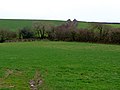
 Farmland near Tregeare Rounds - geograph.org.uk - 513480.jpg 640 × 480 ; 111 kio
-
 Footpath and green lane - geograph.org.uk - 681558.jpg 640 × 480 ; 80 kio
-
 Haymaking above Trewiggett - geograph.org.uk - 513452.jpg 640 × 480 ; 115 kio
-
 Lane Park - geograph.org.uk - 448776.jpg 640 × 480 ; 168 kio
-
 Muddy field near Hendra - geograph.org.uk - 495338.jpg 640 × 480 ; 186 kio
-
 Pendoggett - geograph.org.uk - 448792.jpg 640 × 480 ; 122 kio
-
 Sign Post. - geograph.org.uk - 790228.jpg 640 × 480 ; 62 kio
-
 Someone objected^ - geograph.org.uk - 495359.jpg 640 × 480 ; 250 kio
-
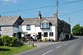 The Cornish Arms - panoramio.jpg 3 872 × 2 592 ; 4,39 Mio
-
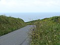 The lane down to the sea - geograph.org.uk - 495345.jpg 640 × 480 ; 191 kio
-
 Tregeare Rounds (best viewed from the air) - panoramio.jpg 2 816 × 2 112 ; 3,44 Mio
-
 Tregeare Rounds (best viewed from the air). - panoramio.jpg 2 816 × 2 112 ; 2,49 Mio
-
 Tregeare Rounds - geograph.org.uk - 513465.jpg 640 × 480 ; 101 kio
-
 Tregeare Rounds - geograph.org.uk - 513476.jpg 640 × 480 ; 95 kio
-
 Tregeare Rounds outer defence - geograph.org.uk - 513471.jpg 640 × 480 ; 184 kio


_-_panoramio.jpg)
._-_panoramio.jpg)


