Category:Penrice
Aller à la navigation
Aller à la recherche

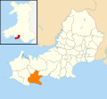
English: Penrice is the name of a hamlet and a community in Swansea, south Wales. Penrice Castle is situated near the village. Penrice has an elected community council.
village et communauté galloise de la cité et comté de Swansea  | |||||
| Téléverser des médias | |||||
| Nature de l’élément | |||||
|---|---|---|---|---|---|
| Lieu | Swansea, pays de Galles | ||||
| Population |
| ||||
| Superficie |
| ||||
 | |||||
Sous-catégories
Cette catégorie comprend 5 sous-catégories, dont les 5 ci-dessous.
Média dans la catégorie « Penrice »
Cette catégorie comprend 383 fichiers, dont les 200 ci-dessous.
(page précédente) (page suivante)-
 2010 Wales Swansea Community Penrice map.svg 512 × 472 ; 632 kio
-
 2024 Wales Swansea Community Penrice map.svg 512 × 472 ; 651 kio
-
 A brewing storm in the Bristol Channel - geograph.org.uk - 2719473.jpg 4 000 × 1 908 ; 2,03 Mio
-
 A field of old bales near Slade Bay - geograph.org.uk - 4900572.jpg 6 000 × 4 000 ; 4,5 Mio
-
 A lazy Friday at Oxwich Bay - geograph.org.uk - 4594659.jpg 3 673 × 2 089 ; 1,44 Mio
-
 A lime kiln above the road near Oxwich Castle - geograph.org.uk - 2287621.jpg 640 × 480 ; 171 kio
-
 A little bit of subsidence on the coast path - geograph.org.uk - 4900530.jpg 6 000 × 4 000 ; 4,8 Mio
-
 A view across the bay - geograph.org.uk - 4026794.jpg 5 813 × 3 865 ; 6,69 Mio
-
 A4118 at Little Reynoldston - geograph.org.uk - 4138197.jpg 640 × 480 ; 65 kio
-
 A4118 westbound - geograph.org.uk - 4138194.jpg 640 × 481 ; 67 kio
-
 Access to The Sands, Slade Bay - geograph.org.uk - 6148026.jpg 1 536 × 2 048 ; 1,11 Mio
-
 Approaching Oxwich Castle on Gower - geograph.org.uk - 4964951.jpg 640 × 480 ; 78 kio
-
 Approaching The Sands - geograph.org.uk - 5149983.jpg 4 000 × 3 000 ; 2,33 Mio
-
 At Oxwich Castle, Gower - geograph.org.uk - 4963578.jpg 640 × 480 ; 78 kio
-
 At St. Illtyd's church, Oxwich, Gower - geograph.org.uk - 4960068.jpg 640 × 480 ; 139 kio
-
 Bae Oxwich Bay - geograph.org.uk - 3842640.jpg 640 × 480 ; 68 kio
-
 Bae Oxwich Bay - geograph.org.uk - 3842646.jpg 640 × 480 ; 59 kio
-
 Bank of wild garlic - geograph.org.uk - 6147594.jpg 2 048 × 1 536 ; 838 kio
-
 Beach and dunes, Oxwich Bay - geograph.org.uk - 6229246.jpg 4 000 × 3 000 ; 2,24 Mio
-
 Beach at The Sands - geograph.org.uk - 5453216.jpg 3 264 × 2 448 ; 3,46 Mio
-
 Beach clearance - geograph.org.uk - 6147523.jpg 2 048 × 1 536 ; 1,18 Mio
-

-
 Beach shop at Oxwich Bay - geograph.org.uk - 6179896.jpg 4 000 × 3 000 ; 2,3 Mio
-
 Bench beside a pond in Mill Wood - geograph.org.uk - 2417205.jpg 640 × 480 ; 139 kio
-
 Berry, The Gower - geograph.org.uk - 3308690.jpg 1 152 × 864 ; 578 kio
-

-
 Bridleway by Slade Cross - geograph.org.uk - 4900840.jpg 6 000 × 4 000 ; 4,32 Mio
-
 Bridleway rising from Norton - geograph.org.uk - 2287632.jpg 640 × 480 ; 101 kio
-

-
 Broad Pool and road north of Cefn Bryn (5394).jpg 4 288 × 2 848 ; 5,85 Mio
-
 Bryn-Sil Top - geograph.org.uk - 6067704.jpg 1 536 × 2 048 ; 1,87 Mio
-
 Bwthyn Moor Cottage - geograph.org.uk - 3842628.jpg 640 × 480 ; 126 kio
-
 Capon's Hill - geograph.org.uk - 3842778.jpg 640 × 480 ; 141 kio
-
 Cefn Bryn (5386).jpg 4 288 × 2 848 ; 6,96 Mio
-
 Cefn Bryn (5390).jpg 4 288 × 2 848 ; 5,96 Mio
-
 Cefn Bryn (5391).jpg 4 288 × 2 848 ; 6,58 Mio
-
 Cefn Bryn - geograph.org.uk - 3842683.jpg 640 × 480 ; 90 kio
-
 Cefn Bryn - geograph.org.uk - 6188343.jpg 1 772 × 1 772 ; 1,42 Mio
-
 Cefn Byrn (5406).jpg 4 288 × 2 848 ; 6,38 Mio
-
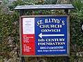 Church Noticeboard, Oxwich - geograph.org.uk - 2573771.jpg 3 072 × 2 304 ; 1,78 Mio
-
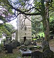 Church of St Illtyd, Oxwich - geograph.org.uk - 5147804.jpg 3 000 × 3 230 ; 2,67 Mio
-
 Clifftop view near Oxwich Point - geograph.org.uk - 5147823.jpg 4 000 × 3 000 ; 2,17 Mio
-
 Coast Path approaching Oxwich Point - geograph.org.uk - 4900348.jpg 5 744 × 3 829 ; 4,76 Mio
-
 Coast Path approaching Oxwich Point - geograph.org.uk - 4900516.jpg 6 000 × 4 000 ; 4,62 Mio
-
 Coast Path at Oxwich Point - geograph.org.uk - 4900337.jpg 6 000 × 4 000 ; 4,58 Mio
-
 Coast Path at Oxwich Point - geograph.org.uk - 5450420.jpg 3 264 × 2 448 ; 3,54 Mio
-
 Coast path below Oxwich Green - geograph.org.uk - 4900548.jpg 6 000 × 4 000 ; 4,05 Mio
-
 Coast Path near Oxwich Point - geograph.org.uk - 4900451.jpg 6 000 × 4 000 ; 4,15 Mio
-
 Coast path near Oxwich point - geograph.org.uk - 6147528.jpg 1 536 × 2 048 ; 1,36 Mio
-
 Coast path through Oxwich Burrows - geograph.org.uk - 4902101.jpg 6 000 × 4 000 ; 4,68 Mio
-
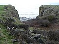
 Coastal erosion above Port-Eynon Bay - geograph.org.uk - 2288836.jpg 640 × 480 ; 115 kio
-
 Coastal gorse - geograph.org.uk - 6147526.jpg 2 048 × 1 536 ; 1,41 Mio
-
 Coastal Path - geograph.org.uk - 5453213.jpg 3 264 × 2 448 ; 2,92 Mio
-
 Coastal Path signpost - geograph.org.uk - 6229988.jpg 4 000 × 3 000 ; 2,95 Mio
-
 Coastal Path, Port Eynon Bay - geograph.org.uk - 1512816.jpg 640 × 632 ; 105 kio
-
 Coastal rocks - geograph.org.uk - 6147529.jpg 3 088 × 2 314 ; 2,26 Mio
-
 Coed y Felin - geograph.org.uk - 6067939.jpg 3 156 × 2 366 ; 3,42 Mio
-
 Converted chapel - geograph.org.uk - 6147591.jpg 2 048 × 1 536 ; 674 kio
-
 Cottage at the cross roads, Oxwich - geograph.org.uk - 4627653.jpg 5 715 × 3 528 ; 2,92 Mio
-
 Descending path near Oxwich Point - geograph.org.uk - 5147828.jpg 3 927 × 2 945 ; 2,16 Mio
-
 Diverted Wales Coast Path - geograph.org.uk - 6230027.jpg 4 000 × 3 000 ; 2,89 Mio
-
 Dog-walkers meet on Oxwich Bay - geograph.org.uk - 6229238.jpg 4 000 × 3 000 ; 2,38 Mio
-

-
 Early evening at Oxwich Bay - geograph.org.uk - 4594432.jpg 5 444 × 3 078 ; 2,57 Mio
-
 Eastern Slade - geograph.org.uk - 4900823.jpg 6 000 × 4 000 ; 7,72 Mio
-
 Ebbing tide at Oxwich Bay - geograph.org.uk - 6147552.jpg 1 536 × 2 048 ; 985 kio
-
 Entrance, Oxwich Castle - geograph.org.uk - 3572680.jpg 3 456 × 2 592 ; 3,15 Mio
-
 Eroded gully near The Sands, south of Slade - geograph.org.uk - 6230022.jpg 4 000 × 3 000 ; 2,3 Mio
-
 Exposed rock on the foreshore - geograph.org.uk - 4900385.jpg 6 000 × 4 000 ; 4,09 Mio
-
 Exposed rocks at Oxwich Point - geograph.org.uk - 4900361.jpg 6 000 × 4 000 ; 5,3 Mio
-
 Eynon's Ford - geograph.org.uk - 3842623.jpg 640 × 480 ; 105 kio
-
 Farm track and bridleway to Scurlage - geograph.org.uk - 5011211.jpg 6 000 × 4 000 ; 3,93 Mio
-
 Field access track on Oxwich Point - geograph.org.uk - 4963565.jpg 640 × 480 ; 69 kio
-
 Field and hedges - geograph.org.uk - 6067694.jpg 3 120 × 2 340 ; 2,7 Mio
-
 Field entrances above Scurlage - geograph.org.uk - 5011149.jpg 5 581 × 3 720 ; 3,83 Mio
-
 Field of wheat above Scurlage - geograph.org.uk - 5011134.jpg 6 000 × 4 000 ; 4,87 Mio
-
 Fields near Scurlage - geograph.org.uk - 5011196.jpg 6 000 × 4 000 ; 4,02 Mio
-
 Fields on Oxwich Point - geograph.org.uk - 2288931.jpg 640 × 480 ; 75 kio
-
 Fingerpost on Oxwich Point, Gower - geograph.org.uk - 2288907.jpg 640 × 480 ; 74 kio
-
 Fish pond in Mill Wood, Penrice - geograph.org.uk - 1764551.jpg 1 600 × 1 170 ; 245 kio
-

-

-
 Footbridge over Nicholaston Pill - geograph.org.uk - 6229052.jpg 4 000 × 3 000 ; 2,41 Mio
-
 Footbridge over the outflow from Oxwich Marsh - geograph.org.uk - 4902134.jpg 6 000 × 4 000 ; 3,55 Mio
-
 Footbridge, Oxwich Bay Beach - geograph.org.uk - 5762396.jpg 3 776 × 2 520 ; 3,09 Mio
-

-
 Footpath and cliff - geograph.org.uk - 6147525.jpg 1 536 × 2 048 ; 1,4 Mio
-
 Footpath carrying the coast path diversion - geograph.org.uk - 2288844.jpg 640 × 480 ; 118 kio
-
 Footpath closed - geograph.org.uk - 6147522.jpg 2 048 × 1 536 ; 1,07 Mio
-
 Footpath closed^ - geograph.org.uk - 6230025.jpg 4 000 × 3 000 ; 2,9 Mio
-
 Footpath diversion above The Sands - geograph.org.uk - 4900582.jpg 6 000 × 4 000 ; 4,47 Mio
-
 Footpath in Oxwich Wood - geograph.org.uk - 2288938.jpg 640 × 480 ; 170 kio
-
 Footpath in Oxwich Wood, Gower - geograph.org.uk - 4960093.jpg 640 × 480 ; 153 kio
-
 Footpath on Cefn Bryn on Gower - geograph.org.uk - 2426225.jpg 640 × 480 ; 90 kio
-
 Footpath Only - geograph.org.uk - 3781576.jpg 1 600 × 1 200 ; 407 kio
-
 Footpath to Scurlage - geograph.org.uk - 6067697.jpg 1 536 × 2 048 ; 1,17 Mio
-

-
 Former boundary wall on Oxwich Point - geograph.org.uk - 6230019.jpg 4 000 × 3 000 ; 2,76 Mio
-
 Former Stromness lifeboat, Oxwich Bay - geograph.org.uk - 1957195.jpg 3 383 × 1 959 ; 4,4 Mio
-
 Gate, stile and woodland - geograph.org.uk - 6067701.jpg 1 536 × 2 048 ; 1,88 Mio
-
 Gatehouse at Oxwich Castle - geograph.org.uk - 4964964.jpg 640 × 480 ; 111 kio
-
 Gates on Oxwich dunes - geograph.org.uk - 6147563.jpg 2 048 × 1 536 ; 978 kio
-
 Gateway to Penrice Castle - geograph.org.uk - 4858148.jpg 5 472 × 3 648 ; 5,8 Mio
-
 Ger - Near Perriswood - geograph.org.uk - 4216007.jpg 640 × 480 ; 99 kio
-
 Gower Walks waymarker on Oxwich Point - geograph.org.uk - 2288935.jpg 640 × 480 ; 172 kio
-
 Gower Way marker stone - geograph.org.uk - 6188562.jpg 2 048 × 1 536 ; 1,59 Mio
-
 Grass field above Scurlage - geograph.org.uk - 5011184.jpg 6 000 × 4 000 ; 4,47 Mio
-
 Grassland at Holy's Wash - geograph.org.uk - 5453214.jpg 3 264 × 2 448 ; 3,37 Mio
-
 Grazing sheep on Oxwich Point - geograph.org.uk - 6230021.jpg 4 000 × 3 000 ; 2,9 Mio
-
 Great House Farm - geograph.org.uk - 6067685.jpg 2 048 × 1 536 ; 1,11 Mio
-
 Great Tor and Three Cliffs from Nicholaston - panoramio.jpg 1 600 × 1 200 ; 515 kio
-
 Green at Oxwich Green - geograph.org.uk - 4901974.jpg 6 000 × 4 000 ; 6,3 Mio
-
 Green lane - geograph.org.uk - 6067687.jpg 1 536 × 2 048 ; 985 kio
-
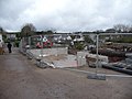
 Ground excavation - geograph.org.uk - 6067684.jpg 2 048 × 1 536 ; 1,25 Mio
-
 Heading out to Oxwich Point on Gower - geograph.org.uk - 4960037.jpg 640 × 480 ; 67 kio
-
 Hen adfail - Old ruin - geograph.org.uk - 4216012.jpg 640 × 480 ; 92 kio
-
 High road or low road^ - geograph.org.uk - 4900377.jpg 6 000 × 4 000 ; 4,77 Mio
-
 Holy's Wash - geograph.org.uk - 6230013.jpg 4 000 × 3 000 ; 2,61 Mio
-
 Horse riders on the sands of Oxwich Bay - geograph.org.uk - 2417041.jpg 640 × 480 ; 91 kio
-
 Horses at Holy's Wash, Port-Eynon Bay - geograph.org.uk - 1512889.jpg 2 848 × 2 136 ; 3 Mio
-
 Horses on Cefn Byrn (5418).jpg 4 288 × 2 848 ; 6,04 Mio
-
 Horses on Cefn Byrn (5419).jpg 4 288 × 2 848 ; 6,35 Mio
-
 Horses on Cefn Byrn (5420).jpg 4 288 × 2 848 ; 6,27 Mio
-
 Horton - geograph.org.uk - 868339.jpg 480 × 640 ; 104 kio
-
 Horton and Port Eynon Lifeboat Station - geograph.org.uk - 6230049.jpg 4 000 × 3 000 ; 2,54 Mio
-
 Horton beach - geograph.org.uk - 5149987.jpg 3 000 × 4 000 ; 1,97 Mio
-
 Horton, Port Eynon Bay - geograph.org.uk - 1512876.jpg 640 × 480 ; 72 kio
-
 Jellyfish at Oxwich Bay - geograph.org.uk - 6229248.jpg 4 000 × 3 000 ; 2,55 Mio
-
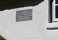 John Wesley Plaque - geograph.org.uk - 4858052.jpg 3 722 × 2 543 ; 5,2 Mio
-
 Kissing gate on the Wales Coast Path at Horton - geograph.org.uk - 6230041.jpg 4 000 × 3 000 ; 2,45 Mio
-
 Lane approaching Oxwich Green - geograph.org.uk - 4902053.jpg 6 000 × 4 000 ; 4,94 Mio
-
 Lane to Oxwich - geograph.org.uk - 4900830.jpg 6 000 × 4 000 ; 4,2 Mio
-
 Llwybr march Scurlage bridleway - geograph.org.uk - 2823824.jpg 690 × 518 ; 113 kio
-
 Llwybr Oxwich Green Path - geograph.org.uk - 4221298.jpg 640 × 480 ; 66 kio
-
 Llwybr Oxwich Path - geograph.org.uk - 3842634.jpg 640 × 480 ; 161 kio
-
 Llwybr The Beeches Path - geograph.org.uk - 3842773.jpg 640 × 480 ; 118 kio
-
 Llwybr yr Arfordir - geograph.org.uk - 6147527.jpg 1 536 × 2 048 ; 1,13 Mio
-
 Low tide and a typical sky, Oxwich Bay - geograph.org.uk - 4627539.jpg 5 880 × 3 747 ; 3,19 Mio
-
 Low tide, Oxwich Bay - geograph.org.uk - 4594690.jpg 5 804 × 3 536 ; 2,77 Mio
-
 Luminous logs - geograph.org.uk - 6067922.jpg 2 048 × 1 536 ; 1,71 Mio
-
 Marshy land below Nicholaston Woods - geograph.org.uk - 4902115.jpg 6 000 × 4 000 ; 4,09 Mio
-
 Merrysun farmhouse - geograph.org.uk - 6067700.jpg 2 046 × 1 536 ; 994 kio
-
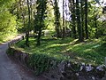 Mill Wood near Penrice - geograph.org.uk - 1318467.jpg 640 × 480 ; 136 kio
-
 Millwood - geograph.org.uk - 3842783.jpg 640 × 480 ; 78 kio
-
 More steps in Oxwich Wood - geograph.org.uk - 6229976.jpg 4 000 × 3 000 ; 2,91 Mio
-
 Muddy footpath to Slade - geograph.org.uk - 6230026.jpg 4 000 × 3 000 ; 2,9 Mio
-
 Nant Nicholaston Pill - geograph.org.uk - 3842648.jpg 640 × 480 ; 58 kio
-

-
-
 New lifeboat building at Horton - geograph.org.uk - 5011000.jpg 6 000 × 4 000 ; 3,56 Mio
-
 Nicholaston Pill - geograph.org.uk - 6229237.jpg 4 000 × 3 000 ; 2,36 Mio
-
 Nicholaston Woods at eastern end of Oxwich Bay - geograph.org.uk - 3056886.jpg 3 648 × 2 736 ; 2,05 Mio
-
 Nicholaston Woods with Cefn Bryn beyond - geograph.org.uk - 5832297.jpg 3 583 × 2 049 ; 2,11 Mio
-
 Nobody mentioned steps - geograph.org.uk - 5147811.jpg 3 000 × 4 000 ; 3,49 Mio
-
 Old courtyard at Oxwich Castle - geograph.org.uk - 4964957.jpg 640 × 480 ; 90 kio
-
 Old Milestone by the A4118, near Home Farm, Little Reynoldston - geograph.org.uk - 6047550.jpg 1 215 × 1 577 ; 377 kio
-
 Old Post Office - geograph.org.uk - 4858043.jpg 5 472 × 3 648 ; 5,23 Mio
-

-
 On Oxwich Bay - geograph.org.uk - 4965012.jpg 640 × 480 ; 83 kio
-
 On Oxwich Bay sands - geograph.org.uk - 4965027.jpg 640 × 480 ; 30 kio
-
 On Oxwich Bay sands in spring - geograph.org.uk - 4965020.jpg 640 × 480 ; 33 kio
-
 On Oxwich Point - geograph.org.uk - 2288922.jpg 640 × 480 ; 96 kio
-
 On Oxwich Point, Gower - geograph.org.uk - 4960227.jpg 640 × 480 ; 78 kio
-
 On Oxwich Point, Gower - geograph.org.uk - 4963511.jpg 640 × 480 ; 65 kio
-

-

-

-
 On the Wales Coast Path in Oxwich Wood, Gower - geograph.org.uk - 4960106.jpg 640 × 480 ; 165 kio
-
 On the Wales Coast Path in Oxwich Wood, Gower - geograph.org.uk - 4960143.jpg 640 × 480 ; 167 kio
-
 On the Wales Coast Path in Oxwich Woods, Gower - geograph.org.uk - 4960080.jpg 640 × 480 ; 163 kio
-

-

-

-
 Ordnance Survey Cut Mark - geograph.org.uk - 4454579.jpg 480 × 640 ; 112 kio
-
 Ordnance Survey Cut Mark - geograph.org.uk - 4454581.jpg 480 × 640 ; 133 kio
-
 Ordnance Survey Cut Mark - geograph.org.uk - 4766720.jpg 480 × 640 ; 101 kio
-
 Ordnance Survey Cut Mark - geograph.org.uk - 4766721.jpg 480 × 640 ; 123 kio
-
 Ordnance Survey Flush Bracket (11189) - geograph.org.uk - 4454590.jpg 480 × 640 ; 138 kio
-
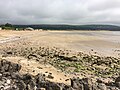
 Oxwich bay - geograph.org.uk - 2008474.jpg 640 × 427 ; 36 kio
-
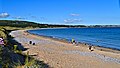
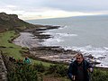
 Oxwich Bay - geograph.org.uk - 3056879.jpg 3 648 × 2 736 ; 2,12 Mio
-
 Oxwich Bay - geograph.org.uk - 3582957.jpg 1 046 × 585 ; 97 kio
-
 Oxwich Bay - geograph.org.uk - 3625118.jpg 3 214 × 2 253 ; 1,56 Mio
-
 Oxwich Bay - geograph.org.uk - 3625127.jpg 3 282 × 2 301 ; 1,42 Mio
-
 Oxwich Bay - geograph.org.uk - 4594679.jpg 5 514 × 3 444 ; 2,75 Mio
-
 Oxwich Bay - geograph.org.uk - 4594703.jpg 5 833 × 3 717 ; 1,62 Mio
-
 Oxwich Bay - geograph.org.uk - 4858062.jpg 5 472 × 3 648 ; 4,97 Mio
-
 Oxwich Bay - geograph.org.uk - 4858074.jpg 5 472 × 3 648 ; 5,03 Mio
-
 Oxwich Bay - geograph.org.uk - 5044417.jpg 1 024 × 766 ; 137 kio
-
 Oxwich Bay - geograph.org.uk - 6188348.jpg 6 260 × 2 512 ; 5,13 Mio
-
 Oxwich Bay at low tide - geograph.org.uk - 6147564.jpg 5 777 × 3 031 ; 3,54 Mio
-
 Oxwich Bay Beach - geograph.org.uk - 5450408.jpg 3 264 × 2 448 ; 2,64 Mio
-
 Oxwich Bay from the dunes - geograph.org.uk - 2417050.jpg 640 × 480 ; 87 kio
-
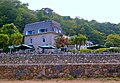
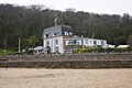
 Oxwich Bay Hotel - geograph.org.uk - 3056116.jpg 2 340 × 1 617 ; 926 kio
-
 Oxwich Bay Hotel - geograph.org.uk - 3571692.jpg 3 438 × 2 364 ; 2,51 Mio
-
 Oxwich Bay Hotel - geograph.org.uk - 4899620.jpg 6 000 × 4 000 ; 4,38 Mio
-
 Oxwich Bay Hotel - geograph.org.uk - 5044362.jpg 1 024 × 754 ; 183 kio
-
 Oxwich Bay Hotel - geograph.org.uk - 6229256.jpg 4 000 × 3 000 ; 2,3 Mio
-
 Oxwich Bay in Winter - geograph.org.uk - 4321302.jpg 1 764 × 1 160 ; 525 kio
-
 Oxwich Bay Sunset - geograph.org.uk - 1512939.jpg 2 848 × 2 136 ; 2,67 Mio
-
 Oxwich Bay with the tide out - geograph.org.uk - 4899571.jpg 6 000 × 4 000 ; 7,78 Mio


.jpg)


.jpg)
.jpg)
.jpg)


.jpg)


.jpg)
.jpg)
.jpg)


_-_geograph.org.uk_-_4454590.jpg)


